Clarendon County, South Carolina
| Clarendon County, South Carolina | |
|---|---|
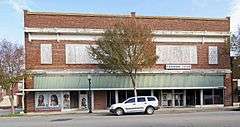 Alderman's 20 Stores in One in Manning | |
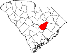 Location in the U.S. state of South Carolina | |
 South Carolina's location in the U.S. | |
| Founded | 1785 |
| Seat | Manning |
| Largest city | Manning |
| Area | |
| • Total | 696 sq mi (1,803 km2) |
| • Land | 607 sq mi (1,572 km2) |
| • Water | 89 sq mi (231 km2), 13% |
| Population | |
| • (2010) | 34,971 |
| • Density | 58/sq mi (22/km²) |
| Congressional district | 6th |
| Time zone | Eastern: UTC-5/-4 |
| Website |
www |
Clarendon County is a county located below the fall line in the Coastal Plain region of U.S. state of South Carolina. As of the 2010 census, its population was 34,971.[1] Its county seat is Manning.[2]
This area was developed for lumber and mills, including textile mills. Clarendon County boasts one of the largest man-made lakes in the United States, Lake Marion, completed in 1941 as a New Deal project. It was planned as part of a national rural electrification initiative. Since the late 20th century, the dam's generation of hydroelectric power has also stimulated economic development and industry in the region.
The South Carolina state legislature, dominated by white Democrats, established racial segregation of public facilities by state law in the late 19th century. During the Civil Rights Movement, Clarendon County was the site of the Briggs v. Elliott trial challenging segregation of public schools. This case was one of five combined with what came to be known as Brown v. Board of Education, under which the United States Supreme Court ruled in 1954 that racial segregation of public schools was unconstitutional.
History
Clarendon County was officially established in 1785, shortly after the American Revolutionary War, when the legislature divided Camden District into seven counties. One was Clarendon County.[3] It was named after Edward Hyde, who was a Lord Proprietor and earl of Clarendon.
During the American Revolutionary War, the Battle of Half Way Swamp was fought in December of 1780. That was one of the many Revolutionary battles that took place in the area of Clarendon County. Others in this area were the following battles: Richbourg’s Mill, Nelson’s Ferry, Fort Watson/Santee Indian Mound, and Tearcoat. The Swamp Fox Murals Trail has been established as an historical landmark depicting the American Revolution and General Francis Marion, the "Swamp Fox".[4]
The first European settlers in Clarendon County were ethnic French Huguenots, who traveled by boat up the Santee River. Their ancestors had earlier settled in Charleston after leaving France in the late 17th century to escape religious persecution. Transportation of goods by land was difficult, so canals were constructed to carry boat traffic around rapids in the river. The first notable canal was the Santee Canal, which was constructed in 1793. But due to the development of the railroads in the mid-1800s and construction linking major markets, the canal was superseded and ended operations some years later.
In 1798, the state legislature combined three counties - Clarendon, Claremont, and Salem - to form Sumter District for ease of administration. On December 19, 1855, a legislative act was passed establishing the Clarendon District, with the same boundaries as defined for the county in 1785. During the antebellum period, the county was developed as large plantations to cultivate commodity crops, particularly short-staple cotton, by the labor of enslaved African Americans. Cultivation of this crop was made profitable by development of the cotton gin by Eli Whitney, which made processing more labor-efficient. By the time of the Civil War, the population of the county was majority black.
In 1855, Captain Joseph C. Burgess was selected to determine the geographical center of the county, the preferred location for the county seat, so that a courthouse village could be built. The commissioners decided on the site where the present courthouse was erected. Manning was developed as the county seat. Captain Burgess deeded six acres to the state, providing sites for the courthouse and jail, in addition to streets 75-feet-wide on four sides.
In 1865, toward the end of the American Civil War, a body of General Sherman's Union troops under command of General Potter raided Clarendon county. They destroyed a large portion of Manning, including the court house. The raid took place a few days before Gen. Robert E. Lee´s surrender at Appomattox. The county recovered slowly from the Civil War due to its reliance on agriculture, which suffered a long depression.
The State Constitution of 1868 renamed the districts as counties. Agriculture continued as the mainstay of the economy through much of the 19th century, and planters had to adjust to a free labor economy. They gradually relied on a system of mostly African-American tenant farmers and sharecroppers. Lumber and related mills and industries became increasingly important, with towns developed along railroad lines in the aarea.
Following Reconstruction, white Democrats regained control of the state legislature, passing laws for segregation of public facilities, Jim Crow and a new constitution of 1895 that effectively disfranchised most blacks in the state. This exclusion from the political system was not ended until after decades of activism by African Americans, who gained passage of federal civil rights legislation in the mid-1960s to enforce their constitutional rights.
In November 1941, Lake Marion was created as a reservoir by construction of the Santee Dam by the United States Corps of Engineers. The dam was built across the Santee River to generate hydroelectric power for rural electrification, one of the major infrastructure projects initiated under President Franklin D. Roosevelt's New Deal federal investments during the Great Depression. Lake Marion and the Santee Dam were part of the Santee-Cooper Hydroelectric and Navigation Project.
Two notable court cases in Clarendon County in the mid-20th century were part of challenges by the Civil Rights Movement to racial segregation of public facilities; these cases related to segregated public schools. This was concluded in law by the United States Supreme Court ruling in Brown v. Board of Education (1954), which declared that separate but equal schools were unconstitutional. The court learned that the separate school were historically underfunded in most Southern states and seldom equal. These cases were Levi Pearson v. Clarendon County Board of Education (1947), and Briggs v. Elliott (1952).[5]
Location and description
Clarendon Country is located in the east central portion of South Carolina in the Piedmont area (See Map 1). The county covers 606.94 square miles; Lake Marion, located in the southern portion of the county, covers an additional 95 square miles of the county (See Map 2). Most of the land is predominantly sand and loamy soils. Clarendon County has a moderate climate with very warm summers and mild winters.[6] The average precipitation is 55 inches per year. The growing season is 225 days, so farmers have a long season to grow crops. Some of the major crops grown in Clarendon County are cotton, tobacco, corn and soybean.
According to Core Based Statistical Classifications, Clarendon County is classified as a non-core area, and is neither a metropolitan or micropolitan statistical area.[4] As seen in Table 1, there are only 57.60 people per square mile in Clarendon County, significantly less than average in South Carolina, areas of which have been urbanized.
Geography
According to the U.S. Census Bureau, the county has a total area of 696 square miles (1,800 km2), of which 607 square miles (1,570 km2) is land and 89 square miles (230 km2) (13%) is water.[7]
Clarendon County is characterized by a Humid subtropical climate with hot, humid summers and cool, dry winters. The county also holds the state's records for both maximum 24-hour snowfall and largest hailstone.
Major Highways
Adjacent Counties
- Sumter County - north
- Florence County - northeast
- Williamsburg County - east
- Berkeley County - southeast
- Orangeburg County - southwest
- Calhoun County - west
National protected area
Demographics
| Historical population | |||
|---|---|---|---|
| Census | Pop. | %± | |
| 1860 | 13,095 | — | |
| 1870 | 14,038 | 7.2% | |
| 1880 | 19,190 | 36.7% | |
| 1890 | 23,233 | 21.1% | |
| 1900 | 28,184 | 21.3% | |
| 1910 | 32,188 | 14.2% | |
| 1920 | 34,878 | 8.4% | |
| 1930 | 30,036 | −13.9% | |
| 1940 | 31,500 | 4.9% | |
| 1950 | 32,215 | 2.3% | |
| 1960 | 29,490 | −8.5% | |
| 1970 | 25,604 | −13.2% | |
| 1980 | 27,464 | 7.3% | |
| 1990 | 28,450 | 3.6% | |
| 2000 | 32,502 | 14.2% | |
| 2010 | 34,971 | 7.6% | |
| Est. 2015 | 33,775 | [8] | −3.4% |
| U.S. Decennial Census[9] 1790-1960[10] 1900-1990[11] 1990-2000[12] 2010-2013[1] | |||
2000 census
As of the 2010 United States Census, there were 34,971 people residing in the county. 50.4% were Black or African American, 44.0% White, 0.6% Asian, 0.2% Native American, 1.2% of some other race and 0.8% of two or more races. 2.6% were Hispanic or Latino (of any race).
The population has only slightly increased since 1920; only 20 percent compared to 71 percent for South Carolina. From 1920 to 1930 and from 1950 to 1970, there were significant declines in population, 16 percent and 26 percent, respectively. In part these declines reflected the Great Migration of African Americans out of the South, to seek better jobs, education and living opportunities.
As seen in the Table, the growing majority of the population of Clarendon County is Black or African American (50.4%). This reflects historic settlement patterns when the area had been developed for commodity agriculture and large plantations. In the 21st century, 27.9 percent of the State of South Carolina is Black or African; White or Caucasians comprise 45 percent of the population in Clarendon County and 60 percent in South Carolina, respectively.
In regard to education, 13.4% of the population had Bachelor’s degree, which is approximately 10% less than the state of South Carolina. There is a higher percentage of elderly, aged 65 and older, in Clarendon County in comparison to South Carolina, 17.6% and 14.1%, respectively. The population of Clarendon County is stationary in the area; more than 90% of the population has been living in the same house for at least a year. The median household income is $33,355, approximately $10,000 less than the median for the State of South Carolina.[13]
2010 census
As of the 2010 United States Census, there were 34,971 people, 13,132 households, and 9,238 families residing in the county.[14] The population density was 57.6 inhabitants per square mile (22.2/km2). There were 17,467 housing units at an average density of 28.8 per square mile (11.1/km2).[15] The racial makeup of the county was 50.1% black or African American, 47.0% white, 0.6% Asian, 0.2% American Indian, 1.2% from other races, and 0.8% from two or more races. Those of Hispanic or Latino origin made up 2.6% of the population.[14] In terms of ancestry, 12.2% were American, 6.8% were Irish, and 5.0% were English.[16]
Of the 13,132 households, 31.7% had children under the age of 18 living with them, 45.1% were married couples living together, 20.6% had a female householder with no husband present, 29.7% were non-families, and 26.1% of all households were made up of individuals. The average household size was 2.54 and the average family size was 3.04. The median age was 41.4 years.[14]
The median income for a household in the county was $33,066 and the median income for a family was $40,492. Males had a median income of $31,860 versus $26,851 for females. The per capita income for the county was $16,562. About 17.5% of families and 23.0% of the population were below the poverty line, including 36.3% of those under age 18 and 13.8% of those age 65 or over.[17]
Natural resources
Clarendon County has abundant ground-water resources of good quality. The Department of Natural Resources report on the ground-water resources in Clarendon suggests that the county is in a fortunate position for obtaining adequate water for domestic and public supplies, industry, and irrigation. Water is obtained chiefly from sand aquifers in the Black Creek and Middendorf Formations.[18]
Quantities obtainable from wells are adequate for public supplies, industrial uses, and irrigation. Well yields as great as 1,500 gallons per minute are obtained, and many wells can produce more than 100 gallons per minute. The water is of good quality, being soft and low in mineral content. There are five public water-supply systems in Clarendon County. In 2008 the systems had the following pumpage rates, in millions of gallons per day:[18]
Alcolu Water System—0.05 Barrineau Water System—0.09 Manning—1.07 Summerton—0.33 Turbeville—0.30
From boating, fishing, hiking and hunting, to golf on some of the world’s finest courses, Clarendon offers outdoor enthusiasts a buffet of things to do. The county is known for its championship-level catches of striped bass. Lake Marion is the site of several professional bass fishing tournaments, including the internationally known Citgo/Bassmasters Tournament and the Wal-Mart/FLW tour. Reader’s Digest magazine rated Lake Marion as one of “America’s 100 Best” for fishing and specifically pointed to the lake’s catfish.
Hunting is also a popular activity in Clarendon County, with deer, turkey and other small game available. or other small game animals. Several sporting clay operations and gun ranges are located throughout the county, as well as hunting preserves devoted to providing hunters a controlled environment.[18]
Clarendon County has a wide range of hiking trails.
Media
- The Manning Times—publishes weekly on Thursday; founded in 1882.
- The Clarendon Citizen news site is available online.
Culture
The Cultural Arts Center in Summerton and Weldon Auditorium in Manning present a diverse mix of cultural activities. These include plays, concerts by nationally renowned artists, and ballet performances, alongside a medley of local artists.
Communities
City
- Manning (county seat)
Towns
Census-designated place
Unincorporated communities
Notable people
- Richard Richardson-Brig. General, Land Owner, and Legislator
- James Burchill Richardson-Governor of South Carolina
- Richard Irvine Manning I-Legislator and Governor of South Carolina
- John Peter Richardson II-Legislator and Governor of South Carolina
- John Lawrence Manning-Governor of South Carolina
- John Peter Richardson III-Legislator and Governor of South Carolina
- Marian McKnight—Miss America 1957
- Peggy Parish—Author, Amelia Bedelia series of children's books
- John C. Land III—Long serving South Carolina State Senator, District 36
- Rob Thomas—Lead singer, Matchbox 20
- Althea Gibson—first African-American woman to win a grand slam tennis title, 1956 Australian champion
- Joseph Armstrong DeLaine-Pastor, Principal, and Civil Rights activist
See also
References
- 1 2 "State & County QuickFacts". United States Census Bureau. Retrieved November 22, 2013.
- ↑ "Find a County". National Association of Counties. Archived from the original on 2011-05-31. Retrieved 2011-06-07.
- ↑ "South Carolina: Individual County Chronologies". South Carolina Atlas of Historical County Boundaries. The Newberry Library. 2009. Retrieved March 20, 2015.
- 1 2 "History." History. Clarendon County Chamber of Commerce, n.d. Web. 07 June 2013.
- ↑ Wolters, Raymond. The Burden of Brown: Thirty Years of School Desegregation. Knoxville: University of Tennessee, 1984.
- ↑ "Clarendon." Encyclopædia Britannica. Encyclopædia Britannica Online Academic Edition. Encyclopædia Britannica Inc., 2013. Web. 02 Jun. 2013.
- ↑ "2010 Census Gazetteer Files". United States Census Bureau. August 22, 2012. Retrieved March 16, 2015.
- ↑ "County Totals Dataset: Population, Population Change and Estimated Components of Population Change: April 1, 2010 to July 1, 2015". Retrieved July 2, 2016.
- ↑ "U.S. Decennial Census". United States Census Bureau. Archived from the original on May 11, 2015. Retrieved March 16, 2015.
- ↑ "Historical Census Browser". University of Virginia Library. Retrieved March 16, 2015.
- ↑ Forstall, Richard L., ed. (March 27, 1995). "Population of Counties by Decennial Census: 1900 to 1990". United States Census Bureau. Retrieved March 16, 2015.
- ↑ "Census 2000 PHC-T-4. Ranking Tables for Counties: 1990 and 2000" (PDF). United States Census Bureau. April 2, 2001. Retrieved March 16, 2015.
- ↑ "Clarendon County QuickFacts from the US Census Bureau." Clarendon County QuickFacts from the US Census Bureau. US Census 2010, n.d. Web. 3 June 2013. <http://quickfacts.census.gov/qfd/states/45/45027.html>.
- 1 2 3 "DP-1 Profile of General Population and Housing Characteristics: 2010 Demographic Profile Data". United States Census Bureau. Retrieved 2016-03-09.
- ↑ "Population, Housing Units, Area, and Density: 2010 - County". United States Census Bureau. Retrieved 2016-03-09.
- ↑ "DP02 SELECTED SOCIAL CHARACTERISTICS IN THE UNITED STATES – 2006-2010 American Community Survey 5-Year Estimates". United States Census Bureau. Retrieved 2016-03-09.
- ↑ "DP03 SELECTED ECONOMIC CHARACTERISTICS – 2006-2010 American Community Survey 5-Year Estimates". United States Census Bureau. Retrieved 2016-03-09.
- 1 2 3 Newcome, Roy, Jr. "Hydrology - Water Resources Report 40." SCDNR. SCDNR, 2006. Web. 07 June 2013.
- ↑ "Profile for Alcolu, South Carolina, SC" ePodunk
- ↑ "Alcolu, South Carolina" Geonames database, United States Geological Survey
- ↑ "Rimini, South Carolina" Geonames database, United States Geological Survey
- ↑ "Profile for Silver, South Carolina, SC" ePodunk
- ↑ "Silver, South Carolina" Geonames database, United States Geological Survey
External links
 |
Sumter County | Florence County | | |
| Calhoun County | |
Williamsburg County | ||
| ||||
| | ||||
| Orangeburg County | Berkeley County |
Municipalities and communities of Clarendon County, South Carolina, United States | ||
|---|---|---|
| City | | |
| Towns | ||
| CDP | ||
| Unincorporated communities | ||
Coordinates: 33°40′N 80°13′W / 33.66°N 80.22°W