Civil Lines, Delhi
| Civil Lines | |
|---|---|
| subdistrict | |
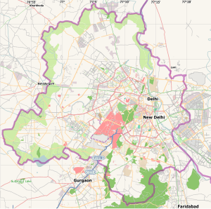 Civil Lines Location in Delhi, India | |
| Coordinates: 28°40′46″N 77°13′34″E / 28.679368°N 77.226076°ECoordinates: 28°40′46″N 77°13′34″E / 28.679368°N 77.226076°E | |
| Country |
|
| State | Delhi |
| District | North Delhi |
| Government | |
| • Body | Municipal Corporation Of Delhi |
| Languages | |
| • Official | Hindi, English |
| Time zone | IST (UTC+5:30) |
| PIN | 110 054 |
| Lok Sabha constituency | North Delhi |
| Civic agency | Municipal Corporation Of Delhi |
The Civil Lines is a noted residential area and subdivision of North Delhi District in the National Capital Territory of Delhi, India. It is one of the 12 zones under the Municipal Corporation of Delhi (MCD). It was the hub of European-style hotels in the city until New Delhi came into being in 1911.[1]
History
The name Civil Lines is a relic of British Raj times, when the city of Delhi was organized into separate areas where the British military and civilian buildings were located.[2] Areas where civilians lived were demarcated as Civil Lines. One interesting monument of British Raj era is the Metcalfe House, Delhi. One of the earliest modern hotels in Delhi was the Maidens Hotel, later Oberoi Maidens, built in 1903. It was situated in the Civil Lines, where all European-style hotels were situated and the officers of British Raj stayed. Other hotels in the area were Swiss Hotel and Hotel Cecil, run by Robert Hotz family, which also owned Wildflower Hall and Cecil Hotel in Shimla. Hotel Cecil was later demolished and today St. Xavier's School stands on the location.[1][3]
Raj Niwas, the official residence of the Lieutenant Governor of Delhi, the head of state of Delhi and National Capital Territory of Delhi, is located on Raj Niwas Marg in Civil Lines.[4] A children's home run by Mother Teresa's Missionaries of Charity lies north of Qudsia Bagh in Civil Lines. Civil Lines is quite a big area consisting of various colonies and offices. One of the main colonies is Delhi Police Staff Quarters which is just behind the Civil Lines Police Station.
Civil Lines is connected to Delhi University North Campus. It is now a developing district. It includes areas like:
- Court Road
- Rajpur Road
- Sham Nath Marg (erstwhile Alipur Road)
- Under Hill Road
- Under Hill Lane
- Police Lines
- Shankracharya Marg
- Raj Narain Road
- Maharaja Lal Lane
- Jamna Marg
- Raj Niwas Road
- Shri Ram Road
- Flagstaff Road
- Racquet Court Road
- Ram Kishore Road
- Yamuna Road
Surrounding areas
- Delhi University, North Campus
- Mukherjee Nagar: an educational centre, mostly known for I.A.S. coachings. It has a famous movie theatre, Batra Cinema.
- Kingsway Camp: main road of G.T.B. Nagar. It is a very congested market.
- Hudson Line
- Timarpur: site of many government offices
- Radio Colony: a housing colony for employees of All India Radio
- Dhir Pur: a small and congested village near Rosary School
- Dhaka Village: a concentration of rental housing for students
- Gandhi Ashram, Delhi: a green open area, sometimes having a "Khadi Mela". Once Gandhi visited it.
- Parmanand Colony: Most of the Sikhs and Punjabis live here.
- Model Town: a shopping district, with many branded showrooms.
- Munshi Ram Colony/Dairy: a residential area adjacent to Parade marg and Sant Nirankari Public School.
- Nirankari Colony
Transport
The Civil Lines underground station of the Delhi Metro services the area.
- Civil Lines to Connaught Place: 10 mins by Metro and 15–20 mins by Road.
- Civil Lines to Delhi Airport: 35–40 mins by car.
- Inter State Bus Terminal (ISBT) at Kashmere Gate, which provides bus service to points in other states, is a 5 min drive.
- Old Delhi Railway Station: 5–6 mins by Metro and 10–12 mins by Road.
- New Delhi Railway Station: 8–10 mins by Metro and 20–25 mins by Road.
Restaurants
- Moets Drive-in Bar-be-Que, Sham Nath Marg
- Moets Chinese, Sham Nath Marg
- Embassy (Indian & Continental), Sham Nath Marg
- McDonald's, Nirula's, Domino's Pizza – ISBT Metro Plaza
Hotels: 3/4 Star : Oberoi Maidens Hotel, Sham Nath Marg
See also
- Civil Lines, Kanpur
- Civil Lines, Allahabad
- Civil Lines (magazine)
- Civil Lines, Rawalpindi
- Civil Lines, Faisalabad
References
- 1 2 "'Lodged' in the heart of New Delhi". Hindustan Times. August 30, 2011.
- ↑ Civil Lines Britannica.com.
- ↑ "Pin Code of Civil Lines Delhi". citypincode.in. Retrieved 2014-03-09.
- ↑ "Home-Lieutenant Governor Secretariat". Retrieved 2013-08-27.