Cibolo, Texas
| Cibolo, Texas | |
|---|---|
| City | |
 | |
 Location of Cibolo in Guadalupe County, Texas | |
| Coordinates: 29°34′2″N 98°14′6″W / 29.56722°N 98.23500°WCoordinates: 29°34′2″N 98°14′6″W / 29.56722°N 98.23500°W | |
| Country |
|
| State |
|
| County | Guadalupe |
| Government | |
| • Type | Council-Manager |
| • City Council |
Mayor Allen Dunn Jennifer Schultes Verlin "Doug" Garrett Marchell Camp-Gebhardt Ted Gibbs Jim Russell Mayor Pro Tem Jay Hogue Glenn Weber Jr. |
| • City Manager | Robert T. Herrera |
| Area | |
| • Total | 6.58 sq mi (17.03 km2) |
| • Land | 6.57 sq mi (17.02 km2) |
| • Water | 0.004 sq mi (0.01 km2) |
| Elevation | 699 ft (213 m) |
| Population (2010 United States Census) | |
| • Total | 26,638 |
| • Density | 2,980/sq mi (1,150.7/km2) |
| Time zone | Central (CST) (UTC-6) |
| • Summer (DST) | CDT (UTC-5) |
| ZIP codes | 78108 |
| Area code(s) | 210, 726 (planned) |
| FIPS code | 48-14920[1] |
| GNIS feature ID | 1332832[2] |
| Website |
www |
Cibolo is a city located in Guadalupe County, Texas, United States. It is part of the San Antonio–New Braunfels Metropolitan Statistical Area. Cibolo was officially established in 1965. As of the 2010 census it had a population of 15,349,[3] up from 3,035 at the 2000 census.[4]
History
Before the first European settlers arrived, the Comanche as well as several other Native American tribes lived in Cibolo. The name Cibolo means "buffalo" in Native American language. The community was first established when the Southern Pacific Railroad cut through the area en route to major cities like Houston and San Antonio. Over time, Cibolo developed into the suburb it is today.[5]
Geography
Cibolo is located in western Guadalupe County, on the north side of Cibolo Creek. It is bordered to the south by Bexar County and to the south, west, and north by the city of Schertz. The city of New Braunfels is 14 miles (23 km) to the northeast, and downtown San Antonio is 21 miles (34 km) to the southwest.
According to the U.S. Census Bureau, Cibolo has a total area of 6.6 square miles (17.0 km2), of which 0.004 square miles (0.01 km2), or 0.07%, is water.[3]
Demographics
| Historical population | |||
|---|---|---|---|
| Census | Pop. | %± | |
| 1970 | 440 | — | |
| 1980 | 549 | 24.8% | |
| 1990 | 1,757 | 220.0% | |
| 2000 | 3,035 | 72.7% | |
| 2010 | 15,349 | 405.7% | |
| Est. 2015 | 26,637 | [6] | 73.5% |
As of the census[1] of 2000, there were 3,035 people, 1,092 households, and 848 families residing in the city. The population density was 569.5 people per square mile (219.9/km²). There were 1,176 housing units at an average density of 220.7/sq mi (85.2/km²). The racial makeup of the city was 81.09% White, 6.16% African American, 0.26% Native American, 1.35% Asian, 0.10% Pacific Islander, 8.11% from other races, and 2.93% from two or more races. Hispanic or Latino of any race were 19.01% of the population.
There were 1,092 households out of which 42.8% had children under the age of 18 living with them, 65.3% were married couples living together, 8.9% had a female householder with no husband present, and 22.3% were non-families. 19.2% of all households were made up of individuals and 6.0% had someone living alone who was 65 years of age or older. The average household size was 2.78 and the average family size was 3.19.
In the city the population was spread out with 29.4% under the age of 18, 7.1% from 18 to 24, 35.6% from 25 to 44, 21.8% from 45 to 64, and 6.2% who were 65 years of age or older. The median age was 35 years. For every 100 females there were 91.8 males. For every 100 females age 18 and over, there were 90.3 males.
The median income for a household in the city was $53,780, and the median income for a family was $65,545. Males had a median income of $42,557 versus $26,333 for females. The per capita income for the city was $23,988. About 4.8% of families and 6.1% of the population were below the poverty line, including 7.7% of those under age 18 and 16.6% of those age 65 or over.
Schools
Cibolo is served by the Schertz-Cibolo-Universal City Independent School District (SCUCISD).
- Maxine and Lutrell Watts Elementary
- O.G. Wiederstein Elementary
- Barbara C. Jordan Intermediate
- Elaine S. Schlather Intermediate
- J. Frank Dobie Junior High
- Samuel Clemens High School
- Byron P. Steele II High School
- Cibolo Center at Marion Dolford Learning Center
- Green Valley Elementary
- Cibolo Valley Elementary
City logo and slogan
In 2009 the city of Cibolo introduced a new logo and a new slogan, "City of Choice".
Notable residents
- Tommy Armstrong Jr., quarterback for the Nebraska Cornhuskers
- Malcolm Brown, NFL Running Back for the Los Angeles Rams
- Alexis Shapiro, craniopharyngioma patient
References
- 1 2 "American FactFinder". United States Census Bureau. Archived from the original on 2013-09-11. Retrieved 2008-01-31.
- ↑ "US Board on Geographic Names". United States Geological Survey. 2007-10-25. Retrieved 2008-01-31.
- 1 2 "Geographic Identifiers: 2010 Demographic Profile Data (G001): Cibolo city, Texas". U.S. Census Bureau, American Factfinder. Retrieved April 11, 2014., 2010 Census revision of 12-20-2012.
- ↑ "Geographic Identifiers: Census 2000 Redistricting Data (Public Law 94-171) Summary File (G001): Cibolo city, Texas". U.S. Census Bureau, American Factfinder. Retrieved April 11, 2014.
- ↑ "Cibolo City History". Retrieved 28 October 2013.
- ↑ "Annual Estimates of the Resident Population for Incorporated Places: April 1, 2010 to July 1, 2015". Retrieved July 2, 2016.
- ↑ "Census of Population and Housing". Census.gov. Archived from the original on May 11, 2015. Retrieved June 4, 2015.
External links
Municipalities and communities of Bexar County, Texas, United States | ||
|---|---|---|
| Cities | 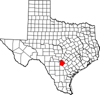 | |
| Towns | ||
| CDPs | ||
| Other unincorporated communities | ||
| Footnotes | ‡This populated place also has portions in an adjacent county or counties | |
Municipalities and communities of Guadalupe County, Texas, United States | ||
|---|---|---|
| Cities | 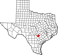 | |
| CDPs | ||
| Other unincorporated places |
| |
| Ghost towns |
| |
| Footnotes | ‡This populated place also has portions in an adjacent county or counties | |