Chūkyō Metropolitan Area
| Chūkyō Metropolitan Area
中京圏 | |
|---|---|
|
Nagoya | |
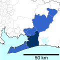
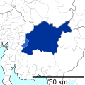
 Location in Japan | |
| Coordinates: 35°10′N 136°55′E / 35.167°N 136.917°ECoordinates: 35°10′N 136°55′E / 35.167°N 136.917°E | |
| Country |
|
| Largest City | Nagoya |
| Area | |
| • Metro | 7,072 km2 (2,731 sq mi) |
| Population (Population Census of Japan 2010)[1] | |
| • Metro | 9,107,414 |
| • Metro density | 1,288/km2 (3,335/sq mi) |
.JPG)

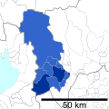
Chūkyō (中京圏 Chūkyō-ken), or the Chūkyō region (中京地方 Chūkyō-chihō), is a major metropolitan area in Japan that is centered on the city of Nagoya (the "Chūkyō", i.e., the "capital in the middle") in Aichi Prefecture. The area makes up the most-urban part of the Tōkai region. The population (as of 2010) of 9,107,414 over an area of 7,072 square kilometers.
It is among the 50 most-populous metropolitan areas in the world and is the third-most-populous metropolitan area in Japan (after Greater Tokyo and Osaka-Kobe-Kyoto), containing roughly 7% of Japan's population. Historically, this region has taken a back seat to the other two power centers, both politically and economically; however, the agglomeration of Nagoya is the 22nd-largest economy, in terms of gross metropolitan product at purchasing power parity in 2014, according to a study by the Brookings Institution.[2] The GDP in Greager Nagoya, Nagoya Metropolitan Employment Area, is US$256.3 billion in 2010.[3][4]
Municipalities
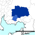
The metropolitan area stretches beyond the central city of Nagoya to other municipalities in Aichi Prefecture, as well as neighboring Gifu and Mie prefectures.
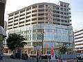
Aichi Prefecture
- Western Aichi Prefecture
.jpg)
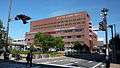


- Eastern Aichi Prefecture

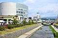
Gifu Prefecture


Mie Prefecture


Transport
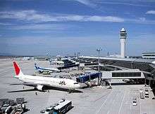

Major airports
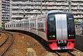
Major railways
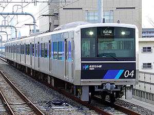
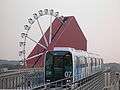
There are at least 38 passenger train lines in the Greater Nagoya area. JR runs six, Nagoya Subway seven, Meitetsu 18, Kintetsu four, and five other operators one each.
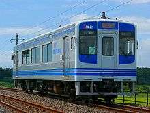
- Other operators


Major intercity highways
- Chita-Hanto Expressway
- Chūō Expressway
- Higashi-Meihan Expressway
- Isewangan Expressway
- Meishin Expressway
- Tōkai Ring Expressway
- Tōkai-Hokuriku Expressway
- Tomei Expressway
See also
- Nagoya
- Greater Nagoya Initiative
- Chūkyō Industrial Area
- Chūkyō Television Broadcasting
- Chukyo University
- List of metropolitan areas in Japan by population
Notes
- ↑ Statistics Bureau of Japan
- ↑ 2014 GLOBAL METRO MONITOR MAP
- ↑ Yoshitsugu Kanemoto. "Metropolitan Employment Area (MEA) Data". Center for Spatial Information Science, The University of Tokyo.
- ↑ Conversion rates - Exchange rates - OECD Data
The area defined by the Chukyo Area Person-Trip Survey, a study of commuter movement, is slightly different from the census definition. It includes southern Aichi and areas immediately north of Gifu City. It adds two cities in Aichi Prefecture (Tahara and Toyohashi) and two cities in Gifu Prefecture (Mino and Seki). Additionally, it excludes two cities in Gifu Prefecture (Ena and Nakatsugawa).
World's fifty most-populous urban areas | ||||||
|---|---|---|---|---|---|---|