Seguin, Ontario
| Seguin | |
|---|---|
| Township (single-tier) | |
| Township of Seguin | |
|
Gordon Bay on Lake Joseph | |
 Seguin | |
| Coordinates: 45°17′18″N 79°48′42″W / 45.288203°N 79.811561°WCoordinates: 45°17′18″N 79°48′42″W / 45.288203°N 79.811561°W | |
| Country |
|
| Province |
|
| District | Parry Sound |
| Incorporated | January 1, 1998 |
| Government | |
| • Type | Township |
| • Mayor | Bruce Gibbon |
| • Federal riding | Parry Sound—Muskoka |
| • Prov. riding | Parry Sound—Muskoka |
| Area[1] | |
| • Land | 595.42 km2 (229.89 sq mi) |
| Population (2011)[1] | |
| • Total | 3,988 |
| • Density | 6.7/km2 (17/sq mi) |
| Time zone | EST (UTC-5) |
| • Summer (DST) | EDT (UTC-4) |
| Area code(s) | 705 |
| Website | www.seguin.ca |

Seguin is a township in central Ontario, Canada, in the District of Parry Sound.
History
The Township of Seguin was created by Minister's Order, dated May 8, 1997. Pursuant to this Order, the Township of Seguin became a newly incorporated municipality, effective January 1, 1998.
The Township of Seguin is the amalgamated municipality of the former Townships of Christie, Foley and Humphrey, and the Village of Rosseau as well as an annexation of the western portion of the unorganized Township of Monteith.
The township
The Township of Seguin is the most southerly municipality in the District of Parry Sound. It is also the first municipality in Northern Ontario in the Highways 69 and 400 corridor.
The township includes the communities of Black Road, Brignall, Dockmure, Dock Siding, Falding, Gordon Bay, Haines Lake, Hamer Bay, Hayes Corners, Holmur, Horseshoe Lake, Humphrey, Lake Joseph, Orrville, Otter Lake, Port Cockburn, Rose Point, Rosseau, Rosseau Road, Seguin Falls, South Parry, Stanley House, Swords and Turtle Lake.
Demographics
According to the 2011 Statistics Canada Census:[1]
- Population: 3,988
- % Change (2001-2006): -6.7%
- Dwellings: 4,348
- Area (km²): 595.42
- Density (persons per km²): 6.7
See also
References
External links
 |
Parry Sound | McDougall, McKellar | Magnetawan | |
| Wasauksing First Nation | |
McMurrich/Monteith Muskoka Lakes | ||
| ||||
| | ||||
| The Archipelago (south part) | Georgian Bay | Muskoka Lakes |
| Towns | 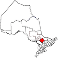 | |
|---|---|---|
| Townships | ||
| Villages | ||
| First Nations | ||
| Indian reserves | ||
| Local services boards | ||
| Unorganized areas | ||
| ||