Chorabari Glacier
| Chorabari Glacier | |
|---|---|
| Chorabari Bamak Glacier | |
|
Satellite image of the glacier | |
| Type | Valley glacier |
| Location | Uttarakhand, India |
| Coordinates | 30°45′27″N 79°03′27″E / 30.75750°N 79.05750°ECoordinates: 30°45′27″N 79°03′27″E / 30.75750°N 79.05750°E |
| Area | 15 square kilometres (5.8 sq mi) |
| Length | 7 kilometres (4.3 mi) |
| Thickness | 30 metres (98 ft) to 75 metres (246 ft) |
| Terminus | Chorabari Tal |
| Status | Receding |

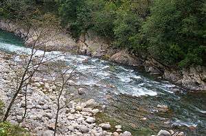
The Chorabari Glacier or Chorabari Bamak Glacier is a glacier in the Garhwal Himalaya region of the state of Uttarakhand in India. The glacier lies close to Kedarnath, an important destination for Hindu pilgrims. One of the glacier's two snouts is the source for the Mandakini River, a tributary of the Alaknanda river.
Geography
The glacier lies between latitudes 30°44′50″N and 30°45′30″N, and longitudes 79°1′16″E and 79°5′20″E, from an altitude of approximately 6,000 metres (20,000 ft) at the slopes of Kedarnath peak, to 3,800 metres (12,500 ft). The glacier is around 7 kilometres (4.3 mi) in length, while the basin area of the glacier is approximately 38 square kilometres (15 sq mi)[1] and the glacier ice cover is 5.9 square kilometres (2.3 sq mi). The glacier slope is around 11 degrees and faces south.[2] The glacier has two snouts. It is hypothesized by R. K. Chaujar that an original single glacier covered the area, which while receding, split into two snouts. One of the snouts is the source of the Mandakini River at 3,865 metres (12,680 ft). The other snout, at 3,835 metres (12,582 ft), drains into the Chorabari Tal.[1]
Glacier retreat
Though the glacier has not been extensively studied in the past, records of its extent exist from 1962 onwards. Since then, studies conducted at the Chorabari glacier are playing an important role in determining the impact of global warming on Himalayan glaciers.[3] The presence of debris and boulders on the glacier's surface comparatively retard the melting of the ice. Retreat for this glacier can be traced from 1960. In recent years, annual observations have been taken of the retreat. Though the glacier has been continuously retreating for the period between 1960 and 2007,[4] this evidence is not conclusively linked to global warming.[5] R. K. Chaujar's research indicates that the glacier has gone through other periods of retreat and advance in the past. Through lichenometry and the study of engravings on the walls of Kedarnath temple, Chaujar concludes that the Chorabari glacier began its current retreat over two-and-a-half centuries ago in 1748. It has been argued that this indicates that the Medieval Warm Period and Little Ice Age were not restricted to Europe. This has also been proposed as evidence that the current retreat of Himalayan glaciers may not solely be due to the effects of human activity and global warming.[5]
| Duration | Total Retreat | Average Annual Retreat |
|---|---|---|
| 1960–1990 | 180 m (590 ft) | 6 m (20 ft) /yr |
| 1990–2003 | 82 m (269 ft) | 6.31 m (20.7 ft) /yr |
| 2003–2004 | 8 m (26 ft) | 8 m (26 ft) /yr |
| 2004–2005 | 10 m (33 ft) | 10 m (33 ft) /yr |
| 2005–2006 | 12 m (39 ft) | 12 m (39 ft) /yr |
| 2006–2007 | 9 m (30 ft) | 9 m (30 ft) /yr |
| 2007–2008 | 12.5 m (41 ft) | 12.5 m (41 ft) /yr |
| 2008–2009 | 5 m (16 ft) | 5 m (16 ft) /yr |
| 2009–2010 | 8 m (26 ft) | 8 m (26 ft) /yr |
| Total | 326.5 m (1,071 ft) | 6.53 m (21.4 ft) /yr |
Chorabari Tal
One of the two snouts of the Chorabari glacier terminates at the tarn, Chorabari Tal.[7] Located about 4 kilometres (2.5 mi) from the town of Kedarnath, the lake is visited by tourists in summer, though not in large numbers because of the trek involved in getting there. The lake is also known as Kanti Sarovar. According to yogic legends, Shiva, who is considered the Adi Guru or first guru, transmitted yoga to the Saptarishis, on the bank of this lake.[8][9] In 1948, some of Mahatma Gandhi's ashes were immersed in the lake, after which it was renamed Gandhi Sarovar. Close to the glacier is a Bhairava temple, adjacent to which is a cliff named Bhairava Jhamp. The cliff was a place where devotees leaped off, believing that it would bring them mukti. The practice was banned by the British administration in the nineteenth century.[10]
See also
References
- 1 2 Chaujar, Ravinder. "Climate change and its impact on the Himalayan glaciers – a case study on the Chorabari glacier, Garhwal Himalaya, India" (PDF). Current Science. Indian Academy of Sciences. 96 (5): 703. Retrieved 19 June 2012.
- ↑ Sah, M P. "Snow and Glacier Mapping, p. 10." (PDF). Wadia Institute of Himalayan Geology. Retrieved 27 June 2012.
- ↑ Sengupta, Somini (17 July 2007). "Glaciers in Retreat". The New York Times. p. 1.
- 1 2 D.P Dobhal (24–25 November 2010). "Climate Change and Himalayan Glaciers; Observations and Facts" (PDF). South Asia Media Briefing Workshop on Climate Change. Centre for Science and Environment. p. 25. Retrieved 19 June 2012.
- 1 2 "Lessons of the Ice". World Climate Report. 4 January 2010. Retrieved 19 June 2012.
- ↑ Anil Gupta, D.P Dobhal (28 November 2010). "Effect of Climate Change on the variability of snow and glacier melt" (PDF). Indo- European Co-operation on climate Research and Innovation. Wadia Institute of Himalayan Geology. p. 9. Retrieved 20 June 2012 (Figures for 2007-2010 are derived from graphical data, to an accuracy of 0.625m.). Check date values in:
|access-date=(help) - ↑ Nitya Nand; Kamlesh Kumar (1 January 1989). The Holy Himalaya: A Geographical Interpretation of Garhwal. Daya Pub. House. p. 24. ISBN 978-81-7035-055-2. Retrieved 20 June 2012.
- ↑ Sadhguru Jaggi Vasudev (19 March 2009). "Yoga originated from Shiva". Times of India. Retrieved 2 July 2012.
- ↑ "Adiyogi - The First Yogi". The Isha Blog. Retrieved 8 January 2013.
- ↑ David Abram (1 December 2003). Rough Guide to India. Rough Guides. p. 354. ISBN 978-1-84353-089-3. Retrieved 20 June 2012.