Chitradurga district
| Chitradurga district ಚಿತ್ರದುರ್ಗ ಜಿಲ್ಲೆ Bayalu Seeme | |
|---|---|
| District | |
|
| |
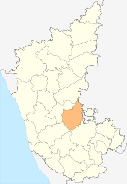 Location in Karnataka | |
| Coordinates: 14°00′N 76°30′E / 14.00°N 76.50°ECoordinates: 14°00′N 76°30′E / 14.00°N 76.50°E | |
| Country |
|
| Division | Bangalore Division |
| Headquarters | Chitradurga |
| Talukas | Chitradurga, Hiriyur, Hosdurga, Molakalmuru, Challakere, Holalkere |
| Government | |
| • Deputy Commissioner | Rajnaik |
| • Member of Parliament | N Chandrappa |
| Area[1] | |
| • Total | 8,440 km2 (3,260 sq mi) |
| Population (2001)[1] | |
| • Total | 1,517,896 |
| • Density | 180/km2 (470/sq mi) |
| Languages | |
| • Official | Kannada |
| Time zone | IST (UTC+5:30) |
| PIN | 577 ? |
| Telephone code | + 91 (8194) |
| ISO 3166 code | IN-KA-CT |
| Vehicle registration | KA-16 |
| Sex ratio | 1.047 ♂/♀ |
| Literacy | 64.5% |
| Lok Sabha constituency | Chitradurga Lok Sabha constituency |
| Precipitation | 522 millimetres (20.6 in) |
| Website |
chitradurga |

Chitradurga district is an administrative district of Karnataka state in southern India.[2] The city of Chitradurga is the district headquarters. Chitradurga gets its name from Chitrakaldurga, an umbrella-shaped lofty hill found there. Tradition dates Chitradurga District to the period of the Ramayana and Mahabharata. The whole district lies in the valley of the Vedavati River, with the Tungabhadra River flowing in the northwest. During the British times it was named Chitaldroog. The district was practically ruled by all the well known dynasties that ruled Karnataka.
Demographics
According to the 2011 census Chitradurga district has a population of 1,660,378,[3] roughly equal to the nation of Guinea-Bissau[4] or the US state of Idaho.[5] This gives it a ranking of 297th in India (out of a total of 640).[3] The district has a population density of 197 inhabitants per square kilometre (510/sq mi).[3] Its population growth rate over the decade 2001–2011 was 9.39%.[3] Chitradurga has a sex ratio of 969 females for every 1000 males,[3] and a literacy rate of 73.82%.[3]
Communities, religions, language
As of 2001 (NB: unreferenced - 2001 census data?), the population was 1,517,896, of which 18.07% were urban. Among the communities represented:, Lingayats, Nayakas, Gollas (Yadavs), Kurubas, Madiga, Bhovi, uppara, kunchitigas Chalavadi and several other communities.Chitradurga district is one amonge the districts where SC/ST population is nearly 42% of total district. The majority of the people in Chitradurga are Hindus, Muslims representing about 9% of the population. Kannada is the most widely spoken language.
Geography
The district is hilly, with lots of forts and villages. The district is bounded by Tumkur District to the southeast and south, Chikmagalur District to the southwest, Davanagere District to the west, Bellary District to the north, and Anantapur District of Andhra Pradesh state to the east. Davanagere District was formerly part of Chitradurga. The district is divided into taluks, namely Chitradurga, Hiriyur, Hosadurga, Holalkere, Challakere and Molakalmuru. It is rich in mineral deposits, including gold prospecting at Halekal, Kotemardi or Bedimaradi, etc., and open cast copper mines at Ingaldhal.
History and Legends
A rock cut edict of Emperor Ashoka, near Bharamagiri reveals that Chitradurga was part of the Mauryan Empire dating to the 3rd century BC. After the fall of the Mauryans, this land was under the rule of royal dynasties like the Rashtrakutas, Chalukyas and Hoysalas. But it really achieved eminence, as a feudatory state of the Vijayanagar Empire, under the dynastic rule of the Nayakas or “Paleyars”, known for their heroic exploits. The most eminent of the feudatory chieftains, was Madakari Nayaka, who after the fall of the Vijayanagar Empire, declared his suzerainty and consolidated his power. This hill fortress built by the Nayakas during the Vijayanagar era, became their stronghold later. In 1779, the fort was captured by Haider Ali, who along with his son Tipu Sultan, was responsible for its expansion and strengthening. After Tipu Sultan’s defeat by the British, the fort came under the rule of the Royal Mysore family.
Chitradurga features bold rock hills and picturesque valleys, huge towering boulders in unimaginable shapes. It is known as the "stone fortress" (Kallina Kote). The landscape looks much like a mischievous giant's playground, with boulders thrown around, forming silhouettes against the sky. According to a story in the Epic Mahabharatha, a man-eating gaint named Hidimbasura lived on the Chitradurga hill and was a source of terror to everyone around. When the Pandavas came with their mother Kunti in the course of their exile, Bhima had a duel with Hidimba. Hidimba was slain by Bhima and peace returned to the area. Legend has it the boulders were part of the arsenal used during that duel. In fact, the boulders on which major part of the city rests belong to the oldest rock formation in the country.
Timmana Nayaka a chieften under the Vijayanagar empire rose to the rank of governor of Chitradurga as a reward for his excellence in military achievements, from the Vijayanagara ruler. This was the beginning of the rule of the Nayakas of Chitradurga. His son Obana Nayaka is known by the name Madakari Nayaka 1588 CE. Madakari Nayaka's son Kasturi Rangappa 1602 succeeded him and consolidated the kingdom to rule peacefully. As he had no heirs to succeed him, his adopted son, the apparent heir was enthroned but was killed in few months by the Dalavayis.
Chikkanna Nayaka1676 the brother of Madakari Nayaka II sat on the throne, and his brother succeeded him with the title Madakari Nayaka III in 1686. The unwillingness of Dalawayis to accept Madakari Nayaka III's rule gave an opportunity to one of their distant relatives, Bharamappa Nayaka to ascend the throne in 1689. He is known as dthe greatest of the Nayaka rulers. Somehow, the subjects of Chitradurga did not experience a good reign of the successive rulers as they ruled on the throne for very brief periods. The Hiri Madakari Nayaka IV 1721, Kasturi Rangappa Nayaka II 1748, Madakari Nayaka V 1758 ruled this area but there is not much to mention of their rule.
Timmana Nayaka a chieften under the Vijayanagar empire rose to the rank of governor of Chitradurga as a reward for his excellence in military achievements, from the Vijayanagara ruler. This was the beginning of the rule of the Nayakas of Chitradurga. His son Obana Nayaka is known by the name Madakari Nayaka 1588 CE. Madakari Nayaka's son Kasturi Rangappa 1602 succeeded him and consolidated the kingdom to rule peacefully. As he had no heirs to succeed him, his adopted son, the apparent heir was enthroned but was killed in few months by the Dalavayis.
Chikkanna Nayaka 1676, the brother of Madakari Nayaka II sat on the throne, and his brother succeeded him with the title Madakari Nayaka III in 1686. The unwillingness of Dalawayis to accept Madakari Nayaka III's rule gave an opportunity to one of their distant relatives, Bharamappa Nayaka to ascend the throne in 1689. He is known as dthe greatest of the Nayaka rulers. Somehow, the subjects of Chitradurga did not experience a good reign of the successive rulers as they ruled on the throne for very brief periods. The Hiri Madakari Nayaka IV 1721, Kasturi Rangappa Nayaka II 1748, Madakari Nayaka V 1758 ruled this area but there is not much to mention of their rule.
Battle with Hyder Ali, Legend of Obavva
During the reign of Madakari Nayaka, the city of Chitradurga was besieged by the troops of Hyder Ali. A chance sighting of a woman entering the Chitradurga fort through an opening in the rocks led to a clever plan by Hyder Ali to send his soldiers through the hole. The guard on duty near that hole had gone home for lunch and asked his wife to be on guard until he was back. The wife of that guard, Obavva while in her temporary seat, noticed soldiers emerging out of this opening. Obavva was not perturbed. She was carrying with her an Onake (a long wooden club meant for pounding paddy grains). She killed Hyder Ali's soldiers one by one as they attempted to enter the fort through the opening and quietly moved the dead. Over a short period of time hundreds of soldiers entered and fell, without raising any suspicion. Obavva's husband, upon his return from his lunch was shocked to see Obavva standing with a blood stained Onake and hundreds of dead bodies of the enemy around her. The opening in the rocks still remains as a historical witness for the story, beside the Tanniru doni a small water source which holds cold water all round the year. Though her sincere and brave attempt saved the fort on that occasion, Madakari Nayaka could not repel Hyder Ali's attack in 1779. In the ensuing battle, the fort of Chitradurga was lost to Hyder Ali. Obavva, like Kittur Rani Chennamma remains a legend, especially to the woman of Karnataka.
The Fort
Chitradurga Fort is renowned for its name Kallina Kote / Ukinna kote / Elu Suttina kote in Kannada, which was built in parts by the Palegar Nayakas, Hyder Ali and Tipu Sultan. It comprises a series of seven enclosure walls. Eighteen ancient temples can be found inside the fort. This seemingly impregnable fort has 19 gateways, 38 posterior entrances, a palace, a mosque, granaries, oil pits, four secret entrances and water tanks. The rulers of this fort built 2000 watch towers to guard and have a better look at enemies movement all the time.
Chitradurga Fort has its root back from 10th century AD. This fort was built and expanded by different rulers such as Chalukyas, Rashtrakutas and Hoysalas but the golden era of this fort was between 14th to 18th centuries. In this period the fort was under the “Nayakas” or “Paleygars” as a feudatory of the Vijaynagar Empire. When Vijaynagar Empire ends in 1565, the Nayakas of Chitradurga took independent control of this fort and the region too, In 1779 AD, Hyder Ali (father of Tipu Sultan) has defeated the Nayakas and included this region to Mysore Dynasty.
Culture under Palegaras
Known for their valour, Chitradurga's Nayaka Palegaras were also patrons of great musicians. Writer Ta. Ra. Su (T.R. Subba Rao) has not only researched extensively in the area but has brought to life several characters who lived in those times in the fortified city. Several films (notably Nagara Haavu, Hamsa Geete and KallaraLi Huvaagi have brought to life the glory of this fort).
Location
Accessible by road, this fortress lies on the outskirts of what is Chitradurga today. The city of Chitradurga is located at the junction of NH-4 (Bangalore-Pune National Highway) and NH-13 (Sollapur-Mangalore National Highway). Chitradurga is also accessible by train. There is a daily service to Bangalore and weekly services to Mumbai. Proposed link between Chitradurga and Tumkur can reduce the travel time to Bangalore by half.
Economy
In 2006 the Ministry of Panchayati Raj named Chitradurga one of the country's 250 most backward districts (out of a total of 640).[6] It is one of the five districts in Karnataka currently receiving funds from the Backward Regions Grant Fund Programme (BRGF).[6]
People
- Madakari Nayaka — Ruler of Chitradurga
- Bichugatti Baramanna Nayaka
- Onake Obavva — Legendary woman who fought Hyder Ali's army.
- Malladihalli Sri Raghavendra Swamiji (Tiruka) — yogi and Ayurvedic guru
- S. Nijalingappa (vinayak) — politician, ex-CM, ex-MP and ex All India Congress lead
- Talukina venkannaiah - literary legend in Kannada literature.
- T.R. Subba Rao (TaRaSu) — a novelist, 1985 winner of Sahitya Akademi Award for his novel Durgasthamana
- Venkata Subba Iyengar — musician about whom the movie Hamsageethe was made
- P.R. Thippeswamy (PRT) Artist, Writer & Folklorist – K. Venkatappa Awardee 1999, ex-Chairman Karnataka Lalithakala Academy, Harthikote Village, Hiriyur Taluk
- Sri Shivamurthy Murugha Sharanaru (SHIMUSHA) of Sri Murugha Mutt, Chitradurga
- Sri Shivamurthy Shivacharya swamiji of Tharalabalu Mutt, Sirigere
- Sri Shivalingananda Swamiji, Kabirananda ashrama, Chitradurga
- B.L. Venu, Novelist, Chitradurga
- Yugadharma Ramanna, Janapada Poet, Founder of Daddarapada University
- Prof. Paramesh, Retired Kannada Professor, Poet, Harthikote Village, Hiriyur Taluk
- Yalanadu Anjanappa, Retired Teacher, writer, Hiriyur
- Sri Niranjanandapuri Swamiji, Kaaginele Mutt, Kaaginele, Harthikote Village, Hiriyur Taluk
Places to visit
- Chitradurga Fort is a fort that is one of a kind, as it is built on top of hill with stones. The city and district are named for it; the name means "picture perfect".
- Chandravalli, archaeological site where painted pottery and coins from the Shatavahana empire and prehistoric times were discovered. The rock inscription of king Mayurasharma dated 450 CE. discovered here gave historians much information about Karnataka's first Kannada kingdom.
- Jogimatti Hill Station (Reserve forest)
- Adumalleshwara, a small zoo near Jogimatti forest
- Murugha Mutt, tourist spot and fort.
- Ashoka Siddapura, archaeological site where emperor Ashoka's edicts were found. Nearby is Ramagiri, a hillock that has mythical associations with the epic Ramayana. A temple dedicated to Rameshwara built in 926 CE. exists here.
- Brahmagiri village is the ancient site of Ishila, one of emperor Ashoka's provincial capitals. His earliest rock edicts in Brahmi script and Prakrit language (3rd century BC) containing Kannada words were discovered here.
- Hiriyur, situated on the right bank of Vedavathi River, is famous for its Therumalleshawara temple. The temple has an impressive lofty gopura and the ceiling of the main hall is painted with scenes from the Shivapurana and Ramayana.
- Molakalmuru, fortified town of the Kadambas
- Neerthadi, famous for its Ranganathaswamy temple built in Vijayanagar style.
- Vani Vilas Sagar (also known as Mari Kanive), an artificial lake built by the Mysore Maharaja across the river Vedavathi. The reservoir has two mantapas built in saracenic style.
- Gavirangapura, 3 km from Srirampura Hosdurga taluk, with a well known temple dedicated to Kurma, the second avatar of Lord Vishnu.
- Thamatekallu, with ancient rock inscription and the oldest virgallu or hero stone inscription in Karnataka.
- Holalkere, known for its 10th-century Jain settlement and 9-foot statue of Bala Ganapathi, a child form of the Hindu god Ganapathi.
- Doddahottrangappa Hill, with a Ranganathaswamy temple on top
- Halu Rameshwara near Hosadurga, well known for its temple and named for the milky water in its wells
- Harthikote, a historic village of Hiriyur taluk, known for the annual Dana Jathra and the Veerabhadreshwara and Revanna Siddeshwara temples.
See also
References
- 1 2 "District at a Glance". Chitradurga district website. Retrieved 3 January 2011.
- ↑
 Chisholm, Hugh, ed. (1911). "Chitaldrug". Encyclopædia Britannica. 6 (11th ed.). Cambridge University Press. p. 247.
 - 1 2 3 4 5 6 "District Census 2011". Census2011.co.in. 2011. Retrieved 30 September 2011.
- ↑ US Directorate of Intelligence. "Country Comparison:Population". Retrieved 1 October 2011.
Guinea-Bissau 1,596,677 July 2011 est.
- ↑ "2010 Resident Population Data". U.S. Census Bureau. Archived from the original on 19 October 2013. Retrieved 30 September 2011.
Idaho 1,567,582
- 1 2 Ministry of Panchayati Raj (8 September 2009). "A Note on the Backward Regions Grant Fund Programme" (PDF). National Institute of Rural Development. Archived from the original (PDF) on 5 April 2012. Retrieved 27 September 2011.
External links
| Wikimedia Commons has media related to Chitradurga district. |
- Chitradurga district website
- List of places in Chitradurga
- Chitradurga City Municipal Council
- all about Chitradurga in kannada
 |
Davanagere district | Bellary district | Anantapur district, Andhra Pradesh | |
| |
Tumkur district (Northern) | |||
| ||||
| | ||||
| Chikmagalur district | Tumkur district (Southern) | Anantapur district, Andhra Pradesh |
District HQ: Chitradurga | |
| Villages and Towns |
|