China–Kazakhstan border
The China–Kazakhstan border, or the Sino-Kazakhstan border (Kazakh: Қазақстан-Қытай мемлекеттiк шекарасы, Russian: Казахстанско-китайская государственная граница, Chinese: 中哈边界; pinyin: Zhōng-Hā biānjiè) is the international border between the People's Republic of China and the Republic of Kazakhstan. The border line between the two countries has been largely inherited from the border existing between the USSR and the PRC, and, earlier, between the Russian Empire and the Qing Empire; however, it has been fully demarcated only in the late 20th and early 21st century. According to the international boundary commissions that have carried out the border demarcation, the border is 1782.75 km long.
History
The origins of the border line between China and Kazakhstan date from the mid-19th century, when the Russian empire was able to establish its control over the Lake Zaysan region. The establishment of the border between the Russian Empire and the Qing Empire, not too different from today's Sino-Kazakh border was provided for in the Convention of Peking of 1860;[1] the actual border line pursuant to the convention was drawn by the Protocol of Chuguchak (1864), leaving Lake Zaysan on the Russian side.[2][3] The Qing Empire's military presence in the Irtysh basin crumbled during the Dungan revolt (1862–77). After the fall of the rebellion and the reconquest of Xinjiang by Zuo Zongtang, the border between the Russian and the Qing empires in the Ili River basin was further slightly readjusted, in Russia's favor, by the Treaty of Saint Petersburg (1881).
After the Xinhai Revolution and the Chinese Civil War and China and the October Revolution and the Russian Civil War in Russia, the Sino-Russian border became the PRC-USSR border. However, the Chinese and Soviet authorities were not always in agreement where the border line ran on the ground, which led, in particular to a border conflict east of Lake Zhalanashkol in August 1969.
After Kazakhstan became an independent country, it negotiated a border treaty with China, which was signed in Almaty on April 26, 1994, and ratified by the Kazakh president on June 15, 1995. According to the treaty, a narrow strip of hilly terrain east of Zhalanashkol which the USSR and China had contested in 1969 has become recognized as part of China.[4]
To delineate certain small sections of the border more precisely, additional agreements were signed on 24 September 1997 and 4 July 1998.[5] Over the next several years, the border was demarcated on the ground by joint commissions. According to the commissions' protocols and maps, the two countries' border line is 1782.75 km long, including 1215.86 km of land border and 566.89 km of border line run along (or across) rivers or lakes. The commissions' work was documented by several joint protocols, finalized with the Protocol signed in Beijing on May 10, 2002.[5]
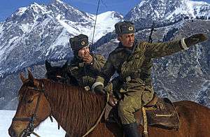
The two countries' border protection authorities carry out regular meetings, and on occasions even joint border patrols.[6]
Border crossings
There are a number of highway crossings on the border, as well as two railway crossings: at Dostyk/Alashankou and at Khorgos.
See also
References
- ↑ Articles 2 and 3 in the Russian text of the treaty
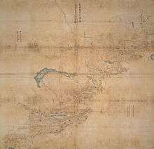
- ↑ (See the map)
- ↑ The Lost Frontier: the treaty maps that changed Qing's northwestern boundaries
- ↑ See the text of the "Agreement between the Republic of Kazakhstan and the People's Republic of China on the Kazakhstan-China international border, signed in Almaty on Aprel 26, 1994" in О ратификации Соглашения между Республикой Казахстан и Китайской Народной Республикой о казахстанско-китайской государственной границе. Указ Президента Республики Казахстан от 15 июня 1995 г. N 2331. The border shown on Google Maps follows the description in the treaty; specifically, border point 38 described in the text is at the border line's crossing with the Terekty River (铁列克提河, Tielieketi he) can be seen at 45°37′00″N 82°15′30″E / 45.61667°N 82.25833°E. The 1969-era Soviet claim in the area can be seen on the period's topo maps, e.g. border point No. 40 on this map.
- 1 2 О ратификации Протокола между Правительством Республики Казахстан и Правительством Китайской Народной Республики о демаркации линии казахстанско-китайской государственной границы. Закон Республики Казахстан от 4 июля 2003 года, N 469. ("On the ratification of the Protocol agreed by the Government of the Republic of Kazakhstan and the Government of the People's Republic of China on the demarcation of the line of the Kazakhstan-China international border. Law No. 469 of the Republic of Kazakhstan. July 4, 2003")
- ↑ Chinese and Kazakh frontier defense troops patrol together along border line, Xinhua, 2011-12-09
External links
| Wikimedia Commons has media related to China-Kazakhstan border. |
- 中哈边界 (China–Kazakhstan border); shows detailed maps of border lines claimed by China and USSR/Kazakhstan, and the final treaty border