Chicken Rock
 | |
 Chicken Rock | |
| Geography | |
|---|---|
| Location | Irish Sea |
| Coordinates | 54°02′16″N 4°50′19″W / 54.03785°N 4.83858°WCoordinates: 54°02′16″N 4°50′19″W / 54.03785°N 4.83858°W |
| Area | 0.1 ha (0.25 acres) |
| Administration | |
|
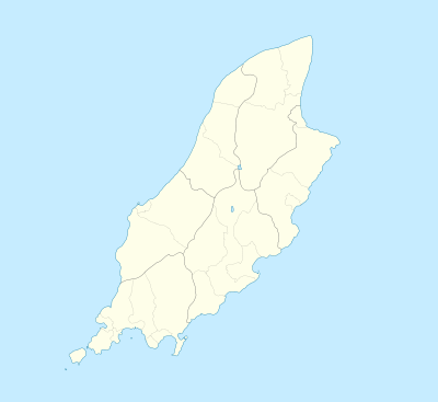
Isle of Man | |
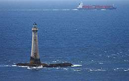
Chicken Rock (Manx: Carrick ny Kirkey), part of Rushen parish, is the southernmost island administered by the Isle of Man. It lies southwest of the Calf of Man, 4.5 kilometres (2.8 mi) off Spanish Head on the Manx mainland.[1] The most prominent feature of the rock is the 19th century Chicken Rock Lighthouse. The 44 metres (144 ft) lighthouse was first lit in 1875, and is owned and maintained by the Northern Lighthouse Board.[2]
See also
References
- ↑ "Chicken Rock - Carrick ny Kirkey". britlink.org.
- ↑ "Chicken Rock Lighthouse". Retrieved 14 October 2014.
External links
| Wikimedia Commons has media related to Chicken Rock. |
This article is issued from Wikipedia - version of the 11/24/2016. The text is available under the Creative Commons Attribution/Share Alike but additional terms may apply for the media files.