Chichicastenango
| Chichicastenango | |
|---|---|
| Municipality | |
|
| |
| Nickname(s): Chichi | |
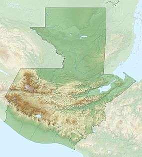
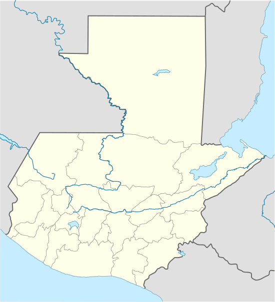 Chichicastenango Location in Guatemala | |
| Coordinates: 14°56′N 91°07′W / 14.933°N 91.117°W | |
| Country |
|
| Department |
|
| Municipality | Chichicastenango |
| Government | |
| • Type | Municipal |
| Area | |
| • Municipality | 400 km2 (200 sq mi) |
| Elevation | 1,965 m (6,447 ft) |
| Population (Census 2012)[1] | |
| • Municipality | 152,833 |
| • Urban | 45,549 |
| • Ethnicities | K'iche' people (98.5%),[2] Ladino (1.5%) |
| • Religions | Roman Catholicism, Evangelicalism, Maya |
| Climate | Cwb |
| Website | Chichicastenango online |
Chichicastenango, also known as Santo Tomás Chichicastenango, is a town in the El Quiché department of Guatemala, known for its traditional K'iche' Maya culture. The Spanish conquistadors gave the town its name from the Nahuatl name used by their soldiers from Tlaxcala: Tzitzicaztenanco, or City of Nettles. Its original name was Chaviar.
Chichicastenango serves as the municipal seat for the surrounding municipality of the same name.
Chichicastenango is a large indigenous town, lying on the crests of mountaintops at an altitude of 1,965 m (6,447 ft). As of 2012, 98.5% of the municipality's population is indigenous Mayan K'iche. 92% of the municipality's population speaks the K'iche language, with the remaining 8% being monolingual Spanish speakers. 71% of the municipality's population was bilingual, speaking both K'iche and Spanish, and an additional 21% were monolingual K'iche speakers. The K'iche people and language dominate the municipality. [3] It is located about 140 km (87 mi) northwest of Guatemala City.[4]
Market

Chichicastenango is well known for its famous market days on Thursdays and Sundays where vendors sell handicrafts, food, flowers, pottery, wooden boxes, condiments, medicinal plants, candles, pom and copal (traditional incense), cal (lime stones for preparing tortillas), grindstones, pigs and chickens, machetes, and other tools. In the central part of the market plaza are small eateries (comedores).
Among the items sold are textiles, particularly the women's blouses. The manufacture of masks, used by dancers in traditional dances, such as the Dance of the Conquest, have also made this city well known for woodcarving.
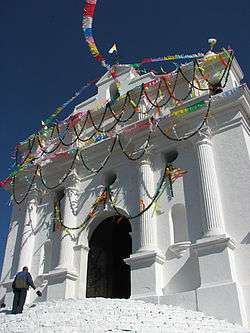
Church of Santo Tomás
Next to the market is the 400-year-old church of Santo Tomás. It is built atop a Pre-Columbian temple platform, and the steps originally leading to a temple of the pre-Hispanic Maya civilization remain venerated. K'iche' Maya priests still use the church for their rituals, burning incense and candles. In special cases, they burn a chicken for the gods. Each of the 18 stairs that lead up to the church stands for one month of the Maya calendar year. Another key element of Chichicastenango is the Cofradia of Pascual Abaj, which is an ancient carved stone venerated nearby and the Maya priests perform several rituals there. Writing on the stone records the doings of a king named Tohil (Fate).[5]
The Chichicastenango Regional Museum lies in its grounds.
In music
At least three songs have been written about the town.
- “Chichicastenango” Xavier Cugat 1937
- "In Chi-Chi Castenango" Edmundo Ros Mambo Jambo: Original Recordings 1941-1950
- "In the Land of The Maya" Lennie Gallant In the Land of The Maya
In addition, the character Rosie from Bye Bye Birdie sings sarcastically of being the toast of Chichicastenango.
Geography
Chichicastenango is composed of the municipal seat and 81 rural communities.[6] Nearby village communities include Paquixic (1.0 nm), Chucam (1.0 nm), Chujupen (1.4 nm), Camanibal (2.2 nm), Chontala (2.2 nm) and Chucojom (1.0 nm).
Gallery
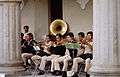 Local band
 Mayan Women
 Mother buying flowers
 Indoor produce market
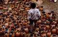 Chichicastenango pots
 A view of the cemetery
In films
The New Adventures of Tarzan' (1935)
In 1935, the film The New Adventures of Tarzan, was filmed on location in Guatemala, taking advantage of the help from the United Fruit Company and president Jorge Ubico. The places where the filming was made were:
- Chichicastenango: scenes of a native town where the explorers first met.[7]
- Antigua Guatemala: The Green Goddess temple
- Río Dulce
- Puerto Barrios: arrival and departure of the boats carrying the explorers
- Tikal: jungle scenes
- Quiriguá: Mayan city where they get lectured on the maya civilization
- Guatemala City: then luxurious Palace Hotel was used to shoot the scenes of the hotel in the imaginary town of At Mantique[7]
Geographic location
 |
Santa Cruz del Quiché, Chiché, Chinique and Patzité, El Quiché Department | | ||
| Totonicapán, Totonicapán Department municipality | |
Tecpán, Chimaltenango Department municipality Joyabaj, El Quiché municipality[8] | ||
| ||||
| | ||||
| Tecpán, Chimaltenango department municipality Concepción and Sololá, Sololá Department municipalities[8] |
See also
-
 Guatemala portal
 -
 Geography portal
 - List of places in Guatemala
References
- ↑ https://translate.google.com/translate?hl=en&sl=es&tl=en&u=http%3A%2F%2Fojoconmipisto.com%2Fchichicastenango%2F&anno=2&sandbox=1
- ↑ "Archived copy". Archived from the original on 2014-11-06. Retrieved 2014-11-06.
- ↑ "Archived copy". Archived from the original on 2014-11-06. Retrieved 2014-11-06.
- ↑ http://ojoconmipisto.com/chichicastenango/
- ↑ Epigraphic Society Occasional Publications, Vol. 17, 1988 A Decipherment of the Chichicastenango Stone (22 pp) John S. Carroll -p 31
- ↑ "Santo Tomás Chichicastenango - Plan de Desarrollo Municipal" (PDF). Municipalidad de Chichicastenango. 2002. Retrieved 2008. Check date values in:
|access-date=(help) - 1 2 Barillas, Edgar (2013). "50 películas filmadas en Guatemala y una que no (1935-1996). Apuntes para una cartografía de los lugares filmados en Guatemala". Revista Historia de la Universidad de San Carlos de Guatemala (in Spanish). Guatemala. Archived from the original on October 22, 2015. Retrieved 22 October 2015.
- 1 2 SEGEPLAN. "Municipios de Quiché, Guatemala". Secretaría General de Planificación y Programación de la Presidencia de la República. Guatemala. Archived from the original on 2 July 2015. Retrieved 30 June 2015.
External links
-
 Media related to Chichicastenango at Wikimedia Commons
 - Official website
- Map with information and pictures of the touristic points of interest in Chichicastenango
Coordinates: 14°56′N 91°07′W / 14.933°N 91.117°W
Capital: Santa Cruz del Quiché | ||
| Municipalities | 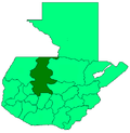 | |