Chian Yai District
| Chian Yai เชียรใหญ่ | |
|---|---|
| Amphoe | |
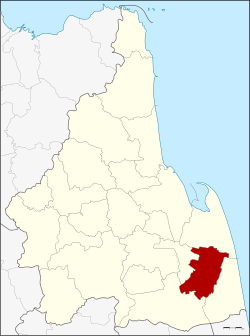 Amphoe location in Nakhon Si Thammarat Province | |
| Coordinates: 8°10′6″N 100°8′42″E / 8.16833°N 100.14500°ECoordinates: 8°10′6″N 100°8′42″E / 8.16833°N 100.14500°E | |
| Country |
|
| Province | Nakhon Si Thammarat |
| Seat | Chian Yai |
| Area | |
| • Total | 232.7 km2 (89.8 sq mi) |
| Population (2005) | |
| • Total | 45,827 |
| • Density | 196.9/km2 (510/sq mi) |
| Time zone | THA (UTC+7) |
| Postal code | 80190 |
| Geocode | 8006 |
Chian Yai (Thai: เชียรใหญ่) is a district (Amphoe) in the southeastern part of Nakhon Si Thammarat Province, southern Thailand.
Geography
Neighboring districts are (from the north clockwise) Pak Phanang, Hua Sai, Cha-uat and Chaloem Phra Kiat.
History
The minor district (King Amphoe) on February 1, 1937 by splitting it from Pak Phanang district. It was upgraded to a full district on November 3, 1947.
Administration
The district is subdivided into 10 subdistricts (tambon), which are further subdivided into 98 villages (muban). Chian Yai is a township (thesaban tambon) which covers parts of tambon Chian Yai, Tha Khanan and Thong Lamchiak. There are further 9 Tambon administrative organizations (TAO).
|
 |
Missing numbers belong to tambon which now form Chaloem Phra Kiat.
External links
This article is issued from Wikipedia - version of the 8/3/2014. The text is available under the Creative Commons Attribution/Share Alike but additional terms may apply for the media files.