Chester Airport
| Chester Airport | |||||||||||
|---|---|---|---|---|---|---|---|---|---|---|---|
| IATA: none – ICAO: KSNC – FAA LID: SNC | |||||||||||
| Summary | |||||||||||
| Airport type | Public | ||||||||||
| Owner | Whelen Aviation | ||||||||||
| Location | Chester, Connecticut | ||||||||||
| Elevation AMSL | 416 ft / 127 m | ||||||||||
| Coordinates | 41°23′02″N 072°30′21″W / 41.38389°N 72.50583°W | ||||||||||
| Map | |||||||||||
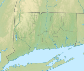 SNC  SNC Location of airport in Connecticut/United States | |||||||||||
| Runways | |||||||||||
| |||||||||||
| Statistics (2000) | |||||||||||
| |||||||||||
Chester Airport (ICAO: KSNC, FAA LID: SNC) is a public use airport located three miles (5 km) southwest of the central business district of Chester, a town in Middlesex County, Connecticut, United States. It is privately owned by Whelen Aviation.[1] It is included in the Federal Aviation Administration (FAA) National Plan of Integrated Airport Systems for 2017–2021, in which it is categorized as a general aviation facility.[2]
Although most U.S. airports use the same three-letter location identifier for the FAA and IATA, Chester Airport is assigned SNC by the FAA but has no designation from the IATA (which assigned SNC to General Ulpiano Paez Airport in Salinas, Ecuador).[3][4]
Facilities and aircraft
Chester Airport covers an area of 146 acres (59 ha) which contains one asphalt paved runway (17/35) measuring 2,566 x 50 ft (782 x 15 m).[1]
For the 12-month period ending August 21, 2000, the airport had 20,800 aircraft operations, an average of 56 per day: 80% general aviation and 20% air taxi. There are 115 aircraft based at this airport: 87% single engine, 9% multi-engine, 3% helicopters and 2% ultralights.[1]
References
- 1 2 3 4 FAA Airport Master Record for SNC (Form 5010 PDF), effective 2007-07-05
- ↑ "List of NPIAS Airports" (PDF). FAA.gov. Federal Aviation Administration. 21 October 2016. Retrieved 27 November 2016.
- ↑ Great Circle Mapper: KSNC - Chester, Connecticut
- ↑ Great Circle Mapper: SNC / SESA - Salinas, Ecuador (General Ulpiano Paez Airport)
External links
- Resources for this airport:
- FAA airport information for SNC
- AirNav airport information for KSNC
- FlightAware airport information and live flight tracker
- NOAA/NWS latest weather observations
- SkyVector aeronautical chart, Terminal Procedures