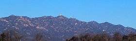
Cheonggyesan (Seoul/Gyeonggi)
| Cheonggyesan | |
|---|---|
 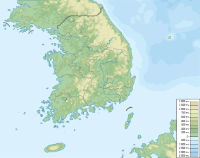 Cheonggyesan Location | |
| Highest point | |
| Elevation | 620 m (2,030 ft) |
| Coordinates | 37°24′56″N 127°02′29″E / 37.41556°N 127.04139°ECoordinates: 37°24′56″N 127°02′29″E / 37.41556°N 127.04139°E |
| Geography | |
| Location | South Korea |
| Climbing | |
| Easiest route | from Indeogwon Station, Yangjae Station then by MaEul Bus 08 to the HwangSeung Bus Stop(환승주차장) |
| Korean name | |
| Hangul | 청계산 |
|---|---|
| Hanja | 淸溪山 |
| Revised Romanization | Cheonggyesan |
| McCune–Reischauer | Ch'ŏnggyesan |
Cheonggyesan is a mountain in South Korea. It extends over the district of Seocho-gu in Seoul, the national capital, and the cities of Gwacheon, Uiwang, and Seongnam in the province of Gyeonggi-do. It has an elevation of 620 m (2,034 ft).[1]
Broadcasting Facilities
| FM Radio | ||||||
| Frequency | Station Name | Call Letters | Output | Broadcast Range | ||
|---|---|---|---|---|---|---|
| 94.5㎒ | YTN NEWSFM | HLQV-FM | 3㎾ | Seoul Metropolitan Area, Northern part of North Chungcheong Province | ||
Transportation
- In Seoul
From Yangjae Station take bus number 4432
- In Uiwang in Gyeonggi Province
From Indeogwon Station Exit 2 take bus number 10 or 10-1 to the "Cheonggyesan Parking Lot" Stop
- In Seongnam in Gyeonggi Province
From Moran Station Exit 3 take the Neighborhood bus number 11-1
See also
Notes
- ↑ Yu 2007, p.120.
References
- Yu Jeong-yeol (2007). 한국의 산 여행 (Travel Guide to Korean Mountains). Seoul: 관동 상억연구회 (Kwandong). ISBN 978-89-958055-1-0.
This article is issued from Wikipedia - version of the 3/14/2015. The text is available under the Creative Commons Attribution/Share Alike but additional terms may apply for the media files.