Chelsea, Alabama
| Chelsea, Alabama | |
|---|---|
| City | |
 | |
| Motto: "It's all about family" | |
 Location in Alabama | |
 Chelsea, Alabama Location in the United States | |
| Coordinates: 33°19′45″N 86°39′3″W / 33.32917°N 86.65083°W | |
| Country | United States |
| State | Alabama |
| County | Shelby |
| Area | |
| • Total | 21.7 sq mi (56.2 km2) |
| • Land | 21.3 sq mi (55.3 km2) |
| • Water | 0.3 sq mi (0.9 km2) |
| Elevation | 512 ft (156 m) |
| Population (2010) | |
| • Total | 10,183 |
| • Density | 469.2/sq mi (1,215.3/km2) |
| Time zone | CST (UTC-6) |
| • Summer (DST) | CDT (UTC-5) |
| ZIP code | 35043 |
| Area code(s) | 205 |
| FIPS code | 01-14104 |
| GNIS feature ID | 0115991 |
| Website | cityofchelsea.com |
Chelsea is a city in Shelby County, Alabama, United States. It is part of the Birmingham metropolitan area. Chelsea was incorporated on March 1, 1996, with a population of 906. At the 2000 census the population was 2,949. According to U.S. Census Bureau, the 2010 population for Chelsea was 10,183.[1] Its seasonal campsite for visitors is Hargis Retreat which began in 1984. Chelsea is widely considered the fastest growing city in Shelby County, which is the fastest growing county in the state of Alabama.[2]
Demographics
| Historical population | |||
|---|---|---|---|
| Census | Pop. | %± | |
| 1990 | 1,329 | — | |
| 2000 | 2,949 | 121.9% | |
| 2010 | 10,183 | 245.3% | |
| Est. 2015 | 12,059 | [3] | 18.4% |
| U.S. Decennial Census[4] 2013 Estimate[5] | |||
In 2010, Chelsea had a population of 10,183. The racial and ethnic composition of the population was 90.5% white or Caucasian, 4.7% black or African American, 0.3% Native American, 2.0% Asian, 0.1% Pacific Islander, 1.1% from some other race, 1.3% from two or more races and 3.2% Hispanic or Latino of any race.[6]
At the 2000 census,[7] there were 2,949 people, 1,022 households and 849 families residing in the city. The population density was 293.6 per square mile (113.4/km2). There were 1,091 housing units at an average density of 108.6 per square mile (42.0/km2). The racial makeup of the city was 96.78% White, 0.78% Black or African American, 0.88% Native American, 0.17% Asian, 0.03% Pacific Islander, 0.58% from other races, and 0.78% from two or more races. 0.81% of the population were Hispanic or Latino of any race.
There were 1,022 households of which 44.2% had children under the age of 18 living with them, 74.2% were married couples living together, 6.6% had a female householder with no husband present, and 16.9% were non-families. 14.0% of all households were made up of individuals and 4.1% had someone living alone who was 65 years of age or older. The average household size was 2.86 and the average family size was 3.17.
29.3% of the population wetre under the age of 18, 7.4% from 18 to 24, 34.0% from 25 to 44, 22.1% from 45 to 64, and 7.3% who were 65 years of age or older. The median age was 34 years. For every 100 females there were 98.9 males. For every 100 females age 18 and over, there were 98.0 males.
The median income for a household in the city was $67,083, and the median income for a family was $72,206. Males had a median income of $46,071 versus $28,403 for females. The per capita income for the city was $24,717. About 5.5% of families and 7.2% of the population were below the poverty line, including 8.4% of those under age 18 and 9.2% of those age 65 or over.
The population of Chelsea is rapidly increasing due to new home construction in the area. The largest of these neighborhoods is Chelsea Park, a joint venture between Eddleman Properties and Thornton Homes, which will have about 3000 new homes when completed.
Schools
Chelsea has five schools in the Shelby County School system:
- Mt. Laurel Elementary (K-5)
- Chelsea Park Elementary (K-5)
- Forest Oaks Elementary (K-5)
- Chelsea Middle (6-8)
- Chelsea High School (9-12).
Politics
The City of Chelsea was incorporated March 1, 1996. Its municipal government is headed by the mayor, Earl Niven, and city council members Juanita Champion, Robert Barnes, Mike Denton and Tony Picklesimer.
Notable people
- Gary Bradberry, Charlie Bradberry, and Stanley Smith - NASCAR
- Fabian Sanchez - Dancing With The Stars member and "Mambo King"
References
- ↑ Source: U.S. Census Bureau, 2010 Census
- ↑ http://factfinder2.census.gov/faces/tableservices/jsf/pages/productview.xhtml?pid=DEC_10_DP_G001&prodType=table
- ↑ "Annual Estimates of the Resident Population for Incorporated Places: April 1, 2010 to July 1, 2015". Retrieved July 2, 2016.
- ↑ "U.S. Decennial Census". Census.gov. Archived from the original on May 11, 2015. Retrieved June 6, 2013.
- ↑ "Annual Estimates of the Resident Population: April 1, 2010 to July 1, 2013". Retrieved June 3, 2014.
- ↑ 2010 race and Hispanic or Latino by place chart for Alabama from the US census
- ↑ "American FactFinder". United States Census Bureau. Archived from the original on 2013-09-11. Retrieved 2008-01-31.
External links
Coordinates: 33°19′45″N 86°39′03″W / 33.329116°N 86.650845°W
Municipalities and communities of Shelby County, Alabama, United States | ||
|---|---|---|
| Cities | 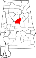 | |
| Towns | ||
| CDPs | ||
| Unincorporated communities | ||
| Footnotes | ‡This populated place also has portions in an adjacent county or counties | |