Cheboygan, Michigan
| Cheboygan, Michigan | |
|---|---|
| City | |
|
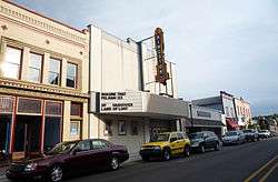
Kingston Theater, downtown Cheboygan | |
 Location in the state of Michigan | |
| Coordinates: 45°38′49″N 84°28′28″W / 45.64694°N 84.47444°W | |
| Country | United States |
| State | Michigan |
| County | Cheboygan |
| Government | |
| • Mayor | Richard B. Sangster |
| Area[1] | |
| • Total | 7.00 sq mi (18.13 km2) |
| • Land | 6.80 sq mi (17.61 km2) |
| • Water | 0.20 sq mi (0.52 km2) |
| Elevation | 591 ft (180 m) |
| Population (2010)[2] | |
| • Total | 4,867 |
| • Estimate (2012[3]) | 4,806 |
| • Density | 715.7/sq mi (276.3/km2) |
| Time zone | EST (UTC-5) |
| • Summer (DST) | EDT (UTC-4) |
| ZIP code | 49721 |
| Area code(s) | 231 |
| FIPS code | 26-15000[4] |
| GNIS feature ID | 0623135[5] |
| Website |
www |
Cheboygan is a city in the U.S. state of Michigan. As of the 2010 census, the city population was 4,876. It is the county seat of Cheboygan County.[6]
The name of the city shares the name of the county and probably has its origin from the Cheboygan River, although the precise meaning is no longer known. It may have come from an Ojibwe word zhaabonigan meaning "sewing needle". Alternatively, the origin may have been "Chabwegan," meaning "a place of ore."[7][8]
The city is at the mouth of the Cheboygan River on Lake Huron. U.S. Highway 23 (US 23) connects with Interstate 75 (I-75) at Mackinaw City and the Mackinac Bridge, about 15 miles (24 km) to the northwest. Rogers City is about 41 miles (66 km) to the southeast. M-27 runs south from the city along the north shore of Mullett Lake to I-75 at Indian River about 18 miles (29 km) to the southwest. M-33 runs due south along the east shore of Lake Mullett to M-68 about 20 miles (32 km) to the south.
History
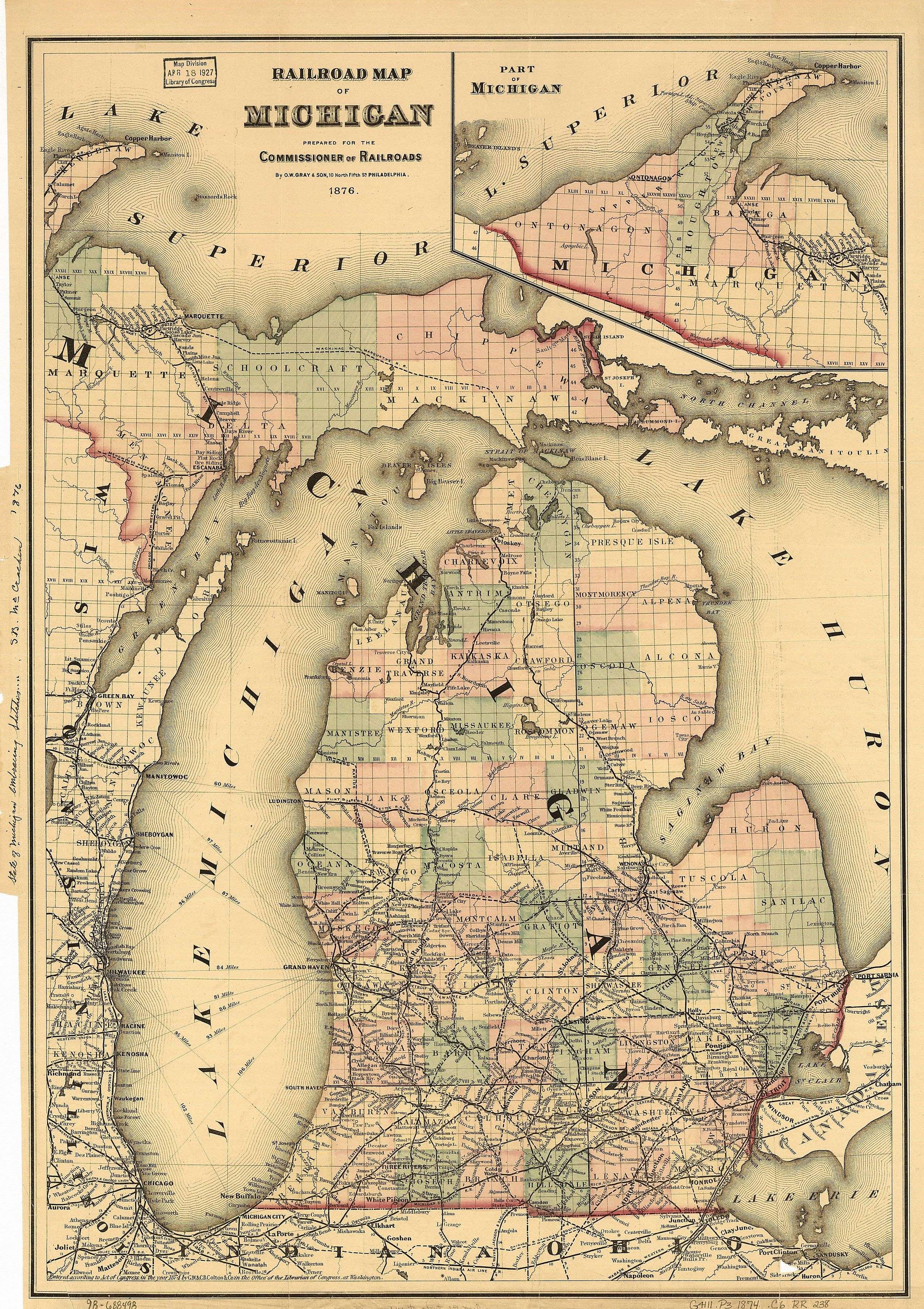
On this 1876 map, Duncan City is shown as a separate city east of Cheboygan in Cheboygan County.
Cheboygan was originally an Ojibwe settlement. In 1844, Jacob Sammons, a cooper from Fort Mackinac, chose the old native camping ground (then called "Shabwegan") as the site for his cabin. He recruited other settlers, and a post office named "Duncan" was established in 1846. It was made the county seat in 1853.
Duncan or Duncan City was given a post office in 1850 as a result of the building of sawmills in this area. Duncan was made the county seat in 1853 and the location of the federal land office in 1855. The county seat shifted to Cheboygan in about 1870. Later Duncan was included within the expanded boundaries of Cheboygan.[9]
The area became known as Cheboygan in 1870. It was incorporated as a village in 1871.[9] Rail maps in 1876 show planned rail service for Cheboygan, but due to various setbacks, rail did not arrive there until 1881.[10] There was a theater built in town in 1877.
Cheboygan was incorporated as a city (versus a village) in 1889.[9]
In approximately 1890, Cheboygan became the home port for ferryboats to nearby Bois Blanc, an island in the Straits of Mackinac. The Kristen D is a ferry which operates between Cheboygan and Bois Blanc Island.[11] Early in the 20th century, it was home to the pioneering brass era cyclecar maker, Flagler.[12]
In 1944, Cheboygan became the home port of the former U.S. Coast Guard cutter and icebreaker Mackinaw, serving from 1944-2006. Beginning in 2006, the port continued this role as the home dock of the new Mackinaw, a successor cutter.
Geography
According to the United States Census Bureau, the city has a total area of 7.00 square miles (18.13 km2), of which 6.80 square miles (17.61 km2) is land and 0.20 square miles (0.52 km2) is water.[1]
Climate
The climate is described as Humid Continental by the Köppen Climate System, abbreviated as Dfb[13]
| Climate data for Cheboygan, Michigan | |||||||||||||
|---|---|---|---|---|---|---|---|---|---|---|---|---|---|
| Month | Jan | Feb | Mar | Apr | May | Jun | Jul | Aug | Sep | Oct | Nov | Dec | Year |
| Average high °C (°F) | −2 (28) |
−2 (28) |
2 (35) |
10 (50) |
17 (62) |
23 (73) |
26 (78) |
25 (77) |
20 (68) |
14 (57) |
5 (41) |
0 (32) |
11.5 (52.4) |
| Average low °C (°F) | −11 (12) |
−13 (8) |
−8 (17) |
−1 (30) |
4 (39) |
10 (50) |
13 (55) |
12 (53) |
9 (48) |
3 (37) |
−1 (30) |
−7 (19) |
0 (32) |
| Average precipitation mm (inches) | 43 (1.7) |
33 (1.3) |
43 (1.7) |
58 (2.3) |
69 (2.7) |
66 (2.6) |
69 (2.7) |
74 (2.9) |
89 (3.5) |
69 (2.7) |
61 (2.4) |
48 (1.9) |
721 (28.4) |
| Source: Weatherbase [14] | |||||||||||||
Demographics
| Historical population | |||
|---|---|---|---|
| Census | Pop. | %± | |
| 1880 | 2,269 | — | |
| 1890 | 6,235 | 174.8% | |
| 1900 | 6,489 | 4.1% | |
| 1910 | 6,859 | 5.7% | |
| 1920 | 5,642 | −17.7% | |
| 1930 | 4,923 | −12.7% | |
| 1940 | 5,673 | 15.2% | |
| 1950 | 5,687 | 0.2% | |
| 1960 | 5,859 | 3.0% | |
| 1970 | 5,553 | −5.2% | |
| 1980 | 5,106 | −8.0% | |
| 1990 | 4,999 | −2.1% | |
| 2000 | 5,295 | 5.9% | |
| 2010 | 4,867 | −8.1% | |
| Est. 2015 | 4,733 | [15] | −2.8% |


2010 census
As of the census[2] of 2010, there were 4,867 people, 2,025 households, and 1,164 families residing in the city. The population density was 715.7 inhabitants per square mile (276.3/km2). There were 2,415 housing units at an average density of 355.1 per square mile (137.1/km2). The racial makeup of the city was 90.8% White, 1.0% African American, 4.6% Native American, 0.2% Asian, 0.2% from other races, and 3.2% from two or more races. Hispanic or Latino of any race were 1.2% of the population.
There were 2,025 households of which 28.3% had children under the age of 18 living with them, 36.7% were married couples living together, 15.2% had a female householder with no husband present, 5.6% had a male householder with no wife present, and 42.5% were non-families. 35.9% of all households were made up of individuals and 16.1% had someone living alone who was 65 years of age or older. The average household size was 2.23 and the average family size was 2.84.
The median age in the city was 40.8 years. 22.1% of residents were under the age of 18; 10.3% were between the ages of 18 and 24; 22.6% were from 25 to 44; 26% were from 45 to 64; and 19% were 65 years of age or older. The gender makeup of the city was 47.9% male and 52.1% female.
2000 census
As of the census[4] of 2000, there were 5,295 people, 2,146 households, and 1,349 families residing in the city. The population density was 779.5 per square mile (301.1/km²). There were 2,365 housing units at an average density of 348.2 per square mile (134.5/km²). The racial makeup of the city was 91.80% White, 0.51% African American, 4.12% Native American, 0.26% Asian, 0.02% Pacific Islander, 0.38% from other races, and 2.91% from two or more races. Hispanic or Latino of any race were 1.44% of the population.
There were 2,146 households out of which 31.8% had children under the age of 18 living with them, 44.4% were married couples living together, 14.9% had a female householder with no husband present, and 37.1% were non-families. 31.6% of all households were made up of individuals and 14.6% had someone living alone who was 65 years of age or older. The average household size was 2.35 and the average family size was 2.94.
In the city the population was spread out with 25.5% under the age of 18, 8.5% from 18 to 24, 27.0% from 25 to 44, 20.4% from 45 to 64, and 18.6% who were 65 years of age or older. The median age was 37 years. For every 100 females there were 89.4 males. For every 100 females age 18 and over, there were 84.7 males.
The median income for a household in the city was $25,033, and the median income for a family was $32,692. Males had a median income of $28,417 versus $19,559 for females. The per capita income for the city was $14,318. About 15.8% of families and 19.9% of the population were below the poverty line, including 31.0% of those under age 18 and 9.1% of those age 65 or over.
Tourist attractions

Media
The city and county are served by a daily newspaper, the Cheboygan Daily Tribune. A television station, WTOM-TV, is licensed to Cheboygan and maintains broadcast facilities along US Highway 23 south of the city, but this station operates as a satellite, with programming originating from parent station WPBN-TV in Traverse City.
Transportation
State trunklines
 US 23
US 23 M-27
M-27 M-33
M-33 I-75 is about 10 miles (16 km) away, but the city is listed as a destination for four interchanges
County-designated highways
Trails
Bus
- Indian Trails provides daily intercity bus service between St. Ignace and Bay City, Michigan.[18] This route doubles as the Amtrak Thruway Motorcoach service for the area.
Notable people
- George M. Humphrey, 55th United States Secretary of the Treasury
- Debbie Massey, golfer. Winner of three LPGA Tour events
- Scott Sigler, 1988 graduate of CAHS. Contemporary American author of science fiction and horror.
References
- 1 2 "US Gazetteer files 2010". United States Census Bureau. Archived from the original on January 24, 2012. Retrieved November 25, 2012.
- 1 2 "American FactFinder". United States Census Bureau. Retrieved November 25, 2012.
- ↑ "Population Estimates". United States Census Bureau. Archived from the original on June 17, 2013. Retrieved June 3, 2013.
- 1 2 "American FactFinder". United States Census Bureau. Archived from the original on September 11, 2013. Retrieved January 31, 2008.
- ↑ "US Board on Geographic Names". United States Geological Survey. October 25, 2007. Retrieved January 31, 2008.
- ↑ "Find a County". National Association of Counties. Archived from the original on May 31, 2011. Retrieved June 7, 2011.
- ↑ Michigan County names per the Michigan government. Archived July 28, 2009, at the Wayback Machine. Compare History of the name "Sheboygan" and List of Michigan county name etymologies. Archived July 28, 2009, at the Wayback Machine.
- ↑ "Bibliography on Cheboygan County". Clarke Historical Library, Central Michigan University. Retrieved January 19, 2013.
- 1 2 3 Romig, Walter (1986) [1973]. Michigan Place Names. Detroit: Wayne State University Press. p. 165. ISBN 0-8143-1838-X.
- ↑ Matthew J. Friday (2010). The Inland Water Route. Arcatia Publishing. p. 14. ISBN 978-0-7385-7734-0.
The railroad arrived in Cheboygan in 1881... prior to this, seasonal navigation provided the only real link to places further south.
- ↑ Robert E. Johnston. "Plaunt Transportation, Inc. :: Ferry Service to Bois Blanc Island". bbiferry.com.
- ↑ It was a 900 pd (408 kg) vehicle which cost US$450. Clymer, p.166.
- ↑ "Cheboygan, Michigan Köppen Climate Classification (Weatherbase)". Weatherbase.
- ↑ "Weatherbase.com". Weatherbase. 2013. Retrieved on August 27, 2013.
- ↑ "Annual Estimates of the Resident Population for Incorporated Places: April 1, 2010 to July 1, 2015". Retrieved July 2, 2016.
- ↑ "Census of Population and Housing". Census.gov. Archived from the original on May 11, 2015. Retrieved June 4, 2015.
- ↑ Friday, Matthew J. (2008). Cheboygan. Postcard History Series. Charleston, SC: Arcadia. p. 40. ISBN 978-0-7385-5220-0 – via Google Books.
- ↑ "BAY CITY-ALPENA-CHEBOYGAN-ST. IGNACE" (PDF). Indian Trails. March 19, 2013. Archived from the original (PDF) on July 24, 2013. Retrieved April 3, 2013.
External links
| Wikimedia Commons has media related to Cheboygan, Michigan. |
- City of Cheboygan
- Cheboygan Area Chamber of Commerce
- Cheboygan: Change in a Small Town 1844-2001
- Website for the USCGC Mackinaw, home ported in Cheboygan
Municipalities and communities of Cheboygan County, Michigan, United States | ||
|---|---|---|
| City | 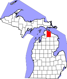 | |
| Villages | ||
| Townships | ||
| CDP | ||
| Other unincorporated communities | ||
| Footnotes | ‡This populated place also has portions in an adjacent county or counties | |
Coordinates: 45°38′49″N 84°28′28″W / 45.64694°N 84.47444°W