Chatham Township, New Jersey
- This article is about a township in New Jersey, for an adjacent borough, see Chatham Borough. For more information about their shared services, including school and library systems, see The Chathams.
| Chatham Township, New Jersey | |
|---|---|
| Township | |
| Township of Chatham | |
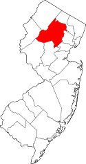
 Chatham Township highlighted in Morris County. Inset map: Morris County highlighted in the state of New Jersey. | |
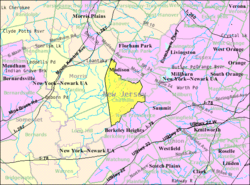 Census Bureau map of Chatham Township, New Jersey | |
| Coordinates: 40°43′02″N 74°26′20″W / 40.717255°N 74.438789°WCoordinates: 40°43′02″N 74°26′20″W / 40.717255°N 74.438789°W[1][2] | |
| Country |
|
| State |
|
| County | Morris |
| Incorporated | February 12, 1806 |
| Named for | William Pitt, 1st Earl of Chatham |
| Government[3] | |
| • Type | Township |
| • Body | Township Committee |
| • Mayor | Curt Ritter (R, term ends December 31, 2016)[4] |
| • Administrator | Thomas E. Ciccarone[5] |
| • Clerk | Gregory J. LaConte[6] |
| Area[1] | |
| • Total | 9.358 sq mi (24.236 km2) |
| • Land | 8.978 sq mi (23.253 km2) |
| • Water | 0.380 sq mi (0.983 km2) 4.06% |
| Area rank |
213th of 566 in state 17th of 39 in county[1] |
| Elevation[7] | 249 ft (76 m) |
| Population (2010 Census)[8][9][10] | |
| • Total | 10,452 |
| • Estimate (2015)[11] | 10,585 |
| • Rank |
235th of 566 in state 19th of 39 in county[12] |
| • Density | 1,164.2/sq mi (449.5/km2) |
| • Density rank |
360th of 566 in state 26th of 39 in county[12] |
| Time zone | Eastern (EST) (UTC-5) |
| • Summer (DST) | Eastern (EDT) (UTC-4) |
| ZIP code | 07928[13][14] |
| Area code(s) | 973[15] |
| FIPS code | 3402712130[1][16][17] |
| GNIS feature ID | 0882194[1][18] |
| Website |
www |
Chatham Township is a township located in Morris County, New Jersey, United States. As of the 2010 United States Census, the township's population was 10,452,[8][9][10] reflecting an increase of 366 (+3.6%) from the 10,086 counted in the 2000 Census, which had in turn increased by 725 (+7.7%) from the 9,361 counted in the 1990 Census.[19]
History
Formation
Chatham Township was incorporated by an act of the New Jersey Legislature on February 12, 1806, from portions of Hanover Township and Morris Township.[20] At the time Chatham Township was created, it included the communities of Chatham, Green Village and Bottle Hill (Madison), together with the extensive rural areas surrounding these communities, with each community retaining its own distinct existence and identity. Before the close of that century however, the township would lose all except one of the settlements under its jurisdiction, as they seceded from the township and established their own municipal governments.
The community known as Bottle Hill was established in the early eighteenth century in Morris Township when the area was within the English Province of New Jersey. Bottle Hill changed its name to Madison in 1834 to honor President James Madison.[21] On December 27, 1889, Madison was incorporated as an independent borough and its former village boundaries were expanded between 1891 - 1899 with annexed portions of rural lands that had formerly been within the township.[20]
The settlement of Chatham had been established in 1710 as John Day's Bridge and, in 1773 when New Jersey was an English province, adopted the name of Chatham to honor William Pitt, 1st Earl of Chatham, a British supporter of the colonial cause.[22][23][24] This village also had been within Morris Township and it was an active community in the Revolutionary War. On August 19, 1892, Chatham seceded from the new township that had taken its name and adopted the village form of government established in the United States for the new state of New Jersey. Shortly thereafter, Chatham adopted the borough form of government on March 1, 1897.[20]
Florham Park was formed from portions of the township on March 20, 1899.[20][25]
Most of Green Village has always been within the township's jurisdiction.
In 1773, the village John Day's Bridge, a community governed by the English township of Morris since its settlement in 1710, was renamed as, Chatham, in honor of Sir William Pitt, a British prime minister and the first Earl of Chatham, who was most favorable toward the colonists of the Province of New Jersey in issues with the British government.[22] Participation in the Revolutionary War was significant by the residents of Chatham. Nearby Morristown was the military center of the revolution, where the winter headquarters were established twice, and revolutionary troops were active in the entire area regularly.
The township form of government is the oldest form of municipal government in the state of New Jersey following the revolution. That form of local government dates back to New Jersey's Township Act of 1798. Chatham Township was formed on February 12, 1806, with jurisdiction over the area of present-day Chatham Borough several communities and settlements, including some that had been part of Hanover and Morris Townships.[20] A great deal of open, swampy, and mountainous land was included with the hamlets.
For a while, the new township included what are now Madison, Chatham Borough and Florham Park, as well as all of Green Village and all of the lands still governed by Chatham Township, but over time these settlements began to secede because of contention over insufficient funding of their projects. Disposition of funds from taxes was perceived as inequitable to the settled areas given their needs versus that of the rural areas, causing them to form their own taxation and governance systems.[26]
Of the pre-revolutionary settlements included in its jurisdiction when it was formed, only portions of Green Village have remained governed by Chatham Township, which has never had a community center.
On December 27, 1889, based on the results of a referendum passed three days earlier, the village of Madison seceded from Chatham Township and adopted the borough form of government in order to develop a local water supply system for its population of 3,250. Madison annexed additional portions of Chatham Township in 1891, and annexed more each year from 1894–1898, followed finally, by an exchange of some lands in 1899 with Chatham Township.[20]
In the midst of these changes, in 1892 "...Chatham Village found itself at odds with the rest of the township. Although village residents paid 40 percent of the township taxes, they got only 7 percent of the receipts in services. The village had to raise its own money to install kerosene street lamps and its roads were in poor repair. As a result, the village voted on August 9, 1892, to secede from the township."[22]
The municipality that is now Florham Park was originally part of Hanover Township, before being included in the township formed in 1806 as Chatham Township. When it seceded from Chatham Township, it incorporated as a borough as Florham Park on March 20, 1899.[20][25]
The boundaries of Chatham Township have remained unchanged since 1899.
Post-World War II suburban development ensued in the 1950s when farm lands, greenhouses, and flower nurseries began to be sold off.[26] Families moved out to this rural suburban area as ownership of automobiles increased dramatically.
The township experienced even more extensive residential development, starting with the 1960s and 1970s, when rezoning enabled residential development of the open spaces and several farms and woodlands were sold off to developers.[27] For several generations, the largest, the Schwartz Farm had produced dairy products that were sold in local stores and schools and that were delivered to homes on scheduled routes. Former rose farms became two major shopping centers near the corner of Shunpike Road and Southern Boulevard. The corner was known as Hickory Tree, named for a hickory tree planted during President Madison's term.[26][27]
Heyl Roses in Green Village was the last and oldest commercial rose and cut flower grower in New Jersey, until its closure in 1999.[28]
Geography
According to the United States Census Bureau, the township had a total area of 9.358 square miles (24.236 km2), including 8.978 square miles (23.253 km2) of land and 0.380 square miles (0.983 km2) of water (4.06%).[1][2]
Chatham Township is located about 25 miles (40 km) west of New York City on the eastern edge of Morris County. Chatham Township's neighboring towns to the south are Union County communities Summit, New Providence, and Berkeley Heights. Long Hill Township and Harding Township/New Vernon to the west, Madison to the north, and Chatham Borough to the east all of which lie within Morris County.
Unincorporated communities, localities and place names located partially or completely within the township include Floral Hill, Great Swamp, Green Village (partially in Harding Township), Hickory Tree, Mount Vernon and The Orchard.[29]
Green Village is the site of the Rolling Knolls Landfill, a landfill identified by the United States Environmental Protection Agency as a Superfund site. The landfill is bordered on two sides by the Great Swamp National Wildlife Refuge, and was formerly known as Miele's Dump, after owner Robert Miele. In operation from the 1930s until the late 1960s, the landfill accepted a wide variety of waste material from municipal and industrial sources, including residential septage and pharmaceutical materials. In 2010, the township designated the site as a redevelopment zone, with the possibility that the area could be remediated as a solar farm.[30]
Weather
Chatham Township has a humid subtropical climate and is slightly more variant (lows are colder, highs are warmer) than its neighbor 20 miles (32 km) east: New York City.
| Climate data for Chatham (07928, includes Chatham Borough and Township) | |||||||||||||
|---|---|---|---|---|---|---|---|---|---|---|---|---|---|
| Month | Jan | Feb | Mar | Apr | May | Jun | Jul | Aug | Sep | Oct | Nov | Dec | Year |
| Record high °F (°C) | 73 (23) |
82 (28) |
89 (32) |
96 (36) |
97 (36) |
103 (39) |
107 (42) |
104 (40) |
99 (37) |
93 (34) |
84 (29) |
76 (24) |
107 (42) |
| Average high °F (°C) | 39 (4) |
42 (6) |
51 (11) |
62 (17) |
73 (23) |
82 (28) |
86 (30) |
85 (29) |
78 (26) |
66 (19) |
55 (13) |
44 (7) |
63.6 (17.8) |
| Average low °F (°C) | 18 (−8) |
20 (−7) |
28 (−2) |
38 (3) |
47 (8) |
57 (14) |
63 (17) |
61 (16) |
53 (12) |
40 (4) |
32 (0) |
24 (−4) |
40.1 (4.4) |
| Record low °F (°C) | −25 (−32) |
−26 (−32) |
−6 (−21) |
12 (−11) |
25 (−4) |
31 (−1) |
41 (5) |
35 (2) |
26 (−3) |
13 (−11) |
−5 (−21) |
−16 (−27) |
−26 (−32) |
| Average precipitation inches (mm) | 3.54 (89.9) |
2.91 (73.9) |
4.20 (106.7) |
4.29 (109) |
4.38 (111.3) |
4.70 (119.4) |
4.73 (120.1) |
4.42 (112.3) |
4.89 (124.2) |
4.65 (118.1) |
4.06 (103.1) |
4.13 (104.9) |
50.9 (1,292.9) |
| Source: [31] | |||||||||||||
Demographics
| Historical population | |||
|---|---|---|---|
| Census | Pop. | %± | |
| 1810 | 2,019 | — | |
| 1820 | 1,832 | −9.3% | |
| 1830 | 1,874 | 2.3% | |
| 1840 | 2,138 | 14.1% | |
| 1850 | 2,469 | 15.5% | |
| 1860 | 2,968 | 20.2% | |
| 1870 | 3,715 | 25.2% | |
| 1880 | 4,276 | 15.1% | |
| 1890 | 4,681 | * | 9.5% |
| 1900 | 620 | * | −86.8% |
| 1910 | 812 | 31.0% | |
| 1920 | 735 | −9.5% | |
| 1930 | 1,115 | 51.7% | |
| 1940 | 2,026 | 81.7% | |
| 1950 | 2,825 | 39.4% | |
| 1960 | 5,931 | 109.9% | |
| 1970 | 8,093 | 36.5% | |
| 1980 | 8,883 | 9.8% | |
| 1990 | 9,361 | 5.4% | |
| 2000 | 10,086 | 7.7% | |
| 2010 | 10,452 | 3.6% | |
| Est. 2015 | 10,585 | [11][32] | 1.3% |
| Population sources: 1810-1920[33] 1840[34] 1850-1870[35] 1850[36] 1870[37] 1880-1890[38] 1890-1910[39] 1910-1930[40] 1930-1990[41] 2000[42][43] 2010[8][9][10] * = Lost territory in previous decade.[20] | |||
Census 2010
At the 2010 United States Census, there were 10,452 people, 3,915 households, and 2,721 families residing in the township. The population density was 1,164.2 per square mile (449.5/km2). There were 4,128 housing units at an average density of 459.8 per square mile (177.5/km2). The racial makeup of the township was 90.84% (9,495) White, 0.75% (78) Black or African American, 0.08% (8) Native American, 6.36% (665) Asian, 0.01% (1) Pacific Islander, 0.38% (40) from other races, and 1.58% (165) from two or more races. Hispanics or Latinos of any race were 3.34% (349) of the population.[8]
There were 3,915 households, of which 37.5% had children under the age of 18 living with them, 63.2% were married couples living together, 4.8% had a female householder with no husband present, and 30.5% were non-families. 27.1% of all households were made up of individuals, and 11.9% had someone living alone who was 65 years of age or older. The average household size was 2.64 and the average family size was 3.29.[8]
In the township, 28.9% of the population were under the age of 18, 4.1% from 18 to 24, 20.1% from 25 to 44, 31.8% from 45 to 64, and 15.1% who were 65 years of age or older. The median age was 43.3 years. For every 100 females there were 89.1 males. For every 100 females age 18 and over, there were 85.5 males.[8]
The Census Bureau's 2006-2010 American Community Survey showed that (in 2010 inflation-adjusted dollars) median household income was $127,679 (with a margin of error of +/- $9,764) and the median family income was $182,216 (+/- $30,473). Males had a median income of $144,400 (+/- $29,559) versus $61,912 (+/- $8,237) for females. The per capita income for the borough was $78,905 (+/- $6,319). About 1.2% of families and 3.6% of the population were below the poverty line, including 3.1% of those under age 18 and 1.5% of those age 65 or over.[44]
Census 2000
As of the 2000 United States Census[16] there were 10,086 people, 3,920 households, and 2,771 families residing in Chatham Township. The population density was 1,081.0 people per square mile (417.4/km2). There were 4,019 housing units at an average density of 430.8 per square mile (166.3/km2). The racial makeup was 93.71% White, 0.45% African American, 0.06% Native American, 4.81% Asian, 0.01% Pacific Islander, 0.15% from other races, and 0.81% from two or more races. Hispanic or Latino of any race were 1.95% of the population.[42][43]
There were 3,920 households out of which 34.7% had children under the age of 18 living with them, 63.4% were married couples living together, 5.9% had a female householder with no husband present, and 29.3% were non-families. 26.3% of all households were made up of individuals and 8.7% had someone living alone who was 65 years of age or older. The average household size was 2.54 and the average family size was 3.11.[42][43]
The population was spread out with 26.7% under the age of 18, 3.7% from 18 to 24, 28.7% from 25 to 44, 27.4% from 45 to 64, and 13.5% who were 65 years of age or older. The median age was 40 years. For every 100 females there were 90.9 males. For every 100 females age 18 and over, there were 85.6 males.[42][43]
The median income for a household was $106,208, and the median income for a family was $131,609. Males had a median income of $100,000 versus $58,750 for females. The per capita income was $65,497. About 1.9% of families and 2.7% of the population were below the poverty line, including 3.0% of those under age 18 and 2.9% of those age 65 or over.[42][43]
Government
Local government
Chatham Township is governed under the township form of government. The five-member Township Committee is elected directly by the voters at-large in partisan elections to serve three-year terms of office on a staggered basis, with either one or two seats coming up for election each year as part of the November general election in a three-year cycle.[3][45] At an annual reorganization meeting, the Township Committee selects one of its members to serve as mayor. The ceremonial mayor serves as the chair of the township committee and has powers vested in the mayor's office by general law.
The township committee is the legislative branch of the community's government and establishes policies for the administration of the various departments. The committee appoints the township administrator who is responsible for carrying out those policies and overseeing the day-to-day operations. Subcommittees of the township committee are public safety; public works; planning, engineering, and land use; parks and recreation; general administration; and finance. Two members of the township committee serve on each and provide oversight to the departments.[46]
As of 2016, members of the Chatham Township Committee are Mayor Curt Ritter (R, term on committee and as mayor ends December 31, 2016), Deputy Mayor Kevin Sullivan (R, term on committee ends 2018; term as deputy mayor ends 2016), Robert Gallop (R, 2016), Michael J. Kelly (R, 2017) and Karen M. Swartz (R, 2017).[47][48][49][50][51][52][53]
Federal, state, and county representation
Chatham Township is located in the 11th Congressional District[54] and is part of New Jersey's 27th state legislative district.[9][55][56] Prior to the 2011 reapportionment following the 2010 Census, Chatham Township had been in the 21st state legislative district.[57]
New Jersey's Eleventh Congressional District is represented by Rodney Frelinghuysen (R, Harding Township).[58] New Jersey is represented in the United States Senate by Cory Booker (D, Newark, term ends 2021)[59] and Bob Menendez (D, Paramus, 2019).[60][61]
For the 2016–2017 session (Senate, General Assembly), the 27th Legislative District of the New Jersey Legislature is represented in the State Senate by Richard Codey (D, Roseland) and in the General Assembly by Mila Jasey (D, South Orange) and John F. McKeon (D, West Orange).[62] The Governor of New Jersey is Chris Christie (R, Mendham Township).[63] The Lieutenant Governor of New Jersey is Kim Guadagno (R, Monmouth Beach).[64]
Morris County is governed by a seven-member Board of Chosen Freeholders, who are elected at-large to three-year terms on a staggered basis, with either two or three seats up for election each year as part of the November general election. The Freeholder Board sets policies for the operation of six super-departments, more than 30 divisions plus authorities, commissions, boards and study committees.[65] Actual day-to-day operation of departments is supervised by County Administrator, John Bonanni.[66] As of 2016, Morris County's Freeholders are Freeholder Director Kathryn A. DeFillippo (Roxbury Township, term ends December 31, 2016),[67] Deputy Freeholder William "Hank" Lyon (Montville, 2017),[68] Douglas Cabana (Boonton Township, 2016),[69] John Cesaro (Parsippany-Troy Hills Township, 2018),[70] Thomas J. Mastrangelo (Montville, 2016)[71] Christine Myers (Mendham Township, 2018),[72] and Deborah Smith (Denville, 2018).[73][66][74] Constitutional officers are County Clerk Ann F. Grossi (Parsippany-Troy Hills Township, 2018),[75] Sheriff Edward V. Rochford (Morris Plains, 2016)[76] and Surrogate John Pecoraro (Mendham Borough, 2019).[66][77]
Politics
As of March 23, 2011, there were a total of 7,354 registered voters in Chatham Township, of which 1,498 (20.4%) were registered as Democrats, 2,826 (38.4%) were registered as Republicans and 3,026 (41.1%) were registered as Unaffiliated. There were 4 voters registered to other parties.[78]
In the 2012 presidential election, Republican Mitt Romney received 61.7% of the vote (3,393 cast), ahead of Democrat Barack Obama with 37.6% (2,064 votes), and other candidates with 0.7% (39 votes), among the 5,521 ballots cast by the township's 7,810 registered voters (25 ballots were spoiled), for a turnout of 70.7%.[79][80] In the 2008 presidential election, Republican John McCain received 53.8% of the vote (3,259 cast), ahead of Democrat Barack Obama with 44.6% (2,699 votes) and other candidates with 1.0% (59 votes), among the 6,053 ballots cast by the township's 7,639 registered voters, for a turnout of 79.2%.[81] In the 2004 presidential election, Republican George W. Bush received 59.3% of the vote (3,499 ballots cast), outpolling Democrat John Kerry with 39.5% (2,334 votes) and other candidates with 0.6% (48 votes), among the 5,905 ballots cast by the township's 7,614 registered voters, for a turnout percentage of 77.6.[82]
In the 2013 gubernatorial election, Republican Chris Christie received 75.3% of the vote (2,594 cast), ahead of Democrat Barbara Buono with 23.6% (814 votes), and other candidates with 1.1% (39 votes), among the 3,499 ballots cast by the township's 7,748 registered voters (52 ballots were spoiled), for a turnout of 45.2%.[83][84] In the 2009 gubernatorial election, Republican Chris Christie received 60.7% of the vote (2,583 ballots cast), ahead of Democrat Jon Corzine with 29.1% (1,236 votes), Independent Chris Daggett with 9.5% (405 votes) and other candidates with 0.3% (13 votes), among the 4,252 ballots cast by the township's 7,407 registered voters, yielding a 57.4% turnout.[85]
Shared services
Chatham Township shares various joint public services with Chatham Borough: the recreation program, the library (since 1974), the school district (created in 1986), the municipal court, and medical emergency squad (since 1936).
Together with Chatham Borough, Madison, and Harding Township, Chatham Township became a member of a joint municipal court, which was created in 2010 and is located in Madison.[86][87][88]
Education
Public schools
Chatham Borough and Chatham Township held elections in November 1986 to consider joining their (at the time separate) school districts. This proposal was supported by the voters of both communities and since then, the two municipalities have shared a regionalized school district, the School District of the Chathams.[89][90]
As of the 2011-12 school year, the district's six schools had an enrollment of 4,057 students and 270.5 classroom teachers (on an FTE basis), for a student–teacher ratio of 15.00:1.[91] Schools in the district (with 2011-12 enrollment data from the National Center for Education Statistics[92]) are Milton Avenue School[93] (grades PreK - 3; 371 students), Southern Boulevard School[94] (K - 3; 491), Washington Avenue School[95] (K - 3; 448), Lafayette School[96] (4 & 5; 641), Chatham Middle School[97] (6 - 8; 961) and Chatham High School[98] (9 - 12; 1,145).[99][100]
For the 2004-05 school year, Chatham High School was recognized with the National Blue Ribbon School Award of Excellence by the United States Department of Education,[101] the highest award an American school can receive. Milton Avenue School was one of 11 in the state to be recognized in 2014 by the United States Department of Education's National Blue Ribbon Schools Program.[102][103] The district's high school was the 1st-ranked public high school in New Jersey out of 339 schools statewide in New Jersey Monthly magazine's September 2014 cover story on the state's "Top Public High Schools", using a new ranking methodology.[104] The school had been ranked 20th in the state of 328 schools in 2012, after being ranked 8th in 2010 out of 322 schools listed.[105]
Private school
Chatham Day School, founded in 1998, is a private coeducational day school located in Chatham Township, serving students in preschool through eighth grade. The school has a total enrollment of 115 students. Originally founded in 1998, the school changed its name from The Darcy School after finding a permanent campus in Chatham Township in 2005.[106]
Transportation
Roads and highways
As of May 2010, the township had a total of 48.14 miles (77.47 km) of roadways, of which 37.14 miles (59.77 km) were maintained by the municipality and 11.00 miles (17.70 km) by Morris County.[107]
Public transportation
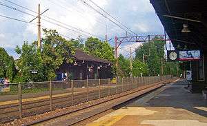
New Jersey Transit stops at the Chatham station[108] to provide commuter service on the Morristown Line, with trains heading to the Hoboken Terminal and to Penn Station in Midtown Manhattan.[109] It is a short drive from most of the township to the stations in Madison[110] and Chatham, while the southern part of the township is closer to the Murray Hill station[111] on the Gladstone Branch.[112][113]
New Jersey Transit local bus service had been provided on the MCM8 route.[114][115][116]
Mail service
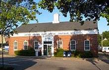
Chatham Township residents receive mail service through the post offices for Green Village and Chatham, depending on their ZIP code. Green Village, a community partially located within Chatham Township, has a ZIP code of 07935 and a post office located at 372 Green Village Road. The remaining area of Chatham Township (which constitutes the majority of its area) is served by the Chatham post office, whose ZIP code is 07928. The main Chatham post office is located at 219 Main Street, across from the library, and its annex is in the old post office, around the corner at 19 Railroad Plaza facing the fire station.
Notable people
People who were born in, residents of, or otherwise closely associated with Chatham Township include:
- Madame Bey (c. 1881 - 1942), Turkish-born opera singer who ran a camp for boxers from 1923 until her death.[117]
- Dan Canter (born 1961), soccer defender who played three seasons in the North American Soccer League and three in Major Indoor Soccer League, in addition to playing with the United States men's national soccer team.[118]
- Chris Carlin (born 1972), radio producer and sportscaster at WFAN Sports Radio 66 in New York City.[119]
- Peter Kuhn (1955-2009), race car driver who won both the USAC and SCCA Formula Super Vee championships in 1980.[120]
- Billy Walsh (born 1975), former professional soccer player who played for the MetroStars.[121]
References
- 1 2 3 4 5 6 2010 Census Gazetteer Files: New Jersey County Subdivisions, United States Census Bureau. Accessed May 21, 2015.
- 1 2 US Gazetteer files: 2010, 2000, and 1990, United States Census Bureau. Accessed September 4, 2014.
- 1 2 2012 New Jersey Legislative District Data Book, Rutgers University Edward J. Bloustein School of Planning and Public Policy, March 2013, p. 94.
- ↑ 2016 New Jersey Mayors Directory, New Jersey Department of Community Affairs. Accessed June 13, 2016.
- ↑ Administration, Chatham Township. Accessed July 20, 2016.
- ↑ Township Clerk, Chatham Township. Accessed July 20, 2016.
- ↑ U.S. Geological Survey Geographic Names Information System: Township of Chatham, Geographic Names Information System. Accessed March 5, 2013.
- 1 2 3 4 5 6 DP-1 - Profile of General Population and Housing Characteristics: 2010 for Chatham township, Morris County, New Jersey, United States Census Bureau. Accessed September 23, 2012.
- 1 2 3 4 Municipalities Grouped by 2011-2020 Legislative Districts, New Jersey Department of State, p. 12. Accessed January 6, 2013.
- 1 2 3 Profile of General Demographic Characteristics: 2010 for Chatham township, New Jersey Department of Labor and Workforce Development. Accessed September 23, 2012.
- 1 2 PEPANNRES - Annual Estimates of the Resident Population: April 1, 2010 to July 1, 2015 - 2015 Population Estimates for New Jersey municipalities, United States Census Bureau. Accessed May 22, 2016.
- 1 2 GCT-PH1 Population, Housing Units, Area, and Density: 2010 - State -- County Subdivision from the 2010 Census Summary File 1 for New Jersey, United States Census Bureau. Accessed September 23, 2012.
- ↑ Look Up a ZIP Code for Chatham, NJ, United States Postal Service. Accessed September 23, 2012.
- ↑ Zip Codes, State of New Jersey. Accessed September 2, 2013.
- ↑ Area Code Lookup - NPA NXX for Chatham, NJ, Area-Codes.com. Accessed September 2, 2013.
- 1 2 American FactFinder, United States Census Bureau. Accessed September 4, 2014.
- ↑ A Cure for the Common Codes: New Jersey, Missouri Census Data Center. Accessed September 23, 2012.
- ↑ US Board on Geographic Names, United States Geological Survey. Accessed September 4, 2014.
- ↑ Table 7. Population for the Counties and Municipalities in New Jersey: 1990, 2000 and 2010, New Jersey Department of Labor and Workforce Development, February 2011. Accessed September 23, 2012.
- 1 2 3 4 5 6 7 8 Snyder, John P. The Story of New Jersey's Civil Boundaries: 1606-1968, Bureau of Geology and Topography; Trenton, New Jersey; 1969. p. 191. Accessed September 23, 2012.
- ↑ Village of Madison, Chatham Township – 1834 to 1889, Madison Historical Society. Accessed July 17, 2011.
- 1 2 3 Cheslow, Jerry. "If You're Thinking of Living In/Chatham; Rich Past, Bustling but Homey Present", The New York Times, April 17, 1994. Accessed September 23, 2012.
- ↑ Hutchinson, Viola L. The Origin of New Jersey Place Names, New Jersey Public Library Commission, May 1945. Accessed August 28, 2015.
- ↑ Gannett, Henry. The Origin of Certain Place Names in the United States, p. 77. United States Government Printing Office, 1905. Accessed August 28, 2015.
- 1 2 Weis, Eleanor. Florham Park History, NJMorrisCountyOnline.com, November 3, 2005. Accessed July 17, 2011. "The growing settlement was always a legal part of a larger township; first Whippany; then Hanover Township (1718) which ran from the Passaic to the Delaware River; then Chatham Township (1806) until Florham Park was founded on March 20, 1899."
- 1 2 3 History, Chatham Township. Accessed September 23, 2013.
- 1 2 Cunningham, John T. Chatham Township, pp. 7-8, Arcadia Publishing, 2001, Charleston, South Carolina. ISBN 0-7385-0865-9. Accessed July 20, 2016.
- ↑ Kwoh, Leslie. "Rose-growing industry wilts in U.S. as South America's blossoms", The Star-Ledger, February 6, 2011. Accessed September 22, 2013. "Before he became a real estate agent, Heyl was New Jersey's last rose grower. Heyl, now 44, remembers spending 16-hour days in his family's Chatham Township greenhouse, the flower's delicate scent filling his nostrils as he worked to cut and wrap thousands of blossoms late into the night.... 'I miss it,' said Heyl, who eventually shuttered the business in 1999, seven decades after his great-grandfather opened it."
- ↑ Locality Search, State of New Jersey. Accessed May 21, 2015.
- ↑ Ness, Tracy. "Chatham Twp. approves former Rolling Knolls landfill site as redevelopment zone", Independent Press, May 17, 2010. Accessed September 2, 2013. "The Rolling Knolls facility operated as a municipal landfill from the early 1930's through December of 1968. During that time, the landfill received solid waste, construction and demolition debris from eleven surrounding municipalities, residential septage wastes and pharmaceutical and industrial waste. It was designated as a Superfund site in 2003 and remedial site investigation work has been ongoing ever since."
- ↑ Average Weather for Chatham, New Jersey (07928) - Temperature and Precipitation, Weather.com. Accessed September 27, 2014.
- ↑ Census Estimates for New Jersey April 1, 2010 to July 1, 2015, United States Census Bureau. Accessed May 22, 2016.
- ↑ Compendium of censuses 1726-1905: together with the tabulated returns of 1905, New Jersey Department of State, 1906. Accessed July 26, 2013.
- ↑ Bowen, Francis. American Almanac and Repository of Useful Knowledge for the Year 1843, p. 231, David H. Williams, 1842. Accessed July 26, 2013.
- ↑ Raum, John O. The History of New Jersey: From Its Earliest Settlement to the Present Time, Volume 1, p. 256, J. E. Potter and company, 1877. Accessed December 17, 2012. Chatham township in 1850, contained a population of 2,469; in 1860, 2,968; and in 1870, 3,715.
- ↑ Debow, James Dunwoody Brownson. The Seventh Census of the United States: 1850, p. 140. R. Armstrong, 1853. Accessed December 17, 2012.
- ↑ Staff. A compendium of the ninth census, 1870, p. 260. United States Census Bureau, 1872. Accessed December 17, 2012.
- ↑ Porter, Robert Percival. Preliminary Results as Contained in the Eleventh Census Bulletins: Volume III - 51 to 75, p. 98. United States Census Bureau, 1890. Accessed September 23, 2012.
- ↑ Thirteenth Census of the United States, 1910: Population by Counties and Minor Civil Divisions, 1910, 1900, 1890, United States Census Bureau, p. 338. Accessed September 23, 2012. Source lists population of 1,432 for 1890, in conflict with the data shown for the 1890 Census.
- ↑ Fifteenth Census of the United States: 1930 - Population Volume I, United States Census Bureau, p. 717. Accessed September 23, 2012.
- ↑ New Jersey Resident Population by Municipality: 1930 - 1990, Workforce New Jersey Public Information Network. Accessed June 28, 2015.
- 1 2 3 4 5 Census 2000 Profiles of Demographic / Social / Economic / Housing Characteristics for Chatham township, Morris County, New Jersey, United States Census Bureau. Accessed September 23, 2012.
- 1 2 3 4 5 DP-1: Profile of General Demographic Characteristics: 2000 - Census 2000 Summary File 1 (SF 1) 100-Percent Data for Chatham township, Morris County, New Jersey, United States Census Bureau. Accessed September 23, 2012.
- ↑ DP03: Selected Economic Characteristics from the 2006-2010 American Community Survey 5-Year Estimates for Chatham township, Morris County, New Jersey, United States Census Bureau. Accessed September 23, 2012.
- ↑ "Forms of Municipal Government in New Jersey", p. 7. Rutgers University Center for Government Studies. Accessed June 3, 2015.
- ↑ Form of Government, Chatham Township. Accessed January 8, 2014.
- ↑ Township Committee, Chatham Township. Accessed July 20, 2016.
- ↑ 2016 Municipal Data Sheet, Chatham Township. Accessed July 20, 2016.
- ↑ Morris County Manual 2016, Morris County, New Jersey Clerk. Accessed July 19, 2016.
- ↑ Morris County Municipal Elected Officials For The Year 2016, Morris County, New Jersey Clerk, updated June 3, 2016. Accessed July 19, 2016.
- ↑ November 3, 2015 Official General Election Winners, Morris County, New Jersey Clerk. Accessed July 19, 2016.
- ↑ November 4, 2014 General Election Winners, Morris County, New Jersey Clerk. Accessed July 19, 2016.
- ↑ November 5, 2013 General Election Winners, Morris County, New Jersey Clerk. Accessed July 19, 2016.
- ↑ Plan Components Report, New Jersey Redistricting Commission, December 23, 2011. Accessed January 6, 2013.
- ↑ 2016 New Jersey Citizen's Guide to Government, p. 55, New Jersey League of Women Voters. Accessed July 20, 2016.
- ↑ Districts by Number for 2011-2020, New Jersey Legislature. Accessed January 6, 2013.
- ↑ 2011 New Jersey Citizen's Guide to Government, p. 56, New Jersey League of Women Voters. Accessed May 22, 2015.
- ↑ Directory of Representatives: New Jersey, United States House of Representatives. Accessed January 5, 2012.
- ↑ About Cory Booker, United States Senate. Accessed January 26, 2015. "He now owns a home and lives in Newark's Central Ward community."
- ↑ Biography of Bob Menendez, United States Senate, January 26, 2015. "He currently lives in Paramus and has two children, Alicia and Robert."
- ↑ Senators of the 114th Congress from New Jersey. United States Senate. Accessed January 26, 2015. "Booker, Cory A. - (D - NJ) Class II; Menendez, Robert - (D - NJ) Class I"
- ↑ Legislative Roster 2016-2017 Session, New Jersey Legislature. Accessed January 17, 2016.
- ↑ "About the Governor". State of New Jersey. Retrieved 2010-01-21.
- ↑ "About the Lieutenant Governor". State of New Jersey. Retrieved 2010-01-21.
- ↑ What is a Freeholder?, Morris County, New Jersey. Accessed July 5, 2016.
- 1 2 3 Morris County Manual 2016, Morris County Clerk. Accessed July 5, 2016.
- ↑ Kathryn A. DeFillippo, Morris County, New Jersey. Accessed July 5, 2016.
- ↑ William “Hank” Lyon, Morris County, New Jersey. Accessed July 5, 2016.
- ↑ Douglas R. Cabana, Morris County, New Jersey. Accessed July 5, 2016.
- ↑ John Cesaro, Morris County, New Jersey. Accessed July 5, 2016.
- ↑ Thomas J. Mastrangelo, Morris County, New Jersey. Accessed July 5, 2016.
- ↑ Christine Myers, Morris County, New Jersey. Accessed July 5, 2016.
- ↑ Deborah Smith, Morris County, New Jersey. Accessed July 5, 2016.
- ↑ Freeholders, Morris County, New Jersey. Accessed July 5, 2016.
- ↑ Ann F. Grossi, Esq., Office of the Morris County Clerk. Accessed July 5, 2016.
- ↑ About Us: Sheriff Edward V. Rochford, Morris County Sheriff's Office. Accessed July 5, 2016.
- ↑ Morris County Surrogate Court, Morris County, New Jersey. Accessed July 5, 2016.
- ↑ Voter Registration Summary - Morris, New Jersey Department of State Division of Elections, March 23, 2011. Accessed December 17, 2012.
- ↑ "Presidential General Election Results - November 6, 2012 - Morris County" (PDF). New Jersey Department of Elections. March 15, 2013. Retrieved December 24, 2014.
- ↑ "Number of Registered Voters and Ballots Cast - November 6, 2012 - General Election Results - Morris County" (PDF). New Jersey Department of Elections. March 15, 2013. Retrieved December 24, 2014.
- ↑ 2008 Presidential General Election Results: Morris County, New Jersey Department of State Division of Elections, December 23, 2008. Accessed December 17, 2012.
- ↑ 2004 Presidential Election: Morris County, New Jersey Department of State Division of Elections, December 13, 2004. Accessed December 17, 2012.
- ↑ "Governor - Morris County" (PDF). New Jersey Department of Elections. January 29, 2014. Retrieved December 24, 2014.
- ↑ "Number of Registered Voters and Ballots Cast - November 5, 2013 - General Election Results - Morris County" (PDF). New Jersey Department of Elections. January 29, 2014. Retrieved December 24, 2014.
- ↑ 2009 Governor: Morris County, New Jersey Department of State Division of Elections, December 31, 2009. Accessed December 17, 2012.
- ↑ Township Committee Meeting Minutes, December 16, 2010, p. 7. Chatham Township. Accessed September 25, 2013.
- ↑ Municipal Court, Chatham Township. Accessed September 23, 2013.
- ↑ Joint Municipal Court Archived September 28, 2013, at the Wayback Machine., Borough of Madison. Accessed June 12, 2013.
- ↑ Padawer, Ruth. "Side By Side: Thirty years ago, Chatham Township was fighting—literally—for respect from Chatham Borough. Now it finishes first among the state's 566 municipalities in our biannual ranking. The Borough's response? 'Way to go!'", New Jersey Monthly, February 19, 2008. Accessed September 27, 2014. "The high schools had to scramble to offer the Advanced Placement classes and electives that the new era required. Kids from one school would go to the other for particular classes, as if it were an extension of the same campus. By 1986, after a contentious vote in both towns, the two districts merged."
- ↑ Belluscio, Frank. "No Surprise: The State Wants Only K-12 Districts" Archived January 21, 2012, at the Wayback Machine., School Leader, New Jersey School Boards Association, January / February 2009. Accessed September 27, 2014. "Since 1982, only four locally initiated regionalization proposals have succeeded:... School District of the Chathams (1986)—combining of the K-12 Chatham borough school district with the K-12 Chatham Township district."
- ↑ District information for School District of the Chathams, National Center for Education Statistics. Accessed September 27, 2014.
- ↑ School Data for the School District of the Chathams, National Center for Education Statistics. Accessed September 27, 2014.
- ↑ Milton Avenue School, School District of the Chathams. Accessed September 27, 2014.
- ↑ Southern Boulevard School, School District of the Chathams. Accessed September 27, 2014.
- ↑ Washington Avenue School, School District of the Chathams. Accessed September 27, 2014.
- ↑ Lafayette School, School District of the Chathams. Accessed September 27, 2014.
- ↑ Chatham Middle School, School District of the Chathams. Accessed September 27, 2014.
- ↑ Chatham High School, School District of the Chathams. Accessed September 27, 2014.
- ↑ Schools Directory, School District of the Chathams. Accessed September 27, 2014.
- ↑ New Jersey School Directory for the School District of the Chathams, New Jersey Department of Education. Accessed September 27, 2014.
- ↑ Blue Ribbon Schools Program: Schools Recognized 1982 Through 2013, United States Department of Education. Accessed September 27, 2014.
- ↑ Goldman, Jeff. "Which N.J. schools were named to national 'Blue Ribbon' list?", NJ Advance Media for NJ.com, October 2, 2014. Accessed December 31, 2014. "Eleven New Jersey schools have been named to the annual National Blue Ribbon list, the U.S. Department of Education announced Tuesday."
- ↑ 2014 National Blue Ribbon Schools All Public and Private, United States Department of Education. Accessed December 31, 2014.
- ↑ Staff. "Top Schools Alphabetical List 2014", New Jersey Monthly, September 2, 2014. Accessed September 5, 2014.
- ↑ Staff. "The Top New Jersey High Schools: Alphabetical", New Jersey Monthly, August 16, 2012. Accessed September 23, 2012.
- ↑ History, Chatham Day School. Accessed July 17, 2011.
- ↑ Morris County Mileage by Municipality and Jurisdiction, New Jersey Department of Transportation, May 2010. Accessed July 18, 2014.
- ↑ Chatham station, New Jersey Transit. Accessed September 27, 2014.
- ↑ Morristown Line, New Jersey Transit. Accessed September 27, 2014.
- ↑ Madison station, New Jersey Transit. Accessed September 27, 2014.
- ↑ Murray Hill station, New Jersey Transit. Accessed September 27, 2014.
- ↑ Gladstone Branch, New Jersey Transit. Accessed September 27, 2014.
- ↑ Morris County System Map, New Jersey Transit. Accessed July 27, 2015.
- ↑ Morris County Bus/Rail Connections, New Jersey Transit, backed up by the Internet Archive as of May 22, 2009. Accessed July 17, 2011.
- ↑ Master Plan: Circulation Plan Element, Chatham Township. Accessed August 6, 2015. "The other bus route is a non-daily local County service route (MCM-8). In Chatham Township it follows Fairmount Avenue and Meyersville Road."
- ↑ Morris County System Map, New Jersey Transit. Accessed August 6, 2015.
- ↑ Rybolt, Barbara. "Madame Bey's boxing training camp was home to 'The Cinderella Man'", Independent Press, August 13, 2009. Accessed July 15, 2016. "The 1914 lightweight boxing champion of the world, Freddie Welsh, started and ran a health farm in Chatham Township. Turkish born Heranoush Bey (known as Madame Bey) took over the reigns when Mr. Walsh entered the army in World War I and eventually opened her own boxing camp on River Road."
- ↑ Yannis, Alex. "Canter's Dream Comes True", The New York Times, June 3, 1984. Accessed October 29, 2013. "The 22-year-old Canter, who was born in North Plainfield, N.J., and grew up in Chatham Township, about 30 minutes by car from Giants Stadium, is in his third year in the league and first with the Cosmos."
- ↑ Chris Carlin profile, WFAN (AM). Accessed June 19, 2007. "Chris grew up in Chatham Township, New Jersey, and attended Oratory Prep High School in Summit."
- ↑ Staff. "Peter H. Kuhn, accomplished race car driver", Hunterdon County Democrat, June 29, 2009. Accessed August 15, 2016. "Born in Summit, April 14, 1955, he was a son of Jean Henry and Elizabeth 'Lib' Dowd Kuhn. Mr. Kuhn had resided in Franklin Township since 1995, having formerly lived in Basking Ridge and Chatham Township."
- ↑ Yannis, Alex. "SOCCER; Great Run Of Rutgers Is Stopped By Virginia", The New York Times, December 10, 1994. Accessed August 6, 2015. "Pollard also started the winning goal, which was scored in the 54th minute by Billy Walsh, a freshman from Chatham Township, N.J."