Ontario Highway 3
| ||||
|---|---|---|---|---|
| Talbot Trail | ||||
|
Location of Highway 3 in Southern Ontario Current route Former route 400-series highways | ||||
| Route information | ||||
| Length: |
259.2 km[1] (161.1 mi) Excludes two gaps of 145.0 km (90.1 mi) and 3.4 km (2.1 mi) | |||
| Existed: | August 4, 1920 – present | |||
| Section 1 | ||||
| Length: | 50.2 km (31.2 mi) | |||
| West end: |
Ambassador Bridge to | |||
| Major junctions: |
E.C. Row Expressway in Windsor | |||
| East end: |
| |||
| Section 2 | ||||
| Length: | 187.9 km (116.8 mi) | |||
| West end: |
| |||
| Major junctions: |
| |||
| East end: | Townline Road at Wainfleet–Port Colborne boundary | |||
| Section 3 | ||||
| Length: | 21.1 km (13.1 mi) | |||
| West end: |
| |||
| East end: | Rosehill Road in Fort Erie | |||
| Location | ||||
| Major cities: | Windsor, St. Thomas, Port Colborne | |||
| Towns: | Leamington, Tillsonburg, Simcoe, Dunnville, Fort Erie | |||
| Villages: | Delhi, Jarvis, Cayuga | |||
| Highway system | ||||
| ||||


King's Highway 3, commonly referred to as Highway 3, is a provincially maintained highway in the Canadian province of Ontario which travels parallel to the northern shoreline of Lake Erie. It has three segments, the first of which travels from the Ambassador Bridge in Windsor to Highway 77 in Leamington. The second portion begins at Talbotville Royal outside of St. Thomas at Highway 4, and travels to the western city limits of Port Colborne. The road is regionally maintained within Port Colborne as Niagara Regional Road 3, but regains its provincial designation at Highway 140. Its third and final terminus is at Edgewood Park, within the Fort Erie town limits. From there, the road continues as Niagara Regional Road 3 to the Peace Bridge, where drivers can cross to the United States. The total length of Highway 3 is 259.2 km (161.1 mi), consisting of 50.2 km (31.2 mi) from Windsor to Leamington, 187.9 km (116.8 mi) from Talbotville Royal to Port Colborne and 21.1 km (13.1 mi) from Port Colborne to Edgewood Park.
Until the late 1990s, Highway 3 formed a single continuous 413.2 km (256.8 mi) route from the Ambassador Bridge to near the Peace Bridge, but since then has had significant portion transferred to regional and county governments. A large segment of the route follows the historic Talbot Trail, a settlement road following the northern shore of Lake Erie constructed by Colonel Talbot in the early 1800s as part of a grand settlement plan along the lake front. East of Canborough, the road generally follows older settlement trails: Forks Road, connecting Dunnville with Wainfleet, portions of Sherk's Road, through Port Colborne to Gasline, and the Garrison Road, a military road built west from Fort Erie. The highway was initially designated in 1920, but not numbered until five years later. It originally connected to Niagara Falls, but was rerouted to Fort Erie following completion of the Peace Bridge in the late 1920s. Although a few portions of Highway 3 were upgraded in the years since, the highway generally follows the same route as it did in 1930. However, in 1997, segments through Port Colborne and Fort Erie were decommissioned as a provincial highway, followed by a segment of the route from Leamington to Talbotville Royal in 1998. All three now exist as county/regional roads. The portion of Highway 3 along Huron Church Road in Windsor was reconstructed as part of the Windsor–Essex Parkway project between 2011 and 2015.
Route description
Highway 3 follows the route of the historic Talbot Trail for most of its length. Abutting the northern shore of Lake Erie between Windsor and Fort Erie, the route deviates in places to bypass towns and to avoid the less than direct trail laid nearly two centuries ago.[2] Prior to 1998, the highway spanned this entire distance,[3] but has since then been divided into three discontinuous sections.[4] The western section travels 50.2 km (31.2 mi) from Windsor to Leamington. From there, a 145.0 km (90.1 mi) gap separates the western and central sections. Highway 3 resumes near St. Thomas at the southern end of Highway 4 and travels 187.9 km (116.8 mi) east to Port Colborne. The central and eastern sections are divided by a 3.4 km (2.1 mi) Connecting Link through Port Colborne. The eastern section begins at Highway 140 and travels 21.1 km (13.1 mi) to Fort Erie. It ends at Rosehill Road, a short distance west of the Peace Bridge crossing into New York.[1][4]
Western segment
The western segment of Highway 3 begins at the Ambassador Bridge, which connects Canada with the U.S. state of Michigan over the Detroit River. The five lane highway travels southeast through Windsor along Huron Church Road, surrounded by residential subdivisions, then curves east to meet the western end of Highway 401.[4] The section through Windsor to Cabana Road is maintained under a Connecting Link agreement.[1][5] Between the E. C. Row Expressway and Highway 401, construction is ongoing as of 2015 on the Windsor–Essex Parkway, which will displace Highway 3 from its former alignment.[6] At Essex County Road 11, Highway 3 enters rural southwestern Ontario, and is dominated by farmland for much of its length through Essex County. The now four-laned route becomes divided as it follows the Essex Bypass around the southern edge of Essex, with commercial services lining the highway, primarily on the north side. Returning to farmland and narrowing to a two lane undivided road, the highway continues southeast, passing nearby, but avoiding, several small communities that the original highway travelled through.[7] After passing Essex County Road 18, the route curves eastward, passing north of Ruthven before entering Leamington along its northern fringe.[4] The western section ends at the southern terminus of Highway 77,[1] where the provincially built but county maintained Leamington Bypass continues east to meet the Talbot Road just east of the town.[4]
Central segment

The central segment is the longest of the three, at 187.9 km (116.8 mi).[1] It begins at the southern terminus of Highway 4 at Talbotville Royal in Elgin County, just northwest of St. Thomas and south of London.[4] The route travels east into St. Thomas, becoming a two-laned expressway aptly named the St. Thomas Expressway. This expressway begins at Wellington Road (Elgin County Road 25 / 26) and travels through St. Thomas to Centennial Road, featuring a single interchange.[4] However, the right-of-way is wide enough to accommodate any future upgrade to a divided expressway.[8] At the eastern end, Highway 3 turns south onto Centennial Road and then east onto Talbot Line, following the historic Talbot Trail to east of Aylmer.[4] This mostly straight and rural portion passes through several small villages before the Talbot Trail splits from it to follow Elgin/Norfolk County Road 38 through Straffordville.[4][8] Highway 3 meanwhile curves northeast and passes through Tillsonburg, encountering Highway 19. It then curves east and travels parallel to the St. Thomas and Eastern Railway to Courtland, remerging with the Talbot Trail and snaking towards Delhi, now within Norfolk County.[4]
At Delhi, Highway 3 turns south for 4 km (2.5 mi) before returning to its eastward orientation. It continues through farmland to the town of Simcoe, where it meets Highway 24. From Simcoe to Canborough, the highway is nearly straight as an arrow, with an occasional jog to the northeast.[8] It enters Haldimand County and intersects Highway 6 in Jarvis. At Cayuga it crosses the Grand River;[4] until 2014, a five-span steel girder bridge crossed the river, but it has since been replaced by a concrete structure.[9] At Canborough, the historic Talbot Trail ends and Highway 3 veers south to Dunnville,[10] briefly travelling along the northern bank of the Grand River and gradually curving back eastward. East of Dunnville, the route follows Forks Road into Wainfleet and the Niagara Region.[4] At Chambers Corners it turns south and passes through Wainfleet village, crossing the old Feeder Canal which once supplied the Welland Canal with water from the Grand River.[10] Just north of Lake Erie, Highway 3 turns east and travels straight towards Port Colborne, passing just south of the Wainfleet Bog. At Townline Road, the boundary between Wainfleet and Port Colborne, the central section ends and the roadway continues as Niagara Regional Road 3 through the city, meeting the southern end of Highway 58.[1][4]

Portions of the central segment of Highway 3 through several towns are maintained under Connecting Link agreements, including within Aylmer, Delhi, Simcoe, Cayuga and Dunnville. The combined length of these segments is 15.9 kilometres (9.9 mi).[5]
Eastern segment
The final and shortest section of Highway 3 begins at Highway 140 on the eastern fringe of Port Colborne and lies entirely within Niagara Region. The 21.1 km (13.1 mi) segment travels several kilometres inland to Lake Erie, as well as parallel to it.[1][4] From there it mostly travels along a straight line eastward through generally rural areas.[11] The notable exception is the village of Gasline, where the Niagara Speedway stands on the northern side of the highway.[4][11] At the Fort Erie boundary, the route widens to four lanes and jogs northeast to align with the old Garrison Road. As the highway progresses eastward into the town, the surroundings gradually become more urbanized before it ends at Rosehill Road.[1][11] The roadway continues east through Fort Erie to the foot of the Peace Bridge as Niagara Regional Road 3, connecting with the Queen Elizabeth Way to provide access to the United States.[4][11]

Connections with the United States
Highway 3 was the only Ontario provincial highway to start and end at bridges (the Ambassador Bridge leading into Detroit, Michigan and the Peace Bridge leading into Buffalo, New York) with both termini at international crossings. A quick link from Chicago, Toledo, and Detroit to Buffalo and Western New York, Highway 3 was shorter and more direct than any American route (including Interstate 90), because the Lake Erie shoreline dips south along Ohio, Pennsylvania, and New York. After the 1954 New York State Thruway opened from Buffalo to New York City,[12] Michigan officials had encouraged Ontario to replace Highway 3 with a turnpike from Detroit to Buffalo.[13]
Highway 3 has been largely replaced as a Detroit–Buffalo truck route by Highway 401, Highway 403 and the Queen Elizabeth Way. The last section of Highway 403 opened in August 1997,[14] leaving a local section of Highway 3 on Windsor surface streets as a bottleneck to be bypassed by the Windsor–Essex Parkway and Gordie Howe International Bridge to Detroit in 2020.[15]
When the Michigan Department of Transportation discontinued US 25 in 1973, much of it through Detroit was redesignated as M-3, whose southern terminus came at Clark Street in Detroit, at the junction of I-75 by the Ambassador Bridge.[16][17] This provided a connection between Michigan's M-3 and Ontario's Highway 3 until 2001, when jurisdictional changes within downtown Detroit created a discontinuous segment of M-3, and this international Route 3 connection was lost when the portion of M-3 along Fort Street was redesignated M-85.[18][19]
History
Talbot Trail
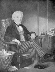
The history of Highway 3 dates back over 200 years to the pioneering settlement era of Upper Canada following the American Revolution and the resulting influx of United Empire Loyalists. Thomas Talbot, an influential scion who joined the British army at the age of 11, would challenge the government, the terrain, and the forces of nature to see to it that his road be built. Due to his family legacy, Talbot worked through the ranks quickly and found himself a personal aide to John Graves Simcoe, the first Lieutenant Governor of Upper Canada. He returned to England after Simcoe fell ill, but vowed to return to the hinterland he had come to love.[20]
After completing his military commission, Talbot returned to Upper Canada in 1801 at the age of 30. Although Simcoe had promised Talbot 5,000 acres (20,000,000 m2) of land in Yarmouth Township on the shoreline of Lake Erie, he had not made it official. Talbot returned to England in 1802 and spoke to the legislature, promoting his concept of a vibrant farming settlement. The government granted Talbot his land and promised an additional 200 acres (81 ha) for each family that settled a 50 acres (20 ha) lot in the original grant.[20] Talbot returned to Upper Canada in 1803 with four families and a letter from Lord Hobart authorizing his grant, and established what is now the town of Port Stanley. Wishing to expand his grant and create his ideal colony, Talbot sought out new settlers; a road was required.[20][2]
Talbot received a grant of $250 in September 1804 for the construction of a road between Brantford and Delhi. John Bostwick would survey the route that year; however, funding shortages would halt construction in 1806.[21] Talbot approached the new Lieutenant Governor – Francis Gore – in 1808 with the intent of persuading him to fund the building of the road. He insisted that a road would increase the value of the land in the surrounding townships, as well as providing a greater incentive for newcomers to settle in what was otherwise a desolate wilderness. Gore instructed deputy surveyor Mahlon Burwell to "Build a road one chain wide, laid out on the principle of Yonge Street with lots on each side."[2] Burwell began this work in 1809 westward from Delhi.[22] In 1811, he was tasked with surveying the West Talbot Road from Talbotville Royale to Amherstburg. By then, a road was already opened between Port Talbot and Talbotville Royale.[22]
Construction of the new road proved far more difficult than first imagined. Workers followed an old Native American trail, wholly consumed by nature, between Delhi and Port Talbot. To get across the numerous swamps, felled trees were laid across the path to create a corduroy road, much to the chagrin of settlers. The outbreak of the War of 1812 would temporarily halt further construction. When it resumed in 1816, Talbot himself began directing the surveyor, ordering that the road remain on the highest ground possible.[2] This led to an irregular and winding route between Aylmer and Delhi. By 1830, the corduroy logs had been removed and the road improved and extended from Amherstburg to Canborough.[23]
Niagara trails
East of Canborough, Highway 3 follows several early settlement trails: Forks Road between Dunnville and Chambers Corners, Sherk's Road through Port Colborne to Gasline, and the military Garrison Road through Fort Erie. These roads predate the land survey grid of concession roads and sidelines, which would be used by the provincial government to make Highway 3 a continuous route through the Niagara Peninsula where none previously existed.[10]
Forks Road, a river road following Forks Creek, served to connect the Grand River at Dunnville with the Welland River west of Welland. Like many early roads in Upper Canada, it was built along a river bank. It can therefore be assumed that this trail was built prior to the completion of the Feeder Canal in 1832.[10] Sherk's Road was built at the request of Elias Sherk (d. 1893) in 1858 to connect his house (the historic Danner House) with his and Michael Gondor's properties.[24] The irregular road connected the Welland Canal at Humberstone (now Port Colborne) to the community of Ridgeway, where it met the west end of the Garrison Road.[25] That road was built due to the threat of American attack to provide quick access from Fort Erie, and, like other military roads in Upper Canada (e.g. Dundas Street or Yonge Street), it travelled in a straight line, in this case parallel to the Lake Erie shoreline.[10]
Provincial Highway Network
Until 1918, the majority of the primary roads through southern Ontario formed part of the County Road System. The Department of Public Works and Highways paid up to 60% of the construction and maintenance costs for these roads, while the counties were responsible for the remaining 40%. In 1919, the federal government passed the Canada Highways Act, which provided $20,000,000 to provinces under the condition that they establish an official highway network; up to 40% of construction costs would be subsidized. The first network plan was approved on February 26, 1920, and included the Talbot Road.[26] The majority of what would soon become Highway 3 was designated several months later in August.[27] However, it would not receive a route number until the summer of 1925.[28]
Four significant changes to Highway 3 have taken place since the designation of the route in 1920. The first was an adjustment to the eastern terminus.[29] The second was the Essex Bypass, built through the 1970s between Windsor and Leamington.[30] The third was the St. Thomas Expressway, a super two highway built in the late 1970s.[31] The final change was the provincial highway transfers conducted in 1997 and 1998 that resulted in three segments of Highway 3 being decommissioned: between Leamington and Talbotville Royale, through Port Colborne and within Fort Erie.[32][33]
Highway 3 originally ended at the Honeymoon Bridge in Niagara Falls; it continued east of Chambers Corners along Forks Road (Regional Road 23) rather than south through Wainfleet as it does today. It then travelled north through Welland and east along Lundys Lane. Highway 58 and Highway 20 would later follow portions of this route.[29] As part of the "spirit of cooperation" that inundated Canada and the US following World War I, as well as to celebrate a century of peace, a new bridge was planned between Fort Erie and Buffalo alongside the international railway crossing. Construction began in 1925; the completed bridge opened to traffic on June 1, 1927. Two months later, on August 7, the bridge was formally dedicated as the Peace Bridge by US Vice President Charles Dawes, and Edward, Prince of Wales.[34]
Traffic patterns quickly shifted to take advantage of the new crossing and the bypass of Niagara Falls that it provided. In foresight of this, the Department of Public Highways took control of a Welland County road between Chambers Corners and Fort Erie on May 11, 1927. This roadway, which followed a significant portion of Sherk's Road and the Garrison Road, in addition to a concession road built west from Port Colborne and north through Wainfleet village, was designated as Highway 3A.[35][36] The following year it was surfaced with concrete and a new bridge built over the Welland Canal in Port Colborne.[37] The new route became so popular that in 1929 the Highway 3 and Highway 3A designations were swapped.[29]
In the early 1970s, as part of a review to determine the future route of Highway 406 south of Welland, proposals arose for a bypass of Highway 3 from east of Dunnville to Port Colborne near Highway 58.[38]
Essex Bypass and St. Thomas Expressway

The Essex Bypass was opened in stages in the 1970s and early 1980s. Plans were completed in 1968 as part of a province-wide program to bypass small towns on busy provincial highways.[39] The first stage, opened by 1972, began west of Maidstone and passed south of Essex, where it then routed along Malden Road to its former alignment (now Essex County Road 34).[30][40] Construction of an eastward extension to Ruthven was underway by 1982,[41] and completed in 1983, with the road following Union Road to the old alignment.[30][42] Construction of a final extension, from Union Road north of Ruthven to past Highway 77 on the northern fringe of Leamington, was underway in late 1998;[30] it opened in early December 1999.[43] Although the Leamington Bypass was constructed by the Ministry of Transportation (MTO),[43] the 1.1-kilometre (0.68 mi) segment east of Highway 77 to County Road 34 (Talbot Road) was never a part of Highway 3 or the provincial highway network.[44] It is signed as Essex County Road 33, as Leamington is planning to link the discontinuous segments of County Road 33 with the East Side Arterial Road.[45]
The St. Thomas expressway was built along the northern edge of that city beginning in 1974.[46] It features six overpasses and a single interchange, at First Avenue. A ribbon cutting ceremony was held on September 7, 1981 to officially open the new route, which bypassed the former Highway 3 alignment along Talbot Street and the short concurrency with Highway 4 (Sunset Drive). The bypass cost C$16.5 million to construct, and features a two-lane roadway with allotted space on the north side for a second two-lane roadway.[31] Plans originally called for the expressway to extend further east to New Sarum and later even as far as Aylmer,[47][48] but these have never materialized.[4]
Downloads and changes since

Aside from the Essex Bypass and St. Thomas Expressway, Highway 3 remained generally unchanged between the 1930s and late 1990s.[3][49] However, budget constraints brought on by a recession in the 1990s resulted in the Mike Harris provincial government forming the Who Does What? committee to determine cost-cutting measures in order to balance the budget after a deficit incurred by former premier Bob Rae.[50] It was determined that many Ontario highways no longer served long-distance traffic movement and should therefore be maintained by local or regional levels of government. The MTO consequently transferred many highways to lower levels of government in 1997 and 1998, removing a significant percentage of the provincial highway network.[51]
Despite once serving as one of the principal highways through southwestern Ontario, Highway 3 had been largely supplanted by Highway 401, the QEW and later Highway 403 as a through-route. As a result, portions of the route through the Regional Municipality of Niagara were transferred to the region on April 1, 1997, including a 3.4-kilometre (2.1 mi) segment through Port Colborne (most of which had existed as a Connecting Link[52]) and a 5.6-kilometre (3.5 mi) segment in Fort Erie.[32] To the west, a segment of the route paralleling Highway 401 between Leamington and Talbotville Royal was decommissioned on January 1, 1998 and transferred to Essex County, Chatham–Kent and Elgin County.[33] It has since been designated as Essex County Road 34, Chatham–Kent Road 3 and Elgin County Road 3.[4]
In 2001, the MTO considered renumbering the western segment of Highway 3 as Highway 103 to avoid confusion.[53] However, this never came to pass.[4]
Future
At the western end of Highway 3, two major traffic concerns have been the focus of controversy since the mid-1990s and early 2000s: the Essex Bypass and the approach to the Ambassador Bridge. Numerous attempts by local and provincial politicians since then have led the MTO to begin remedying the situation by upgrading the bypass to a divided four lane road and constructing the Windsor–Essex Parkway to a new international crossing.[30][54]
The Essex Bypass, completed around the village of Essex in 1972,[30] was designed to accommodate future widening to a divided four lane road when traffic volumes warranted. By the mid-1990s, a regular pattern of fatalities were occurring, prompting local politicians and Essex Member of Provincial Parliament (MPP) Bruce Crozier to lobby the MTO widen the route.[55][56] It was announced in June 2006 that the entire 33 kilometres (21 mi) bypass would be widened to four lanes with a grassy median separating the opposing flows of traffic.[57][58] The three phase project began in September 2007 with a 6.4 kilometres (4.0 mi) stretch between Maidstone and County Road 8 west of Essex.[58][59] The four-laned highway opened in June 2009 at a cost of C$20.7 million. The C$22.1 million second phase involved widening the highway between Walker Road and Maidstone to a five lane cross-section, and began in mid-November 2009.[60] It was completed in early 2012.[61] Despite concerns raised by Crozier in 2006 that the project would be halted after the first phase, which were dismissed at the time,[59] no further work has actually been completed on the Essex Bypass since 2012, and the section between Essex and Ruthven remains a two lane highway.[7] It is still considered as a future project by the MTO, with no time line set.[62][63] Three months after Crozier's unexpected death on June 3, 2011, the entire Essex Bypass was renamed the Bruce Crozier Way in honour of his commitment to the widening of the highway.[64]
In 2004, a joint announcement by the federal government of the United States and Government of Canada confirmed that a new border crossing would be constructed between Detroit and Windsor. The Detroit River International Crossing (DRIC) was formed as a bi-national committee to manage the project.[65] The MTO took advantage of this opportunity to extend Highway 401 to the international border and began an environmental assessment on the entire project in late 2005.[65] The new parkway will be below-grade and have six through-lanes. It will follow (but not replace) Talbot Road and Huron Church Road from a new interchange at the current end of Highway 401 to the E. C. Row Expressway, where it will run concurrently westward for 2 km (1.2 mi). From there, it will turn northwest and follow a new alignment to the border.[6] Initial construction of a noise barrier from North Talbot Road to Howard Avenue began in March 2010. Full construction began on August 19, 2011,[66] with an expected completion date of mid-2015 for the first phase and 2015-16 for the remainder of the parkway.[67] In early 2015, it was announced that the parkway would open to traffic between Highway 3 and Labelle Street (near the E.C. Row Expressway) in the spring.[68]
Work is ongoing in Cayuga to install a new crossing over the Grand River, replacing the five-span steel structure that previously served traffic since 1924.[9][69] The new concrete structure was opened to traffic on June 20, 2014,[70] and the former structure was demolished after that. On November 4 and December 4 of that year, construction on the bridge was halted by the Haudenosaunee Confederacy Chiefs Council on the claim that the structure impeded on land reserved for a towpath along the Grand River by the Six Nations of the Grand River First Nation. The remaining work includes a scheduled three-day closure during which the new bridge will be jacked 5 metres (16 ft) north to align with the former structure, as well as decorative work.[9][71][72] Work is scheduled for completion in the autumn of 2015.[70]
Major intersections
The following table lists the major junctions along Highway 3, as noted by the Ministry of Transportation of Ontario.[1]
| Division | Location | km[1] | mi | Destinations | Notes |
|---|---|---|---|---|---|
| Essex | Windsor | 0.0 | 0.0 | Sandwich Street / Riverside Drive | Beginning of Windsor Connecting Link agreement; access to Ambassador Bridge border crossing |
| Windsor–La Salle boundary | 7.0 | 4.3 | End of Windsor Connecting Link agreement | ||
| 10.6 | 6.6 | ||||
| Tecumseh | 11.5 | 7.1 | |||
| 13.7 | 8.5 | ||||
| 18.7 | 11.6 | ||||
| 21.5 | 13.4 | ||||
| Essex | |||||
| 28.4 | 17.6 | ||||
| Kingsville | |||||
| 34.6 | 21.5 | ||||
| 37.6 | 23.4 | ||||
| 40.9 | 25.4 | ||||
| 44.2 | 27.5 | County Road 34E (Union Avenue) | |||
| 46.7 | 29.0 | ||||
| Leamington | |||||
| 50.2 | 31.2 | End of eastern segment of Highway 3 | |||
| Highway 3 is discontinuous for 145.0 km (90.1 mi) between Leamington and Talbotville Royale | |||||
| Elgin | Talbotville Royale | 195.2 | 121.3 | ||
| Central Elgin | 198.9 | 123.6 | County Road 25 (Wellington Road) | Beginning of St. Thomas Expressway | |
| St. Thomas | 202.5 | 125.8 | First Avenue | Sole interchange along expressway | |
| 204.8 | 127.3 | Centennial Road | End of St. Thomas Expressway | ||
| 206.0 | 128.0 | Talbot Street (west) / Talbot Line (east) Centennial Road (north) / County Road 28 south | Traffic must turn to remain on Highway 3 | ||
| Malahide | 211.1 | 131.2 | County Road 74 | ||
| Aylmer | 218.2 | 135.6 | Aylmer western limits; beginning of Connecting Link agreement | ||
| 220.5 | 137.0 | End of Connecting Link agreement | |||
| Bayham | 227.7 | 141.5 | Carter Road | ||
| 234.6 | 145.8 | County Road 44 (Eden Road) | |||
| Oxford | Tillsonburg | 242.1 | 150.4 | Elgin RR Crossing | |
| 244.2 | 151.7 | Norfolk County Highway 19 | |||
| Norfolk | 247.0 | 153.5 | Simcoe Street | ||
| Courtland | 250.8 | 155.8 | Haldimand-Norfolk Road 59/13 | ||
| 252.0 | 156.6 | County Road 38 south (Talbot Street) | |||
| Delhi | 262.1 | 162.9 | County Road 59 north Big Creek Drive south | ||
| 262.7 | 163.2 | Talbot Road | Beginning of Delhi Connecting Link agreement | ||
| 264.8 | 164.5 | Wilson Avenue | End of Delhi Connecting Link agreement | ||
| Gilbertville | 266.6 | 165.7 | County Road 46 (Pinegrove Road) | ||
| 273.8 | 170.1 | County Road 25 (Nixon Road) – Nixon | |||
| Simcoe | 281.0 | 174.6 | Simcoe Connecting Link agreement | ||
| Renton | 288.4 | 179.2 | County Road 5 | ||
| Haldimand | Jarvis | 297.8 | 185.0 | Jarvis Connecting Link agreement | |
| Nelles Corners | 312.4 | 194.1 | County Road 20 | ||
| Cayuga | 320.5 | 199.1 | Ouse Street / Grand River bridge | Beginning of Cayuga Connecting Link agreement | |
| 320.9 | 199.4 | Haldimand County Highway 54 | Formerly Highway 54 | ||
| 321.8 | 200.0 | Monture Street | End of Cayuga Connecting Link agreement | ||
| 328.3 | 204.0 | Haldimand County Highway 56 | Formerly Highway 56 | ||
| Dunnville | 345.5 | 214.7 | County Road 17 | ||
| 346.8 | 215.5 | County Road 15 (Robinson Road) | Beginning of Dunnville Connecting Link agreement | ||
| 351.5 | 218.4 | Inman Road | End of Dunnville Connecting Link agreement | ||
| Niagara|Regional Municipality of Niagara|Niagara | Chambers Corners | 369.7 | 229.7 | Highway 3 turns south | |
| Wainfleet | 372.1 | 231.2 | Feeder Road | ||
| Ostryhon Corners | 376.1 | 233.7 | |||
| 378.5 | 235.2 | Regional Road 30 (Golf Course Road) | |||
| Wainfleet–Port Colborne boundary | 383.1 | 238.0 | Townline Road | ||
| Highway 3 is discontinuous for 3.4 km (2.1 mi) between Townline Road and Highway 140 | |||||
| Port Colborne | 386.5 | 240.2 | |||
| 390.9 | 242.9 | ||||
| 394.0 | 244.8 | Neff Road north Sherkston Road south – Sherkston | |||
| Fort Erie | 401.3 | 249.4 | |||
| 402.4 | 250.0 | Ridge Road | |||
| 407.6 | 253.3 | Rosehill Road | Eastern end of Highway 3 | ||
| 413.2 | 256.8 | Niagara Boulevard | Decommissioned on January 1, 1998, now known as Niagara Regional Road 3 | ||
| 1.000 mi = 1.609 km; 1.000 km = 0.621 mi | |||||
See also
References
- Footnotes
- 1 2 3 4 5 6 7 8 9 10 Ministry of Transportation of Ontario (2008). "Annual Average Daily Traffic (AADT) counts". Retrieved August 29, 2012.
- 1 2 3 4 Shragge 1984, pp. 27–29.
- 1 2 Official Road Map (Map). Cartography by Cartography Section. Ministry of Transportation. 1990. § M1–P10.
- 1 2 3 4 5 6 7 8 9 10 11 12 13 14 15 16 17 18 19 Ontario Back Road Atlas (Map). Cartography by MapArt. Peter Heiler Ltd. 2011. pp. 4–5, 14–19. §§ T1–E36. ISBN 978-1-55198-226-7.
- 1 2 Contract Management and Operations Branch (2011). Highway Connecting Link List (Report). Ministry of Transportation of Ontario.
- 1 2 Detroit River International Crossing Study team (May 1, 2008). "Parkway Map" (PDF). URS Corporation. Retrieved February 26, 2010.
- 1 2 Google (May 9, 2015). "Route of western segment of Highway 3" (Map). Google Maps. Google. Retrieved May 9, 2015.
- 1 2 3 Google (May 10, 2015). "Route of central segment of Highway 3" (Map). Google Maps. Google. Retrieved May 10, 2015.
- 1 2 3 Nolan, Daniel (November 5, 2014). "Confederacy Chiefs Stop Work on Cayuga Bridge Over Six Nations Land Claim". The Hamilton Spectator. Retrieved May 27, 2015.
- 1 2 3 4 5 Burghardt, Andrew F. (September 1969). "Niagara Peninsula Road Network". Annals of the Association of American Geographers. Association of American Geographers. 59 (3): 417–440. doi:10.1111/j.1467-8306.1969.tb00683.x.
- 1 2 3 4 Google (May 9, 2015). "Route of eastern segment of Highway 3" (Map). Google Maps. Google. Retrieved May 9, 2015.
- ↑ Dales, Douglas (June 20, 1954). "Across The Map". The New York Times. p. XX21.
- ↑ "Toll Highways considered by Ontario". Saskatoon Star-Phoenix. The Canadian Press. January 12, 1955. p. 26. Retrieved August 30, 2013.
- ↑ "Highway 403 extension opens Friday". The Toronto Star. August 15, 1997. Retrieved June 28, 2010.
- ↑ Battagello, Dave (April 12, 2013). "New Detroit crossing seven years away". Windsor Star. Retrieved August 4, 2013.
- ↑ Michigan Department of State Highways (1973). Michigan, Great Lake State: Official Highway Map (Map). c. 1:918,720. Lansing: Michigan Department of State Highways. §§ I14–M14, M13–N13. OCLC 12701120, 81679137.
- ↑ Michigan Department of State Highways and Transportation (1974). Michigan, Great Lake State: Official Transportation Map (Map). c. 1:918,720. Lansing: Michigan Department of State Highways and Transportation. §§ I14–M14, M13–N13. OCLC 12701177, 83138602.
- ↑ Michigan Department of Transportation (2001). Michigan, Great Lakes Great Times: Official Department of Transportation Map (Map). c. 1:158,400. Lansing: Michigan Department of Transportation. Detroit and Vicinity inset. OCLC 42778335.
- ↑ Michigan Department of Transportation (2002). Michigan, Great Lakes Great Times: Official Department of Transportation Map (Map). c. 1:158,400. Lansing: Michigan Department of Transportation. Detroit and Vicinity inset. OCLC 42778335.
- 1 2 3 "Colonel Thomas Talbot". Elgin County. Retrieved August 27, 2012.
- ↑ "Original Talbot Road". Heron Trips. Retrieved August 27, 2012.
- 1 2 Brown 2009, p. 175.
- ↑ May, Gary (September 2010). "You'll Love this Lakefront Trail! History, Scenery Abound on Road Col. Thomas Talbot Built". MyNewWaterfrontHome.com. Retrieved August 27, 2012.
- ↑ "History of Danner House". Danner House Bed & Breakfast. Retrieved May 27, 2015.
- ↑ "Welland County". Canadian County Atlas Project. McGill University. 2001. Retrieved May 27, 2015.
- ↑ Shragge 1984, pp. 73–75.
- ↑ Annual Report (Report). Department of Public Highways. March 31, 1921. pp. 40–45.
- ↑ "Provincial Highways Now Being Numbered". The Canadian Engineer. Monetary Times Print. 49 (8): 246. August 25, 1925.
Numbering of the various provincial highways in Ontario has been commenced by the Department of Public Highways. Resident engineers are now receiving metal numbers to be placed on poles along the provincial highways. These numbers will also be placed on poles throughout cities, towns and villages, and motorists should then have no trouble in finding their way in and out of urban municipalities. Road designations from "2" to "17" have already been allotted...
- 1 2 3 "System of the King's Highways". Annual Report (Report). Department of Public Highways. March 31, 1930. p. 14.
- 1 2 3 4 5 6 Sacheli, Sarah (September 17, 1998). "County Hoping to Make Hwy. 3 Four-lane Road". The Windsor Star. p. A5.
- 1 2 Porter, Lesley (September 14, 2011). "St. Thomas Expressway Open to Traffic in 1981". St. Thomas Times-Journal. Retrieved May 6, 2015.
- 1 2 Highway Transfers List (Report). Ministry of Transportation of Ontario. April 1, 1997. p. 3.
- 1 2 Highway Transfers List - "Who Does What" (Report). Ministry of Transportation of Ontario. June 20, 2001. pp. 5, 7.
- ↑ Stamp 1987, p. 37.
- ↑ "System of the King's Highways". Annual Report (Report). Department of Public Highways. March 31, 1928. p. 14.
- ↑ "Appendix 6: Schedule of Assumptions and Reversions of Sections". Annual Report (Report). Department of Public Highways. March 31, 1928. p. 60.
- ↑ Stamp 1992, p. 87.
- ↑ M. M. Dillon Limited (December 1973). Decision 406: Welland - Port Colborne - Thorold: Feasibility Study Summary (Report). Ministry of Transportation and Communications. Decision Hwy. 3, pp. 4–5.
- ↑ Annual Report of the fiscal year... (Report). Department of Highways. 1969. p. 14.
- ↑ Ontario Road Map (Map). Cartography by Photogrammetry Office. Department of Transportation and Communications. 1972. §§ O16–P17.
- ↑ Ontario Road Map (Map). Cartography by Cartography Section. Ministry of Transportation and Communications. 1982–83. §§ O17–18.
- ↑ Ontario Road Map (Map). Cartography by Cartography Section. Ministry of Transportation and Communications. 1984–85. §§ O17–18.
- 1 2 "Official Records for 21 December 1999". Highway 3 Bypass. Legislative Assembly of Ontario. December 21, 1999. Retrieved December 9, 2010.
- ↑ Ontario Road Map (Map). Cartography by Geomatics Office. Ministry of Transportation. 1999. §§ T19.
- ↑ "Leamington bypass backed". The Windsor Star. December 4, 2008. p. A5. Retrieved May 27, 2015.
- ↑ "Engineering and Contract Record". 87 (7–12). H.C. MacLean Publications Limited. 1974.
- ↑ Functional Planning Office, Technical Advisory Committee (1971). The St. Thomas Expressway: Highway 401 Easterly to Highway 3 at New Sarum (Report). Ontario Department of Highways.
- ↑ Platiel, Rudy (March 31, 1975). "Bypass is Disguised Freeway for Americans, Residents Say". The Globe and Mail. p. 8.
- ↑ Official Road Map (Map). Cartography by D. Barclay. Department of Highways. 1938–39. § D10–N11.
- ↑ "The Age of Non-Planning". The Neptis Foundation. Retrieved May 26, 2015.
- ↑ Association of Municipalities of ontario (Autumn 1999). "5.5 Highway Transfers". Local Services Realignment: A User's Guide (Report). Government of Ontario. p. 5.13. ISBN 0-7778-9068-2. Retrieved May 26, 2015.
- ↑ M.M. Dillon Limited (December 1973). Decision 406: Welland - Port Colborne - Thorold: Feasibility Study Summary (Report). Ministry of Transportation and Communications. Stage 2 Route 406 Alternatives.
- ↑ Sacheli, Sarah (January 18, 2001). "Highway 3 Name Fine, Councillors Tell MoT". The Windsor Star. p. A5.
- ↑ Savage, Luiza (May 21, 2015). "Land of the Freeloaders: The Battle For a New Cross-Border Bridge". Maclean's. Retrieved May 27, 2015.
- ↑ Palser, Lee (June 17, 2006). "Hwy. 3 project gets OK: Exact dates unclear". The Windsor Star. p. A1. Retrieved May 27, 2015.
- ↑ Sacheli, Sarah (October 5, 1998). "Essex Bypass a Death Trap: 'Everybody's in a Big Rush to Get to the Next Light'". The Windsor Star. p. A1.
- ↑ Rennie, Gary (April 8, 2005). "Public Views Plans For Hwy. 3". The Windsor Star. p. A5.
- 1 2 Bellavy, Emily (August 29, 2007). "4-Laning Work Starts Within Days; With Its History of Fatal Head-on Crashes, Widening Highway 3 Benefits Everyone, MPP Says". The Windsor Star. p. A5.
- 1 2 Hill, Sharon (October 14, 2006). "$80M to Widen Hwy. 3: Project's First 6.4-km Phase Will Take Two Years". The Windsor Star. p. A1.
- ↑ Rennie, Gary (November 13, 2009). "Second Phase of Highway 3 Widening Approved". The Windsor Star. p. A5.
- ↑ Comber, Andy (January 11, 2012). "Road Expansions Old News". The Windsor Star. p. A7.
- ↑ Wolfson, Monica (June 17, 2013). "Big Changes Planned for Highway 3 Through Essex". The Windsor Star. p. A2.
- ↑ Pearson, Craig (May 16, 2015). "Wider Hwy. 3 Still on Hold; Natyshak Calls on Province to Finish the Job". The Windsor Star. p. A2.
- ↑ Battagello, Dave (September 3, 2011). "Stretch of Hwy. 3 Named After Crozier; Late MPP Lobbied Years For Divided Road". The Windsor Star. p. A5.
- 1 2 Detroit River International Crossing Study Team. "DRIC Reports (Canada)". Detroit River International Crossing Project. Retrieved February 26, 2010.
- ↑ "Ground Breaks on Windsor-Essex Parkway". Today's Trucking. August 19, 2011. Retrieved May 27, 2015.
- ↑ Battagello, Dave (May 22, 2013). "Canada to start buying property in Delray for DRIC bridge". Windsor Star. Retrieved August 4, 2013.
- ↑ "What's Ahead This Spring" (PDF). The Rt. Honourable Herb Gray Parkway (Windsor-Essex Parkway) Web Site. Retrieved April 21, 2015.
- ↑ "Hwy. 3 Grand River Bridge Replacement". Dufferin Construction Company. Retrieved May 27, 2015.
- 1 2 Nevans, Jen (August 25, 2014). "Cayuga Bridge construction to finish fall 2015". The Sachem and Glanbrook Gazette. Metroland Media. Retrieved May 27, 2015.
- ↑ Marion, Michael-Allan (December 4, 2014). "Cayugsa Bridge Work Stopped Again". Brantford Expositor. Canoe Sun Media. Retrieved May 27, 2015.
- ↑ Humphreys, Adrian (November 14, 2014). "Ontario to Continue Building Bridge on Contested Land Despite Cease Work Order From Aboriginal Group". National Post. Retrieved May 27, 2015.
- Bibliography
- Brown, Ron (2009). The Lake Erie Shore: Ontario's Forgotten South Coast. Dundurn Press. ISBN 978-1-55488-388-2. Retrieved August 27, 2012.
- Shragge, John; Bagnato, Sharon (1984). From Footpaths to Freeways. Ontario Ministry of Transportation and Communications, Historical Committee. ISBN 0-7743-9388-2.
- Stamp, Robert M. (1987). QEW – Canada's First Superhighway. The Boston Mills Press. ISBN 0-919783-84-8.
- Stamp, Robert M. (1992). Bridging the Border: Structures of Canadian–American Relations. Toronto: Dundurn Press. ISBN 1-55002-074-9.
External links