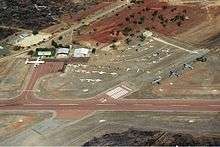
Charters Towers Airport
| Charters Towers Airport | |||||||||||||||
|---|---|---|---|---|---|---|---|---|---|---|---|---|---|---|---|
 Airport overview | |||||||||||||||
| IATA: CXT – ICAO: YCHT | |||||||||||||||
| Summary | |||||||||||||||
| Airport type | Public | ||||||||||||||
| Operator | Charters Towers Regional Council | ||||||||||||||
| Location | Charters Towers, Queensland | ||||||||||||||
| Elevation AMSL | 955 ft / 291 m | ||||||||||||||
| Coordinates | 20°02′36″S 146°16′24″E / 20.04333°S 146.27333°ECoordinates: 20°02′36″S 146°16′24″E / 20.04333°S 146.27333°E | ||||||||||||||
| Map | |||||||||||||||
 YCHT Location in Queensland | |||||||||||||||
| Runways | |||||||||||||||
| |||||||||||||||
Charters Towers Airport (IATA: CXT, ICAO: YCHT) is an airport located 2.9 nautical miles (5.4 km; 3.3 mi) north[1] of Charters Towers, Queensland, Australia.
History
World War II
.jpg)
No. 22 Squadron aircrew and ground crew preparing for a sortie in October 1944
During World War II, the United States Army Air Forces Fifth Air Force stationed the following units at the airfield:[2]
- No. 22 Squadron RAAF, A-20 Boston
- 3d Bombardment Group, (10 March 1942 – 28 January 1943) (Headquarters)
- 8th Bombardment Squadron, A-20 Havoc (17–31 March 1942; 9 May 1942 – 28 January 1943)
- 90th Bombardment Squadron, A-20 Havoc (8 March 1942 – 28 January 1943)
- 431st Fighter Squadron (475th Fighter Group), P-38 Lightning (14 May-1 July 1943)
- 432d Fighter Squadron (475th Fighter Group), P-38 Lightning (14 May-11 July 1943)
- 433d Fighter Squadron (475th Fighter Group), P-38 Lightning (14 May-17 June 1943)
- 16th Bombardment Squadron (Light) (27th Bombardment Group (Light)), A-24 Dauntless (1 April-4 May 1942)
- 17th Bombardment Squadron (Light) (27th Bombardment Group (Light)), A-24 Dauntless (1 April-4 May 1942)
- 91st Bombardment Squadron (Light) (27th Bombardment Group (Light)), A-24 Dauntless (24 March 1942)
In addition, 370th Service Squadron managed the day to day USAAF Base operations of the airfield.
See also
References
![]() This article incorporates public domain material from the Air Force Historical Research Agency website http://www.afhra.af.mil/.
This article incorporates public domain material from the Air Force Historical Research Agency website http://www.afhra.af.mil/.
- 1 2 YCHT – Charters Towers (PDF). AIP En Route Supplement from Airservices Australia, effective 10 November 2016
- ↑ Maurer, Maurer, ed. (1982) [1969]. Combat Squadrons of the Air Force, World War II (PDF) (reprint ed.). Washington, DC: Office of Air Force History. ISBN 0-405-12194-6. LCCN 70605402. OCLC 72556.
External links
| Wikimedia Commons has media related to Charters Towers Airport. |
This article is issued from Wikipedia - version of the 12/4/2016. The text is available under the Creative Commons Attribution/Share Alike but additional terms may apply for the media files.