Chapple, Ontario
| Chapple | |
|---|---|
| Township (single-tier) | |
| Township of Chapple | |
|
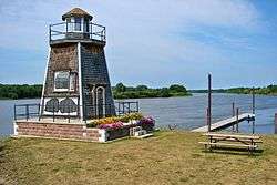
Rainy River in Barwick | |
 Chapple | |
| Coordinates: 48°45′N 93°59′W / 48.750°N 93.983°WCoordinates: 48°45′N 93°59′W / 48.750°N 93.983°W | |
| Country |
|
| Province |
|
| District | Rainy River |
| Incorporated | 1899 |
| Government | |
| • Reeve | Peter Van Heyst |
| • Federal riding | Thunder Bay—Rainy River |
| • Prov. riding | Kenora—Rainy River |
| Area[1] | |
| • Land | 529.02 km2 (204.26 sq mi) |
| Elevation[2] | 335.00 m (1,099.08 ft) |
| Population (2011)[1] | |
| • Total | 741 |
| • Density | 1.4/km2 (4/sq mi) |
| Time zone | CST (UTC-6) |
| • Summer (DST) | CDT (UTC-5) |
| Postal Code FSA | P0W 1A0 |
| Area code(s) | 807 |
| Website | www.chapple.on.ca |
Chapple (Canada 2011 Census population 741)[1] is a township in the Canadian province of Ontario, located in the Rainy River District. Communities located in the township include Barwick, Black Hawk, Finland and Shenston.
The township is served by Ontario Highway 71, a branch of the Trans-Canada Highway, and by Highway 600.
History
It was named after Thomas William Chapple, a former Ontario MPP, who served as judge for the Rainy River District.
Demographics
| Canada census – Chapple community profile | |||
|---|---|---|---|
| 2011 | 2006 | 2001 | |
| Population: | 741 (-13.4% from 2006) | 856 (-5.9% from 2001) | 910 (0.1% from 1996) |
| Land area: | 529.02 km2 (204.26 sq mi) | 529.02 km2 (204.26 sq mi) | 529.02 km2 (204.26 sq mi) |
| Population density: | 1.4/km2 (3.6/sq mi) | 1.6/km2 (4.1/sq mi) | 1.7/km2 (4.4/sq mi) |
| Median age: | 35.7 (M: 35.7, F: 35.8) | 33.1 (M: 30.3, F: 35.3) | |
| Total private dwellings: | 376 | 345 | 347 |
| Median household income: | $39,593 | $43,062 | |
| References: 2011[1] 2006[3] 2001[4] | |||
Population trend:[5]
- Population in 2011: 741
- Population in 2006: 856
- Population in 2001: 910
- Population in 1996: 909
- Population in 1991: 948
Climate
| Climate data for Barwick (1981−2010) | |||||||||||||
|---|---|---|---|---|---|---|---|---|---|---|---|---|---|
| Month | Jan | Feb | Mar | Apr | May | Jun | Jul | Aug | Sep | Oct | Nov | Dec | Year |
| Record high °C (°F) | 9.0 (48.2) |
14.0 (57.2) |
19.5 (67.1) |
31.0 (87.8) |
34.0 (93.2) |
36.5 (97.7) |
35.5 (95.9) |
36.0 (96.8) |
34.0 (93.2) |
28.5 (83.3) |
21.0 (69.8) |
9.0 (48.2) |
36.5 (97.7) |
| Average high °C (°F) | −9.5 (14.9) |
−5.4 (22.3) |
1.3 (34.3) |
10.6 (51.1) |
18.0 (64.4) |
22.6 (72.7) |
25.2 (77.4) |
24.1 (75.4) |
18.3 (64.9) |
10.3 (50.5) |
0.5 (32.9) |
−7.0 (19.4) |
9.1 (48.4) |
| Daily mean °C (°F) | −15.3 (4.5) |
−11.6 (11.1) |
−4.4 (24.1) |
4.4 (39.9) |
11.4 (52.5) |
16.4 (61.5) |
19.0 (66.2) |
17.9 (64.2) |
12.6 (54.7) |
5.5 (41.9) |
−3.4 (25.9) |
−11.8 (10.8) |
3.4 (38.1) |
| Average low °C (°F) | −21.1 (−6) |
−17.8 (0) |
−10.1 (13.8) |
−1.8 (28.8) |
4.7 (40.5) |
10.1 (50.2) |
12.8 (55) |
11.7 (53.1) |
6.9 (44.4) |
0.8 (33.4) |
−7.3 (18.9) |
−16.7 (1.9) |
−2.3 (27.9) |
| Record low °C (°F) | −45.5 (−49.9) |
−49.0 (−56.2) |
−38.0 (−36.4) |
−25.0 (−13) |
−7.5 (18.5) |
−2.0 (28.4) |
2.5 (36.5) |
−1.0 (30.2) |
−5.5 (22.1) |
−17.0 (1.4) |
−39.0 (−38.2) |
−44.0 (−47.2) |
−49.0 (−56.2) |
| Average precipitation mm (inches) | 29.8 (1.173) |
21.3 (0.839) |
29.8 (1.173) |
39.2 (1.543) |
76.2 (3) |
124.7 (4.909) |
102.9 (4.051) |
78.8 (3.102) |
76.2 (3) |
58.8 (2.315) |
41.8 (1.646) |
30.7 (1.209) |
710.2 (27.961) |
| Average rainfall mm (inches) | 0.2 (0.008) |
3.0 (0.118) |
11.0 (0.433) |
30.4 (1.197) |
75.1 (2.957) |
124.7 (4.909) |
102.9 (4.051) |
78.8 (3.102) |
75.5 (2.972) |
51.3 (2.02) |
13.6 (0.535) |
2.1 (0.083) |
568.4 (22.378) |
| Average snowfall cm (inches) | 29.5 (11.61) |
18.3 (7.2) |
18.8 (7.4) |
8.9 (3.5) |
1.1 (0.43) |
0.0 (0) |
0.0 (0) |
0.0 (0) |
0.8 (0.31) |
7.5 (2.95) |
28.3 (11.14) |
28.6 (11.26) |
141.8 (55.83) |
| Average precipitation days (≥ 0.2 mm) | 13.7 | 10.7 | 11.3 | 9.4 | 12.5 | 13.4 | 12.2 | 11.4 | 12.9 | 12.7 | 12.4 | 14.8 | 147.5 |
| Average rainy days (≥ 0.2 mm) | 0.35 | 1.4 | 3.3 | 6.5 | 12.2 | 13.4 | 12.2 | 11.4 | 12.8 | 10.1 | 3.4 | 1.2 | 88.1 |
| Average snowy days (≥ 0.2 cm) | 13.5 | 10.0 | 9.0 | 3.7 | 0.81 | 0.0 | 0.0 | 0.0 | 0.31 | 3.7 | 10.0 | 14.2 | 65.2 |
| Source: Environment Canada[2] | |||||||||||||
See also
References
- 1 2 3 4 "Chapple census profile". 2011 Census of Population. Statistics Canada. Retrieved 2012-03-30.
- 1 2 "Barwick, Ontario". Canadian Climate Normals 1981–2010. Environment Canada. Retrieved 12 February 2015.
- ↑ "2006 Community Profiles". Canada 2006 Census. Statistics Canada. March 30, 2011. Retrieved 2011-05-04.
- ↑ "2001 Community Profiles". Canada 2001 Census. Statistics Canada. February 17, 2012. Retrieved 2011-05-04.
- ↑ Statistics Canada: 1996, 2001, 2006 census
External links
 |
Unorganized Rainy River | | ||
| Morley | |
Unorganized Rainy River | ||
| ||||
| | ||||
| Long Sault 12 | Manitou Rapids 11 Rainy River |
Emo |

This article is issued from Wikipedia - version of the 6/1/2015. The text is available under the Creative Commons Attribution/Share Alike but additional terms may apply for the media files.