Chapagaun
| Chapagaun चापागाउँ | |
|---|---|
| Village development committee | |
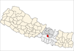
 Chapagaun Location in Nepal | |
| Coordinates: 27°36′N 85°18′E / 27.600°N 85.300°ECoordinates: 27°36′N 85°18′E / 27.600°N 85.300°E | |
| Country |
|
| Zone | Bagmati Zone |
| District | Lalitpur District |
| Population (1991) | |
| • Total | 9,600 |
| Time zone | Nepal Time (UTC+5:45) |
| Postal code | 44710 |
| Area code(s) | 01 |
Chapagaun is a village development committee in Lalitpur District in the Bagmati Zone of central Nepal. At the time of the 1991 Nepal census it had a population of 9600 in 1643 individual households.[1]
References
- ↑ "Nepal Census 2001". Nepal's Village Development Committees. Digital Himalaya. Archived from the original on 2008-10-12. Retrieved 2008-09-03.
External links
This article is issued from Wikipedia - version of the 11/19/2016. The text is available under the Creative Commons Attribution/Share Alike but additional terms may apply for the media files.