Chanute, Kansas
| Chanute, Kansas | |
|---|---|
| City | |
|
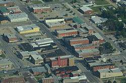
Aerial view of Chanute (2013) | |
| Motto: "a Tradition of Innovation" | |
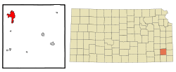 Location within Neosho County and Kansas | |
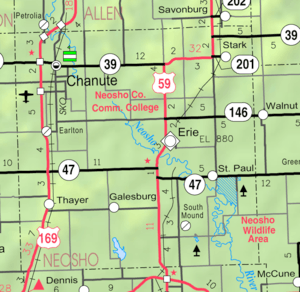 KDOT map of Neosho County (legend) | |
| Coordinates: 37°40′37″N 95°27′23″W / 37.67694°N 95.45639°WCoordinates: 37°40′37″N 95°27′23″W / 37.67694°N 95.45639°W | |
| Country | United States |
| State | Kansas |
| County | Neosho |
| Area[1] | |
| • Total | 7.15 sq mi (18.52 km2) |
| • Land | 7.03 sq mi (18.21 km2) |
| • Water | 0.12 sq mi (0.31 km2) |
| Elevation | 958 ft (292 m) |
| Population (2010)[2] | |
| • Total | 9,119 |
| • Estimate (2012[3]) | 9,161 |
| • Density | 1,297.2/sq mi (500.9/km2) |
| Time zone | Central (CST) (UTC-6) |
| • Summer (DST) | CDT (UTC-5) |
| ZIP code | 66720 |
| Area code(s) | 620 |
| FIPS code | 20-12500 |
| GNIS feature ID | 0484936[4] |
| Website | Chanute.org |
Chanute is a city in Neosho County, Kansas, United States. Founded on January 1, 1873, it was named after railroad engineer and aviation pioneer Octave Chanute.[5][6] As of the 2010 census, the city population was 9,119.[7] Chanute is home of Neosho County Community College.
History
In 1870 when the Leavenworth, Lawrence & Galveston Rail Road (later the Atchison, Topeka & Santa Fe, now the BNSF Railway) crossed the Missouri, Kansas and Texas line within the limits of Neosho county four rival towns sprang up, in the vicinity of the junction: New Chicago, Chicago Junction, Alliance, and Tioga. Two years of the most bitter animosity ensued until the four were consolidated in 1872, and the name of Chanute given it in honor of Octave Chanute, a railroad civil engineer.[8]
Though Chanute was not founded until 1873, settlers had begun populating the area as early as 1856. With the LL&G Railroad set to arrive shortly thereafter, the early residents of the towns of Tioga, Chicago Junction, Alliance, and New Chicago needed an innovative solution to an escalating dispute over which town would claim the right to house the LL&G Railroad’s new land office. The towns were unable to settle their differences until an individual by the name of Octave Chanute came to town. Octave was the Chief Engineer and General Superintendent of the LL&G Railroad. In 1872, he suggested the towns merge to end the bickering. On January 1, 1873 the towns merged and became chartered as the City of Chanute.
With the Southern Kansas Railroad locating a division headquarters in Chanute, the city began to flourish. In 1887, Chanute boasted a rapid growth in flourmills, grain elevators, banks, drug and hardware stores, and natural gas. In 1903, the City of Chanute established the electric utility, and in the years to follow, established the gas, water, wastewater,refuse utilities. Ash Grove Cement Company, the sixth largest cement manufacturer in North America, and the largest US-owned cement company, commenced cement manufacture in 1908 in Chanute. In September 2011 Spirit AeroSystems announced the expansion of an assembly facility which will grow to 150 employees in five years and boost the local economy. Chanute is one of only a handful of remaining full-service cities in the State of Kansas.
Geography
According to the United States Census Bureau, the city has a total area of 7.15 square miles (18.52 km2), of which, 7.03 square miles (18.21 km2) is land and 0.12 square miles (0.31 km2) is water.[1]
Climate
| Month | Jan | Feb | Mar | Apr | May | Jun | Jul | Aug | Sep | Oct | Nov | Dec | Year |
|---|---|---|---|---|---|---|---|---|---|---|---|---|---|
| Record high °F (°C) | 75 (24) |
83 (28) |
95 (35) |
96 (36) |
99 (37) |
108 (42) |
116 (47) |
113 (45) |
107 (42) |
98 (37) |
89 (32) |
77 (25) |
116 (47) |
| Average high °F (°C) | 40.5 (4.7) |
47.2 (8.4) |
57.8 (14.3) |
67.9 (19.9) |
75.8 (24.3) |
84.7 (29.3) |
90.5 (32.5) |
89.3 (31.8) |
81.0 (27.2) |
70.0 (21.1) |
55.3 (12.9) |
44.0 (6.7) |
67.0 (19.4) |
| Average low °F (°C) | 21.0 (−6.1) |
26.0 (−3.3) |
35.4 (1.9) |
44.9 (7.2) |
54.8 (12.7) |
63.8 (17.7) |
68.5 (20.3) |
66.7 (19.3) |
58.4 (14.7) |
46.8 (8.2) |
34.8 (1.6) |
25.0 (−3.9) |
45.5 (7.5) |
| Record low °F (°C) | −23 (−31) |
−13 (−25) |
−4 (−20) |
14 (−10) |
28 (−2) |
38 (3) |
48 (9) |
45 (7) |
30 (−1) |
17 (−8) |
1 (−17) |
−17 (−27) |
−23 (−31) |
| Average precipitation inches (mm) | 1.28 (32.5) |
1.90 (48.3) |
3.47 (88.1) |
3.83 (97.3) |
5.29 (134.4) |
5.05 (128.3) |
4.24 (107.7) |
3.96 (100.6) |
3.95 (100.3) |
4.03 (102.4) |
3.06 (77.7) |
1.89 (48) |
41.95 (1,065.5) |
| Source: National Weather Service[9][10] | |||||||||||||
Demographics
| Historical population | |||
|---|---|---|---|
| Census | Pop. | %± | |
| 1880 | 887 | — | |
| 1890 | 2,826 | 218.6% | |
| 1900 | 4,208 | 48.9% | |
| 1910 | 9,272 | 120.3% | |
| 1920 | 10,286 | 10.9% | |
| 1930 | 10,277 | −0.1% | |
| 1940 | 10,142 | −1.3% | |
| 1950 | 10,109 | −0.3% | |
| 1960 | 10,849 | 7.3% | |
| 1970 | 10,341 | −4.7% | |
| 1980 | 10,506 | 1.6% | |
| 1990 | 9,488 | −9.7% | |
| 2000 | 9,411 | −0.8% | |
| 2010 | 9,119 | −3.1% | |
| Est. 2015 | 9,252 | [11] | 1.5% |
| U.S. Decennial Census[12] 2012 Estimate[13] | |||
2010 census
As of the census[2] of 2010, there were 9,119 people, 3,720 households, and 2,322 families residing in the city. The population density was 1,297.2 inhabitants per square mile (500.9/km2). There were 4,178 housing units at an average density of 594.3 per square mile (229.5/km2). The racial makeup of the city was 92.4% White, 1.9% African American, 1.2% Native American, 0.8% Asian, 0.1% Pacific Islander, 1.4% from other races, and 2.2% from two or more races. Hispanic or Latino of any race were 5.4% of the population.
There were 3,720 households of which 32.4% had children under the age of 18 living with them, 44.1% were married couples living together, 12.6% had a female householder with no husband present, 5.7% had a male householder with no wife present, and 37.6% were non-families. 33.1% of all households were made up of individuals and 15.1% had someone living alone who was 65 years of age or older. The average household size was 2.35 and the average family size was 2.93.
The median age in the city was 37.2 years. 25.3% of residents were under the age of 18; 10.5% were between the ages of 18 and 24; 23% were from 25 to 44; 24.5% were from 45 to 64; and 16.8% were 65 years of age or older. The gender makeup of the city was 48.0% male and 52.0% female.
2000 census
As of the census of 2000, there were 9,411 people, 3,864 households, and 2,496 families residing in the city. The population density was 1,533.7 people per square mile (591.8/km²). There were 4,262 housing units at an average density of 694.6 per square mile (268.0/km²). The racial makeup of the city was 93.20% White, 1.42% African American, 1.11% Native American, 0.47% Asian, 0.04% Pacific Islander, 1.39% from other races, and 2.37% from two or more races. Hispanic or Latino of any race were 3.89% of the population.
There were 3,864 households out of which 30.6% had children under the age of 18 living with them, 49.9% were married couples living together, 10.8% had a female householder with no husband present, and 35.4% were non-families. 31.7% of all households were made up of individuals and 16.1% had someone living alone who was 65 years of age or older. The average household size was 2.34 and the average family size was 2.92.
In the city the population was spread out with 25.2% under the age of 18, 10.1% from 18 to 24, 25.2% from 25 to 44, 20.5% from 45 to 64, and 18.9% who were 65 years of age or older. The median age was 38 years. For every 100 females there were 88.0 males. For every 100 females age 18 and over, there were 84.8 males.
The median income for a household in the city was $29,912, and the median income for a family was $36,630. Males had a median income of $25,696 versus $17,938 for females. The per capita income for the city was $16,288. About 12.0% of families and 15.0% of the population were below the poverty line, including 20.3% of those under age 18 and 9.9% of those age 65 or over.
Education
Public Schools
Chanute public schools (Unified School District #413) include one elementary school, one middle school, and one high school. Chanute's elementary school is Chanute Elementary School. Chanute’s middle school is Royster Middle School. Chanute’s high school is Chanute High School. Chanute’s public school system also includes Chanute High School-affiliated New Beginnings Academy, a program for students lacking credits to graduate and designed for individuals who have dropped out or are in danger of dropping out of high school. High school credits for New Beginnings Academy are provided by Chanute High School.
Private schools
Chanute is home to two private schools: Saint Patrick Catholic School and Chanute Christian Academy. Saint Patrick Catholic School provides schooling for students from pre-school(ages three to four) through the fifth grade while Chanute Christian Academy (CCA) provides schooling for students from kindergarten through the twelfth grade. The Kansas State Department of Education (KSDE) recognizes Saint Patrick Catholic School as an accredited, non-public school. Chanute Christian Academy is not listed as an accredited school on the KSDE website.[14]
St. Patrick Catholic School was awarded the Governor's Award for meeting the standard of excellence and scoring in the top 5% on Kansas assessments in both reading and math.[15]
Colleges
Chanute’s only college is the Neosho County Community College known locally as NCCC, or sometimes as NC3. Neosho County Community College is a public, two-year institution, that currently provides post-secondary education for just under 3,200 students.
Area attractions
The Chanute area has many tourist attractions known for their historical significance.
- Martin and Osa Johnson Safari Museum
The Martin and Osa Johnson Safari Museum offers award winning exhibits and programs that highlight the achievements of Martin and Osa Johnson, pioneering documentary filmmakers, photographers, authors, explorers, and Kansans. A trip to the museum allows one to relive the Johnsons’ 1917–1936 adventures in Africa, Borneo and the South Seas. Additional exhibits feature the rich cultures and art of Africa.
- Tioga Suites Hotel
The Tioga Suites Hotel was built in 1929 as Kansas' first "fireproof" hotel. All exterior and interior walls, floors and ceilings are masonry or concrete. This Art Deco building is listed on the National Register of Historic Places. It has been completely remodeled and modernized. Known as the "Jewel of Southeast Kansas" it is the hub of many of the community and area activities. It is located in the heart of downtown Chanute.
- Chanute Art Gallery
The Chanute Art Gallery includes more than 1,500 square feet of exhibit area and houses a Permanent Core Collection of more than 500 works of art that includes 25 mediums, representing 135 artists. Special exhibits change every month. Collections include: The Luigi Kasimir Etchings, European and Oriental Art, The Kansas Prairie Printmakers and local and area artists.
- Chanute Historical Museum
The Chanute Historical Museum is commonly known as the Flat Iron Building, this unusual structure is now home to a museum featuring Chanute artifacts. It houses a large genealogy collection and various artifacts from Chanute's colorful history, including an extensive collection of MKT Railroad memorabilia. Members of the Chanute Historical Society opened the museum in June 2005. The collection on display contains sports, railroad and aviation memorabilia.
- Downtown & Historic Homes
Both the downtown and historic home districts offer a variety of architectural styles and beautiful examples of restoration. The historic home driving tour takes you down broad, tree-lined streets that make you feel you have stepped back into another era. Chanute's wonderful downtown is filled with historic buildings, most of which have been restored to their original beauty. Chanute also has several examples of WPA projects.
- Cardinal Drug Store
The Cardinal Drug Store in downtown Chanute is the home of one of the oldest original soda fountains in Kansas. It has a collection of Coke memorabilia and medicine bottles. Cardinal is located at 103 East Main Street.
- Austin Bridge
The King Bridge Company constructed the Austin Bridge in 1872. The 160-foot bowstring arch design spanned the Neosho River east of what is now Chanute. Local pioneers invested $15,000 in the bridge for their economic future of getting livestock and crops to the railhead. In 1910 the bridge was moved downstream to the community of Austin. In 1972 it was closed to vehicular traffic, remaining open to foot traffic. On September 15, 1977 the bridge was added to the National Register of Historic Places. In August 1999 the bridge was moved into Santa Fe Park to become the southern terminus of a 3.11 mile hike/bike path. A Federal grant, Neosho County and the City of Chanute funded the project.
- Summit Hill Gardens
Summit Hill Gardens was the first school in Neosho County. Summit Hill was restored and a historic home and modern structure were added to the family residence. It has a flower and herb garden. It is located at 2605 160th Road.
- Chanute-Wright Brothers Memorial
Located in the heart of downtown, this sculpture was dedicated as a gift to the community in September 2003 by the Chanute High School Class of 1941. The sculpture honors engineer and city namesake, Octave Chanute, and the Wright Brothers. Chanute was a mentor to Wilbur and Orville Wright and very influential in the early days of flight exploration. The sculpture measures 23 feet from wingtip to wingtip and 20 feet from nose to tail. The project was in partnership with the City of Chanute.
Transportation
Highways
Major highways running through Chanute are north-south route US-169 and east-west route K-39 (East-West). Chanute is also within 10 miles of two other major north-south highways: US-75 and US-59. These highways provide easy access to I-70 and I-35, the two Interstate Highways passing through Kansas, as well as east-west highway US-400.
Bus
Bus service is provided northward towards Kansas City, Missouri and southward towards Tulsa, Oklahoma by Jefferson Lines (subcontractor of Greyhound Lines).[16][17]
Railways
The South Kansas and Oklahoma Railroad (SKO) serves Chanute, as well as Southern and Eastern Kansas and Northern Oklahoma. The SKO connects to several major railroads allowing local businesses the opportunity to bid and negotiate their rail transportation costs to acquire the best possible price to all locations throughout North America.
Airports
Chanute's Martin Johnson Municipal Airport is a general aviation airport with a 4,255-foot runway and taxiway. Expansion of services and infrastructure is in the planning stages, including new T-hangars and pavement improvements.
Infrastructure
In October 2014, the City of Chanute announced it planned to establish a municipal-operated broadband network, offering 1 Gigabit Internet connectivity for about US$40 per month. AT&T, which currently offers only 6 megabit DSL service to the town (at a higher price), filed a petition with the Kansas Corporation Commission to intervene in the city's proposed offering, arguing it has the right to intervene since a 1947 law requires the Commission to approve any bond issue the city would use to finance the construction.[18] In April 2015, incoming city commissioners voted not to issue bonds and to temporarily halt the plans on municipal operated broadband, pending further public discussion and a public vote [19]
Notable people
- Eden Ahbez (1908–1995), songwriter and mystic, lived in Chanute in his youth as George McGrew
- Jimmy Allen, former lead guitarist for Puddle of Mudd
- Edwin Bideau, lawyer and politician
- Osa Johnson, adventurer, author, and documentary filmmaker
- Jennifer Knapp, Christian singer-songwriter
- Paul Lindblad, MLB player
- Ralph Miller, Hall of Fame basketball coach
- Kustom Amplification, had a factory in Chanute. Bud Ross changed the face of American music in the 60's and 70's.[20]
- Grace Olive Wiley, herpetologist.
Gallery
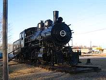 Steam locomotive in Santa Fe Park
 Lake in Santa Fe Park
See also
References
- 1 2 "US Gazetteer files 2010". United States Census Bureau. Archived from the original on 2012-01-24. Retrieved 2012-07-06.
- 1 2 "American FactFinder". United States Census Bureau. Retrieved 2012-07-06.
- ↑ "Population Estimates". United States Census Bureau. Archived from the original on 2013-06-17. Retrieved 2013-05-29.
- ↑ "US Board on Geographic Names". United States Geological Survey. 2007-10-25. Retrieved 2008-01-31.
- ↑ Brackman, Barbara (1997). Kansas Trivia. Thomas Nelson Inc. p. 12.
- ↑
 Chisholm, Hugh, ed. (1911). "Chanute". Encyclopædia Britannica. 5 (11th ed.). Cambridge University Press. p. 849.
 - ↑ "2010 City Population and Housing Occupancy Status". U.S. Census Bureau. Archived from the original on July 21, 2011. Retrieved December 1, 2011.
- ↑ Chanute History Archived September 1, 2006, at the Wayback Machine.
- ↑ "National Weather Service Climate Normals". National Weather Service. Retrieved September 7, 2010.
- ↑ "National Weather Service Climate Records". National Weather Service. Retrieved September 7, 2010.
- ↑ "Annual Estimates of the Resident Population for Incorporated Places: April 1, 2010 to July 1, 2015". Retrieved July 2, 2016.
- ↑ United States Census Bureau. "Census of Population and Housing". Archived from the original on May 11, 2015. Retrieved January 3, 2014.
- ↑ "Annual Estimates of the Resident Population: April 1, 2010 to July 1, 2012". Retrieved January 3, 2014.
- ↑ http://svapp15586.ksde.org/k12/county.aspx?cnty_no=067
- ↑ http://www.stpatrickschoolchanute.com/index.html Archived October 6, 2007, at the Wayback Machine., St Patrick School Chanute, KS
- ↑ Jefferson Lines
- ↑ Greyhound Lines - Bus stops in Kansas
- ↑ "AT&T Allowed To Weigh In On Town's Effort To Build New Fiber Network". Mediapost. December 4, 2014. Retrieved December 4, 2014.
- ↑ McDowell, Brian (April 15, 2015). "New City Commissoners kill bond issuance for fiber plan" (6). Chanute Tribune. Chanute Tribune. Retrieved 23 April 2015.
- ↑ History of Kustom Amps Archived August 17, 2011, at the Wayback Machine.
External links
| Wikimedia Commons has media related to Chanute, Kansas. |
- City
- Schools
- USD 413, local school district
- Maps
Municipalities and communities of Neosho County, Kansas, United States | ||
|---|---|---|
| Cities | 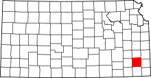 | |
| Unincorporated communities | ||
| Civil townships | ||