Channagiri
| Channagiri ಚನ್ನಗಿರಿ | |
|---|---|
| town | |
| Nickname(s): The land of arecanut | |
 Channagiri Location in Karnataka, India | |
| Coordinates: 14°02′N 75°56′E / 14.03°N 75.93°ECoordinates: 14°02′N 75°56′E / 14.03°N 75.93°E | |
| Country |
|
| State | Karnataka |
| Region | Are-Malenadu |
| District | Davanagere |
| Elevation | 662 m (2,172 ft) |
| Population (2001) | |
| • Total | 18,517 |
| Languages | |
| • Official | Kannada |
| Time zone | IST (UTC+5:30) |
| ISO 3166 code | IN-KA |
| Vehicle registration | KA-17 |
| Website |
karnataka |
Channagiri is a panchayat town in Davanagere district in the state of Karnataka, India. It is a taluk headquarters in Davanagere District.
Etymology
It is said that the hill was fortified by Rani Chennamma of Keladi (1672–1697), queen of Keladi Nayaka Kingdom and town was named after her.[1]
Geography
Channagiri is located at 14°02′N 75°56′E / 14.03°N 75.93°E.[2] It has an average elevation of 662 metres (2171 feet).
Demographics
As of 2001 India census, Channagiri had a population of 18,517. Males constitute 52% of the population and females 48%. Channagiri has an average literacy rate of 71%, higher than the national average of 59.5%; with male literacy of 74% and female literacy of 67%. 13% of the population is under 6 years of age. it comes under semi-malnad region.[3]
Culture
The city has multiethnic population. Most of them are Hindus (Veerashaivas/Lingayaths) and rest Mohammadans, Jains. Every year Anjaneya Swamy Ratotsawa at Muddenahalli and Gaddigeshwara Utsava is held for three days. On this occasion, the Mutt will arrange with Prasadam thrice a day. Most beautiful scene to see will be Pallakki Utsava and Veeragaase played there. The main temples in town are situated on hills. One is at Mudenahalli (Aanjaneya) and other at Fort (Ranganathaswamy). Gowramma Street is in the heart of city. This street is famous for Gowramma temple.
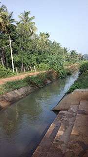
Channagiri is famous for Aracanut farming and famous Shanti Sagara is located here.
Hill Fort
Channagiri has a hill fort of about 1770 A.D. with a Ranganatha temple inside it, which rises to a height of about 200 feet to the west of the town consists of a single soft dark covered with earth which commands a wide plain. The fort consists of two rubble walls defending by moats, the chief gate being on the north where the gradient is lowest.[4]
On the peak stands a temple dedicated to Sri Ranganatha. It is called Bete-Ranganatha and depicts Vishnu standing in samabhanga holding chakra and sankha in his back hands and arrow in his front hands with a low Garuda pedestal below him and a consort in relievo on the prabhavali on each side.[5]
To its south-west is a small shrine dedicated to Bhutappa which contains the head of the god whose tongue projects out of his mouth.[6]
Notable people
- Dhondia Wagh, born in Channagiri
See also
References
- ↑ Annual Report of the Mysore Archaeological department for the year 1937 Archaeological Survey of India, Government Of India
- ↑ Falling Rain Genomics, Inc - Channagiri
- ↑ Census 2011 Official website of Office of The Registrar General & Census
- ↑ Annual Report of the Mysore Archaeological department for the year 1937 Archaeological Survey of India, Government Of India
- ↑ Annual Report of the Mysore Archaeological department for the year 1937 Archaeological Survey of India, Government Of India
- ↑ Annual Report of the Mysore Archaeological department for the year 1937 Archaeological Survey of India, Government Of India
External links
| Wikimedia Commons has media related to Channagiri. |