Changlang
This article is about the municipality in India. For its namesake district, see Changlang district.
| Changlang | |
|---|---|
| Town | |
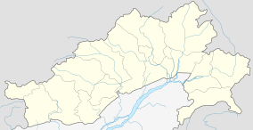 Changlang  Changlang Location in Arunachal Pradesh, India | |
| Coordinates: 27°07′N 95°43′E / 27.12°N 95.71°ECoordinates: 27°07′N 95°43′E / 27.12°N 95.71°E | |
| Country |
|
| State | Arunachal Pradesh |
| District | Changlang |
| Population (2001) | |
| • Total | 6,394 |
| Languages | |
| • Official | English |
| Time zone | IST (UTC+5:30) |
| Telephone code | 03808 |
| Vehicle registration | AR |
| Climate | Cwa |
| Website |
www |
Changlang is a census town and headquarters of the Changlang district in the Indian state of Arunachal Pradesh. It has become one of the major districts in the area owing to the presence of crude oil, coal and mineral resources other than tourism and hydro power.
Changlang is located at the co-ordinates 27°07′N 95°43′E / 27.12°N 95.71°E.[1]
As of 2001 India census,[2] Changlang had a population of 6394. Males constitute 56% of the population and females 44%. Changlang has an average literacy rate of 72%, higher than the national average of 59.5%; with male literacy of 78% and female literacy of 65%. 14% of the population is under 6 years of age.
Notes
- ↑ "Yahoo maps for Changlang, Arunachal Pradesh". Yahoo maps. Retrieved 16 December 2008.
- ↑ "Census of India 2001: Data from the 2001 Census, including cities, villages and towns (Provisional)". Census Commission of India. Archived from the original on 16 June 2004. Retrieved 1 November 2008.
References
This article is issued from Wikipedia - version of the 11/19/2016. The text is available under the Creative Commons Attribution/Share Alike but additional terms may apply for the media files.