Champa, Chhattisgarh
| Champa चाँपा | |
|---|---|
| city | |
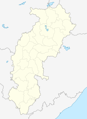 Champa  Champa Location in Chhattisgarh, India | |
| Coordinates: 22°03′N 82°39′E / 22.05°N 82.65°ECoordinates: 22°03′N 82°39′E / 22.05°N 82.65°E | |
| Country |
|
| State | Chhattisgarh |
| District | Janjgir-Champa |
| Elevation | 253 m (830 ft) |
| Population (2001) | |
| • Total | 37,949 |
| Languages | |
| • Official | Hindi, Chhattisgarhi |
| Time zone | IST (UTC+5:30) |
| PIN | 495671 |
| Telephone code | 07819 |
| Vehicle registration | CG 11 |
| Website |
www |
Champa is a city and a municipality situated at bank of Hasdeo river in Janjgir-Champa district in the state of Chhattisgarh, India.
Geography
Champa has an average elevation of 253 metres (830 feet). It is located on the banks of Hasdeo river, a tributary of Mahanadi.
Demographics
As of 2001 India census,[1] Champa had a population of 37,949. Males constitute 52% of the population and females 48%. Champa has an average literacy rate of 67%, higher than the national average of 59.5%; with male literacy of 77% and female literacy of 56%. 14% of the population is under 6 years of age.In Champa mainly two caste Dewangan and Soni are in majority.The city is divided in two parts by a temple of Samleshwari Devi which is situated in heart of the city.In one part of city Dewangan caste has many para and mohalla and in another part Soni caste has same.
Economy
Champa is famous for its Kosa silk, gold and brass metal works. Champa has large industries viz. Madhya Bharat Paper Limited (MBPL),Prakash Industries Ltd., CSPGCL's Marwa Power Plant and many mega power projects are in under construction.Kosa silk merchant are particularly Dewangan caste.They import Kosa(Tassar silk) yarn from China and Korea and make silk shirtings and sarees.They also make yarn from Kosa called Cocoon in English and make Khadi Shirtings. They Export it to many Indian states and countries like U.K. and U.S.A. and Brazil.
Education
Colleges
- Indian Institute of Handloom and Textile Technology
- Govt. M.M.R.Post Graduate college
School
- Kidzone English School
- Delhi Public School Champa
- Hasdeo Public School Champa
- Lions Hr. Sec. School Champa
- Saraswati Shishu Mandir Champa
- Rainbow Kidzee School, Champa
- Amardeep Public School Champa
- Prince of peace school
- LDN SCHOOL CHAMPA
- Little Angle Covent School Champa
- Bachpan Play School
- Fairy Public School
- Keshar Public School
Janjgir Champa District Overview
- An official Census 2011 detail of Janjgir Champa, a district of Chhattisgarh has been released by Directorate of Census Operations in Chhattisgarh. Enumeration of key persons was also done by census officials in Janjgir Champa District of Chhattisgarh.
Janjgir Champa District Population 2011
- In 2011, Janjgir Champa had population of 1,619,707 of which male and female were 815,717 and 803,990 respectively. In 2001 census, Janjgir Champa had a population of 1,317,431 of which males were 659,388 and remaining 658,043 were females. Janjgir Champa District population constituted 6.34 percent of total Chhattisgarh population. In 2001 census, this figure for Janjgir Champa District was at 6.32 percent of Maharashtra population.
Janjgir Champa District Population Growth Rate
- There was change of 22.94 percent in the population compared to population as per 2001. In the previous census of India 2001, Janjgir Champa District recorded increase of 18.67 percent to its population compared to 1991.
Janjgir Champa District Density 2011
- The initial provisional data released by census India 2011, shows that density of Janjgir Champa district for 2011 is 420 people per km2. In 2001, Janjgir Champa district density was at 342 people per km2. Janjgir Champa district administers 3,853 square kilometers of areas.
Janjgir Champa Literacy Rate 2011
- Average literacy rate of Janjgir Champa in 2011 were 73.07 compared to 65.94 of 2001. If things are looked out at gender wise, male and female literacy were 84.72 and 61.31 respectively. For 2001 census, same figures stood at 81.82 and 50.14 in Janjgir Champa District. Total literate in Janjgir Champa District were 1,019,634 of which male and female were 593,679 and 425,955 respectively. In 2001, Janjgir Champa District had 720,507 in its district.
Janjgir Champa Sex Ratio 2011
- With regards to Sex Ratio in Janjgir Champa, it stood at 986 per 1000 male compared to 2001 census figure of 998. The average national sex ratio in India is 940 as per latest reports of Census 2011 Directorate. In 2011 census, child sex ratio is 950 girls per 1000 boys compared to figure of 966 girls per 1000 boys of 2001 census data.
Janjgir Champa Child Population 2011
- In census enumeration, data regarding child under 0-6 age were also collected for all districts including Janjgir Champa. There were total 224,218 children under age of 0-6 against 224,792 of 2001 census. Of total 224,218 male and female were 114,957 and 109,261 respectively. Child Sex Ratio as per census 2011 was 950 compared to 966 of census 2001. In 2011, Children under 0-6 formed 13.84 percent of Janjgir Champa District compared to 17.06 percent of 2001. There was net change of -3.22 percent in this compared to previous census of India.
Description 2011 2001
- Actual Population 1,619,707 1,317,431
- Male 815,717 659,388
- Female 803,990 658,043
- Population Growth 22.94% 18.67%
- Area km2 3,853 3,853
- Density/km2 420 342
- Proportion to Chhattisgarh Population 6.34% 6.32%
- Sex Ratio (Per 1000) 986 998
- Child Sex Ratio (0-6 Age) 950 966
- Average Literacy 73.07 65.94
- Male Literacy 84.72 81.82
- Female Literacy 61.31 50.14
- Total Child Population (0-6 Age) 224,218 224,792
- Male Population (0-6 Age) 114,957 114,349
- Female Population (0-6 Age) 109,261 110,443
- Literates 1,019,634 720,507
- Male Literates 593,679 445,925
- Female Literates 425,955 274,582
- Child Proportion (0-6 Age) 13.84% 17.06%
- Boys Proportion (0-6 Age) 14.09% 17.34%
- Girls Proportion (0-6 Age) 13.59% 16.78%
Description Rural Urban
- Population (%) 86.10% 13.90%
- Total Population 1,394,646 225,061
- Male Population 701,401 114,316
- Female Population 693,245 110,745
- Sex Ratio 988 969
- Child Sex Ratio (0-6) 955 923
- Child Population (0-6) 195,052 29,166
- Male Child(0-6) 99,788 15,169
- Female Child(0-6) 95,264 13,997
- Child Percentage (0-6) 13.99% 12.96%
- Male Child Percentage 14.23% 13.27%
- Female Child Percentage 13.74% 12.64%
- Literates 859,400 160,234
- Male Literates 503,744 89,935
- Female Literates 355,656 70,299
- Average Literacy 71.64% 81.80%
- Male Literacy 83.73% 90.71%
- Female Literacy 59.48% 72.66%
Janjgir Champa District Urban Population 2011
- Out of the total Janjgir Champa population for 2011 census, 13.90 percent lives in urban regions of district. In total 225,061 people lives in urban areas of which males are 114,316 and females are 110,745. Sex Ratio in urban region of Janjgir Champa district is 969 as per 2011 census data. Similarly child sex ratio in Janjgir Champa district was 923 in 2011 census. Child population (0-6) in urban region was 29,166 of which males and females were 15,169 and 13,997. This child population figure of Janjgir Champa district is 13.27% of total urban population. Average literacy rate in Janjgir Champa district as per census 2011 is 81.80% of which males and females are 90.71% and 72.66% literates respectively. In actual number 160,234 people are literate in urban region of which males and females are 89,935 and 70,299 respectively.
Janjgir Champa District Rural Population 2011
- As per 2011 census, 86.10% population of Janjgir Champa districts lives in rural areas of villages. The total Janjgir Champa district population living in rural areas is 1,394,646 of which males and females are 701,401 and 693,245 respectively. In rural areas of Janjgir Champa district, sex ratio is 988 females per 1000 males. If child sex ratio data of Janjgir Champa district is considered, figure is 955 girls per 1000 boys. Child population in the age 0-6 is 195,052 in rural areas of which males were 99,788 and females were 95,264. The child population comprises 14.23% of total rural population of Janjgir Champa district. Literacy rate in rural areas of Janjgir Champa district is 71.64% as per census data 2011. Gender wise, male and female literacy stood at 83.73 and 59.48 percent respectively. In total, 859,400 people were literate of which males and females were 503,744 and 355,656 respectively.
All details regarding Janjgir Champa District have been processed by us after receiving from Govt. of India. We are not responsible for errors to population census details of Janjgir Champa District.
Hospitals
- B.D.M. Dharam Hospital (Government Hospital)
- Mission Hospital
- Osho Dhara Hospital
- Gitanjali clinic.
- Thawani dental clinic.
- Bachpan Hospital
Railway station
Champa railway station is a junction on the Tatanagar–Bilaspur section of Howrah-Nagpur-Mumbai line. Korba (Gewra) passengers need to change line from here for going to Korba.It is The Biggest Railway Station In The Janjgir-Champa District of Chhattisgarh.It Is one of the 'A' Graded Stations of the country
References
- ↑ "Census of India 2001: Data from the 2001 Census, including cities, villages and towns (Provisional)". Census Commission of India. Archived from the original on 2004-06-16. Retrieved 2008-11-01.