Chakunda urf milki
| CHAKUNDA URF MILKI | |
|---|---|
| Gram Panchayat | |
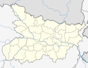 CHAKUNDA URF MILKI  CHAKUNDA URF MILKI Location in bihar , India | |
| Coordinates: 25°44′01.1″N 85°17′48.5″E / 25.733639°N 85.296806°ECoordinates: 25°44′01.1″N 85°17′48.5″E / 25.733639°N 85.296806°E | |
| Country |
|
| State | Bihar |
| District | vaishali |
| Assembly Constituency | hajipur assembly constituency (AC.123)[1] |
| Languages | |
| • Official | Hindi |
| Time zone | IST (UTC+5:30) |
chakunda urf milki is a Gram panchayat in hajipur, vaishali district, bihar.
Geography
This panchayat is located at 25°44′01.1″N 85°17′48.5″E / 25.733639°N 85.296806°E
panchayat office
samudayik bhawan chakunda urf milki (समुदाियक भवन chakunda urf milki )[2]
Nearest City/Town
Nearest major road highway or river
roadway (milki rd)[4]
compass
 |
| |||
| |
||||
| ||||
| | ||||
| panapur langa | dayalpur panchayat |
Villages in panchayat
There are villages in this panchayat[6]
| s.n | villages | |
|---|---|---|
| 1 | Chak Said Kari | |
| 2 | Kansara | |
| 3 | Basauli | |
| 4 | Chak Khunda urf Milki | |
| 5 | Chak Khunda urf Milik Chak | |
| 6 | Bejha | |
| 7 | Loawan urf Loma | |
| 8 | Bishunpur Ram | |
| 9 | Sopha | |
| 10 | Gumti | |
| 11 | Az Rakbe Gumti | |
See also
References
- ↑ The Chief Electoral Officer of Bihar official,hajipur pdf
- ↑ Panchayati Raj Department,Government of Bihar page number 7
- ↑ village profile census government official website Archived October 30, 2014, at the Wayback Machine. State - Bihar, District- vaishali, Sub District - Hajipur
- ↑ Map - vaishali district official government website Archived November 4, 2014, at the Wayback Machine. file type: image/jpeg, size:13.9 MB
- ↑ The Chief Electoral Officer of Bihar official,hajipur pdf
- ↑ Reports of National Panchayat Directory Ministry of Panchayati Raj Government of India List of Census Villages mapped for CHAKUNDA Gram Panchayat,HAJIPUR,VAISHALI,BIHAR Archived November 3, 2014, at the Wayback Machine. Report printed on 26/09/2014 National Panchayat Portal,Panchayat Informatics Division
This article is issued from Wikipedia - version of the 11/19/2016. The text is available under the Creative Commons Attribution/Share Alike but additional terms may apply for the media files.