Chagres National Park
| Chagres National Park | |
|---|---|
|
IUCN category II (national park) | |
 | |
 Chagres National Park (top center) within Panama | |
| Location | Panamá Province, Panama |
| Coordinates | 9°24′N 79°30′W / 9.4°N 79.5°WCoordinates: 9°24′N 79°30′W / 9.4°N 79.5°W |
| Area | 129,000 hectares (320,000 acres) |
| Established | 1985 |
| http://www.fundacionchagres.org/ Chagres National Park Foundation — | |
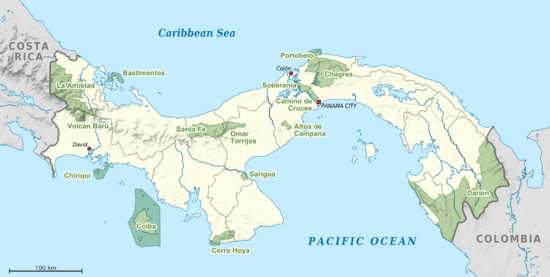
The Chagres National Park is located between the Province of Panama and Colon, in the Eastern sector of the Panama Canal with a total surface area of 129,000 hectares (320,000 acres).
The park contains tropical rain forests and a set of rivers which provide sufficient water to guarantee the operation of the Gatun Lake, main lake of the Panama Canal: The Chagres River and the Gatun River.
Panama Canal Watershed
The park was created in 1985,[1] with the aim of preserving the natural forest that composes it to produce water in amount and quality sufficient to guarantee the normal operation of the Panama Canal, to supply potable water for the cities of Panama, Colon and la Chorrera, and the generation of electricity for the cities of Panama and Colon.
For the operation of the Panama Canal it is necessary to maintain high water levels, since each boat that crosses the locks needs around 52 million nonrecoverable gallons of fresh water.