Chabahar
| Chabahar چابهار | |
|---|---|
| city | |
 | |
 Chabahar | |
| Coordinates: 25°17′31″N 60°38′35″E / 25.29194°N 60.64306°ECoordinates: 25°17′31″N 60°38′35″E / 25.29194°N 60.64306°E | |
| Country |
|
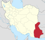
| Province | Sistan and Baluchestan |
| County | Chabahar |
| Bakhsh | Central |
| Population (2014) | |
| • Total | 120,000 |
| Time zone | IRST (UTC+3:30) |
| • Summer (DST) | IRDT (UTC+4:30) |
Chābahār ![]() pronunciation (Persian: چابهار, formerly Bandar Beheshtī)[1] is a city in and capital of Chah Bahar County, Sistan and Baluchestan Province, Iran. Chabahar is a free port (Free Trade Zone) on the coast of the Gulf of Oman. At the 2014 census, its population was 120,000. Chabahar is Iran's southernmost city.
pronunciation (Persian: چابهار, formerly Bandar Beheshtī)[1] is a city in and capital of Chah Bahar County, Sistan and Baluchestan Province, Iran. Chabahar is a free port (Free Trade Zone) on the coast of the Gulf of Oman. At the 2014 census, its population was 120,000. Chabahar is Iran's southernmost city.
Chabahar is situated on the Makran Coast of the Sistan and Baluchestan province of Iran and is officially designated as a Free Trade and Industrial Zone by Iran's government. Due to its free trade zone status, the city has increased in significance in international trade. The overwhelming majority of the city's inhabitants are ethnic Baluch who speak the Baluchi language.
Etymology
The name bases on Persian char that means four and bahar that means Spring. Hence, it means a place that all four seasons of the year are Spring time.
History
There is a fishing village and former port named Tis in Chabahar's neighborhood, which dates from 2500 BC, known in Alexander the Great's conquests as Tiz, eventually renamed Tis. In addition, in his book Aqd al-Ala lel-Moghefe al Ahla, Afdhal al-Din abu Hamid Kermani wrote in 584 A.H. (1188) about the port of Tiz and its commerce and trade. According to the scholar and historian, Alberuni, author of an encyclopedic work on India called "Tarikh Al-Hind", the sea coast of India commences with Tiz or modern Chabahar.[2][3] Tis was formerly an active commercial port, and was destroyed by the Mongols. There are still some ruins in the village. The Portuguese were the first colonial country to attack the Makran (Oman) Sea. The Portuguese forces under Afonso de Albuquerque gained control of Chabahar and Tis, staying there until 1031 A.H. (1621). The British, and later the Portuguese in the 17th century (year 1616) AC (1026 A.H.), entered this region.
Modern Chabahar dates back to around 1970, when it was declared a municipality and large port projects were started by order of Mohammad Reza Pahlavi. A modern naval and air base was established as part of the Shah's policy of making Iran into a dominant power in the Indian Ocean. At that time these and other development projects in and around Chabahar involved the extensive participation of foreign companies, especially from the United States. After the 1979 revolution the foreign companies left the projects and Iranian public companies linked to the Ministry of Jahad-e Sazandegi (or jihad for construction) took them over. The Iraq-Iran war caused Chabahar to gain in logistical and strategic importance. War brought insecurity to the Strait of Hormuz and ships were unable to enter the Persian Gulf. Accordingly, Chabahar became a major port during the war. In the 1980s the Iranian government developed a new scheme named the Eastern Axis Development Scheme, which aimed to use Chabahar's geographical position as a regional development tool to stimulate economic growth in the eastern provinces. The establishment of the Chabahar Free Trade-Industrial Zone in 1992 resulting from the EAD Scheme brought development and encouraged immigration from other parts of the country to Chabahar.
Economic significance


Chabahar is Iran's closest and best access point to the Indian Ocean. For this reason, Chabahar is the focal point of Iranian development of the east of the country through expansion and enhancement of transit routes among countries situated in the northern part of the Indian Ocean and Central Asia.[4] The hope is that with the development of transit routes, and better security and transit services, the benefits will reach the local residents. Chabahar's economic sectors are fish industries and commercial sector, fishery sectors with the largest amount of country's fish catch, mainly located out of the Chabahar Free Trade-Industrial Zone. Growing commercial sector located at free trade area with high potentiality to turn to a place that would connect business growth centers in south Asia (India) and Middle East (Dubai) to central Asian and Afghanistan market. The government plans to link the Chabahar free trade area to Iran's main rail network, which is connected to Central Asia and Afghanistan as well.
Transportation
Chabahar is connected to multimodal transportation through air, sea and roads. Its Konarak Airport has twice daily flights to the capital Tehran, thrice weekly flights to Zahedan and twice weekly flights to Mashhad, Shiraz and Bandar Abbas. It has also a weekly international flight to Doha and Dubai and a biweekly flight to Mascat. Chabahar has two jetties that connect it to international waterways. Iranian contractors are developing both jetties to provide port facilities for handling of 6 million tons of goods a year; this is expected to be completed by 2011. Chabahar is connected to national road networks. Chabahar-Bandar Abbas, Chabahar-Iranshahr-Kerman, Chabahar-Iranshahr-Zahedan-Mashahd and Chabahar-Iranshahr-Zahedan-Milak (on the Afghanistan border) are four main routes connecting Chabahar to national and international roads.
The government is pursuing a multibillion-dollar railway project which was named "Iran's eastern corridor" by President Mahmud Ahmadinejad. It will connect Chabahar port to Central Asia, Afghanistan and Central Iran. This project would have three branches including Chabahar-Iranshahr Fahraj County, Chabahar-Iranshahre-Zahedan-Mashhad and Chabahar-Iranshahr-Zahedan-Milak. Construction began in December 2010.[5]
India is finalising a plan to construct a 900-km railway line that will connect Chabahar port in Iran, being built with Indian help, to the mineral-rich Hajigak region of Afghanistan.[6]
Chabahar Port
India is helping develop the Chabahar Port, which will give it access to the oil and gas resources in Iran and the Central Asian states. By doing so, India hopes to compete with the Chinese, who are building Gwadar Port, which sits less than 50 miles away in Pakistani Baluchistan. In 2014, Indian government sanctioned an initial amount USD 85 million for the development of Chabahar port. By 2016, as sanctions against Iran were being lifted after the nuclear deal, Indian investment plans had risen to USD 500 million.[7]
In turn, Iran will get its first deepwater port, to allow it to conduct global trade with big cargo ships rather than the small ships its ports can currently handle, thus putting an end to its reliance on the United Arab Emirates as a shipping intermediary.[7] On top of that, Chabahar shall be used for transshipment to Afghanistan and Central Asia, while keeping the port of Bandar Abbas as a major hub mainly for trade with Russia and Europe.
India, Iran and Afghanistan have signed an agreement to give Indian goods, heading for Central Asia and Afghanistan, preferential treatment and tariff reductions at Chabahar.
Work on the Chabahar-Milak-Zaranj-Dilaram route from Iran to Afghanistan is in progress. Iran is, with Indian aid, upgrading the Chabahar-Milak road and constructing a bridge on the route to Zaranj. India's BRO is laying the 213-kilometer Zaranj-Dilaram road. It is a part of India's USD 750 million aid package to Afghanistan.
Interest in Chabahar port's project renewed once US-sponsored economic isolation of Iran was relieved, and benefits from the resurgent Indian economy. Along with Bandar Abbas, Chabahar is the Iranian entrepot on the North-South corridor. A strategic partnership between India, Iran and Russia is intended to establish a multi-modal transport link connecting Mumbai with St. Petersburg, providing Europe and the former Soviet republics of Central Asia access to Asia and vice versa.
India and Iran are discussing building a gas pipeline between the two countries along the bed of the Arabian Sea to bypass Pakistan, using the Chabahar port. Both the countries are pondering the delivery of natural gas produced in Turkmenistan with Indian assistance to north Iran while the Islamic Republic will send natural gas from its southern deposits to Indian consumers. This pipeline is conceived by India to replace the proposed Iran-Pakistan-India gas pipeline, the negotiations for which have dragged on due to the worsening of relations between India and Pakistan.[8]
Railway line from Bamiyan province in Afghanistan
India has finalized a plan to build a 900 km long railway line from Bamiyan Province in Afghanistan to Chabahar port.[9] An Indian steel consortium led by Steel Authority of India Limited has landed an exploration contract in the Hajigak coal fields located in the Bamiyan Province 130 km west of Kabul. This region is believed to have iron ore reserves of around 1.8 billion tonnes containing around 62% ferrous iron worth $3 trillion according to Afghan-Soviet studies of the region in the 1960s.
Religions and sects
A majority of Chabahar's people are Baluchs linked to Islam.
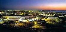
Society and culture
.jpeg)
Society and culture in Chabahar gained its characteristics from the classified tribal community of the Makran region. In this classification, Chabahar society is divided into superior and inferior tribes. Social structure is hierarchical; at the top of the pyramid are superior tribes locally dubbed as Hakom, independent influential tribes are in the middle, and other inferior weak tribes are at the bottom of the pyramid. Hakomes are Khans or Sardars, which in Chabahar refers to Sardarzahi and Boledehi tribes. Hoot and Mir (jadgals) are examples of independent, influential tribes which are at the next higher level in the hierarchy. There are many tribes in the upper and lower middle level, but at the bottom are former slaves from eastern Africa that have been brought by colonialists and Arab traders, especially Omanis, to the Makran Coastal area. These tribes are known as Darzada, Nokar, Sheedi and Gholams.
The dominant culture in Chabahar is similar to other parts of Makran.
Tourism
Chabahar is home of different natural and historical phenomenons which could attract every tourist:
Mangrove forest: This forest is located alongside the Gwater Gulf which have made suitable residence for valuable species of seabirds such as flamingo, eagle, heron etc. Beaches: The Chabahar Beaches own one of the most scenic coastal areas in all of Iran. Chabahar Beaches are suitable for many water sports and activities including swimming,diving,snorkeling, canoeing, water skiing,surfing among others. Easkey Britton an internationally renowned surfer from Ireland was among the first people who pioneered surfing of chabahar beaches.
Lipar Lagoon: This lagoon is close to Ramin village and 15 kilometers far from the east of Chabahar in direction of coastal road of Chabahar to Gwatre.
Mars or Martian Mounts: are also known as koohaye merikhi are a type of badlands stretched out parallel to the sea, starting from Kachoo village up to the proximity of Gwater. Martian Mounts are extremely beautiful and considered to be symbols of the unique geo-morphological phenomena of Chabahar.
Tis Fortress: This fortress is located on a hill along the Chabahar – Tis road and far from Chabahar city by 6 kilometers. The fortress is constructed in 34*59 meters. The materials used in this fortress are bricks, stones, a kind of plaster cast and lime. The gate is located in the east, and the fortress comprehends a big vestibule with numerous rooms, a private veranda, a cistern, ramparts, well, etc. This sign of two ramparts, founded on the cube shape like a room with veranda can be seen from the dais. these ramparts may have been used as watch-towers and lighthouse. The history of this fortress dates back to Islamic era.
Historical Port Village of Tis: This village is 5 kilometer north of Chabahar City and situated in the opening mouth of Chabahar Gulf. Moghadassi , the historian of the fourth century of Hijra (Islamic Calendar) has written that Tis or Tiz is a small port, but very habitable and highly flourishing. This village is located in the direction of south shores of Iran. Tis used to be considered as the commercial center for sugar and wheat of both Makran and Sistan province in those days.
Old Telegraph Building ( Telegraphic Office ): This building is one of the oldest available stone buildings in Chabahar. The stone inscription on the forehead of building shows the date of 1845 A.D., which was constructed by Britain for promotion of business, marine affairs and connection between India, Gwater, Jask and Bandar Abbass.
Banmasity Caves: This complex includes two natural and an artificial cave which are located in Tis village on the slope of Shabaz Mountain. Ban is a pious man's name and Masity is that of temple. These caves used to be for the worship and religious or official ceremonies.
Gwater Castle: This castle is located in the farthest South East of Iran, in the direction of coastal road of Gwater-Chabahar on the top of the Hill. There are an ancient graveyard and a well in this area. The discovered earthen wares and postsherds in this place belong to the third millennium B.C.
Climate
The county of Chabahar has hot, humid weather in the summer and warm weather in the winter, giving it a hot desert climate (Köppen climate classification BWh). The western winds in the winter bring about scattered rainfalls in this region, and very occasionally winds from the Indian monsoon affect the region, as in July 1976 when 46.6 millimetres (1.8 in) fell.[10] In most years around 100 millimetres (3.9 in) will fall; however a positive Indian Ocean Dipole in 1997/1998 led to a record total of 470 millimetres (18.5 in); in contrast between July 2000 and June 2002 only 57.5 millimetres (2.3 in) fell in two years.[10] The summer monsoon winds from the Indian subcontinent make Chabahar the coolest southern port in the summer and the warmest port of Iran in the winter. It has an average maximum temperature of 34 °C and an average minimum temperature of 21.5 °C. It has the same latitude as Miami in Florida, USA, and temperatures are very similar to those in Miami.
| Climate data for Chabahar | |||||||||||||
|---|---|---|---|---|---|---|---|---|---|---|---|---|---|
| Month | Jan | Feb | Mar | Apr | May | Jun | Jul | Aug | Sep | Oct | Nov | Dec | Year |
| Record high °C (°F) | 31.0 (87.8) |
33.0 (91.4) |
38.0 (100.4) |
42.0 (107.6) |
46.0 (114.8) |
45.2 (113.4) |
47.0 (116.6) |
42.4 (108.3) |
42.0 (107.6) |
41.4 (106.5) |
37.0 (98.6) |
32.0 (89.6) |
47 (116.6) |
| Average high °C (°F) | 24.5 (76.1) |
25.0 (77) |
28.1 (82.6) |
31.0 (87.8) |
34.0 (93.2) |
35.0 (95) |
33.8 (92.8) |
32.4 (90.3) |
32.2 (90) |
32.4 (90.3) |
29.5 (85.1) |
26.3 (79.3) |
30.35 (86.63) |
| Daily mean °C (°F) | 20.4 (68.7) |
21.3 (70.3) |
24.2 (75.6) |
27.1 (80.8) |
30.4 (86.7) |
31.9 (89.4) |
31.1 (88) |
29.8 (85.6) |
29.1 (84.4) |
28.2 (82.8) |
25.0 (77) |
22.0 (71.6) |
26.71 (80.08) |
| Average low °C (°F) | 15.0 (59) |
16.0 (60.8) |
19.0 (66.2) |
22.3 (72.1) |
25.2 (77.4) |
28.0 (82.4) |
28.1 (82.6) |
26.9 (80.4) |
25.4 (77.7) |
22.7 (72.9) |
18.8 (65.8) |
16.2 (61.2) |
21.97 (71.54) |
| Record low °C (°F) | 7.0 (44.6) |
7.0 (44.6) |
9.6 (49.3) |
14.0 (57.2) |
16.0 (60.8) |
22.0 (71.6) |
21.0 (69.8) |
19.0 (66.2) |
19.0 (66.2) |
13.2 (55.8) |
9.0 (48.2) |
7.0 (44.6) |
7 (44.6) |
| Average rainfall mm (inches) | 29.4 (1.157) |
37.9 (1.492) |
14.9 (0.587) |
6.1 (0.24) |
0.1 (0.004) |
0.5 (0.02) |
6.2 (0.244) |
2.1 (0.083) |
1.2 (0.047) |
0.0 (0) |
4.4 (0.173) |
13.7 (0.539) |
116.5 (4.586) |
| Average rainy days | 3.6 | 3.4 | 2.0 | 1.3 | 0.1 | 0.1 | 1.3 | 0.8 | 0.2 | 0.0 | 0.5 | 1.7 | 15 |
| Average relative humidity (%) | 61 | 66 | 69 | 70 | 72 | 75 | 77 | 77 | 76 | 73 | 67 | 61 | 70.3 |
| Mean monthly sunshine hours | 240.2 | 234.1 | 263.8 | 278.2 | 330.2 | 284.8 | 244.6 | 241.4 | 260.9 | 295.5 | 272.5 | 249.2 | 3,195.4 |
| Source: NOAA (1963–1990)[11] | |||||||||||||
See also
References
- ↑ Chabahar can be found at GEOnet Names Server, at this link, by opening the Advanced Search box, entering "-3055106" in the "Unique Feature Id" form, and clicking on "Search Database".
- ↑ Sachau, Edward C., ed. (1910) [first published 1888], Alberuni's India, Vol. 1, Kegan Paul, Trench, Trubner & Co, p. 208
- ↑ Wink, André (2002) [first published 1990], Al-Hind: The Making of the Indo-Islamic World (Third ed.), Brill, p. 132, ISBN 0391041738
- ↑ "India, China's rivalry and a tale of two ports". Reuters 2011-3-25. Retrieved 2011-5-12
- ↑ "NEW CHABAHAR –ZAHEDAN LINE IN IRAN". Railways Africa. 2010-12-11. Retrieved 2010-12-11.
- ↑ India's Track 3: Afghan-Iran rail link - Hindustan Times
- 1 2 "India's $500 Million Bet on Iran". Foreign Policy. Retrieved 22 July 2016.
- ↑ "Iran, India discuss building underwater gas pipeline". Tehran Times. Retrieved 25 December 2010.
- ↑ Judge refuses to hear plea against Sethi | The Frontier Post
- 1 2 Chabahar rainfall
- ↑ "Chahbahar Climate Normals 1963–1990". National Oceanic and Atmospheric Administration. Retrieved December 29, 2012.
External links
- https://web.archive.org/web/20110722015628/http://www.sb-ostan.ir/DesktopModules/OrgAmar/OrgAmar_813_64.pdf
- http://www.iranchamber.com/people/articles/cultural_anthropology_of_baluchis.php
- http://www.freezones.ir/Default.aspx?tabid=263