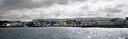
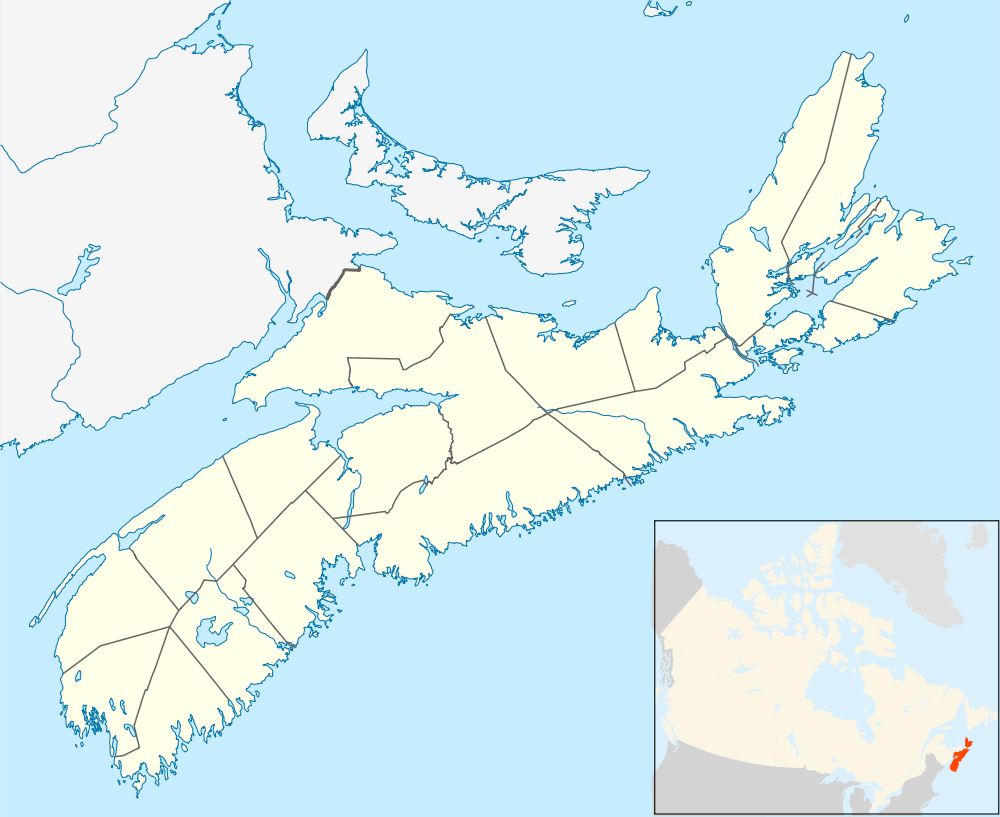
Chéticamp, Nova Scotia
| Chéticamp | |
|---|---|
| Village | |
 | |
 Chéticamp | |
| Coordinates: 46°38′16.39″N 61°0′32.9″W / 46.6378861°N 61.009139°WCoordinates: 46°38′16.39″N 61°0′32.9″W / 46.6378861°N 61.009139°W | |
| Country |
|
| Province |
|
| District | Inverness County |
| Established | 1785 |
| Government | |
| • Type | Village |
| • MP | Rodger Cuzner (Cape Breton—Canso) |
| • MLA | Allan MacMaster (Inverness) |
| Area[1] | |
| • Land | 98.67 km2 (38.10 sq mi) |
| Population (2006)[1] | |
| • Total | 3,039 |
| • Density | 30.80/km2 (79.8/sq mi) |
| Time zone | EST (UTC-4) |
| • Summer (DST) | AST (UTC-4) |
| Postal code span | B0E |
| Area code(s) | 902 |
| Website | https://www.cheticamp.ca/ |
Chéticamp (locally [ʃatikɑ̃]) is a fishing village on the Cabot Trail on the west coast of Cape Breton Island in Nova Scotia at the western entrance to Cape Breton Highlands National Park which contains Acadian Trail. The downtown area overlooks a harbour that is protected from the Gulf of Saint Lawrence by Chéticamp Island. The Cheticamp River flows into the Gulf of St. Lawrence approximately 5 km northeast of the village. Having a number of public facilities it performs a service function for the northernmost part of Inverness County. The community has almost 4,000 residents, a large majority of whom are Acadians and speak French natively. Together with its smaller neighbour, Saint-Joseph-du-Moine, Chéticamp makes up the largest Francophone enclave on Cape Breton Island. The 2006 population was 3,039 people.[1]
Name
The name "Chéticamp" derives from the name given by the Mi'kmaq First Nations, who still live on Cape Breton Island (but not in Chéticamp). The name is Awjátúj[2] (Francis-Smith orthography) in the Micmac language, meaning "rarely full", presumably making reference to the mouth of Chéticamp harbor that once had a large dune that grew during low tide.[3]
The French spelling of the town's name went through several variations including Ochatisia (1660), Ochatis (1689), Chétican, Chéticamps (1725) and Chétifcamp (1803).[3] The current spelling appeared for the first time on 3 May 1815, in the writings of the missionary Antoine Manseau.[3] In French, the name has been pronounced successively Le Chady, Le Grand Chady, Le Chady Grand, Île de Chedegan and finally, the current version, Chatican (IPA: [ʃatikɑ̃]).[3] Chéticamp is usually pronounced phonetically in French outside of the area.
The name does not always take the acute accent on the e in English (i.e., "Cheticamp").
A village in western Nova Scotia, Saint Alphonse de Clare, was originally called Chéticamp de Clare. Its name was changed to avoid confusion for postal delivery.
History
Chéticamp was a fishing station used during the summer months by Charles Robin, a merchant from the island of Jersey, and is considered one of the Acadian capitals of the world. In the years following the Great Expulsion, many Acadians came to this area. The first permanent settlers following that era were the families of Pierre Bois and Joseph Richard, who arrived in 1782, although both brothers John and Paul Chiasson along with many other French settlers like the AuCoin family were believed to have predated Bois, Richard and Robin by over 100 years. Chiasson is looked at today as the oldest family name on record in the town. Many of the original family names still reside in and around the small town. They, like all the original founding family names of Cheticamp, can be found chiseled in stone in the town still to this day. Settlement was formally established in 1785 by a grant of land to the 14 original settlers. Today Chéticamp, which is at the entrance of the Cape Breton Highlands National Park, is a popular tourist spot.
Economy
Apart from an important gypsum mine which operated off and on until the Second World War, the main industry in Chéticamp historically has been fishing. As fish quotas have declined, tourism has taken on more importance and is the largest industry at this time.
The tourism industry is based on the scenery found in the coastal village at the entrance of Cape Breton's national park. Chéticamp has also marketed its traditional rug hookers ("tapis hookers"), Acadian music and food. Activities for visitors include whale watching, hiking, swimming, cross country skiing, golfing, snowmobiling, cultural events and festivals and photography. They also host an International Dance Festival,[4] and La fête nationale de l'Acadie (August 15).
Tourist attractions
The local beach named La Plage St. Pierre [5] gives the locals as well as tourists a place for swimming, camping, and other recreational activities. There are a great deal of accommodations for visitors and hospitality is a trademark.
The Northern Inverness Recreational Association also manages the local golf course.[6] is considered part of "Cape Breton's Fabulous Foursome"[7] and is renowned for the beautiful views and challenging course.
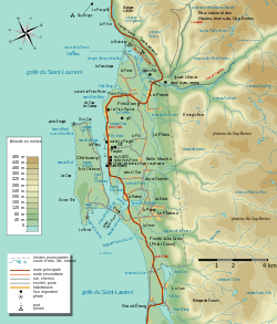
Chéticamp extends itself for four kilometres along the Cabot Trail. One kilometre northeast is Petit Étang, then further east is La Prairie. South of La Prairie is Le Platin and Belle-Marche. Even further south is Pointe-à-la-Croix (Point Cross). From Main street Chéticamp, you can view the typical Chéticamp houses. Saint Peter's is unique and rich in Acadian history.
The Université Sainte-Anne has a campus in Saint-Joseph-du-Moine. Many fisherman travel from Chéticamp to the Magdalen Islands, which are also Acadian, even though they are part of Quebec.
The town's official Website is www.cheticamp.ca to get up to date information on Chéticamp, the Acadian village on the Cabot Trail.
Gallery
 Acadian Monument to their Return (1790)
 Main street in Chéticamp.
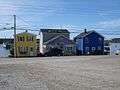 Houses in Chéticamp.
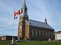 Saint Peter's Church
 Fishing boats at Chéticamp.
Climate
Chéticamp experiences a humid continental climate (Dfb). The highest temperature ever recorded in Chéticamp was 33.3 °C (92 °F) on 10 August 2001.[8] The coldest temperature ever recorded was −29.5 °C (−21.1 °F) on 27 January 1994.[9]
| Climate data for Chéticamp, 1981–2010 normals, extremes 1935–present | |||||||||||||
|---|---|---|---|---|---|---|---|---|---|---|---|---|---|
| Month | Jan | Feb | Mar | Apr | May | Jun | Jul | Aug | Sep | Oct | Nov | Dec | Year |
| Record high °C (°F) | 18.3 (64.9) |
18.3 (64.9) |
20.3 (68.5) |
24.3 (75.7) |
29.5 (85.1) |
31.7 (89.1) |
32.0 (89.6) |
33.3 (91.9) |
30.0 (86) |
28.0 (82.4) |
23.0 (73.4) |
19.2 (66.6) |
33.3 (91.9) |
| Average high °C (°F) | −0.9 (30.4) |
−1.4 (29.5) |
2.0 (35.6) |
7.6 (45.7) |
14.2 (57.6) |
18.8 (65.8) |
22.7 (72.9) |
22.4 (72.3) |
18.1 (64.6) |
12.6 (54.7) |
7.5 (45.5) |
2.3 (36.1) |
10.5 (50.9) |
| Daily mean °C (°F) | −4.9 (23.2) |
−5.9 (21.4) |
−2.3 (27.9) |
3.6 (38.5) |
9.4 (48.9) |
14.1 (57.4) |
18.3 (64.9) |
18.1 (64.6) |
14.1 (57.4) |
9.0 (48.2) |
4.3 (39.7) |
−1.0 (30.2) |
6.4 (43.5) |
| Average low °C (°F) | −8.9 (16) |
−10.3 (13.5) |
−6.5 (20.3) |
−0.4 (31.3) |
4.6 (40.3) |
9.3 (48.7) |
13.8 (56.8) |
13.8 (56.8) |
10.0 (50) |
5.3 (41.5) |
1.1 (34) |
−4.2 (24.4) |
2.3 (36.1) |
| Record low °C (°F) | −29.5 (−21.1) |
−29.0 (−20.2) |
−27.8 (−18) |
−14.0 (6.8) |
−6.7 (19.9) |
−1.7 (28.9) |
3.5 (38.3) |
1.1 (34) |
−1.1 (30) |
−6.0 (21.2) |
−16.0 (3.2) |
−19.5 (−3.1) |
−29.5 (−21.1) |
| Average precipitation mm (inches) | 142.9 (5.626) |
107.8 (4.244) |
103.2 (4.063) |
88.1 (3.469) |
85.3 (3.358) |
96.4 (3.795) |
90.0 (3.543) |
114.4 (4.504) |
124.1 (4.886) |
129.8 (5.11) |
140.5 (5.531) |
152.6 (6.008) |
1,375.1 (54.138) |
| Average rainfall mm (inches) | 61.3 (2.413) |
40.1 (1.579) |
52.2 (2.055) |
66.4 (2.614) |
83.3 (3.28) |
96.4 (3.795) |
90.0 (3.543) |
114.4 (4.504) |
124.1 (4.886) |
129.1 (5.083) |
121.3 (4.776) |
84.6 (3.331) |
1,063 (41.85) |
| Average snowfall cm (inches) | 81.6 (32.13) |
67.7 (26.65) |
51.1 (20.12) |
21.7 (8.54) |
2.0 (0.79) |
0.0 (0) |
0.0 (0) |
0.0 (0) |
0.0 (0) |
0.7 (0.28) |
19.3 (7.6) |
68.0 (26.77) |
312.0 (122.83) |
| Average precipitation days (≥ 0.2 mm) | 21.6 | 15.6 | 15.6 | 13.5 | 15.4 | 14.7 | 14.6 | 14.4 | 16.8 | 18.7 | 20.1 | 22.2 | 203.0 |
| Average rainy days (≥ 0.2 mm) | 6.4 | 4.6 | 6.8 | 10.9 | 15.3 | 14.7 | 14.6 | 14.4 | 16.8 | 18.7 | 17.2 | 10.1 | 150.2 |
| Average snowy days (≥ 0.2 cm) | 17.4 | 12.6 | 10.4 | 3.2 | 0.39 | 0.0 | 0.0 | 0.0 | 0.0 | 0.18 | 4.8 | 14.7 | 63.6 |
| Source: Environment Canada[9][10][11] | |||||||||||||
References
- 1 2 3 Statistics Canada 2006 Census - Hearst community profile
- ↑ Silliboy, Helen (1998). "Mi'kmaw Place Names in Cape Breton". [Cape Breton University - Mi'kmaq Resource Centre]. Retrieved 25 July 2011.
- 1 2 3 4 Anselme Chiasson. Chéticamp: History and Acadian Traditions. Translation of Chéticamp: histoire et traditions acadiennes by Jean Doris LeBlanc. Wreck Cove, NS: Breton Books, 1998. p. 6. ISBN 1-895415-29-2.
- ↑ Festival de l'Escaouette
- ↑ La Plage St. Pierre
- ↑ Le Portage Golf Course
- ↑ Cape Breton's Fabulous Foursome
- ↑ "Daily Data Report for August 2001". Canadian Climate Data. Environment Canada. Retrieved 8 April 2016.
- 1 2 "Chéticamp, Nova Scotia". Canadian Climate Normals 1981–2010. Environment Canada. Retrieved 12 April 2015.
- ↑ "Cheticamp CS". Canadian Climate Data. Environment Canada. Retrieved 8 April 2016.
- ↑ "Cheticamp". Canadian Climate Data. Environment Canada. Retrieved 8 April 2016.
External links
| Counties | |
|---|---|
| Economic Regions | |
| Regional municipalities | |
| Municipal districts | |
| Towns | |
| Incorporated villages | |
| Lists | |
| |
| History |  | |
|---|---|---|
| People and culture | ||
| Language and education | ||
| Related | ||
| ||