Château-Arnoux-Saint-Auban Airport
| Château-Arnoux-Saint-Auban Airport Aérodrome de Château-Arnoux-Saint-Auban | |||||||||||
|---|---|---|---|---|---|---|---|---|---|---|---|
| IATA: none – ICAO: LFMX | |||||||||||
| Summary | |||||||||||
| Airport type | Public | ||||||||||
| Serves | Château-Arnoux-Saint-Auban, France | ||||||||||
| Elevation AMSL | 1,507 ft / 459 m | ||||||||||
| Coordinates | 44°03′31″N 005°59′27″E / 44.05861°N 5.99083°ECoordinates: 44°03′31″N 005°59′27″E / 44.05861°N 5.99083°E | ||||||||||
| Map | |||||||||||
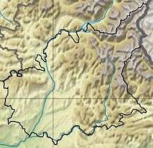 LFMX Location in Alpes-de-Haute-Provence department Location of department in France  | |||||||||||
| Runways | |||||||||||
| |||||||||||
|
Source: French AIP[1] | |||||||||||
Château-Arnoux-Saint-Auban Airport (ICAO: LFMX) is an airport located 4 kilometres (2.5 mi) south-southwest of Château-Arnoux-Saint-Auban,[1] in the Alpes-de-Haute-Provence département of the Provence-Alpes-Côte d'Azur region in France
A campus of the École nationale de l'aviation civile (French civil aviation university) is located on the aerodrome.[2]
References
- 1 2 LFMX – CHÂTEAU ARNOUX SAINT AUBAN. AIP from French Service d'information aéronautique, effective 10 November 2016.
- ↑ Campus life
External links
- Aérodrome de Château-Arnoux - Saint-Auban at Union des Aéroports Français
- National Gliding Centre (Centre National de Vol à Voile)
This article is issued from Wikipedia - version of the 3/22/2013. The text is available under the Creative Commons Attribution/Share Alike but additional terms may apply for the media files.