Cerro Escorial
| Cerro Escorial | |
|---|---|
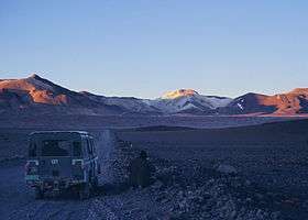 Road to Mina Julia on Cerro Escorial (1970). | |
| Highest point | |
| Elevation | 5,447 m (17,871 ft) [1] |
| Coordinates | 25°04′59″S 68°22′01″W / 25.083°S 68.367°W [1] |
| Geography | |
| Location | Argentina and Chile |
| Parent range | Andes |
| Geology | |
| Mountain type | Stratovolcano |
Cerro Escorial is a stratovolcano at the border of Argentina and Chile. It is part of the Corrida de Cori volcanic group and its youngest member. A well-preserved 1-kilometre-wide (0.6 mi) crater forms its summit area. Lava flows are found on the Chilean and smaller ones on the Argentinian side, the former reaching as far as 3–4 kilometres (1.9–2.5 mi) from the volcano. One of these is dated 342,000 years ago by argon-argon dating.[1]
A Plinian eruption on Escorial was the source of the dacitic Escorial ignimbrite.[2][3] Pulsed changes in the magma supply during the eruption generated a radial ignimbrite structure which was deposited in various flows. The source magma underwent significant crustal contamination and contains quartz veins, indicating that the ignimbrite interacted with a buried hydrothermal system.[3] Lithic clasts including basement material are also present. The ignimbrite has a volume of about 0.6 cubic kilometres (0.14 cu mi) and was erupted 460,000±10,000 years ago.[2]
A sulfur mine lies 4 kilometres (2.5 mi) southwest of Escorial.[1] Mining ceased about 1983.[2]
See also
Sources
- 1 2 3 4 "Escorial". Global Volcanism Program. Smithsonian Institution. Retrieved 25 September 2015.
- 1 2 3 Richards, Jeremy P. (September 2003). "HIGH-TEMPERATURE HYDROTHERMAL ACTIVITY BENEATH THE CERRO ESCORIAL VOLCANO, NW ARGENTINA, AS SAMPLED BY AN EXPLOSIVE VOLCANIC ERUPTION". Abstracts with Programs. Geological Society of America. 35 (6): 551. Retrieved 25 September 2015.
- 1 2 Richards, Jeremy P; Villeneuve, Michael (August 2002). "Characteristics of late Cenozoic volcanism along the Archibarca lineament from Cerro Llullaillaco to Corrida de Cori, northwest Argentina". Journal of Volcanology and Geothermal Research. 116 (3-4): 161–200. doi:10.1016/S0377-0273(01)00329-8. Retrieved 25 September 2015.