Cerro Cora National Park
| Cerro Cora National Park | |
|---|---|
|
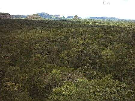
View of the Park and hills | |
| Location | Amambay Department, Paraguay |
| Nearest city | Pedro Juan Caballero |
| Area | 5.538 ha |
| Established | 1976 |
Cerro Cora National Park is the largest protected area in Paraguay with 5,538 hectares. It is located in Amambay Department, 45 km from the departmental capital, Pedro Juan Caballero and the border with Brazil. Established on February 11, 1976, it is a nature reserve, as well as a major historical site. This place was the setting where last battle of the Paraguayan War took place, on March 1, 1870.
The park has several historical monuments, a museum, and a recreation area by the Aquidabán River.
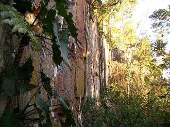
In addition to the historical background, many visitors come to the park to appreciate ancient rock writings located in hill caves around the area.
History
The Triple Alliance War (1864–1870) ended next to the Aquidaban Nigui Brook, where Francisco Solano López died saying his famous last words, "I die along with my country". Fortunately, Paraguay was not extinguished, as the Marshall announced, but it was deeply ruined after an endless war that left the country desolated and deprived.
This zone, that once was a virgin Rain Forest started to suffer deforestation. Therefore the area was declared protected, and the National Park has been created.
The Park is surrounded by hills. Some of them are Ponta Porá, Guazu, Tacuru Pytâ, Alambique, Cerro Corá, Miron, Tanqueria y Tangaro. These and other elevations give shape to a peculiar landscape.

Access
The Park is located 454 km from Asunción, and 45 km from Pedro Juan Caballero. If one is leaving from Asunción, needs to take Ruta 2, and go until Coronel Oviedo city. There it is necessary to take Ruta 3, up to the connection with Ruta 5. Once there, take the exit to Yby Yaú city.

Culture
The Park is divided in zones, according to the theme of the place and accessibility. It has guides and guards. There is an auditorium, a visitors center and a recreation area.
Petroglyphs are inscribed in rock shelters throughout the park. A rock art research team from the National Museum and Research Center of Altamira dated the petroglyphs in 2008 and found that some of them were 5,000 years old.[1] The Paï Tavytera indigenous peoples live in the region now.
References
- ↑ "Exposición "Petroglifos, Misterios Ancestrales"". Arquitectos (in Portuguese). Galería Social de Arguitectura Paraguaya. Retrieved 17 April 2015.
External links
| Wikimedia Commons has media related to Cerro Cora National Park. |
- Secretaria del Ambiente (Spanish)
Coordinates: 22°39′S 56°11′W / 22.650°S 56.183°W