Central Jakarta
| City of Central Jakarta Kota Administrasi Jakarta Pusat | ||
|---|---|---|
| Administrative city | ||
|
The National Monument is located in the City of Central Jakarta. | ||
| ||
 | ||
| Country | Indonesia | |
| Province | DKI Jakarta | |
| Government | ||
| • Mayor | H. Saefullah (2010) | |
| Area | ||
| • Total | 48.13 km2 (18.58 sq mi) | |
| Population (2010 Census)[1] | ||
| • Total | 898,883 | |
| • Density | 19,000/km2 (48,000/sq mi) | |
| Time zone | WIB (UTC+7) | |
| Website | pusat.jakarta.go.id | |


Central Jakarta (Indonesian: Jakarta Pusat) is one of the five cities (kota) which form Jakarta, Indonesia. It had 898,883 inhabitants at the 2010 Census.
Central Jakarta is the smallest in area and population of the five cities of Jakarta. It is the administrative and political center of Jakarta and Indonesia. Central Jakarta contains a number of large international hotels and major landmarks such as Hotel Indonesia.
Subdistricts

Central Jakarta is bounded by North Jakarta to the north, East Jakarta to the east, South Jakarta to the south, and West Jakarta to the west.
Central Jakarta is divided into 8 kecamatan (districts):
Demographics
Central Jakarta has an average of 19,000 residents per square kilometre, making it the most densely populated municipality in Jakarta.[2]
Economy
Both GRDP at current market price and GRDP at 2000 constant price in 2007 for Municipality of Central Jakarta is higher than other municipalities in DKI Jakarta, which is Rp. 145 million and Rp. 80 million respectively.[1]
At the end of the first quarter of 2010, the Jakarta CBD had an occupancy rate of 80%, an increase from the 78% at the end of the first quarter of 2009. According to Jones Lang LaSalle, the amount of office space in the Jakarta CBD increased by 93,000 square metres (1,000,000 sq ft) between the second half of 2010 and the second half of 2009.[3]
In September 2010 Jones Lang LaSalle estimated that the Jakarta CBD had 30,000 square metres (320,000 sq ft) of serviced office space, making up less than 1 percent of the total amount of office space in the CBD. 70% of the tenants in the serviced spaces were international companies. The number of serviced office spaces in Central Jakarta increased by 50% in the year leading to September 2010.[3]

Government and infrastructure
Government agencies with head offices in Central Jakarta include the National Search and Rescue Agency, which has its head office in Kemayoran,[4] and the National Transportation Safety Committee (NTSC, Indonesian acronym KNKT), which has its head office in the Ministry of Transport Building.[5]
Education
SMA Negeri 4 Jakarta SMA Negeri 68 Jakarta SMA Negeri 77 Jakarta
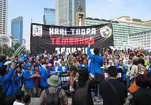
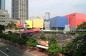
Gallery
-

Roundabout of Hotel Indonesia towards South
-

TransJakarta Bus in the front of the Roundabout
-
World Tobacco Free Day celebration near the Roundabout
-

Thamrin road seen from the Imperium tower
-

Street crossing near the office of Bank Mandiri
-

Jalan Thamrin in Central Jakarta.
-

MH Thamrin Road before TransJakarta was built
-

Wisma Nusantara & Nikko Hotel
-

Mandarin Oriental Hotel, The Embassy of Germany & Deutsche Bank
-
EX Plaza
-

Jaya Building
-

Bank Indonesia Main Office
References
- 1 2 Jakarta in Figures. Statistics DKI Jakarta Provincial Office, Jakarta. 2008.
- ↑ Primanita, Arientha. "Cramped Capital Facing ‘Ecological Suicide’ Archived April 5, 2012, at the Wayback Machine.." Jakarta Globe. September 7, 2010. Retrieved on September 16, 2010.
- 1 2 Tisnabudi, Ervan. "Booming Demand in Indonesia for Serviced Offices Archived April 5, 2012, at the Wayback Machine.." Jakarta Globe. September 12, 2010. Retrieved on September 16, 2010.
- ↑ "Home." (Archive) National Search and Rescue Agency. Retrieved on 10 May 2012. "Jl. Angkasa Blok B.15 KAV 2-3 Kemayoran - Jakarta Pusat Jakarta - Indonesia 10720"
- ↑ "Contact Us Archived January 1, 2014, at the Wayback Machine.." National Transportation Safety Committee. Retrieved on 31 December 2013. "Ministry Of Transportation Republic Of Indonesia Transportation Building 3rd Floor Jalan Medan Merdeka Timur No. 5 Jakarta Pusat 10110 Indonesia" Indonesian address Archived January 1, 2014, at the Wayback Machine.: "Kantor Komite Nasional Keselamatan Transportasi Kementerian Perhubungan Republik Indonesia Gedung Perhubungan Lantai 3 Jalan Medan Merdeka Timur No. 5 Jakarta Pusat 10110 Indonesia"
External links
- (Indonesian) Official site
 Jakarta/Central travel guide from Wikivoyage
Coordinates: 6°11′11″S 106°49′46″E / 6.1864°S 106.8294°E