Cordillera Central (Luzon)
| Cordillera Central | |
|---|---|
 The southern limits of the range as viewed from the plains of Sison | |
| Highest point | |
| Peak | Mount Pulag |
| Elevation | 9,587 ft (2,922 m) |
| Geography | |
.svg.png) | |
| Country | Philippines |
| Provinces | |
| Range coordinates | 17°20′N 120°57′E / 17.33°N 120.95°ECoordinates: 17°20′N 120°57′E / 17.33°N 120.95°E |
The Cordillera Central is a massive mountain range situated in the northern central part of the island of Luzon, in the Philippines. The mountain range encompasses all provinces of the Cordillera Administrative Region (Abra, Apayao, Benguet, Ifugao, Kalinga and Mountain Province), as well as portions of eastern Ilocos Norte, eastern Ilocos Sur, eastern La Union, northeastern Pangasinan, western Nueva Vizcaya, and western Cagayan.

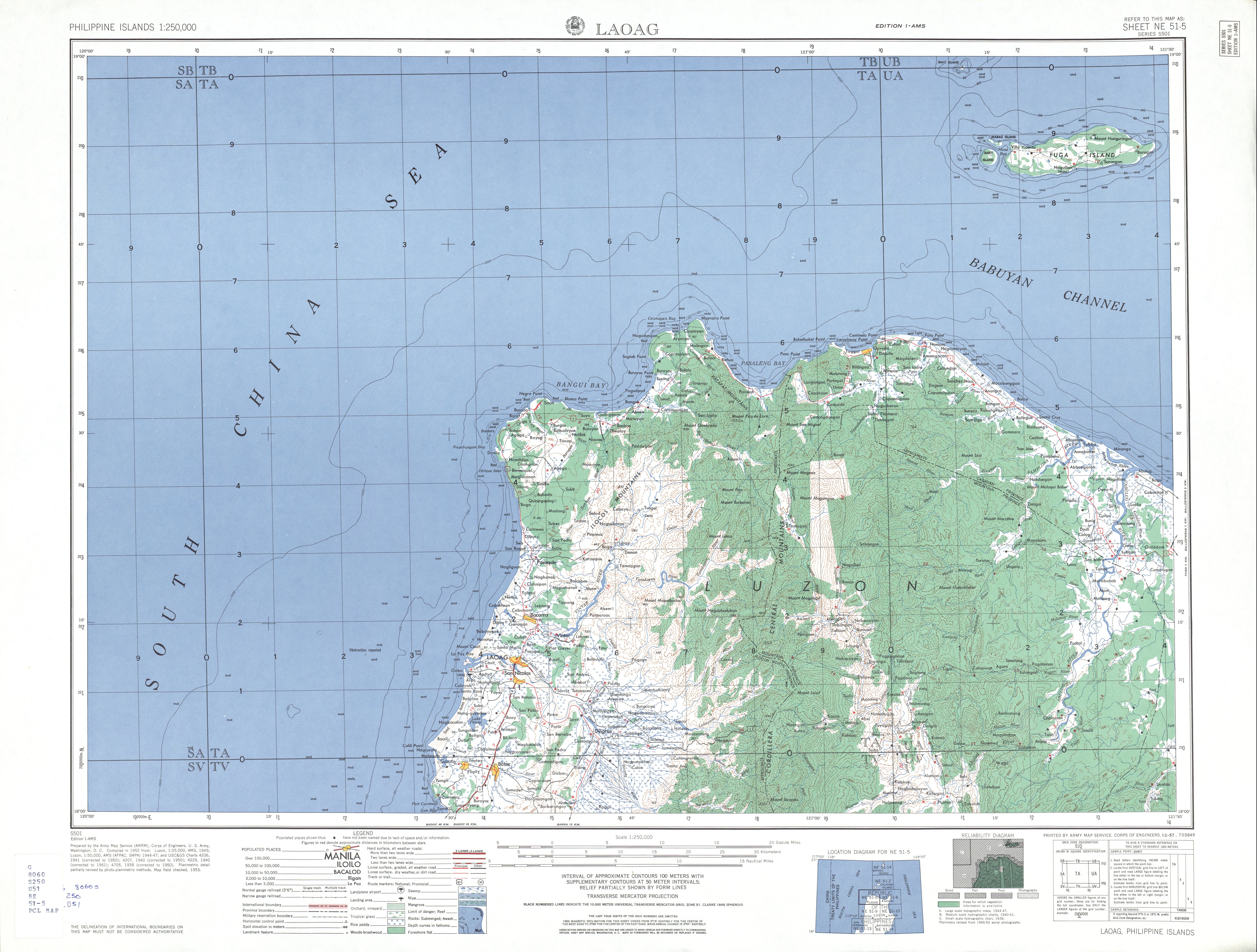
To the north, the mountain range terminates at the northern shores of Luzon along the Babuyan Channel in Ilocos Norte and Cagayan provinces.[1] At its southeastern part, the Central Cordillera is linked to the Sierra Madre Mountains, the longest mountain range in the country, through the Caraballo Mountains in Nueva Vizcaya province. During Spanish colonial period, the whole range was called Nueva Provincia, (New Province).[2]
Geography

The Cordillera Central is the highest mountain range in the Philippines. It comprises about 1/6 of the whole Luzon island with a total area of 18,300 km2 (7,100 sq mi). The highest mountain in the range, Mount Pulag, is also the highest mountain on Luzon Island at 2,922 metres (9,587 ft). It is officially the second highest mountain in the country after Mount Apo on Mindanao Island, the second largest island of the Philippines.
Volcanoes
Three volcanoes with no historical locations but still thermally active are located within the Cordillera Central:
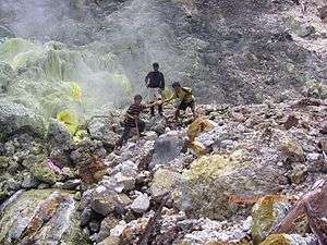
- Mount Binuluan, 2,329-meter (7,641 ft) high in Kalinga province, has active solfataras and thermal springs.
- Mount Patoc, 1,865-meter (6,119 ft) high about 6 km (3.7 mi) north of Bontoc town proper in Mountain Province, has several thermal springs in Barangay Mainit, Bontoc, on the western slope of the mountain.
- Mount Santo Tomas, 2,260-meter (7,410 ft) high in Tuba, Benguet near Baguio City, has Asin Hot Springs on its western slope.
National Parks
- Balbalasang-Balbalan National Park
- Cassamata Hill National Park
- Mount Data National Park
- Mount Pulag National Park
- Northern Luzon Heroes Hill National Park
Environment
The mountains support a number of different types of habitat. Elevations above 1000m are covered in Luzon tropical pine forests of Benguet pine (Pinus insularis) except in the north of the range where the high slopes consist of Luzon montane rain forests.
Two major problems threaten the environment of the Cordillera: dam projects flood river valleys and remove habitat and also cause people to flee their houses and seek refuge in other areas; mining project destroy forest areas and also don't create wealth and resources for the upkeep of the tribal lands.
People
Inhabitants
At the time of American rule in the Philippines, the disparate people of the Cordilleras were not well understood and were all lumped together under the name Igorot. In some circles, especially political ones, this term acquired a pejorative characteristic. In current usage, Northern Cordillerans use it disparagingly, when speaking of people from eastern Mountain Province.
Culture and language
Most of the Cordillera Central is the ancestral domain of the 'people of the mountains.' These ethno-linguistic groups include: Abra (Itneg), Apayao (Apayao), Benguet (Kankanaey and Ibaloi), Ifugao (Ifugao), Kalinga (Kalinga) and Mountain Province (Bontoc and Kankanaey).[3] Each of these major ethno-linguistic groups has its own family of languages and cultures.
An alternative listing for the Northern Philippine tribes is: Apayao/Isnag, Abra/Tinguian, Kalinga, Gaddang, Applai, Bontoc, Bago, I-lagod, Kankana-ey, Kangkanai, Balangao, Ibaloi, Ifugao, Ikalahan, Kalanguya, Karao and Ilongot.
Beside their own tribal cultures, there is a Cordilleran culture which is largely molded by the geography of the Cordilleras, and their common heritage of resisting the invading imperial powers (Spain, US, Japan in the past - and after 1946 the central government in Manila is also regarded as such), including the continuing adverse encroachments by lowlanders.[3]
Not withstanding their resistance to invasion from the lowlands, the lingua franca used throughout the Cordilleras is Ilocano, adopted from the lowlander traders of Ilocos Region in the west.
Cordillerans are a group of indigenous people, recognized as such by Republic law, with their own sets of customary laws. Customary law takes precedence over Republic law. Tribal criminal law takes precedence over the Criminal Code of the Philippines. Murder and manslaughter, for instance is more usually dealt with under tribal law which might include blood debt, only satisfied by the death of the perpetrator. Tribal land law applies in preference to lowland registration law. Spanish deeds were never issued for the land in the Cordilleras since the Spanish were continuously repelled for the whole of Spanish colonial period.
Cordillerans view land as the source of life, an integral part of their cultural identity, that traces its origins from the land. Land is considered sacred and tribal land can neither be owned nor sold, but it nurtured to produce life for the communal benefit.
Economy
The Cordillera Central is one of the country's richest regions in terms of natural resources, a major resource base of the Philippines. It contains 11% of the total area is agricultural rice fields, orchards, pig farms and pasture lands. 60% of the country’s temperate vegetables are produced in the area. It is the country's premier mining district. There are eight big mining companies operating which are mostly foreign controlled. Some 80% of the total Philippine gold production comes from the Cordillera.
The range is also home to the headwaters of the major rivers in Northern Luzon, with several dams which include the Ambuklao and Binga in Benguet.

History
The Philippines, named after King Philip II of Spain in 1618, was already of interest to Spain before the Spaniards even reached the land. In 1565, reports of huge gold mines in the Cordillera reached the Viceroy of Mexico, which led to the first official Spanish expedition to the Cordillera in 1576. King Philip III, waging the Thirty Year War which needed funding, sent orders for large expeditions to the Philippines.

In 1620, Captain Garcia de Aldana Cabrera offered the resisting Igorot tribal leaders clemency if they were willing to accept Catholic religion, obey the Spanish government and pay a fifth of all their mined gold to the Spanish King. They refused and the Spanish conquerors built forts and organized military troops to start the exploitation of the gold mines.
During the years that followed, the Spanish managed to trade gold despite setbacks from the Igorots, who because of their resistance remained relatively independent from Spanish rule. The price that the Igorots had to pay for this independence was that they became different from their colonized brothers.
The Philippines staged Asia’s first nationalistic revolution in 1896, and declared its independence on June 12, 1898. The newly founded country was soon taken over by the United States of America. The US was the first foreign nation to fully invade the highlands of the Cordillera to push the mining operations in the territory.
Spain relinquished control of the Philippines to the United States of America due to the Treaty of Paris (1898), which officially ended the hostilities of the Spanish–American War. After a short period of peace in the region after the treaty was finalized the Philippine–American War began until 1902, though pockets of fighting did not end until 1913. The result of these conflicts led to the US declaring the Philippines a protectorate, a form of colonialism with local autonomy. The United States established strategic military bases in the Philippines with the consent of the established government in Manila. During World War II, the Japanese temporarily seized control of the Philippines. A combined effort between the American armed forces and the Philippine commonwealth military managed to successfully drive out the Japanese by 1945.
On September 27, 1927, the Benquet Consolidated Mining Company discovered one of the richest veins of gold ever, at a time when the US was entering the Great Depression. This was the start of a real gold rush into Cordillera region: in 1929, there were 94 mining companies, by 1933 there were 17,812.
This extreme growth had tremendous results for the landscape; it changed the original one way Mountain Trail into a busy highway despite the road slides and cuts that occur up to this day. Again, similar to the fight against the Spanish, the indigenous inhabitants protested against the destruction of their land and the neglecting of their rights. Mining operations continued to grow and by 1939 the Philippines ranked among the world’s leading gold producers, and second to the state of California among US producers.
From 1936 to 1946, the Philippines was granted domestic self-administration under the Commonwealth of the Philippines as a transitional period for complete independence. From 1941 to 1945, the country fell under Japanese rule and was liberated by military forces of the United States of America, and dare inside by the combined forces of the Allied Philippine Commonwealth military forces and local Igorot and Cordilleran guerrilla forces in Northern Luzon. The US subsequently recognized Philippine independence on July 4, 1946.
The independent republic's policy shifted towards the integration of the 'cultural minorities' into mainstream culture. In 1966 the Philippine Congress passed the 'Separation Bill', dividing the old Mountain Province into four: Benguet, Mountain Province (Bontoc), Ifugao and Kalinga-Apayao. The political elite hoped that the creation of several provinces would, by increasing the region’s representation, increase development spending in the area.
Under the Marcos' administration, politicization of the Cordillera took a new turn. National government development projects in the area were against the interests of the indigenous peoples, and were strongly resisted by them. Particularly important were the Chico River Dam project and the Cellophil project. The first threatened to inundate traditional villages, the second gave outsiders control over vast forest lands. Resistance resulted in increased regional consciousness rather than local ethnic consciousness.
In 1986 Marcos had to step back from office and was succeeded by Corazon Aquino.
However, the Aquino administration failed to tackle substantial issues such as land reform and the restructuring of the economy. After the collapse of the negotiations between the government and the National Democratic Front (NDF), Aquino declared the "Total War Policy", aimed at recovering New People's Army (NPA) controlled areas and to destroy the NPA's organizational and infrastructure base. The NPA had moved into the Cordillera to assist in the resistance against the projects.
References
- ↑ U.S. Army Corps of Engineer (1953). "Laoag (topography map)". University of Texas in Austin Library. Retrieved on 2014-09-26.
- ↑ The Philippines - Google Books
- 1 2 Worcester, Dean C. (1906-10). "The Non-Christian Tribes of Northern Luzon - The Philippine Journal of Science". Google Books. Retrieved on 2014-09-27.
Gallery
-

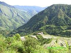
A river valley in Bokod
-
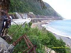
Patapat Viaduct in Ilocos Norte, forced over the sea by the northern extremity of the mountain range
-
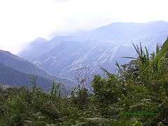
Pasil Valley, viewed from top of Magmag‑an Pass, looking west-north-west
-
Upper Uma Elementary School, Pasil Valley, viewed from Ag‑gama to Duya‑as track
