Central City, Kentucky
| Central City | |
|---|---|
| City | |
|
St. Joseph's Catholic Church is at the corner of E. Broad St. and S. 3rd St. | |
| Motto: It's that friendly. | |
 Location of Central City within Kentucky. | |
| Coordinates: 37°17′42″N 87°7′43″W / 37.29500°N 87.12861°WCoordinates: 37°17′42″N 87°7′43″W / 37.29500°N 87.12861°W | |
| Country | United States |
| State | Kentucky |
| County | Muhlenberg |
| Established | Morehead's Horse Mill, 1826[1] |
| Incorporated | Stroud City, 1873[1] |
| Incorporated | Central City, 1882[1] |
| Government | |
| • Type | Mayor-City Administrator- City Council |
| • Mayor | Barry Shaver |
| Area | |
| • Total | 5.2 sq mi (13.5 km2) |
| • Land | 5.2 sq mi (13.6 km2) |
| • Water | 0.0 sq mi (0.0 km2) |
| Elevation | 436 ft (133 m) |
| Population (2010) | |
| • Total | 5,978 |
| Time zone | CST (UTC-6) |
| • Summer (DST) | CDT (UTC-5) |
| ZIP Code | 42330 |
| Area code(s) | 270 & 364 |
| FIPS code | 21-13978 |
| GNIS feature ID | 0489282 |
| Website | http://www.centralcitykytourism.com/ |
_-_exterior_2.jpg)
Central City is a home rule-class city[2] in Muhlenberg County, Kentucky, in the United States. The population was 5,978 at the 2010 census. It is also the largest city in the county and the principal community in the Central City Micropolitan Statistical Area, which includes all of Muhlenberg County.
History
The site of present-day Central City was originally known as Morehead's Horse Mill after local resident Charles S. Morehead's steam-powered gristmill. A larger community began to develop after the 1870 advent of the Elizabethtown and Paducah Railroad. A post office was constructed the next year in 1871 and called Owensboro Junction after the projected 1872 completion of the Owensboro and Russellville Railroad. By 1873, the settlement was large enough to be incorporated by the state legislature as Stroud City, after local landowner John Stroud.[3]
The same year, however, the du Pont's Central Coal and Iron Company began operation in the area and became so vital to the local economy that the city was reïncorporated in 1882 as Central City.[3] Recessions replaced the E&P and the O&R with a procession of different companies, including the Owensboro and Nashville Railway, but the two rights of way always remained in separate hands, keeping Central City an important regional hub for the Illinois Central and the L&N, with train yards, roundhouses, and even an elevated rail station. Coal was mined from nearby fields, prompting explosions such as one in 1912 that killed 5 workers.[4]
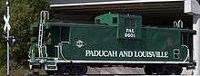
The expansion of automotive traffic in the early 20th century reduced some of Central City's importance, but it continues to service mainline freight traffic on the Paducah and Louisville Railway and trunk-line service for CSX from Madisonville to the Paradise Fossil Plant, minutes south of the city.
Central City is the only city in Muhlenberg County that allows liquor to be sold by package stores and by the drink in restaurants seating at least 100 persons. Muhlenberg County is dry.
Geography
Central City is located at 37°17′42″N 87°07′43″W / 37.294989°N 87.128622°W (37.294989, -87.128622).[5]
According to the United States Census Bureau, the city has a total area of 5.2 square miles (13 km2), all land.
Terrain in Central City is rolling hills to steep bluffs along the northern boundaries of the city along the Green River. The city, along its northwestern border, is known for its swamps and lowland area that remain at or near the water table year-round.
Most of Central City has a sandstone bedrock with #9 bituminous coal underlying the bedrock. Central City has a number of old underground coal mine shafts that still crisscross the city. Most of these old shafts date back to the early 1900s. The majority of terrain around the city limits is reclaimed land where surface mining has taken place.
Demographics
| Historical population | |||
|---|---|---|---|
| Census | Pop. | %± | |
| 1890 | 1,144 | — | |
| 1900 | 1,348 | 17.8% | |
| 1910 | 2,545 | 88.8% | |
| 1920 | 3,108 | 22.1% | |
| 1930 | 4,321 | 39.0% | |
| 1940 | 4,199 | −2.8% | |
| 1950 | 4,110 | −2.1% | |
| 1960 | 3,694 | −10.1% | |
| 1970 | 5,450 | 47.5% | |
| 1980 | 5,214 | −4.3% | |
| 1990 | 4,979 | −4.5% | |
| 2000 | 5,893 | 18.4% | |
| 2010 | 5,978 | 1.4% | |
| Est. 2015 | 5,892 | [6] | −1.4% |
As of the census[8] of 2000, there were 5,893 people, 2,065 households, and 1,410 families residing in the city. The population density was 1,126.2 people per square mile (435.0/km2). There were 2,313 housing units at an average density of 442.0 per square mile (170.8/km2). The racial makeup of the city was 88.07% White, 10.67% African American, 0.05% Native American, 0.24% Asian, 0.02% Pacific Islander, 0.41% from other races, and 0.54% from two or more races. Hispanic or Latino of any race were 0.80% of the population.
There were 2,065 households out of which 28.7% had children under the age of 18 living with them, 51.5% were married couples living together, 13.4% had a female householder with no husband present, and 31.7% were non-families. 29.5% of all households were made up of individuals and 15.5% had someone living alone who was 65 years of age or older. The average household size was 2.39 and the average family size was 2.95.
In the city the population was spread out with 20.1% under the age of 18, 10.6% from 18 to 24, 30.8% from 25 to 44, 22.2% from 45 to 64, and 16.3% who were 65 years of age or older. The median age was 38 years. For every 100 females there were 116.7 males. For every 100 females age 18 and over, there were 120.3 males.
The median income for a household in the city was $27,371, and the median income for a family was $32,959. Males had a median income of $29,284 versus $18,265 for females. The per capita income for the city was $12,637. About 18.4% of families and 20.5% of the population were below the poverty line, including 25.3% of those under age 18 and 21.4% of those age 65 or over.
Education
Central City is home to Central City Elementary School. Central City Elementary School is a feeder school for Muhlenberg North Middle School which, in turn, feeds Muhlenberg County High School.
Central City is also home to the Muhlenberg Campus of Madisonville Community College, completed in 2001.
Media
- WMTA AM 1380, founded 1955
- WNES AM, founded in 1955, owned by the Andy Anderson Corporation which founded the station.
- WQXQ FM 101.9, 100,000 watt station, owned and operated by Andy Anderson Corporation, licensed to Central City where the main studio is, tower and transmitter located in Pleasant Ridge, (Daviess County), Kentucky.
- A number of regional radio stations have Radio repeater's located in Central City. Two are currently active while a third is under consideration.
- Leader-News, weekly newspaper founded in Greenville Leader, moved to Central City in the 1960s and became the "Greenville Leader-Central City News", owned and published by the Andy Anderson Corporation.
- Times Argus, formerly the Messenger Times Argus, founded in 1909, published weekly.
Economy
Major employers in Central City include:
- Brewco
- Brewer, Inc.
- Green River Correctional Complex
- Kentucky Utilities Green River Generating Station
- Armstrong Coal Company Parkway Mine
- KenAmerican Paradise Underground Mine
- Wal-Mart Supercenter
- Central City Elementary School
Sites and events of interest
Everly Brothers Homecoming / Labor Day Cruise-In
On Labor Day Weekend 1988, Central City began hosting The Everly Brothers Homecoming event to raise money for a scholarship fund for Muhlenberg County students.[9] The Homecoming became a popular annual event for fourteen years, before ending in 2002.[10]
Not to be discouraged, the citizens reformed the event as a weekend long cruise-in and car show that is still held annually on Labor Day Weekend.
Kentucky Women's Hall of Fame, Inc.
Sponsored by the Central City Business & Professional Women's Club, the Hall of Fame is located inside the Central City Public Library, 108 E. Broad Street and features a portrait and memorabilia gallery which includes former Governor Martha Layne Collins, Country & Western music giant Loretta Lynn, and local author, editorialist, historian, war correspondent for the Service Star and noted cultivator of roses Agnes S. Harralson. Central City Library hours are Monday 9 am - 7 pm; Tuesday - Friday 9 am - 5 pm ; Saturday 9 am - 1 pm. www.mcplib.org for more info; Central City BPW meets the second Tuesday of each month in the library meeting room at 6:00 pm - visitors are welcome.
Muhlenberg County Rail Trail
The Muhlenberg County Rail Trail is a paved trail following an old Paducah and Louisville railway route between Central City and Greenville that is open to pedestrian and non-motorized vehicle traffic. Kentucky's most extensive rail trail conversion to date, the Muhlenberg Rail Trail opened October 20, 2000 and was named "Trail of the Month" by the Rails to Trails Conservancy in May 2004.[11] A viewing platform and birding guide are available where the trail passes through a local wetland.[12] The Muhlenberg County Rails to Trails Committee has railbanked an additional 3 miles of abandoned rail, possibly for a later extension into McLean County.[13]
Notable residents
- Tom Christerson, second recipient of an artificial heart
- T. Coleman du Pont,[14] manager for the Central Coal & Iron Company, later president of Dupont and a Republican senator for Delaware
- Don Everly, of The Everly Brothers, singers from the late 1950s in Rock and Roll Hall of Fame
- Ziggy Sears, Major League Baseball umpire
- Musician Jim Walker (musician), world-renowned flute soloist—orchestral and film soundtracks
References
- 1 2 3 History of Central City, Kentucky
- ↑ "Summary and Reference Guide to House Bill 331 City Classification Reform" (PDF). Kentucky League of Cities. Retrieved December 30, 2014.
- 1 2 Rennick, Robert. Kentucky Place Names, p. 55. University Press of Kentucky (Lexington), 1987. Accessed 22 Jul 2013.
- ↑ Indianapolis Star. "Explosion Kills 5 Miners in Kentucky Coal Shaft". 18 Jan 1912. Accessed 22 Jul 2013.
- ↑ "US Gazetteer files: 2010, 2000, and 1990". United States Census Bureau. 2011-02-12. Retrieved 2011-04-23.
- ↑ "Annual Estimates of the Resident Population for Incorporated Places: April 1, 2010 to July 1, 2015". Retrieved July 2, 2016.
- ↑ "Census of Population and Housing". Census.gov. Archived from the original on May 11, 2015. Retrieved June 4, 2015.
- ↑ "American FactFinder". United States Census Bureau. Archived from the original on 2013-09-11. Retrieved 2008-01-31.
- ↑ Everly Brothers Biography
- ↑ Everlys Homecoming Ends
- ↑ Trail of the Month - Muhlenberg County Rail Trail
- ↑ Rails to Trails Conservancy - Muhlenberg County Rail Trail
- ↑ Kentucky Rails to Trails Council - Muhlenberg County Rail Trail
- ↑ Winkler, John K. The DuPont Dynasty, pp. 156 f. Accessed 22 Jul 2013.
External links
- Greater Muhlenberg Chamber of Commerce
- Central City Tourism
- City of Central City Official Website
- Central City Police Department Website
- Central City Fire Department Website
Municipalities and communities of Muhlenberg County, Kentucky, United States | ||
|---|---|---|
| Cities |  | |
| CDPs | ||
| Unincorporated communities | ||
| Ghost town | ||
| Footnotes | ‡This populated place also has portions in an adjacent county or counties | |