Cedro, New Mexico
| Cedro, New Mexico | |
|---|---|
| Census-designated place | |
 Cedro | |
| Coordinates: 35°1′19″N 106°21′11″W / 35.02194°N 106.35306°WCoordinates: 35°1′19″N 106°21′11″W / 35.02194°N 106.35306°W | |
| Country | United States |
| State | New Mexico |
| County | Bernalillo |
| Area | |
| • Total | 5.3 sq mi (13.8 km2) |
| • Land | 5.3 sq mi (13.8 km2) |
| • Water | 0.0 sq mi (0.0 km2) |
| Elevation | 7,060 ft (2,150 m) |
| Population (2010) | |
| • Total | 430 |
| • Density | 81/sq mi (31.1/km2) |
| Time zone | Mountain (MST) (UTC-7) |
| • Summer (DST) | MDT (UTC-6) |
| Area code(s) | 505 |
| FIPS code | 35-13450 |
| GNIS feature ID | 0904883 |
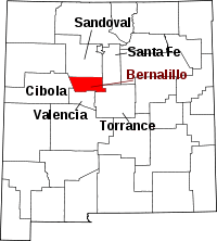
Cedro is a census-designated place (CDP) in Bernalillo County, New Mexico, United States. The population was 430 at the 2010 census.[1] It is part of the Albuquerque Metropolitan Statistical Area.
Geography
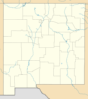
Cedro is located in eastern Bernalillo County. It is bordered to the south by the Ponderosa Pine CDP. The center of Cedro lies in Cedro Canyon in the northern end of the Manzano Mountains southeast of Albuquerque. New Mexico State Road 337 leads through the canyon and the Cedro CDP, leading north 6 miles (10 km) to Tijeras, from where it is a further 14 miles (23 km) west via Interstate 40 to downtown Albuquerque.
According to the United States Census Bureau, the Cedro CDP has a total area of 5.3 square miles (13.8 km2), all of it land.[1]
References
- 1 2 "Geographic Identifiers: 2010 Demographic Profile Data (G001): Cedro CDP, New Mexico". U.S. Census Bureau, American Factfinder. Retrieved January 28, 2014.
This article is issued from Wikipedia - version of the 1/29/2014. The text is available under the Creative Commons Attribution/Share Alike but additional terms may apply for the media files.
