Cedar Rapids, Iowa
| Cedar Rapids, Iowa | |||
|---|---|---|---|
| City | |||
 | |||
| |||
| Nickname(s): City of Five Seasons, CR | |||
| Motto: The fifth season is a time to enjoy life, to enjoy the other four seasons.[1] | |||
 Location in the State of Iowa | |||
 Map from U.S. Census | |||
 Cedar Rapids, Iowa Location in the United States | |||
| Coordinates: 41°58′59″N 91°40′7″W / 41.98306°N 91.66861°WCoordinates: 41°58′59″N 91°40′7″W / 41.98306°N 91.66861°W | |||
| Country | United States | ||
| State | Iowa | ||
| County | Linn | ||
| Incorporated | 1849 | ||
| Government | |||
| • Type | Home Rule | ||
| • Mayor | Ron Corbett | ||
| Area[2] | |||
| • City | 72.07 sq mi (186.66 km2) | ||
| • Land | 70.8 sq mi (183.37 km2) | ||
| • Water | 1.27 sq mi (3.29 km2) | ||
| Elevation | 810 ft (247 m) | ||
| Population (2010)[3] | |||
| • City | 126,326 | ||
| • Estimate (2015[4]) | 130,405 | ||
| • Rank | 2nd in Iowa | ||
| • Density | 1,784.3/sq mi (688.9/km2) | ||
| • Urban | 177,844 (US: 193rd) | ||
| • Metro | 266,040 (US: 179th) | ||
| Time zone | CST (UTC-6) | ||
| • Summer (DST) | CDT (UTC-5) | ||
| ZIP codes | 524XX | ||
| Area code(s) | 319 | ||
| FIPS code | 19-12000 | ||
| GNIS feature ID | 0465941 | ||
| Interstate Spurs | I-380 | ||
| Website | cedar-rapids.org | ||

.png)
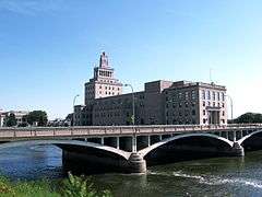
Cedar Rapids /ˈsiːdər ˈræpᵻdz/ is the second largest city in Iowa and is the county seat of Linn County. The city lies on both banks of the Cedar River, 20 miles (32 km) north of Iowa City and 100 miles (160 km) northeast of Des Moines, the state's capital and largest city. It is a part of the Cedar Rapids/Iowa City Corridor of Linn, Benton, Cedar, Jones, Johnson, and Washington counties.[5] Until massive flooding in 2008, the city's government was headquartered in the Veterans Memorial Building, near the Linn County Courthouse and jail on Mays Island in the Cedar River; Cedar Rapids was one of a few cities in the world, along with Paris, France, with governmental offices on a municipal island.[6]
A flourishing center for arts and culture in Eastern Iowa, the city is home to the Cedar Rapids Museum of Art, the National Czech & Slovak Museum & Library, the Paramount Theatre, Orchestra Iowa, Theatre Cedar Rapids, the African-American Historical Museum and Cultural Center of Iowa, the Iowa Cultural Corridor Alliance. Cedar Rapids is an economic hub of the state, located in the core of the Interstate 380. As of the 2010 United States Census, the city population was 126,326.[7][8]
The estimated population of the three-county Metropolitan Statistical Area, which includes the nearby cities of Marion and Hiawatha, was 255,452 in 2008.[9]
Cedar Rapids has been residence to famous figures for the United States, including American Gothic painter Grant Wood, journalist and historian William L. Shirer, writer and photographer Carl Van Vechten, and aerodynamics pioneer Dr. Alexander Lippisch. In the 1990s and 2000s, Hollywood would feature several Cedar Rapidians including actors Bobby Driscoll, Ashton Kutcher, Elijah Wood, and Ron Livingston. The area has also produced a number of professional athletes such as Landon Cassill, Ryan Sweeney, Trent Green, Zach Johnson, and Kurt Warner, as well as Mark Walter, co-owner and chairman of baseball's Los Angeles Dodgers. The city is also the setting for the musical The Pajama Game and the comedy film Cedar Rapids.
Cedar Rapids is nicknamed the "City of Five Seasons", for the "fifth season", which is time to enjoy the other four.[1] The symbol of the five seasons is the Tree of Five Seasons sculpture in downtown along the north river bank. The name "Five Seasons" and representations of the sculpture appear throughout the city in many forms.[1]
History


The location of present-day Cedar Rapids was in the territory of the Fox and Sac tribes.
The first permanent settler, Osgood Shepherd, arrived in 1838. When Cedar Rapids was first established in 1838, William Stone named the town Columbus. In 1841 it was resurveyed and renamed by N.B. Brown and his associates. They named the town Cedar Rapids for the rapids in the Cedar River at the site, and the river itself was named for the large number of red cedar trees that grew along its banks.[10] Cedar Rapids was incorporated on January 15, 1849.[11] Cedar Rapids annexed the community of Kingston in 1870.
The economic growth of Cedar Rapids increased in 1871 upon the founding of the Sinclair meatpacking company.
In 2010, the Census Bureau reported Cedar Rapids' population as 87.98% white, and 5.58% black.[12]
Flood of 2008
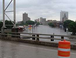
During the Iowa flood of 2008, the Cedar River reached a record high of 31.12 feet (9.49 m) on June 13, 2008, the previous record was 20 feet (6.1 m) surpassing the 500-year flood plain. 1,126 city blocks were flooded, or more than 10 square miles (26 km2), 561 city blocks were severely damaged, on both banks of the Cedar River. This is 14% of the city's total area. There were a total of 7,749 flooded properties that had to be evacuated, 5,900 were homes, and 310 were city facilities including the City Hall, Central Fire Station, Main Public Library, Ground Transportation Center, Public Works building, and Animal Control building. It is estimated 1300 or more properties are to be demolished in the Cedar Rapids area because of the flood, which caused several billions of dollars in damages. More than 4000 members of the Iowa National Guard were called up to assist the city. The temporary levies became saturated not only with the flood waters but also with additional rainfall causing the levies to fail.[13][14]
Flood of 2016
During the flood of 2016, remnants of Hurricane Paine from the eastern Pacific Ocean via the Gulf of California caused the second highest recorded crest of the Cedar River in Cedar Rapids reaching 22 feet (6.7 m) on Tuesday, September 27, 2016.[15][16][17] The inundation of southern Minnesota, central and western Wisconsin, and northeastern Iowa by Hurricane Paine's remnants began on September 21 and 22 and continued until the end of September 2016.[18][19][20][21] This cresting in Cedar Rapids was below the initial estimate of 25 feet (7.6 m) and the revised estimate of 23 feet (7.0 m), but more than 10 feet (3.0 m) above the flood stage of 12 feet (3.7 m).[22][23][24] This flood was above levels considered to have about a 1 percent chance of occurring in a given year.[25][lower-alpha 1] More than 5,000 homes were affected including the flooded areas around Time Check Park, the Czech Village, and the New Bohemia district causing over 5,000 persons to be evacuated.[25][14][26][27] The Cedar Rapids Schools did not have school for a week.[28]
In 2015, the city of Cedar Rapids approved a $625 million flood protection plan over 20 years for levee improvements.[25] Although the improvement to the levee system in Cedar Rapids had not been completed due to over $80 million in funding not appropriated by the United States Congresses of 2014 and 2016 and the voting down by local residents of a temporary increase in the local sales tax to pay for the levee improvements,[lower-alpha 2] these students along with the hundreds of thousands of volunteers and 412 Iowa National Guard troops filled more than a quarter of a million sand bags in a successful effort that prevented any major flooding of the city outside of the evacuation zone.[25][29] A 9.8-mile (15.8 km) system of Hesco barriers, earthen berms, and over 400,000 sand bags were used to plug the gaps in the levee system.[25][30][31] The city of Cedar Rapids purchased additional Hesco barriers from Iowa City for $1.4 million.[32] Numerous upstream cities which had been earlier affected by the September flooding and mandatory evacuations including Charles City, Greene, Manchester, Clarksville, Shell Rock, Vinton, Janesville, Cedar Falls and Waterloo sent hundreds of thousands of unused sand bags to support efforts in Cedar Rapids and nearby communities.[19][27] The remnants of Hurricane Paine did not produce any rain to saturate the temporary earth berms and sand bags, which would have greatly increased the likelihood of breech in the temporary levee structures and thus causing a much greater flooded area; the river crested during very sunny weather in Cedar Rapids. Additionally beginning on the evening of Sunday, September 25, 300 to 400 National Guard troops along with the Iowa State Patrol, other law enforcement agencies, and 60 duly sworn law enforcement officials enforced an 8pm to 7am curfew, nightly.[27][28][29]
Geography
The city is divided into four quadrants, used in addressing. 1st Avenue (U.S. Route 151 Business) divides the north and south sides of the city, and the Cedar River divides east and west. Mays Island, in the middle of the river, is the only area of the city where addresses have no quadrant. Areas outside of the city limit that use the "Cedar Rapids" city name on their mailing address also do not use the quadrants.
Except in the downtown area, 1st Avenue and the Cedar River tend to run diagonally instead of along the cardinal directions. Due to the curving of 1st Avenue, there are some areas in western Cedar Rapids where NW addresses are actually south of SW addresses.
Cedar Rapids is divided into fourteen ZIP Codes. Mays Island and the downtown area are covered by 52401. The northeast quadrant is covered by 52402 and 52411. The southeast quadrant is covered by 52403. The southwest quadrant is covered by 52404. The northwest quadrant is covered by 52405. Post office boxes are covered by ZIP codes 52406, 52407, 52408, 52409, and 52410. Several other ZIP codes are for specific business (Aegon USA, Rockwell Collins, etc.).
According to the United States Census Bureau, the city has a total area of 72.07 square miles (186.66 km2), of which, 70.8 square miles (183.37 km2) is land and 1.27 square miles (3.29 km2) is water.[2]
Neighborhoods

Czech Village is located along 16th Avenue SW, which is south of the Cedar River. It is home to such Czech-related businesses as The Czech Cottage, Sykora Bakery, and Deda and Babi's Antiques. The National Czech & Slovak Museum & Library is one of the major tourist attractions in Cedar Rapids, and the nearby Bohemian National Cemetery may also be of interest to visitors. The National Czech & Slovak Museum's main building was located directly on the river and was badly damaged by the 2008 floods. 1400 The museum moved a few blocks after the flood to Inspiration Pl SW, Cedar Rapids, IA 52404.
The Cedar Rapids Czech Heritage Foundation is one of many local organizations working to promote and preserve Czech heritage in Cedar Rapids. They support and sponsor many programs and events throughout the year. One of these programs is the Miss Czech-Slovak Iowa pageant. Two Miss Czech-Slovak US queens can claim this community as home: Lisa Volesky and Stasia Krivanek.
Olga Drahozal was the famed band leader of the Czech Plus Polka Band, a performing group that frequents the Kosek Band Stand in Czech Village. She, along with Bessie Duggena and Leona Poduška, taught Czech School (Česká škola) at Wilson Middle School.
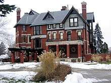
In 2003, the African-American Historical Museum and Cultural Center of Iowa opened its doors. Cedar Rapids is also home to the historic 26 acre (105,000 m²) Brucemore Estate, on which sits a 21-room mansion, and the Masonic Library and Museum.
There are twelve active neighborhood associations in Cedar Rapids. The neighborhoods nearest downtown include Wellington Heights and Oakhill Jackson in the southeast quadrant and Moundview in the northeast quadrant. Also farther north in the northeast quadrant is the Kenwood Park, which was independent until it was incorporated into the Cedar Rapids city limits, and Noelridge Park neighborhood. The boundaries of Kenwood are 32nd Street to Oakland Road to Old Marion Road to C Avenue to 40th Street then 1st Avenue between 40th street and 32nd Street.[33]
In addition to the neighborhood associations in Cedar Rapids, there are many informal, unofficial neighborhoods, such as Bowman Woods, Vernon Heights, Stoney Point, New Bohemia (NewBo) and Wilderness Estates.
In 2009, Cedar Rapids was rated one of the "Top 10 cities to Grow Up In" in the United States, partly due to a low crime rate and a good public school system.[34]
Climate
Cedar Rapids has a humid continental climate with long, cold, sometimes brutal winters with plenty of snow, while summers are hot and humid, with frequent severe thunderstorms.
The record low temperature in Cedar Rapids is −29 °F (−34 °C), set on January 15, 2009,[35] while the record high temperature of 104 °F (40 °C) was set on July 31, 1988.
| Climate data for Cedar Rapids, IA | |||||||||||||
|---|---|---|---|---|---|---|---|---|---|---|---|---|---|
| Month | Jan | Feb | Mar | Apr | May | Jun | Jul | Aug | Sep | Oct | Nov | Dec | Year |
| Record high °F (°C) | 65 (18) |
67 (19) |
88 (31) |
95 (35) |
96 (36) |
100 (38) |
104 (40) |
102 (39) |
98 (37) |
92 (33) |
77 (25) |
67 (19) |
104 (40) |
| Average high °F (°C) | 28 (−2) |
34 (1) |
47 (8) |
61 (16) |
71 (22) |
80 (27) |
84 (29) |
82 (28) |
75 (24) |
62 (17) |
47 (8) |
32 (0) |
59 (15) |
| Average low °F (°C) | 11 (−12) |
16 (−9) |
27 (−3) |
38 (3) |
49 (9) |
57 (14) |
63 (17) |
61 (16) |
51 (11) |
40 (4) |
28 (−2) |
15 (−9) |
38 (3.3) |
| Record low °F (°C) | −29 (−34) |
−21 (−29) |
−20 (−29) |
1 (−17) |
25 (−4) |
39 (4) |
46 (8) |
40 (4) |
27 (−3) |
18 (−8) |
−11 (−24) |
−22 (−30) |
−29 (−34) |
| Average precipitation inches (mm) | 0.92 (23.4) |
1.27 (32.3) |
2.10 (53.3) |
3.05 (77.5) |
4.15 (105.4) |
4.92 (125) |
4.46 (113.3) |
4.48 (113.8) |
3.16 (80.3) |
2.62 (66.5) |
2.11 (53.6) |
1.42 (36.1) |
34.66 (880.5) |
| Average snowfall inches (cm) | 6.20 (15.75) |
6.90 (17.53) |
3.10 (7.87) |
1.00 (2.54) |
0 (0) |
0 (0) |
0 (0) |
0 (0) |
0 (0) |
0.10 (0.25) |
1.70 (4.32) |
7.80 (19.81) |
26.80 (68.07) |
| Source: http://www.intellicast.com/Local/History.aspx?location=USIA0138 | |||||||||||||
Demographics
| Historical populations | ||
|---|---|---|
| Year | Pop. | ±% |
| 1860 | 1,830 | — |
| 1870 | 5,940 | +224.6% |
| 1880 | 10,104 | +70.1% |
| 1890 | 18,020 | +78.3% |
| 1900 | 25,656 | +42.4% |
| 1910 | 32,811 | +27.9% |
| 1920 | 45,566 | +38.9% |
| 1930 | 56,097 | +23.1% |
| 1940 | 62,120 | +10.7% |
| 1950 | 72,296 | +16.4% |
| 1960 | 92,035 | +27.3% |
| 1970 | 110,642 | +20.2% |
| 1980 | 110,243 | −0.4% |
| 1990 | 108,772 | −1.3% |
| 2000 | 120,758 | +11.0% |
| 2010 | 126,326 | +4.6% |
| 2015 | 130,405 | +3.2% |
| "American FactFinder". United States Census Bureau. and Iowa Data Center Source: | ||

The Cedar Rapids Metropolitan Statistical Area consists of Linn, Benton, and Jones counties. The MSA had a 2000 census population of 237,230, with an estimated 2008 population of 255,452;[9] Linn County was the only county in the MSA before the MSA was redefined after the 2000 census.
As a growing job center, Cedar Rapids pulls commuters from nearby Marion and Hiawatha. Other towns that have become bedroom communities include Ely, Swisher, Shueyville, Palo, Atkins, Fairfax, Walford, Robins and Bertram.
Based on the 2010 American Community Survey[37] 1 Year Estimates, the median income for a household in the city was $51,186, and the median income for a family was $63,265. Males had a median income of $40,413 versus $26,402 for females. The per capita income for the city is $26,370. About 6.3% of families and 11.7% of the population were below the poverty line, including 15.5% of those under the age of 18 and 4.3% of those 65 or older.
2010 census
As of the census[38] of 2010, there were 126,326 people, 53,236 households, and 30,931 families residing in the city. The population density was 1,784.3 people per square mile (688.9/km²). There were 57,217 housing units at an average density of 808.2 per square mile (312.0/km²). The racial makeup of the city was 87.98% White, 5.58% African American, 0.31% Native American, 2.21% Asian, 0.12% Pacific Islander, 0.93% from other races, and 2.87% from two or more races. Hispanic or Latino of any race were 3.31% of the population.
There were 53,236 households of which 28.9% had children under the age of 18 living with them, 42.8% were married couples living together, 11.0% had a female householder with no husband present, and 41.9% were non-families. 32.5% of all households were made up of individuals and 10.3% had someone living alone who was 65 years of age or older. The average household size was 2.31 and the average family size was 2.95.
Age spread: 23.5% under the age of 18, 11.2% from 18 to 24, 27.4% from 25 to 44, 24.8% from 45 to 64, and 13.1% who were 65 years of age or older. The median age was 35.3 years. For every 100 females there were 96.6 males. For every 100 females age 18 and over, there were 94.4 males.[39]
2000 census
In the 2000 census, Cedar Rapids was 91.9% non-Hispanic white, with well over half of the population claiming a specific ethnic European ancestry, such as Germans (35.5%), Irish (17.1%), English (9.4%), Czechs (7.8%), Norwegians (5.1%), and French from either France or Canada (3.2%).[40] The city also has a growing minority population: for example, in the three-year period from 2006 to 2008, the U.S. Census Bureau estimated that 4.9% of the Cedar Rapids population identified as African Americans, up from 3.7% in the 2000 census.[40][41]
Muslim heritage
Cedar Rapids has played an important role in Muslim culture in the United States. The National Muslim Cemetery, on 12 acres (49,000 m2) of land donated by Haj. Yahya William Aossey in 1948, is said to be the first exclusively Muslim cemetery in North America. Graves in the cemetery face Mecca.[42] The Mother Mosque of America, dedicated on June 16, 1934, is the longest standing mosque in North America.[43][44] In 1972, another mosque was built and the original mosque was sold and fell into disrepair before being purchased in 1990 by the Islamic Council of Iowa and renovated.[45][46] It is on the National Register of Historic Places. The Iowa flood of 2008 extensively damaged the basement, destroying many historic documents.
Muslim presence in the area dates to 1895 when the first immigrants arrived from the Beqaa Valley in today's Lebanon and Syria.[47] Islamic Services of America (I.S.A.) was established in Cedar Rapids in 1975 and provides Halal Certification and supervision throughout the world.[48]
Economy
Cedar Rapids is one of the largest cities in the world for corn processing. The grain processing industry is Cedar Rapids' most important sector, directly providing 4,000 jobs that pay on average $85,000, and also providing 8,000 indirectly.[50] Fortune 500 company Rockwell Collins and trucking company CRST are based in Cedar Rapids,[51] and Aegon has its United States headquarters there. A large Quaker Oats mill, one of the four that merged in 1901 to form Quaker Oats, dominates the north side of downtown. Other large companies that have facilities in Cedar Rapids include Archer Daniels Midland, Cargill, General Mills, Toyota Financial Services and Nordstrom.[50] Newspaperarchive, based in Cedar Rapids, is the largest newspaper archive in North America with a repository of more than 150 million pages assembled over 250 years; it was taken offline for two days by the 2008 flood.
Top employers
According to Cedar Rapids' 2014 Comprehensive Annual Financial Report,[52] the top employers in the area are:
| # | Employer | Employees |
|---|---|---|
| 1 | Rockwell Collins | 8,700 |
| 2 | Transamerica | 3,872 |
| 3 | St. Luke's Hospital | 3,184 |
| 4 | Cedar Rapids Community School District | 2,936 |
| 5 | Hy-Vee | 2,599 |
| 6 | Mercy Medical Center | 2,312 |
| 7 | Kirkwood Community College | 1,895 |
| 8 | City of Cedar Rapids | 1,311 |
| 9 | Nordstrom | 1,200 |
| 10 | Quaker Oats | 1,018 |
Arts and culture
Cedar Rapids is home to Orchestra Iowa, the Paramount Theatre, Theatre Cedar Rapids, and Brucemore, a National Trust Historic Site, among others.
Cedar Rapids is also home to the Cedar Rapids Museum of Art, The Cedar Rapids Ceramics Center, Legion Art's CSPS Hall, the National Czech & Slovak Museum & Library, the African American Historical Museum, Kirkwood Community College's Iowa Hall Gallery, and the legendary Grant Wood Studio at 5 Turner Alley. These Cedar Rapids venues have recently hosted world class and award nominated exhibitions, including the works of Andy Warhol, Grant Wood, and the Iowa Biennial, among others.
The Cedar Rapids Museum of Art houses the largest collection of Grant Wood paintings in the world. The 1920s Paramount Theatre is home to the Orchestra Iowa and the Cedar Rapids Area Theatre Organ Society. Concerts and events such as high school graduations, sporting events, exhibitions, and political rallies are held in the U.S. Cellular Center, formerly known as The Five Seasons Center.
Many arts centers in Cedar Rapids sustained severe damage during the June 2008 flood. Among those severely damaged are the Paramount Theatre, Theatre Cedar Rapids, the National Czech & Slovak Museum, and the African American Historical Museum. Two Wurlitzer organs were damaged, located at the Paramount Theatre and Theatre Cedar Rapids. The Cedar Rapids Museum of Art suffered minor damage. It is expected to cost $25 million to repair the Paramount;[53][54] Theatre Cedar Rapids reopened in February 2010.[55]
Sports
Cedar Rapids is home to four minor league sports franchises:
- the Cedar Rapids Kernels, a member of minor league baseball's Midwest League since 1962, are the Class-A affiliate of the Minnesota Twins and play at Veterans Memorial Stadium
- the Cedar Rapids Roughriders are members of the United States Hockey League, playing at the Cedar Rapids Ice Arena
- the Cedar Rapids Titans, members of the Indoor Football League, play at the U.S. Cellular Center
- the Cedar Rapids Rampage play Major Arena Soccer League matches at the U.S. Cellular Center
Parks and recreation
Cedar Rapids has over 3,360 acres (13.6 km2) of city owned property for undeveloped green space and recreational use. There are 74 formally named parks or recreational facilities. These include baseball and softball fields, all-weather basketball courts, two frisbee golf courses, sand volleyball courts, the Tuma Soccer Complex, a BMX dirt track, two off-leash dog exercise areas, the Old MacDonald's Farm (a children's zoo), 10 splash pads, and many parks that have pavilions, picnicking areas and restroom facilities. The various trail systems in Cedar Rapids have a total of 24 miles (39 km) for walking, running or bicycling.[56]
The YMCA has had a local chapter since 1868. It has many facilities including Camp Wapsie.[57]
Government
| Mayor | In office |
|---|---|
| Don Canney | 1969–1992 |
| Larry Serbousek | 1992–1995 |
| Lee Clancey | 1995–2002 |
| Paul Pate | 2002–2006 |
| Kay Halloran | 2006–2009 |
| Ron Corbett[58] | 2010– |

From April 6, 1908, to December 31, 2005, Cedar Rapids used the city commission form of government. It was one of the few larger American cities remaining to operate under this model. Under this form of government, the council was made up of a public safety commissioner, a streets commissioner, a finance commissioner, a parks commissioner, and a mayor. The council members worked on a full-time basis, served two-year terms, and were considered department heads. Don Canney, the longest serving mayor in city history, served for twenty-two years under this system.[59] The last mayor of Cedar Rapids under this form of government was Paul Pate.
In 2005 the Cedar Rapids Area Chamber of Commerce spearheaded a movement to change from the commission form of government. A panel was appointed by Mayor Pate and the City Council to study the issue, and recommended that voters be presented with three options:
- Stay with the current commission form of government.
- Adopt a "strong mayor form" where the council would be part-time, the mayor would be full-time, and a city manager would run the day-to-day affairs of the city.
- Adopt a "weak mayor form" of government, in this form the mayor and council would both work on a part-time basis. A full-time city manager would run the day-to-day operations of the city.
On June 14, 2005, voters went to the polls to decide whether to adopt a new form of government or continue with the commission form. 28,818 of the 83,514 registered voters (29.72%) cast ballots on the issue. 68.80% of the voters decided to adopt a new form of government.[60] Elections were held on November 8, 2005 and 30 candidates ran. Kay Halloran, a retired attorney and state legislator, became the first mayor elected under the new system. Several members of the city council were elected outright; however, the remaining races were close enough to require a runoff election, which took place in December.
Cedar Rapids now has an Iowa "Home Rule" charter which establishes a weak mayor system with a part-time City Council and Mayor both on four-year terms.[61]
Education
Cedar Rapids is home to two four-year colleges: Coe College and Mount Mercy University. The University of Iowa also has an evening MBA facility there.[62] Kirkwood Community College is the area's only two-year college, while Kaplan University (formerly Hamilton College) and Upper Iowa University also have campuses there. Cornell College in Mount Vernon and the University of Iowa's main campus in Iowa City are both within 30 miles (48 km) of Cedar Rapids.
The Cedar Rapids Community School District is the largest school district in the metropolitan area with an enrollment of 17,263 in the 2006–2007 school year.[63] The district contains 24 elementary schools, six middle schools, and four high schools: Jefferson, Washington, Kennedy, and Metro High School (an alternative high school).[64] Two neighboring school districts draw students from within the Cedar Rapids city limits. The Linn-Mar Community School District serves part of the northeast quadrant of the city and has seven elementary schools inside the city limits.[65] The College Community School District serves part of the southwest quadrant of Cedar Rapids as well as neighboring rural portions of Linn, Benton and Johnson counties. Located in a central campus off Interstate 380 are College Community's five elementary schools, Prairie Creek Intermediate, Prairie Point Middle School & Ninth Grade Academy, and Prairie High School.[66]
The Cedar Rapids Metro Catholic Education System, which is affiliated with the Roman Catholic Archdiocese of Dubuque, consists of six elementary schools,[67] two middle schools,[68] and one high school (Xavier). The Cedar Rapids Catholic Education System and Cedar Rapids Community School District are synonymous with each other in the Cedar Rapids Public and Parochial School System.
The city hosts several private schools, including Summit Schools, Cedar Valley Christian School, Trinity Lutheran School, Isaac Newton Christian Academy, and Faith Christian Learning Center.
Media
Radio
Cedar Rapids' radio market, which consists of Linn County,[69] is ranked 211th by Arbitron with 172,000 listeners aged 12 and older.[70]
Clear Channel Communications owns four stations in the Cedar Rapids area, including WMT 600 AM, a news/talk station that has broadcast since 1922. Clear Channel also owns KKSY-FM 96.5, a modern country music station; KMJM 1360 AM, a classic country station; and KOSY-FM 95.7 FM, a hit music station.[71] Townsquare Media owns four radio stations in Cedar Rapids, which were formerly owned by Cumulus Media: KDAT 104.5 FM (adult contemporary), KHAK 98.1 FM (country music), and KRNA 94.1 FM (active rock). Townsquare also operates KRQN 107.1 under a Lease-Management Agreement. KRQN broadcasts a (contemporary hits) format.[72] Three other stations in Cedar Rapids are independently owned: KZIA 102.9 FM (contemporary hits), KGYM 1600 AM (sports radio), and KMRY 1450 AM/93.1 FM (Classic).[73] Several stations from Davenport, Waterloo, and Iowa City also figure into ratings in Cedar Rapids.[74] These stations include Waterloo-licensed contemporary Christian "Life 101.9," KNWS-FM; KFMW 107.9 FM, known as "Rock 108," with an active rock format; and KOKZ 105.7 FM, which has a classic hits format. Clear Channel-owned KKRQ 100.7 FM, with a classic rock format, is the Iowa City station that is typically highly rated in Cedar Rapids.
The only noncommercial station licensed to Cedar Rapids is KCCK-FM 88.3 FM, a jazz station licensed to Kirkwood Community College. KXGM 89.1 is a non-commercial contemporary Christian music station licensed to neighboring Hiawatha.[73] NPR stations from Cedar Falls (KUNI (FM) 90.9 FM) and Iowa City (KSUI 91.7 FM and WSUI 910 AM) reach Cedar Rapids.[75]
Television
The Cedar Rapids-Waterloo-Iowa City-Dubuque media market consists of 21 eastern Iowa counties: Allamakee, Benton, Black Hawk, Bremer, Buchanan, Butler, Cedar, Chickasaw, Clayton, Delaware, Dubuque, Fayette, Grundy, Iowa, Johnson, Jones, Keokuk, Linn, Tama, Washington, and Winneshiek.[69] It is ranked 88th by Nielsen Media Research for the 2008–2009 television season with 346,330 television households.[76]
Cedar Rapids is home to four network-affiliated stations: KGAN channel 2 (CBS), KCRG channel 9 (ABC), KFXA channel 28 (Fox), and KPXR-TV channel 48 (ION). NBC affiliate KWWL channel 7 is based in Waterloo but maintains a newsroom inside the Alliant Energy tower in downtown Cedar Rapids. Other stations in the market are KWKB channel 20 (CW/MyNetwork TV), licensed to Iowa City; KWWF channel 22 (RTN), licensed to Waterloo; and KFXB-TV channel 40 (CTN), licensed to Dubuque. Public television is provided by Iowa Public Television, which has two stations in the area: KIIN channel 12 in Iowa City and KRIN channel 32 in Waterloo. Mediacom and local company ImOn Communications provide cable television service to Cedar Rapids.
The Gazette is the primary daily newspaper for Cedar Rapids. The Cedar Rapids Gazette won a Pulitzer Prize in 1936, under editor Verne Marshall and primarily due to his efforts and articles, for its campaign against corruption and misgovernment in the State of Iowa.[77]
Film
Cedar Rapids is an American comedy film about a naive insurance agent, played by Ed Helms, who is sent to represent his company at a regional conference in big town Cedar Rapids.[78] Although the film is set in Cedar Rapids, it was actually mostly shot in Ann Arbor, Michigan, although exterior shots were done in Cedar Rapids.[79]
Released on February 26, 2010,The Crazies is a 2010 film which fictionally takes place near Cedar Rapids at Odgen Marsh, Iowa. In the film, residents both in and near Ogden Marsh become infected with a "Rhabdoviridae prototype" biological weapon called Trixie. At the end of the movie, David and Judy, who are unaffected victims within the affected area, arrive at a truck stop to search for a vehicle but discover that the National Guard have also executed those who were evacuated. Fending off three Trixie infected persons, they escape in a semi-truck. In order to stop the infection from spreading, the National Guard destoys Ogden Marsh in a massive explosion. As the couple flees, their truck flips in the passing shockwave. They then exit their wrecked semi and begin walking towards Cedar Rapids. A view from a military satellite highlights first the couple, then the city of Cedar Rapids. The words "Initiate containment protocol" appear, signifying a new containment attempt by the National Guard. Later, during the credits, Bruce Aune, a real newscaster from KCRG-TV 9 in Cedar Rapids reports that an explosion originating from the Dakon Pendrill chemical plant started a massive fire in Ogden Marsh which is merely a cover story for the National Guard's actual destruction of the town. Bruce Aune then reports that a perimeter has been set and civilians are not being allowed into the area. A Trixie-infected individual appears on camera just before the signal is lost.[80][81][82][83][84][85][86][87]
Infrastructure
Transportation
Cedar Rapids is served by The Eastern Iowa Airport (formerly known as the Cedar Rapids Airport), a regional airport that connects with other regional and international airports. Cedar Rapids Transit and private bus lines also connect at the airport.[88]
Interstate 380, part of the Avenue of the Saints, runs north-south through Cedar Rapids. U.S. Highways 30, 151, and 218 and Iowa Highway 13 and Iowa Highway 100 also serve the city.[89]
Cedar Rapids is served by four major railroads. They are the Union Pacific, the Cedar Rapids and Iowa City Railway (Crandic), the Canadian National, and the Iowa Northern Railway Company [IANR]. The Iowa Northern Railway has its headquarters in the historic Paramount Theater Building. The Crandic and the Iowa Interstate Railroad also are headquartered in Cedar Rapids. The Iowa Interstate reaches the city via the Crandic tracks, running a daily train from Iowa City, Iowa to Cedar Rapids.
Cedar Rapids is linked to other Midwestern cities by the Burlington Trailways bus hub at the Eastern Iowa Airport.[90]
The city is also served by Cedar Rapids Transit, consisting of an extensive bus system and taxis. Cedar Rapids Transit operates scheduled bus service throughout the city and to Marion and Hiawatha.[91] A series of enclosed pedestrian skywalks connect several downtown buildings.[92]
Health care
There are two hospitals in Cedar Rapids, St. Luke's and Mercy Medical Center.
Notable people
See also
Notes
References
- 1 2 3 "What is the "City of Five Seasons"?". City of Cedar Rapids. Retrieved 2010-08-18.
- 1 2 "US Gazetteer files 2010". United States Census Bureau. Archived from the original on January 24, 2012. Retrieved 2012-05-11.
- ↑ "American FactFinder". United States Census Bureau. Retrieved 2012-05-11.
- ↑ "Population Estimates". United States Census Bureau. Retrieved 2015-05-23.
- ↑ Cedar Rapids/Iowa City Technology Corridor. "About the Corridor". Archived from the original on July 27, 2007. Retrieved 2007-05-29.
- ↑ Mark Hunter (2005). "Downtown History sourced from Cedar Rapids History Center". Cedar Rapids Downtown District.
- ↑ "Iowa's Largest Cities". Quad City Times. February 10, 2011. Retrieved 2011-02-13.
- ↑ "Population Estimates and Rankings for Population, Numerical Change, and Percent Change for Iowa's Incorporated Places: 2000–2008" (PDF). Iowa Data Center. Archived from the original (PDF) on July 19, 2011. Retrieved 2009-07-11.
- 1 2 United States Census Bureau. "Cumulative Estimates of Population Change for Metropolitan Statistical Areas and Rankings: April 1, 2000 to July 1, 2008". Retrieved 2009-07-11.
- ↑ Chicago and North Western Railway Company (1908). A History of the Origin of the Place Names Connected with the Chicago & North Western and Chicago, St. Paul, Minneapolis & Omaha Railways. p. 54.
- ↑ Tom Savage (2007). "a dictionary of Iowa place-names."
- ↑ "Iowa – Race and Hispanic Origin for Selected Cities and Other Places: Earliest Census to 1990". U.S. Census Bureau.
- ↑ "Flood of 2008 Facts & Statistics". City of Cedar Rapids, Iowa. Retrieved 2011-06-17.
- 1 2 Blin, Crystal (September 27, 2016). "Cedar River Expected to Crest, Town Evacuated". AgDay. Retrieved September 28, 2016.
- ↑ "Hurricane Paine Named in Pacific Could Bring Rain to Southwest". The Weather Channel. September 19, 2016. Retrieved September 28, 2016.
- ↑ "Tropical Storm Paine Will Bring Rain to the Southwest". The Weather Channel. September 20, 2016. Retrieved September 28, 2016.
- ↑ "Tropical Storm Paine Weakens as it Nears Land". The Weather Channel. September 26, 2016. Retrieved September 28, 2016.
- ↑ Erdman, Jon (September 23, 2016). "Upper Midwest Flooding Recap September 2016". The Weather Channel. Retrieved September 28, 2016.
- 1 2 "AgDay Daily Recap -September 27, 2016". AgDay. September 27, 2016. Retrieved September 28, 2016.
- ↑ "AgDay Daily Recap -September 28, 2016". AgDay. September 28, 2016. Retrieved September 28, 2016.
- ↑ Pavlak, Shanna (September 24, 2016). "Iowa, Wisconsin face flood threat with swollen rivers: Evacuations underway in Cedar Rapids, Iowa". WOI tv. CNN. Retrieved September 28, 2016.
- ↑ "Cedar River at Cedar Rapids". National Oceanic and Atmospheric Administration. Retrieved September 28, 2016.
- ↑ Maricle, Kelly (September 26, 2016). "River Level Forecast Drops but Cedar Rapids Still to See Major Flooding". WHO tv. Des Moines. Retrieved September 28, 2016.
- ↑ "Gazette Flood Center 2016". The Gazette. Retrieved September 28, 2016.
- 1 2 3 4 5 6 7 Aschbrenner, Joel (September 23, 2016). "8 years after flood, Cedar Rapids lacks new levees". The Des Moines Register. Retrieved September 28, 2016.
- ↑ "New Cedar Rapids evacuation map". The Gazette. September 28, 2016. Retrieved September 28, 2016.
- 1 2 3 Petrosky, William; Leys, Tony (September 25, 2016). "Residents of 5,000 Cedar Rapids homes asked to evacuate". The Des Moines Register. Retrieved September 28, 2016.
- 1 2 Gazette Staff (September 27, 2016). "Cedar Rapids Flood 2016: What you need to know: The latest flood news, closures, volunteer information and more". The Gazette. Retrieved September 28, 2016.
- 1 2 "Iowa city braces for highest floodwaters since 2008 record". Bowling Green Sentinel-Tribune. Bowling Green. Associated Press. September 27, 2016. Retrieved September 28, 2016.
- ↑ Leland, Micheal; Borg, Dean (September 27, 2016). "Cedar Rapids Sees River Crest, Flood Protection Holding". Iowa Public Radio. Retrieved September 28, 2016.
- ↑ Whitworth, Jodi (September 27, 2016). "Cedar Rapids' Levee Protection System Battling Floods". WHO tv. Des Moines. Retrieved September 28, 2016.
- ↑ "Flood Summary: Thousands will return home Wednesday". KCCI. Des Moines. September 28, 2016. Retrieved September 28, 2016.
- ↑ "CR Neighborhoods". Home. Retrieved 2010-12-13.
- ↑ Yahoo! Homes - Home for Sale and Rent, Makeovers, Design and Décor, Real Estate. Realestate.yahoo.com. Retrieved on 2013-09-05.
- ↑ http://www.kcrg.com/news/local/37642604.html
- ↑ "Census of Population and Housing". Census.gov. Archived from the original on May 11, 2015. Retrieved June 4, 2015.
- ↑ "Median Income in the Past 12 Months". US Census Bureau. Retrieved 2011-10-17.
- ↑ "2010 Demographic Profile for Cedar Rapids, Iowa". US Census Bureau. Archived from the original on March 5, 2014. Retrieved 2011-10-17.
- ↑ "Age Groups and Sex:2010". US Census Bureau. Retrieved 2011-10-17.
- 1 2 "Cedar Rapids city, Iowa – DP-2. Profile of Selected Social Characteristics: 2000". Retrieved 2010-06-20.
- ↑ "Cedar Rapids city, Iowa – 2006–2008 American Community Survey 3-Year Estimates". Retrieved 2010-06-20.
- ↑ Islamic Services of America – Background and History – Retrieved June 20, 2010
- ↑ ; see also
- ↑ "CAIR-MN: Flood Damages Historic American Mosque". Council on American-Islamic Relations. Retrieved 2008-06-17.
- ↑ Mothermosque.com – History
- ↑ History of Islam in Iowa – The Islamic Center – Retrieved June 18, 2008
- ↑ Ronald L. Johnstone (2006) Religion in society: a sociology of religionp.362. Prentice Hall
- ↑ "Islamic Services of America!". Islamic Services of America. Retrieved 2010-06-20.
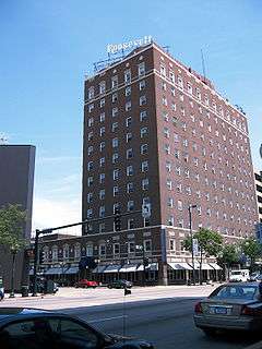
- ↑ Rick Smith (May 27, 2008). "Minneapolis developer makes his first move in downtown; readies to buy The Roosevelt and renovate it". Eye on the Island.
- 1 2 Ford, George (November 28, 2009). "Impact of grain-processing industry runs deep, but people don't see it". Cedar Rapids Gazette. pp. 1A. Archived from the original on July 11, 2011. Retrieved November 29, 2009.
- ↑ Fortune.com. "FORTUNE 500 2009: States: Iowa". CNN. Retrieved 2009-06-28.
- ↑ City of Cedar Rapids CAFR
- ↑ Weber, Carly (June 29, 2008). "Long road to recovery for arts groups". The Gazette. Archived from the original on February 2, 2015.
- ↑ Clark, Eric (January 1, 2009). "Is Paramount Theatre worth $25 million to repair?". The Gazette. Archived from the original on February 2, 2015.
- ↑ "Theatre Cedar Rapids". Retrieved 2011-10-17.
- ↑ "Parks & Recreation". City of Cedar Rapids. Retrieved 2011-07-05.
- ↑ http://www.crmetroymca.org/en/camp_wapsie
- ↑ Former state lawmaker wins Cedar Rapids mayor race
- ↑ Smith, Rick (March 24, 2011). "Corbett is forming committee to name memorial for Don Canney". The Gazette (Cedar Rapids). Retrieved 2011-04-08.
- ↑ Election Results
- ↑ Home Rule Charter
- ↑ The University of Iowa. "Tippie School of Management: Our Locations". Retrieved 2008-01-22.
- ↑ Iowa Department of Education. "2006–2007 Iowa Public School PreK-12 Enrollments by District, Grade, Race and Gender" (XLS). Retrieved 2008-01-22.
- ↑ Cedar Rapids Community Schools. "About Us". Retrieved 2008-01-22.
- ↑ Linn-Mar Community School District. "Boundaries". Archived from the original on March 11, 2008. Retrieved 2008-01-22.
- ↑ College Community School District. "General Information". Archived from the original on January 10, 2008. Retrieved 2008-01-22.
- ↑ Cedar Rapids Metro Education System. "Cedar Rapids Metro Education System Elementary Schools". Retrieved 2008-01-22.
- ↑ Cedar Rapids Metro Education System. "Cedar Rapids Metro Education System Middle Schools". Retrieved 2008-01-22.
- 1 2 Arbitron. "Arbitron Radio Metros Based on Fall 2006 Market Definitions" (PDF). Retrieved 2008-01-13.
- ↑ Arbitron. "Market Ranks and Schedule (201–250)". Archived from the original on December 15, 2007. Retrieved 2008-01-13.
- ↑ Clear Channel Communications. "Radio: Station Search". Retrieved 2008-01-13.
- ↑ http://www.townsquaremedia.com/local-media/brands?state=iowa
- 1 2 Northpine.com. "Iowa Radio Stations". Retrieved 2008-01-13.
- ↑ Arbitron. "Arbitron Ratings Data". Archived from the original on October 14, 2007. Retrieved 2008-01-03.
- ↑ Northpine.com. "Cedar Rapids Dial Guides". Retrieved 2008-01-13.
- ↑ Nielsen Media Research. "Nielsen Local Television Market Universe Estimates". Retrieved 2009-01-17.
- ↑ "1936 Winners". Pulitzer. Retrieved March 31, 2011.
- ↑ "Cedar Rapids". FOX Pictures. Retrieved January 20, 2011.
- ↑ "Cedar Rapids' movie debuts tonight at Sundance". The Cedar Rapids Gazette. Retrieved 2011-10-17.
- ↑ "The Crazies (2010)". Box Office Mojo. Internet Movie Database. Retrieved 2016-09-28.
- ↑ Phillips, Michael (2010-02-25). "'The Crazies': Remake bests the master". Chicago Tribune. Retrieved 2016-09-28.
- ↑ Armstrong, Eric M. (2010-03-10). "'The Crazies (2010)'". The Moving Arts Film Journal. Retrieved 2016-09-28.
- ↑ Burr, Ty (2010-02-26). "'The Crazies' movie review". Boston Globe. Retrieved 2016-09-28.
- ↑ Harvey, Dennis (2010-02-25). "The Crazies Review – Read Variety's Analysis of the Film, The Crazies". Variety. Retrieved 2016-09-28.
- ↑ Gleiberman, Owen (2010-02-25). "The Crazies". EW. Retrieved 2016-09-28.
- ↑ Hale, Mike (2010-02-26). "Movie Review – The Crazies". The New York Times. Retrieved 2016-09-28.
- ↑ Biancolli, Amy (2010-02-26). "Review: 'The Crazies'". San Francisco Chronicle. Retrieved 2016-09-28.
- ↑ "THE EASTERN IOWA AIRPORT (CID)". The Eastern Iowa Airport. Retrieved 2011-07-04.
- ↑ "Cedar Rapids, Iowa". Google maps. Retrieved 2011-07-04.
- ↑ "Burlington Trailways Bus Service Locations in Iowa". Burlington Trailways. Retrieved 2011-07-04.
- ↑ "CR Transit". City of Cedar Rapids. Retrieved 2011-07-04.
- ↑ "Downtown Parking & Skywalk Map". Cedar Rapids Downtown District. Retrieved 2011-07-04.
External links
| Wikimedia Commons has media related to Cedar Rapids, Iowa. |
| Wikivoyage has a travel guide for Cedar Rapids. |
| Wikisource has the text of the 1911 Encyclopædia Britannica article Cedar Rapids. |
- City of Cedar Rapids Official Website
- City Data Statistical Data about Cedar Rapids, Iowa
- History of Linn County Iowa by Luther A. Brewer and Barthinius L. Wick The Pioneer Publishing Company (1911 copyright expired) This searchable and pdf down loadable book was scanned into the public domain by Google books.
- The History of Linn county, Iowa not authored Western Historical Company(1878 copyright expired) This searchable and pdf downloadable book was scanned into the public domain by Google books.
- A History of African-Americans in Cedar Rapids, Iowa
Municipalities and communities of Linn County, Iowa, United States | ||
|---|---|---|
| Cities | ||
| Townships | ||
| Unincorporated communities | ||
| Footnotes | ‡This populated place also has portions in an adjacent county or counties | |