Cedar Crest, New Mexico
| Cedar Crest, New Mexico | |
|---|---|
| Census-designated place | |
|
Hiking trail in Cedar Crest | |
 Location of Cedar Crest, New Mexico | |
 Cedar Crest, New Mexico Location in the United States | |
| Coordinates: 35°6′26″N 106°22′25″W / 35.10722°N 106.37361°WCoordinates: 35°6′26″N 106°22′25″W / 35.10722°N 106.37361°W | |
| Country | United States |
| State | New Mexico |
| County | Bernalillo |
| Area | |
| • Total | 3.1 sq mi (8.1 km2) |
| • Land | 3.1 sq mi (8.1 km2) |
| • Water | 0.0 sq mi (0.0 km2) |
| Elevation | 6,581 ft (2,006 m) |
| Population (2010) | |
| • Total | 958 |
| • Density | 307/sq mi (118.6/km2) |
| Time zone | Mountain (MST) (UTC-7) |
| • Summer (DST) | MDT (UTC-6) |
| ZIP code | 87008 |
| Area code(s) | 505 |
| FIPS code | 35-13200 |
| GNIS feature ID | 0904869 |

Cedar Crest is a census-designated place (CDP) in Bernalillo County, New Mexico, United States. The population was 958 at the 2010 census.[1] It is part of the Albuquerque Metropolitan Statistical Area.
Geography
Cedar Crest is located in eastern Bernalillo County at 35°6′26″N 106°22′25″W / 35.10722°N 106.37361°W (35.107145, -106.373543),[2] along the eastern base of the Sandia Mountains. It is bordered by the village of Tijeras to the south.
According to the United States Census Bureau, the CDP has a total area of 3.1 square miles (8.1 km2), all of it land.[1]
Demographics
As of the census[3] of 2000, there were 1,060 people, 470 households, and 322 families residing in the CDP. The population density was 323.9 people per square mile (125.2/km²). There were 501 housing units at an average density of 153.1 per square mile (59.2/km²). The racial makeup of the CDP was 86.89% White, 1.23% African American, 1.42% Native American, 1.13% Asian, 0.09% Pacific Islander, 6.89% from other races, and 2.36% from two or more races. Hispanic or Latino of any race were 19.81% of the population.
There were 470 households out of which 23.8% had children under the age of 18 living with them, 57.7% were married couples living together, 8.1% had a female householder with no husband present, and 31.3% were non-families. 26.0% of all households were made up of individuals and 5.1% had someone living alone who was 65 years of age or older. The average household size was 2.22 and the average family size was 2.64.
In the CDP the population was spread out with 19.2% under the age of 18, 4.6% from 18 to 24, 27.1% from 25 to 44, 36.0% from 45 to 64, and 13.0% who were 65 years of age or older. The median age was 45 years. For every 100 females there were 103.1 males. For every 100 females age 18 and over, there were 96.3 males.
The median income for a household in the CDP was $50,865, and the median income for a family was $62,054. Males had a median income of $42,400 versus $28,500 for females. The per capita income for the CDP was $27,263. About 5.1% of families and 7.6% of the population were below the poverty line, including 2.1% of those under age 18 and 10.3% of those age 65 or over.
Culture
The Tinkertown Museum is located in Cedar Crest.
References
| Wikivoyage has a travel guide for Cedar Crest. |
- 1 2 "Geographic Identifiers: 2010 Demographic Profile Data (G001): Cedar Crest CDP, New Mexico". U.S. Census Bureau, American Factfinder. Retrieved January 28, 2014.
- ↑ "US Gazetteer files: 2010, 2000, and 1990". United States Census Bureau. 2011-02-12. Retrieved 2011-04-23.
- ↑ "American FactFinder". United States Census Bureau. Archived from the original on 2013-09-11. Retrieved 2008-01-31.
Municipalities and communities of Bernalillo County, New Mexico, United States | ||
|---|---|---|
| Cities | 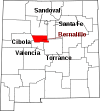 | |
| Town | ||
| Villages | ||
| CDPs | ||
| Other unincorporated communities | ||
| Indian reservations | ||
| Footnotes | ‡This populated place also has portions in an adjacent county or counties | |