Cathedral of the Assumption of Mary and St. Rupert, Wiener Neustadt
| Cathedral of the Assumption of Mary and St. Rupert | |
|---|---|
| Dom Mariä Himmelfahrt und Sankt Rupert | |
 | |
| Location | Wiener Neustadt |
| Country |
|
| Denomination | Roman Catholic Church |
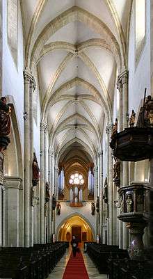
The Cathedral of the Assumption of Mary and St. Rupert [1] (German: Dom Mariä Himmelfahrt und Sankt Rupert, Wiener Neustädter Dom) also called Wiener Neustadt old Cathedral It is a Catholic church located in Wiener Neustadt,[2] a city of Austria.[3][4] The church was the cathedral of the diocese of Wiener Neustadt between 1468 and 1785, year of the diocese suppression. It should not be confused with the Cathedral of St. George belongs to the military ordinariate.
The location and orientation of the cathedral was made as part of town planning in the Middle Ages. The ship is facing north and west in alignment with sunrise the day of Pentecost on May 24, 1192, when Duke Leopold V is invested by Emperor Henry VI.
In 1207 the construction of the Romanesque cathedral began. The building was inaugurated in 1279. From 1588 to 1630, Melchor Klesl was the administrator of the diocese, and built the first baroque pulpit. The baroque altar with the altarpiece of the Assumption of Mary Giandomenico Cignaroli was opened in 1776. In 1886 the towers were demolished they were to deteriorate and later were rebuilt under the leadership of the Viennese architect Richard Jordan.
On March 6, 2012 a fire affected the cathedral, which was closed for six months to allow for repairs.
See also
References
- ↑ Cathedral of the Assumption of Mary in Wiener Neustadt
- ↑ "Propstei- und Hauptpfarre Wiener Neustadt". www.dompfarre-wienerneustadt.at. Retrieved 2016-09-08.
- ↑ Erwin Reidinger: Planung oder Zufall – Wiener Neustadt 1192. Wiener Neustadt 1995/Wien 2001 (Planbeilage), ISBN 3-900844-33-X/ISBN 3-205-99339-X, S. 267–389
- ↑ Erwin Reidinger: Stadtplanung im hohen Mittelalter, Wiener Neustadt – Marchegg – Wien. In: Europäische Städte im Mittelalter, Forschungen und Beiträge zur Wiener Stadtgeschichte. Band 52, Wien 2010, ISBN 978-3-7065-4856-4, S. 155–176.
Coordinates: 47°48′54″N 16°14′33″E / 47.8150°N 16.2425°E