Castlegregory
| Castlegregory Caisleán Ghriaire | |
|---|---|
| Village | |
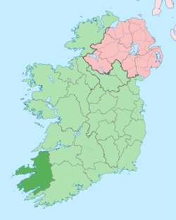
 Castlegregory Location in Ireland | |
| Coordinates: 52°15′20″N 10°01′16″W / 52.255549°N 10.02099°WCoordinates: 52°15′20″N 10°01′16″W / 52.255549°N 10.02099°W | |
| Country | Ireland |
| Province | Munster |
| County | County Kerry |
| Population (2006) | |
| • Urban | 205 |
| Time zone | WET (UTC+0) |
| • Summer (DST) | IST (WEST) (UTC-1) |
| Irish Grid Reference | Q617134 |
Castlegregory (Irish: Caisleán Ghriaire) is a village in County Kerry, Ireland. It is situated on the north side of the Dingle Peninsula, halfway between Tralee and Dingle. Castlegregory has a population of 205 (CSO 2006).
Castlegregory was named after a castle built by Gregory Hoare in the 16th century. It is the capital of Lettragh, whose population is now a quarter of what it was before the Great Irish Famine, and it remains the only place in the area which resembles a real village.[1]
Geography

The village is located at the foot of a sandy peninsula called the Maharees separating Brandon Bay to the west from Tralee Bay on the east. Off the peninsula are a number small islands, called the Seven Hoggs, or the Maharee Islands. A small fishing harbour is located at Fahamore on Scraggane Bay, about 5 km outside the village at the tip of the Maharees peninsula. The village is surrounded by the mountains of the Dingle peninsula and overlooked directly by Beenoskee and Stradbally Mountains. To the west is Brandon Mountain. Castlegregory is also the name of the parish which includes most of the north east area of the Dingle Peninsula. The village is renowned as a tourist destination as it is near to spectacular beaches located on the Maharees peninsula. Castlegregory Golf and Fishing club, a nine-hole links golf course is also located nearby, to the west of the village on the shores of Lough Gill, a freshwater lake.
History
On the largest of the Magharee Islands, Illauntannig (Irish Oileán tSeanaigh), the ruins of a 7th-century monastic site founded by St Senach, stand containing:
- two oratories
- three beehive (or Clochan) huts
- three examples of a leacht (or altar)
Local events
Castlegregory Pattern Day was traditionally celebrated on 15 August, when the tradition is to eat locally-made mutton pies. In recent years it has been expanded into a three-day summer festival.[2]
The Wren's Day on the 26th of December is also celebrated. The traditional straw dresses have given way to pajamas, curtains, Halloween masks, and Christmas decorations, but there is still plenty of traditional Irish music to be heard.
Sport
Castlegregory GAA Club was first known as Castlegregory Allen, named after William Allen, one of the Manchester Martyrs. The club took part in the first Kerry County Championship played in 1889. For well over 40 years football was played on a pitch with a 21 feet gradient from top to bottom, however a new ground was opened on 17 May 2003.[3]
Common surnames in Castlegregory
According to Irish Census 1901 & 1911. Included surrounding area with Fahamore and Kilshannig villages.
O'Connor, Moriarty, Fitzgerald, Spillane, Courtney, Kennedy, Sullivan, Flynn, Ashe, O'Donnell, McCarthy, Murphy, O'Neill, Connor, Shea, Maunsell, Harrington, Deen, Egan, Kelliher, Kenny, Mahony, Crean, Farrell, Griffin, Hoare, Lynch, McKenna, Moore, O'Flaherty, Cahillane, Bynane,
Transport
- Castlegregory was the terminus of a branch line of the Tralee and Dingle Light Railway. The railway station opened on 1 April 1891, closed for passenger and goods traffic on 17 April 1939. It connected to the main Tralee - Dingle route at Castlegregory Junction (near Camp). This main route also closed to passenger traffic the same day, but was to remain open for a once-daily goods train until 1947, after which nothing but a monthly Tralee - Dingle cattle train operated until the main line's final closure in 1953. [4]
See also
References
- ↑ "Castlegregory". MyGuide Ireland. Retrieved 2007-09-16.
- ↑ Marisa Reidy (22 August 2012). "Revived pattern draws crowds to Castlegregory". The Kerryman.
- ↑ "Castlegregory GAA Club History". Castlegregory GAA club. Retrieved 2007-09-16.
- ↑ "Castlegregory station" (PDF). Railscot - Irish Railways. Retrieved 2007-09-16.
External links
| Wikimedia Commons has media related to Castlegregory. |
| Look up Castlegregory in Wiktionary, the free dictionary. |