Castle Hills, Texas
| Castle Hills, Texas | |
|---|---|
| City | |
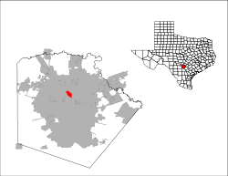 Location of Castle Hills, Texas | |
| Coordinates: 29°31′18″N 98°31′0″W / 29.52167°N 98.51667°WCoordinates: 29°31′18″N 98°31′0″W / 29.52167°N 98.51667°W | |
| Country | United States |
| State | Texas |
| County | Bexar |
| Area | |
| • Total | 2.5 sq mi (6.4 km2) |
| • Land | 2.5 sq mi (6.4 km2) |
| • Water | 0.0 sq mi (0.0 km2) |
| Elevation | 840 ft (256 m) |
| Population (2010) | |
| • Total | 4,116 |
| Time zone | Central (CST) (UTC-6) |
| • Summer (DST) | CDT (UTC-5) |
| ZIP code | 78213 |
| Area code(s) | 210, 726 (planned) |
| FIPS code | 48-13276[1] |
| GNIS feature ID | 1332298[2] |
| Website | http://www.cityofcastlehills.com/ |
Castle Hills is a city located in Bexar County, Texas, United States. As of the 2010 census, the city had a total population of 4,116. It is an enclave of San Antonio and is part of the San Antonio Metropolitan Statistical Area.
Geography
Castle Hills is located at 29°31'18" North, 98°30'60" West (29.521762, -98.516601).[3] The town borders Uptown San Antonio to the west and is about 7 miles (10 miles driving distance) north of Downtown San Antonio.
According to the United States Census Bureau, the city has a total area of 2.5 square miles (6.5 km2), of which, 2.5 square miles (6.5 km2) of it is land and none of the area is covered with water.
Castle Hills is an independent municipality, completely surrounded by the city of San Antonio. It is bisected into a northern and southern half by interstate highway loop I-410. It is located at the southern end of Northwest Military Highway, the northern end being located at U.S. Army Camp Bullis.
Demographics
| Historical population | |||
|---|---|---|---|
| Census | Pop. | %± | |
| 1960 | 2,622 | — | |
| 1970 | 5,311 | 102.6% | |
| 1980 | 4,773 | −10.1% | |
| 1990 | 4,198 | −12.0% | |
| 2000 | 4,202 | 0.1% | |
| 2010 | 4,116 | −2.0% | |
| Est. 2015 | 4,424 | [4] | 7.5% |
As of the census[1] of 2010, there are 4,116 people, 1,887 households, and 1,124 families residing in the city. There are 2,047 housing units. The racial makeup of the city is 90.5% White, 1.0% African American, 0.3% Native American, 1.7% Asian, 4.8% from other races, and 1.7% from two or more races. 38.9% of the population are Hispanic or Latino of any race, with the majority being Mexican American.
There are 1,877 households out of which 18.0% have children under the age of 18 living with them, 49.0% are married couples living together, 7.8% have a female householder with no husband present, and 40.4% are non-families. 35.8% of all households are made up of individuals and 26.3% have someone living alone who is 65 years of age or older. The average household size is 2.18 and the average family size is 2.83.
In the city the population is spread out with 17.1% under the age of 18, 4.8% from 18 to 24, 15.2% from 25 to 44, 30.0% from 45 to 64, and 32.8% who are 65 years of age or older. The median age is 54 years.
The median income for a household in the city is $69,637, and the median income for a family is $104,716. Males have a median income of $59,911 versus $36,676 for females. The per capita income for the city is $49,137. 5.9% of the population and 4.2% of families are below the poverty line. Out of the total population, none of those under the age of 18 and 11.8% of those 65 and older are living below the poverty line.
Education
The city is served by North East Independent School District.[6] Two elementary schools, Castle Hills Elementary School and Jackson Keller Elementary School, are within the city limits and serve portions of the city.[7][8] Jackson Middle School in San Antonio serves a portion of Castle Hills,[9] while Nimitz Middle School in San Antonio serves a portion of Castle Hills,[10] Lee High School in San Antonio serves all of Castle Hills.[11]
The city also has a wide range of private schools that include Antonian College Prep, St George Episcopal School, Holy Spirit Catholic School, Cornerstone Christian School, Mount Sacred Heart School and Castle Hills First Baptist School.
City government
The City of Castle Hills is served by five Alderpersons: JR Treviño, Matthew Daggett, John Squire, Frank Paul and Douglas Gregory, all elected by the people of Castle Hills, as well as the Mayor of Castle Hills, Timothy Howell.[12] The Mayor cannot vote, but does play a deciding role on many issues.
Castle Hills has its own Police, Fire, and Public Works departments. The Fire Department is a First Responder organization staffed with Firefighter/EMT(Basic and Paramedics). Acadian Ambulance Service is the EMS provider for City of Castle Hills. Castle Hills Fire Departments responds with Acadian EMS to all Fire and EMS calls. The City of Castle Hills also has a small green-space, known as the Castle Hills Commons, located on Lemonwood Drive between the Fire Department and City Hall. City Hall is located in a building formerly used as a church. Drinking water is provided to residents of the city by the San Antonio Water System. Most of the properties in Castle Hills are single family residences, many located on large lots. Many were built in the early 1950s. Ranch style architecture is predominant. There are several retail establishments in Castle Hills, mostly located along Military Highway. Also located within Castle Hills is the McGimsey Boy Scout Camp, a 140-acre (0.57 km2) park for BSA use. The city was ranked the 5th best place in Texas to start a business by a 2016 Fundera study.[13]
Climate
The climate in this area is characterized by hot, humid summers and generally mild to cool winters. According to the Köppen Climate Classification system, Castle Hills has a humid subtropical climate, abbreviated "Cfa" on climate maps.[14]
Parks and recreation
The Commons at Castle Hills, a recreational area, opened in 2003. It hosts recreational activities, and is between the fire station and city hall.[15]
References
- 1 2 "American FactFinder". United States Census Bureau. Archived from the original on 2013-09-11. Retrieved 2008-01-31.
- ↑ "US Board on Geographic Names". United States Geological Survey. 2007-10-25. Retrieved 2008-01-31.
- ↑ "US Gazetteer files: 2010, 2000, and 1990". United States Census Bureau. 2011-02-12. Retrieved 2011-04-23.
- ↑ "Annual Estimates of the Resident Population for Incorporated Places: April 1, 2010 to July 1, 2015". Retrieved July 2, 2016.
- ↑ "Census of Population and Housing". Census.gov. Archived from the original on April 22, 2013. Retrieved June 4, 2015.
- ↑ "City of Castle Hills Map." City of Castle Hills. Retrieved on March 24, 2010.
- ↑ "Castle Park Elementary School" Map. North East Independent School District. Retrieved on March 24, 2010.
- ↑ "Jackson Keller Elementary School" Map. North East Independent School District. Retrieved on March 24, 2010.
- ↑ "Jackson Middle School" Map. North East Independent School District. Retrieved on March 24, 2010.
- ↑ "Nimitz Middle School" Map. North East Independent School District. Retrieved on March 24, 2010.
- ↑ "Lee High School" Map. North East Independent School District. Retrieved on March 24, 2010.
- ↑ http://cityofcastlehills.com/2152/City-Council
- ↑ "The 10 Best Places to Start a Small Business in Texas". Fundera Ledger. 2016-11-29. Retrieved 2016-12-02.
- ↑ Climate Summary for Castle Hills, Texas
- ↑ "About Castle Hills." City of Castle Hills. Retrieved on August 25, 2016.
External links
Municipalities and communities of Bexar County, Texas, United States | ||
|---|---|---|
| Cities | 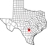 | |
| Towns | ||
| CDPs | ||
| Other unincorporated communities | ||
| Footnotes | ‡This populated place also has portions in an adjacent county or counties | |