Castle Dale, Utah
| Castle Dale, Utah | |
|---|---|
| City | |
|
Castle Dale's city hall | |
 Location in Emery County and the state of Utah | |
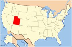 Location of Utah in the United States | |
| Coordinates: 39°12′57″N 111°1′15″W / 39.21583°N 111.02083°WCoordinates: 39°12′57″N 111°1′15″W / 39.21583°N 111.02083°W | |
| Country | United States |
| State | Utah |
| County | Emery |
| Settled | 1877 |
| Incorporated | 1920 |
| Area | |
| • Total | 2.2 sq mi (5.6 km2) |
| • Land | 2.2 sq mi (5.6 km2) |
| • Water | 0.0 sq mi (0.0 km2) |
| Elevation | 5,676 ft (1,730 m) |
| Population (2010) | |
| • Total | 1,630 |
| • Density | 756/sq mi (291.8/km2) |
| Time zone | Mountain (MST) (UTC-7) |
| • Summer (DST) | MDT (UTC-6) |
| ZIP code | 84513 |
| Area code(s) | 435 |
| FIPS code | 49-10660[1] |
| GNIS feature ID | 1426380[2] |


Castle Dale is a city in Emery County, Utah, United States. The population was 1,630 at the 2010 census.[3] It is the county seat of Emery County.[4]
History
Castle Dale, the seat of Emery County government, is located on Cottonwood Creek in Castle Valley, a region of benchlands and river valleys bounded by the Wasatch Plateau to the west and the striking buttes, mesas, and canyons of the San Rafael Swell to the east. The high plateau barrier and the ruggedness of the Castle Valley landscape delayed settlement of the region until the late 1870s, when population growth and expanding livestock herds in Utah's central valleys stimulated a search for new agricultural and grazing lands. In 1875, brothers Orange Seely and Justus Wellington Seely, Jr., first brought the Mount Pleasant cooperative cattle and sheep herds to winter on Cottonwood Creek. On 22 August 1877 Brigham Young issued a formal call for settlers to locate in Castle Valley, the last such directive from the "Great Colonizer" before his death on 29 August. Orange Seely was appointed LDS bishop of the entire region east of the Wasatch Plateau, including present-day Emery, Carbon, and Grand counties. Local tradition describes Bishop Seely as a man of immense girth who made his pastoral rounds riding one mule and leading another laden with staple food items to be distributed to needy families, blacksmith tools for the shoeing of horses and sharpening of plowshares, and dental forceps to remove aching teeth.
The 1880 census found 237 people residing on homesteads strung along more than 6 miles (10 km) of Cottonwood Creek. In that year two townsites were surveyed, one known as Upper Castle Dale and the other as Lower Castle Dale. In 1882 Upper Castle Dale took the name Orangeville in honor of Orange Seely, even though he resided in the lower town. The two communities, only 3 miles (5 km) apart, have had closely related histories, but Castle Dale has been home to the main public institutions.
The period from 1890 to 1910 brought a doubling of Castle Dale's population, from 409 to 848. The town expanded from the original plat on a sloping shelf beside the creek onto the adjacent benchlands. A two-story brick courthouse was erected in 1892. The Emery Stake Academy, founded in 1889 as the first high-school level educational institution in southeastern Utah, occupied a new two-story brick building in 1899, then moved in 1910 to a larger three-story building on the bench. This period also saw the town's incorporation (1900), the building of several commercial structures, the establishment (in 1900) of a weekly newspaper, the Emery County Progress, the first electric service (1906), and the Emery County Bank (1906).
The following decades saw little additional growth but did bring improvements in public services. A culinary water system and a telephone system were installed in about 1914. In 1922 the Emery Stake Academy was sold to the Emery County School District and became Central High School.
Like the other communities in western Emery County, for most of its history Castle Dale has depended on an economic base of farming and livestock raising, supplemented by coal mining. The community was hard hit by the Great Depression of the 1930s, when mining unemployment and low prices for farm products combined with a devastating drought. The local bank was merged with a bank in Price, leaving Emery County without banking services. During the same period, however, the Wilberg Resort, situated in a grove of trees 4 miles (6 km) north of town, enjoyed great success as a recreation center for Emery and Carbon counties, with several hundred people typically attending the Saturday night dances.
The period from 1940 to 1970 saw a decline in Castle Dale's population, from 953 to 541. Once the educational center of the region, the town lost its high school in a county school consolidation in 1943. A portent of a brighter economic future came when Congress approved the Emery County Reclamation Project in 1956. The central feature of the project, the Joe's Valley Reservoir, completed in 1966, for the first time provided long-term water storage, improving the supply for irrigation and making additional water available for industrial uses. The same period brought an improvement in the level of public services throughout western Emery County, with the installation of a modern telephone system, improved water and sewage systems, a relay station to direct television signals from Salt Lake City stations past the barrier of the Wasatch Plateau, as well as upgraded police and fire protection being provided. As the county government center, Castle Dale benefited substantially from the expansion of county services. The town's central place in education was reestablished in 1962 when North and South Emery high schools were consolidated into Emery County High School, located at Castle Dale.

Emery County received a fresh economic stimulus in the mid-1970s when Utah Power and Light Company began construction of two large steam-electric generating plants designed to use the extensive coal deposits in the region. The larger of the two, the Hunter Plant, is located 2 miles (3 km) south of Castle Dale, and the mines that supply it are northwest of town in the ledges of the Wasatch Plateau. After a "boom" period during construction of the plants, Castle Dale has settled in recent years into a more stable community with a population more than double that of its historic level and with continuing improvement in public services. The town's population in 1990 was 1,704, plus an additional 1,459 in the "twin" community of Orangeville.
Geography
Castle Dale lies on the north side of Cottonwood Creek, a tributary of the San Rafael River, in Castle Valley.
According to the United States Census Bureau, the city has a total area of 2.2 square miles (5.6 km2), all of it land.[3]
Utah State Route 10 passes through the center of town, leading northeast 31 miles (50 km) to Price and southwest 37 miles (60 km) to Interstate 70.
Demographics
| Historical population | |||
|---|---|---|---|
| Census | Pop. | %± | |
| 1890 | 505 | — | |
| 1900 | 559 | 10.7% | |
| 1910 | 693 | 24.0% | |
| 1920 | 715 | 3.2% | |
| 1930 | 713 | −0.3% | |
| 1940 | 841 | 18.0% | |
| 1950 | 715 | −15.0% | |
| 1960 | 617 | −13.7% | |
| 1970 | 541 | −12.3% | |
| 1980 | 1,910 | 253.0% | |
| 1990 | 1,704 | −10.8% | |
| 2000 | 1,657 | −2.8% | |
| 2010 | 1,630 | −1.6% | |
| Est. 2015 | 1,550 | [5] | −4.9% |
As of the census[1] of 2000 there were 1,657 people, 508 households, and 420 families residing in the city. The population density was 887.5 people per square mile (342.1/km²). There were 618 housing units at an average density of 331.0 per square mile (127.6/km²). The racial makeup of the city was 95.47% White, 0.06% African American, 0.66% Native American, 0.54% Asian, 0.18% Pacific Islander, 0.91% from other races, and 2.17% from two or more races. Hispanic or Latino of any race were 2.17% of the population.
There were 508 households out of which 49.2% had children under the age of 18 living with them, 72.6% were married couples living together, 7.1% had a female householder with no husband present, and 17.3% were non-families. 15.6% of all households were made up of individuals and 7.9% had someone living alone who was 65 years of age or older. The average household size was 3.22 and the average family size was 3.60.
In the city the population was spread out with 37.2% under the age of 18, 9.7% from 18 to 24, 23.5% from 25 to 44, 21.5% from 45 to 64, and 8.1% who were 65 years of age or older. The median age was 28 years. For every 100 females there were 105.8 males. For every 100 females age 18 and over, there were 100.4 males.
The median income for a household in the city was $44,185, and the median income for a family was $48,603. Males had a median income of $40,515 versus $20,294 for females. The per capita income for the city was $14,175. About 6.7% of families and 9.5% of the population were below the poverty line, including 12.4% of those under age 18 and 5.6% of those age 65 or over.
References
- 1 2 "American FactFinder". United States Census Bureau. Archived from the original on 11 September 2013. Retrieved 2008-01-31.
- ↑ "US Board on Geographic Names". United States Geological Survey. 2007-10-25. Retrieved 2008-01-31.
- 1 2 "Geographic Identifiers: 2010 Census Summary File 1 (G001): Castle Dale city, Utah". American Factfinder. U.S. Census Bureau. Retrieved March 29, 2016.
- ↑ "Find a County". National Association of Counties. Archived from the original on 31 May 2011. Retrieved 2011-06-07.
- ↑ "Annual Estimates of the Resident Population for Incorporated Places: April 1, 2010 to July 1, 2015". Retrieved July 2, 2016.
- ↑ "Census of Population and Housing". Census.gov. Archived from the original on 22 April 2013. Retrieved June 4, 2015.
- Emery County Daughters of Utah Pioneers. Castle Valley: A History of Emery County. 1949.
- Powell, Allan Kent. Emery County: Reflections on Its Past and Future. 1979.
- Emery County Historical Society. Emery County 1880-1980. 1981.
External links
![]() Media related to Castle Dale, Utah at Wikimedia Commons
Media related to Castle Dale, Utah at Wikimedia Commons
- Castle Dale City at Emery County official website
- Emery County Progress
 |
Mount Pleasant Spring City / Manti-La Sal National Forest |
Scofield | Huntington, Cleveland | |
| Orangeville | |
Green River / | ||
| ||||
| | ||||
| Clawson | Goblin Valley State Park Hanksville |
Green River |
Municipalities and communities of Emery County, Utah, United States | ||
|---|---|---|
| Cities | 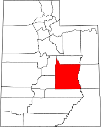 | |
| Towns | ||
| Unincorporated communities | ||
| Indian reservation | ||
| Ghost towns | ||
| Footnotes | ‡This populated place also has portions in an adjacent county or counties | |