Castelló d'Empúries
| Castelló d'Empúries | |||
|---|---|---|---|
| Municipality | |||
|
| |||
| |||
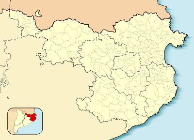 Castelló d'Empúries  Castelló d'Empúries Location in Catalonia | |||
| Coordinates: ES 42°15′30″N 3°4′30″E / 42.25833°N 3.07500°ECoordinates: ES 42°15′30″N 3°4′30″E / 42.25833°N 3.07500°E | |||
| Country |
| ||
| Community |
| ||
| Province |
| ||
| Comarca |
| ||
| Government | |||
| • Mayor | Assumpció Brossa Gratacós (2015)[1] | ||
| Area[2] | |||
| • Total | 42.3 km2 (16.3 sq mi) | ||
| Population (2014)[1] | |||
| • Total | 11,473 | ||
| • Density | 270/km2 (700/sq mi) | ||
| Website |
www | ||
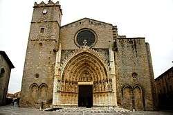

Castelló d'Empúries is a town and municipality in the Alt Empordà in Girona, Catalonia, Spain. It lies 9 km east of Figueres.
In 1079, Castelló d'Empúries became the capital of the Empúries county due to the previous capital, Sant Martí d'Empúries, being too easily sacked by pirates. 1325-1341 saw a period of large expansion of this capital town, which ultimately ceased being the capital once the county joined the Crown of Aragon and Catalonia in 1385.
In 1809 the 113th Regiment de Ligne of Napoleon's Army fought here.[3]
The old town is somewhat dwarfed by the neighboring urbanisation of Empuriabrava, on the coastline of the Costa Brava.
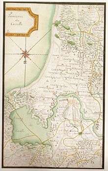
Old map of the Castelló d'Empúries lake. This coastal lake no longer exists.
See also
References
- 1 2 "Ajuntament de Castelló d'Empúries". Generalitat of Catalonia. Retrieved 2015-11-13.
- ↑ "El municipi en xifres: Castelló d'Empúries". Statistical Institute of Catalonia. Retrieved 2015-11-23.
- ↑ Tony Broughton. "French Infantry Regiments and the Colonels who Led Them: 1791 to 1815". The Napoleon Series.
External links
| Wikimedia Commons has media related to Castelló d'Empúries. |
- Castelló d'Empúries-Empuriabrava (espai web de l'Ajuntament)
- Informació de la Generalitat de Catalunya
- Informació de l'Institut d'Estadística de Catalunya
- CRAE Poble a poble: Castelló d'Empúries
 |
Peralada | Pau | Palau-saverdera | |
| Fortià | |
Roses | ||
| ||||
| | ||||
| Riumors Vilamacolum |
Sant Pere Pescador | Mediterranean Sea |
This article is issued from Wikipedia - version of the 11/10/2016. The text is available under the Creative Commons Attribution/Share Alike but additional terms may apply for the media files.