Castelginest
| Castelginest | |
|---|---|
 | |
 Castelginest | |
|
Location within Occitanie region  Castelginest | |
| Coordinates: 43°41′41″N 1°26′01″E / 43.6947°N 1.4336°ECoordinates: 43°41′41″N 1°26′01″E / 43.6947°N 1.4336°E | |
| Country | France |
| Region | Occitanie |
| Department | Haute-Garonne |
| Arrondissement | Toulouse |
| Canton | Toulouse-14 |
| Intercommunality | Grand Toulouse |
| Government | |
| • Mayor (2008–2014) | Grégoire Carneiro |
| Area1 | 8.11 km2 (3.13 sq mi) |
| Population (2008)2 | 8,588 |
| • Density | 1,100/km2 (2,700/sq mi) |
| Time zone | CET (UTC+1) |
| • Summer (DST) | CEST (UTC+2) |
| INSEE/Postal code | 31116 / 31780 |
| Elevation |
122–193 m (400–633 ft) (avg. 115 m or 377 ft) |
|
1 French Land Register data, which excludes lakes, ponds, glaciers > 1 km² (0.386 sq mi or 247 acres) and river estuaries. 2 Population without double counting: residents of multiple communes (e.g., students and military personnel) only counted once. | |
Castelginest is a commune in the Haute-Garonne department in southwestern France.
Population
| Historical population | ||
|---|---|---|
| Year | Pop. | ±% |
| 1936 | 542 | — |
| 1954 | 669 | +23.4% |
| 1962 | 782 | +16.9% |
| 1968 | 1,412 | +80.6% |
| 1975 | 3,846 | +172.4% |
| 1982 | 5,349 | +39.1% |
| 1990 | 6,757 | +26.3% |
| 1999 | 7,735 | +14.5% |
| 2008 | 8,588 | +11.0% |
International relations
Castelginest is twinned with:
 Ponte di Piave, Italy
Sights
 Town hall
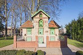 Dovecote
 Municipal cultural center
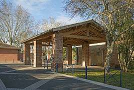 Market hall
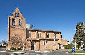 Church Saint-Étienne
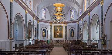 Church interior
See also
References
| Wikimedia Commons has media related to Castelginest. |
This article is issued from Wikipedia - version of the 3/19/2014. The text is available under the Creative Commons Attribution/Share Alike but additional terms may apply for the media files.