Caspar, California
| Caspar | |
|---|---|
| census-designated place | |
|
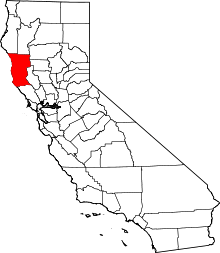
Former mill site in Caspar, California | |
 Caspar Location in California | |
| Coordinates: 39°21′49″N 123°48′57″W / 39.36361°N 123.81583°WCoordinates: 39°21′49″N 123°48′57″W / 39.36361°N 123.81583°W | |
| Country |
|
| State |
|
| County | Mendocino |
| Area[1] | |
| • Total | 2.992 sq mi (7.749 km2) |
| • Land | 2.992 sq mi (7.749 km2) |
| • Water | 0 sq mi (0 km2) 0% |
| Elevation[2] | 82 ft (25 m) |
| Population (2010) | |
| • Total | 509 |
| • Density | 170/sq mi (66/km2) |
| Time zone | PST (UTC-8) |
| • Summer (DST) | PDT (UTC-7) |
| ZIP code | 95420 |
| Area code(s) | 707 |
| GNIS feature IDs | 1658232; 2628717 |
| U.S. Geological Survey Geographic Names Information System: Caspar, California; U.S. Geological Survey Geographic Names Information System: Caspar, California | |
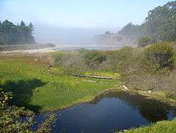
Caspar is a census-designated place in Mendocino County, California.[2] It is located on the Pacific Ocean, 4 miles (6.4 km) north of Mendocino,[3] at an elevation of 82 feet (25 m).[2] It is bounded on three sides by state parks: the historic 1909 Point Cabrillo Light Station is nearby to the south, Jug Handle State Natural Reserve lies to the north, and its coast forms Caspar Headlands State Beach. The population was 509 at the 2010 census.
History
Caspar was settled in 1857 by Siegfried Caspar, who later sold the land to Jacob Green Jackson, one of the founders of the Caspar Lumber Company which turned Caspar into a significant logging town in Northern California from 1864 to 1955.[4] Pilings from the mill can be seen on Caspar Beach, located south of the community. The mill was featured on the cover of a 1938 National Geographic magazine.[5]
Multiple heirs to the Caspar Lumber Company sold their holdings to Georgia Pacific and a pair of private investors in 1989. Ownership of the central parcels, consisting of more than 300 acres and comprising much of "downtown Caspar," was taken over by the Caspar Cattle Company in 1997. The company's principal immediately offered the land for sale.[6] This offer reportedly "spark[ed] debate and discussion in the sometimes divided community" but it was an orderly community process, facilitated by a professor and team of graduate student community planners from the University of California, Berkeley. The process early on committed to consensus and inclusive self-governance, and identified several sacred spaces, principal among them the headlands, once the site of the Caspar Lumber Company's mill, and successfully managed the acquisition of the 30 acres (12 ha) headlands parcel in partnership with the Trust for Public Land and the Mendocino Land Trust which acquired the adjoining beach in 1999.[7] Funded by a California State Coastal Conservancy grant in May, 2000,[7] as well as state and federal funds, the headlands were transferred to California State Parks and designated as Caspar Headlands State Reserve in June 2002.[8][9]
The Caspar Schoolhouse, built in the late 1800s during Caspar's heyday, and expanded during the boom years after 1906, served as a Headstart school and a mail-order company office, then remained empty until it was sold by the Cattle Company to Caspar Community, Inc., the nonprofit entity that organized the community's campaign to preserve its sacred spaces. CCI continues to attempt to acquire the remainder of the property in accordance with the vision of the community since its formation.[10] While it has been noted that reaching consensus amongst the Casparados is "like herding cats," the process has resulted in several major triumphs benefiting Caspar and its neighboring communities. In July, 2013, the majority of the land is still for sale.[10]
 Point Cabrillo Light Station
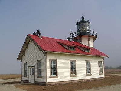
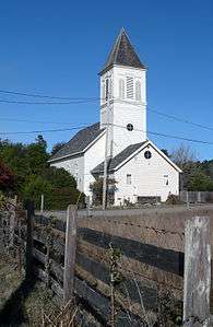 Church
 Mill ruins at Caspar beach
The Caspar post office opened in 1874[3] and closed on November 15, 1986, when postmaster, Georgia Johnston, retired.[11]
In 2013, Caspar has a community center, church and a thriving nightclub.[12] The Caspar Inn existed continuously as a roadhouse from the heyday of the logging era in 1906 to February 2013.[13]
Geography
According to the United States Census Bureau, the CDP covers an area of 3.0 square miles (7.8 km2), all of it land.
Demographics
2010
The 2010 United States Census[14] reported that Caspar had a population of 509. The population density was 170.1 people per square mile (65.7/km²). The racial makeup of Caspar was 474 (93.1%) White, 3 (0.6%) African American, 0 (0.0%) Native American, 8 (1.6%) Asian, 0 (0.0%) Pacific Islander, 3 (0.6%) from other races, and 21 (4.1%) from two or more races. Hispanic or Latino of any race were 15 persons (2.9%).
The Census reported that 507 people (99.6% of the population) lived in households, 2 (0.4%) lived in non-institutionalized group quarters, and 0 (0%) were institutionalized.
There were 252 households, out of which 33 (13.1%) had children under the age of 18 living in them, 109 (43.3%) were opposite-sex married couples living together, 15 (6.0%) had a female householder with no husband present, 7 (2.8%) had a male householder with no wife present. There were 28 (11.1%) unmarried opposite-sex partnerships, and 5 (2.0%) same-sex married couples or partnerships. 88 households (34.9%) were made up of individuals and 38 (15.1%) had someone living alone who was 65 years of age or older. The average household size was 2.01. There were 131 families (52.0% of all households); the average family size was 2.47.
The population was spread out with 51 people (10.0%) under the age of 18, 15 people (2.9%) aged 18 to 24, 96 people (18.9%) aged 25 to 44, 199 people (39.1%) aged 45 to 64, and 148 people (29.1%) who were 65 years of age or older. The median age was 57.1 years. For every 100 females there were 90.6 males. For every 100 females age 18 and over, there were 90.8 males.
There were 336 housing units at an average density of 112.3 per square mile (43.4/km²), of which 164 (65.1%) were owner-occupied, and 88 (34.9%) were occupied by renters. The homeowner vacancy rate was 4.0%; the rental vacancy rate was 7.4%. 345 people (67.8% of the population) lived in owner-occupied housing units and 162 people (31.8%) lived in rental housing units.
2000
As of the census of 2000, there are 317 people, 145 households, and 77 in the ZCTA 95420. The population density is 41/sq mi. There are 204 housing units, of which 20.3% are vacant, with 12.1% reserved for vacation/recreational use. The racial makeup of the ZCTA is 88% White, .6% Black or African American, .6% Native American, .6% Asian, 4.7% from other races, and 5.4% from two or more races. 3.5% of the population are Hispanic or Latino of any race.
There are 145 households out of which 19.3% have children under the age of 18 living with them, 42% are married couples living together, 8.3% have a female householder with no husband present, and 46.9% are non-families. 37.2% of all households are made up of individuals and 9.7% have someone living alone who is 65 years of age or older. The average household size is 2.14 and the average family size is 2.77.
In the ZCTA the population is spread out with 17% under the age of 18, 3.5% from 18 to 24, 23.6% from 25 to 44, 39.7% from 45 to 64, and 16.2% who are 65 years of age or older. The median age is 47 years. 47.6% of the population is male, 52.4 female.
The median income for a household in the ZCTA is $37,813, and the median income for a family is $47,639. Males have a median income of $55,357 versus $27,841 for females. The per capita income for the ZCTA is $26,191. 22% of the population and 42.4% of families are below the poverty line. Out of the total population, 43.6% of those under the age of 18 are living below the poverty line.
Politics
In the state legislature, Caspar is in the 2nd Senate District, represented by Democrat Mike McGuire,[15] and the 2nd Assembly District, represented by Democrat Jim Wood.[16]
Federally, Caspar is in California's 2nd congressional district, represented by Democrat Jared Huffman.[17]
Notable residents
References
- ↑ U.S. Census Archived 2012-07-14 at WebCite
- 1 2 3 U.S. Geological Survey Geographic Names Information System: Caspar, California
- 1 2 Durham, David L. (1998). California's Geographic Names: A Gazetteer of Historic and Modern Names of the State. Clovis, Calif.: Word Dancer Press. p. 34. ISBN 1-884995-14-4.
- ↑ Carranco, Lynwood (1982). Redwood Lumber Industry. Golden West Books. p. 205. ISBN 0-87095-084-3.
- ↑ Caspar Headlands History, Caspar Commons, 2013, retrieved July 7, 2013
- ↑ Brown, Patricia Leigh (August 4, 2002), "Coastal Village Preserves Its Nature", New York Times.
- 1 2 Caspar Headlands Funding Secure, Caspar Commons, 29 May 2000, retrieved July 7, 2013
- ↑ Caspar Headlands SNR State Natural Reserve, California Department of Parks and Recreation, 2013, retrieved July 7, 2013
- ↑ Caspar Headlands Become Addition to State Beach, The Trust for Public Land, archived from the original on 2004-01-28, retrieved 2011-03-18.
- 1 2 Caspar Village Planning, retrieved July 7, 2013
- ↑ Farewell to Postmaster Georgia, 15 November 1986
- ↑ Caspar Commons webpage, retrieved July 7, 2013
- ↑ Symes, Nelson, Farewell to the Caspar Inn, Stevenswood, February 9, 2013, retrieved July 7, 2013
- ↑ "2010 Census Interactive Population Search: CA - Caspar CDP". U.S. Census Bureau. Retrieved July 12, 2014.
- ↑ "Senators". State of California. Retrieved March 10, 2013.
- ↑ "Members Assembly". State of California. Retrieved March 2, 2013.
- ↑ "California's 2nd Congressional District - Representatives & District Map". Civic Impulse, LLC. Retrieved March 1, 2013.
- ↑ Levene, Bruce (Summer 2009), An Interview With Ronnie Gilbert (PDF), Mendocino Art Center.
External links
| Wikimedia Commons has media related to Caspar, California. |