Cascade, Montana
| Cascade, Montana | |
|---|---|
| Town | |
 Location of Cascade, Montana | |
| Coordinates: 47°16′19″N 111°42′10″W / 47.27194°N 111.70278°WCoordinates: 47°16′19″N 111°42′10″W / 47.27194°N 111.70278°W | |
| Country | United States |
| State | Montana |
| County | Cascade |
| Area[1] | |
| • Total | 0.53 sq mi (1.37 km2) |
| • Land | 0.53 sq mi (1.37 km2) |
| • Water | 0 sq mi (0 km2) |
| Elevation | 3,389 ft (1,033 m) |
| Population (2010)[2] | |
| • Total | 685 |
| • Estimate (2015)[3] | 696 |
| • Density | 1,292.5/sq mi (499.0/km2) |
| Time zone | Mountain (MST) (UTC-7) |
| • Summer (DST) | MDT (UTC-6) |
| ZIP code | 59421 |
| Area code(s) | 406 |
| FIPS code | 30-12775 |
| GNIS feature ID | 0769638 |
Cascade is a town in Cascade County, Montana, United States. The population was 685 at the 2010 census.[4] It is part of the Great Falls, Montana Metropolitan Statistical Area.
Geography
Cascade is located at 47°16′19″N 111°42′10″W / 47.271954°N 111.702675°W (47.271954, -111.702675).[5]
According to the United States Census Bureau, the town has a total area of 0.53 square miles (1.37 km2), all of it land.[1]
Climate
According to the Köppen Climate Classification system, Cascade has a semi-arid climate, abbreviated "BSk" on climate maps.[6]
Demographics
| Historical population | |||
|---|---|---|---|
| Census | Pop. | %± | |
| 1920 | 465 | — | |
| 1930 | 520 | 11.8% | |
| 1940 | 419 | −19.4% | |
| 1950 | 447 | 6.7% | |
| 1960 | 604 | 35.1% | |
| 1970 | 714 | 18.2% | |
| 1980 | 773 | 8.3% | |
| 1990 | 729 | −5.7% | |
| 2000 | 819 | 12.3% | |
| 2010 | 685 | −16.4% | |
| Est. 2015 | 696 | [7] | 1.6% |
| U.S. Decennial Census[8] 2015 Estimate[3] | |||
2010 census
As of the census[2] of 2010, there were 685 people, 287 households, and 188 families residing in the town. The population density was 1,292.5 inhabitants per square mile (499.0/km2). There were 328 housing units at an average density of 618.9 per square mile (239.0/km2). The racial makeup of the town was 94.9% White, 2.5% Native American, 0.7% from other races, and 1.9% from two or more races. Hispanic or Latino of any race were 2.5% of the population.
There were 287 households of which 27.5% had children under the age of 18 living with them, 53.3% were married couples living together, 8.4% had a female householder with no husband present, 3.8% had a male householder with no wife present, and 34.5% were non-families. 28.6% of all households were made up of individuals and 14.7% had someone living alone who was 65 years of age or older. The average household size was 2.32 and the average family size was 2.87.
The median age in the town was 47.6 years. 22% of residents were under the age of 18; 5.8% were between the ages of 18 and 24; 18.3% were from 25 to 44; 31.1% were from 45 to 64; and 22.6% were 65 years of age or older. The gender makeup of the town was 47.3% male and 52.7% female.
2000 census
As of the census[9] of 2000, there were 819 people, 323 households, and 221 families residing in the town. The population density was 1,561.9 people per square mile (608.1/km2). There were 349 housing units at an average density of 665.6 per square mile (259.1/km2). The racial makeup of the town was 97.56% White, 0.37% African American, 1.22% Native American, and 0.85% from two or more races. Hispanic or Latino of any race were 0.73% of the population.
There were 323 households out of which 34.7% had children under the age of 18 living with them, 56.0% were married couples living together, 9.0% had a female householder with no husband present, and 31.3% were non-families. 28.2% of all households were made up of individuals and 16.7% had someone living alone who was 65 years of age or older. The average household size was 2.54 and the average family size was 3.14.
In the town the population was spread out with 30.0% under the age of 18, 6.8% from 18 to 24, 24.4% from 25 to 44, 21.7% from 45 to 64, and 17.0% who were 65 years of age or older. The median age was 40 years. For every 100 females there were 91.4 males. For every 100 females age 18 and over, there were 94.9 males.
The median income for a household in the town was $30,602, and the median income for a family was $34,938. Males had a median income of $30,446 versus $18,542 for females. The per capita income for the town was $14,219. About 10.0% of families and 12.1% of the population were below the poverty line, including 16.2% of those under age 18 and 10.7% of those age 65 or over.
History
The founder of the town was Mr. Thomas Graham.
Notable people
- J. Robert Atkinson, founder of the Braille Institute of America
- Mary Fields a.k.a. "Stagecoach Mary", the first black woman to work for the United States Postal Service, was so popular in the town in the early 20th century that schools closed every year on her birthday.[10]
- Charles Marion Russell, artist
- Steamboat Williams, Major League Baseball player
References
- 1 2 "US Gazetteer files 2010". United States Census Bureau. Archived from the original on 2012-07-14. Retrieved 2012-12-18.
- 1 2 "American FactFinder". United States Census Bureau. Retrieved 2012-12-18.
- 1 2 "Population Estimates". United States Census Bureau. Retrieved July 15, 2016.
- ↑ "Profile of General Population and Housing Characteristics: 2010 Demographic Profile Data (DP-1): Cascade town, Montana". U.S. Census Bureau, American Factfinder. Archived from the original on September 11, 2013. Retrieved January 26, 2012.
- ↑ "US Gazetteer files: 2010, 2000, and 1990". United States Census Bureau. 2011-02-12. Retrieved 2011-04-23.
- ↑ Climate Summary for Cascade, Montana
- ↑ "Annual Estimates of the Resident Population for Incorporated Places: April 1, 2010 to July 1, 2015". Retrieved July 2, 2016.
- ↑ "Census of Population and Housing". Census.gov. Archived from the original on April 22, 2013. Retrieved June 4, 2015.
- ↑ "American FactFinder". United States Census Bureau. Archived from the original on 2013-09-11. Retrieved 2008-01-31.
- ↑ http://www.cascademontana.com/mary.htm
External links
| Communities of the Great Falls Metro area | |||||||||||
|---|---|---|---|---|---|---|---|---|---|---|---|
| Geography | |||||||||||
| History | |||||||||||
| Education |
| ||||||||||
| Media |
| ||||||||||
| Services |
| ||||||||||
| Sports |
| ||||||||||
| Breweries | |||||||||||
| Notable people | |||||||||||
| |||||||||||
Municipalities and communities of Cascade County, Montana, United States | ||
|---|---|---|
| City | 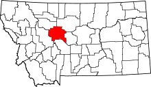 | |
| Towns | ||
| CDPs | ||
| Unincorporated community | ||