Carmel Valley Village, California
| Carmel Valley Village | |
|---|---|
| census-designated place | |
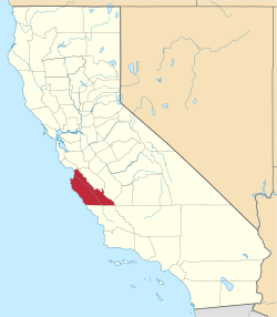
 Location in Monterey County and the state of California | |
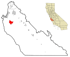
 Carmel Valley Village Location in the United States | |
| Coordinates: 36°29′10″N 121°43′26″W / 36.48611°N 121.72389°WCoordinates: 36°29′10″N 121°43′26″W / 36.48611°N 121.72389°W | |
| Country |
|
| State |
|
| County | Monterey |
| Government | |
| • Board of Supervisors | Dave Potter |
| • State senator | Bill Monning (D)[1] |
| • Assemblymember | Mark Stone (D)[1] |
| • U. S. rep. | Sam Farr (D)[2] |
| Area[3] | |
| • Total | 19.179 sq mi (49.673 km2) |
| • Land | 18.983 sq mi (49.166 km2) |
| • Water | 0.196 sq mi (0.507 km2) 1.02% |
| Elevation[4] | 846 ft (258 m) |
| Population (2010) | |
| • Total | 4,407 |
| • Density | 230/sq mi (89/km2) |
| Time zone | PST (UTC-8) |
| • Summer (DST) | PDT (UTC-7) |
| ZIP code | 93924[5] |
| Area code(s) | 831 |
| FIPS code | 06-11324 |
| GNIS feature ID | 1867002 |
Carmel Valley Village (also known as Carmel Valley for short) is a census-designated place (CDP) in Monterey County, California, United States. At the time of the 2010 census the population was 4,407, down from 4,700 at the 2000 census. In November 2009, a majority of residents voted against incorporation.
Geography and ecology
Carmel Valley Village is located at 36°29′10″N 121°43′26″W / 36.48611°N 121.72389°W.[4] According to the United States Census Bureau, the CDP has a total area of 19.2 square miles (50 km2), 98.98% of it land and 1.02% of it water. The community of Robles Del Rio is located on the opposite bank of the Carmel River.
The Carmel River drains the area of Carmel Valley. Primary ecosystems of the vicinity include California oak woodland, riparian woodland, chaparral, grassland and savanna. Dominant oak trees include Quercus agrifolia. The locale of Carmel Valley is also the northernmost range of the hybrid oak Quercus x alvordiana.[6]
Climate
This region experiences warm (but not hot) and dry summers, with no average monthly temperatures above 71.6 °F. According to the Köppen Climate Classification system, Carmel Valley Village has a warm-summer Mediterranean climate, abbreviated "Csb" on climate maps.[7]
Demographics
2010
The 2010 United States Census[8] reported that Carmel Valley Village had a population of 4,407. The population density was 229.8 people per square mile (88.7/km²). The racial makeup of Carmel Valley Village was 4,044 (91.8%) White, 21 (0.5%) African American, 22 (0.5%) Native American, 70 (1.6%) Asian, 11 (0.2%) Pacific Islander, 120 (2.7%) from other races, and 119 (2.7%) from two or more races. Hispanic or Latino of any race were 328 persons (7.4%).
The Census reported that 4,403 people (99.9% of the population) lived in households, 4 (0.1%) lived in non-institutionalized group quarters, and 0 (0%) were institutionalized.
There were 1,895 households, out of which 447 (23.6%) had children under the age of 18 living in them, 988 (52.1%) were opposite-sex married couples living together, 162 (8.5%) had a female householder with no husband present, 72 (3.8%) had a male householder with no wife present. There were 104 (5.5%) unmarried opposite-sex partnerships, and 18 (0.9%) same-sex married couples or partnerships. 506 households (26.7%) were made up of individuals and 214 (11.3%) had someone living alone who was 65 years of age or older. The average household size was 2.32. There were 1,222 families (64.5% of all households); the average family size was 2.77.
The population was spread out with 763 people (17.3%) under the age of 18, 220 people (5.0%) aged 18 to 24, 726 people (16.5%) aged 25 to 44, 1,788 people (40.6%) aged 45 to 64, and 910 people (20.6%) who were 65 years of age or older. The median age was 51.7 years. For every 100 females there were 93.8 males. For every 100 females age 18 and over, there were 90.1 males.
There were 2,156 housing units at an average density of 112.4 per square mile (43.4/km²), of which 1,326 (70.0%) were owner-occupied, and 569 (30.0%) were occupied by renters. The homeowner vacancy rate was 2.4%; the rental vacancy rate was 5.6%. 3,214 people (72.9% of the population) lived in owner-occupied housing units and 1,189 people (27.0%) lived in rental housing units.
2000
As of the census[9] of 2000, there were 4,700 people, 1,963 households, and 1,279 families residing in the CDP. The population density was 246.3 people per square mile (95.1/km²). There were 2,105 housing units at an average density of 110.3 per square mile (42.6/km²). The racial makeup of the CDP was 97.15% White, 0.38% African American, 0.38% Native American, 1.13% Asian, 0.11% Pacific Islander, 2.72% from other races, and 2.06% from two or more races. Hispanic or Latino of any race were 5.81% of the population.
There were 1,963 households out of which 26.6% had children under the age of 18, 54.0% were married couples living together, 7.7% had a female householder with no husband present, and 34.8% were non-families. 26.0% of all households were made up of individuals and 9.7% had someone who was 65 years of age or older. The average household size was 2.39 and the average family size was 2.86.
In the CDP the population was spread out with 20.6% under the age of 18, 4.7% from 18 to 24, 22.5% from 25 to 44, 36.2% from 45 to 64, and 16.0% who were 65 years of age or older. The median age was 46 years. For every 100 females there were 94.8 males. For every 100 females age 18 and over, there were 92.2 males.
The median income for a household in the CDP was $70,799, and the median income for a family was $85,191. Males had a median income of $56,083 versus $37,406 for females. The per capita income for the CDP was $42,991. About 3.1% of families and 3.9% of the population were below the poverty line, including 3.2% of those under age 18 and 5.1% of those age 65 or over.
History
In 1946, Byington Ford and his brother, Tirey Ford, developed the Carmel Valley Village and Airway Market, first known as the General Store, a barber shop, a drug store and soda fountain, a beauty shop, and a liquor store. All were in walking distance of the Airpark and decorated to resemble a Mexican village. [10] Byrington Ford recorded house lots adjacent to the airfield that would constitute a village of "hangar houses",and his brother Tirey built a prototype hangar house off Ford Road at the west end of the airfield to serve as an example for the airborne community of the future. Following the War it became apparent that there would not be a plane in every garage,so Ford had to adjust his enterprise, combining sales to plane owners with sales to home seekers,and he enjoyed a brisk trade. Only 2 true hangar houses were ever built at Carmel Valley Airport: Tirey's (which later burned), and one other, still standing, on the north side of the runway. Non-pilots bought up many of the runway Airpark sites, and to suit their many tastes Byington created ranch-house sites of 1-3 acres and envisioned hillside homes where residents could look down on incoming planes. A clubhouse built for the Airpark later became an integral part of the Village's Blue Sky Lodge. The Monterey County Board of Supervisors was intent on shutting down the airport,and a handful of Carmel Valley residents also aligned themselves toward the same goal. A group of local pilots & concerned citizens formed the Carmel Valley Historic Airpark Society (CVHAS) in 2000,grabbed some petitions, started talking to the neighbors & set out to fight city hall. In a fitting ironic twist, the CVHAS used one of city hall's favorite tactics to push their cause - they turned to environmental protection - a strategy not commonly used to protect an airport. The airport was shut down in 2002. Now the airport is used by local residents as a park and for modelers to fly remote controlled planes. The village is about 12 miles from the mouth of Carmel Valley. [11]
Government
At the county level, Carmel Valley Village is represented on the Monterey County Board of Supervisors by Supervisor Dave Potter.[12]
In the California State Assembly, Carmel Valley Village is in the 17th Senate District, represented by Democrat Bill Monning, and in the 29th Assembly District, represented by Democrat Mark Stone.[13]
In the United States House of Representatives, Carmel Valley Village is in California's 20th congressional district, represented by Democrat Sam Farr.[14]
Tourism
Carmel Valley Village has a number of wine tasting rooms, as well as several high-end hotels affiliated with the wineries. Wineries with tasting rooms in Carmel Valley include Bernardus, Boëté, Chateau Julien, Chateau Sinnet, Folktale, Galante, Georis, Heller Estate, Joullian Village, Joyce Vineyards, Parsonage, San Saba and Talbott.[15] A public bus, called the Grapevine Express Route 24 and run by Monterey-Salinas Transit, stops at most of these tasting rooms.[16]
The Monterey Wine Trolley also offers a tour on a former San Francisco trolley that makes stops at several wineries in the Monterey Peninsula and Carmel Valley Village.[17]
Notable sites
- The Jamesburg Earth Station, one of the world's largest tracking satellite dish antennas, is located in Carmel Valley. This telecommunication facility was used by NASA during its Apollo moon landings. Currently it is being used by Lone Signal a crowdfunded active SETI project designed to send messages from Earth to an extraterrestrial civilization.
- Treasure was hidden somewhere in Carmel Valley by Sheriff William Roach's brother-in-law, Jerry MacMahon. MacMahon was killed in a barroom brawl before he could reveal the location of the money. Preceding the incident, Maria Encarnacion Ortega de Sanchez, the widow of a wealthy rancher, was being cheated by local authorities, including the Sheriff, William Roach, who took her fortune under the guise of guardianship. After kidnapping Roach with the help of a local gunslinger named Anastacio Garcia, they held Roach in a jail cell in Stockton until he agreed to release the widow's gold. But Roach had bribed a guard to ride to Monterey and urge Roach's family to hide the gold. Chief Justice of California David S. Terry had been interested in the 'Widow Sanchez' case.
Notable residents
- Scott Fujita, retired NFL football player for New Orleans Saints[18]
- MC Lars, inventor of "post-punk laptop rap"
- Ingemar Henry Lundquist, inventor and mechanical engineer
- Jesse Metcalfe, actor known for his role in John Tucker Must Die
- Michael Nesmith, musician, songwriter and filmmaker, former member of The Monkees[19]
- Leon Panetta, former United States Secretary of Defense, former Director of the Central Intelligence Agency (2009–11), former Congressman (1977–93) and White House Chief of Staff (1994–97)
- Maurice White, founder of R&B/Soul group Earth, Wind & Fire
References
- 1 2 "Statewide Database". UC Regents. Retrieved November 2, 2014.
- ↑ "California's 20th Congressional District - Representatives & District Map". Civic Impulse, LLC. Retrieved September 24, 2014.
- ↑ "2010 Census U.S. Gazetteer Files – Places – California". United States Census Bureau.
- 1 2 "Carmel Valley Village". Geographic Names Information System. United States Geological Survey.
- ↑ "ZIP Code(tm) Lookup". United States Postal Service. Retrieved November 9, 2014.
- ↑ C. Michael Hogan. 2008. Blue Oak: Quercus douglasii, GlobalTwitcher.com, ed. N. Stromberg
- ↑ "Carmel Valley, California Köppen Climate Classification (Weatherbase)". Weatherbase. Retrieved 15 October 2015.
- ↑ "2010 Census Interactive Population Search: CA - Carmel Valley Village CDP". U.S. Census Bureau. Retrieved July 12, 2014.
- ↑ "American FactFinder". United States Census Bureau. Archived from the original on 2013-09-11. Retrieved 2008-01-31.
- ↑ Monterey County California Regional Guide
- ↑ airfields-freeman.com
- ↑ "Monterey County Supervisorial District 5 Map (North District 5)" (PDF). County of Monterey. Archived from the original (PDF) on 1 July 2012. Retrieved 21 September 2012.
- ↑ "Statewide Database". UC Regents. Retrieved February 2, 2015.
- ↑ "California's 20th Congressional District - Representatives & District Map". Civic Impulse, LLC.
- ↑ Carmel Valley Chamber of Commerce: Wineries and Tasting Rooms Archived May 14, 2008, at the Wayback Machine.
- ↑ Monterey-Salinas Transit: Schedules Archived October 23, 2008, at the Wayback Machine.
- ↑ http://www.toursmonterey.com/WTPages/WTTicket.html
- ↑ Anderson, Mark C. (2010-09-23). "New county resident Scott Fujita uses the game to attack everything from quarterbacks to social injustice". Monterey County Weekly. Retrieved 2013-07-30.
- ↑ "Secret life of Mike Nesmith, the missing Monkee". Mirror. 2011-03-05. Retrieved 2013-07-30.