Carling, Moselle
For other uses, see Carling (disambiguation).
| Carling | ||
|---|---|---|
 | ||
| ||
 Carling | ||
|
Location within Grand Est region  Carling | ||
| Coordinates: 49°10′02″N 6°43′00″E / 49.1672°N 6.7167°ECoordinates: 49°10′02″N 6°43′00″E / 49.1672°N 6.7167°E | ||
| Country | France | |
| Region | Grand Est | |
| Department | Moselle | |
| Arrondissement | Forbach-Boulay-Moselle | |
| Canton | Saint-Avold | |
| Intercommunality | Communauté de communes du Pays naborien | |
| Government | ||
| • Mayor (2008–2014) | Gaston Adier | |
| Area1 | 2.67 km2 (1.03 sq mi) | |
| Population (1999)2 | 3,736 | |
| • Density | 1,400/km2 (3,600/sq mi) | |
| Time zone | CET (UTC+1) | |
| • Summer (DST) | CEST (UTC+2) | |
| INSEE/Postal code | 57123 / 57490 | |
| Elevation |
228–267 m (748–876 ft) (avg. 240 m or 790 ft) | |
|
1 French Land Register data, which excludes lakes, ponds, glaciers > 1 km² (0.386 sq mi or 247 acres) and river estuaries. 2 Population without double counting: residents of multiple communes (e.g., students and military personnel) only counted once. | ||
.svg.png)
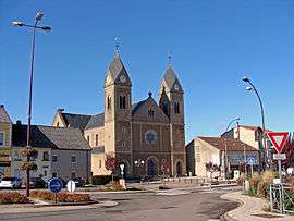
Carling (German: Karlingen) is a commune in the Moselle department in Grand Est in north-eastern France.
See also
This article is issued from Wikipedia - version of the 11/17/2016. The text is available under the Creative Commons Attribution/Share Alike but additional terms may apply for the media files.