Caringbah
| Caringbah Sydney, New South Wales | |||||||||||||
|---|---|---|---|---|---|---|---|---|---|---|---|---|---|
 The Kingsway, Caringbah | |||||||||||||
| Population | 10,955 (2011 census)[1] | ||||||||||||
| Postcode(s) | 2229 | ||||||||||||
| Location | 24 km (15 mi) south of Sydney CBD | ||||||||||||
| LGA(s) | Sutherland Shire | ||||||||||||
| State electorate(s) | |||||||||||||
| Federal Division(s) | Cook | ||||||||||||
| |||||||||||||
Caringbah is a suburb, in southern Sydney, in the state of New South Wales, Australia. Caringbah is 24 kilometres (15 mi) south of the Sydney central business district in the local government area of Sutherland Shire.
Caringbah once stretched from Woolooware Bay on the Georges River to Yowie Bay and Burraneer Bay on the Port Hacking estuary. A number of Caringbah localities have been declared as separate suburbs but still share the postcode 2229. These suburbs are to the north, Taren Point on the Georges River and to the south, Port Hacking, Lilli Pilli, Dolans Bay and Caringbah South on the Port Hacking River.
History
Caringbah is an Aboriginal word for a pademelon wallaby. The suburb was originally called Highfield, but it is unclear whether this was a position description or whether it was named after an early resident. Caringbah was used from 1911, after the steam trams began operating between Cronulla and Sutherland.[2]
Thomas Holt (1811–88) owned most of the land that stretched from Sutherland to Cronulla in the 1860s. Most of the area around Miranda and Caringbah was used for market gardening from the 1880s. Caringbah was still used for orchards and farming until after World War II. The railway line to Cronulla opened in 1939.[3]
Commercial area
Caringbah features a mixture of residential, commercial and industrial areas. The commercial district is made up mostly of small businesses specialising in professional services. A large commercial and industrial area is also centred on Taren Point Road and surrounding areas. Commercial developments here include many home furnishing retailers such as Nick Scali Furniture and home renovation showrooms.
The main shopping centre is located close to Caringbah railway station and is centred on the intersections of President Avenue, the Kingsway and Port Hacking Road South. A small group of shops, known as Caringbah South, is located further south on Port Hacking Road South. Another small group of shops is located even further south, close to the border of Lilli Pilli. Caringbah is home to the public district Sutherland Hospital adjacent to Caringbah Ambulance Station and Kareena Private Hospital on Kareena Road.
Transport
Caringbah is a central suburb of the Sutherland Shire, considering some of the main roads intersect here. President Avenue and the Kingsway both run from Sutherland via Miranda in the west, to the popular beachside suburb of Cronulla in the east. Taren Point Road leads north to the Captain Cook Bridge, St George area and further north to the Sydney CBD.
Caringbah railway station is on the Cronulla branch of the Eastern Suburbs & Illawarra Line T4 on the Sydney Trains network.
Transdev NSW runs buses to such places as Bankstown (weekends only), Lilli Pilli, South Cronulla, Hurstville, Sutherland, Cronulla and Dolans Bay and Sydney Buses operates one school route. For full route details see Caringbah Station.
Demographics
According to the 2011 census of Population, there were 10,955 residents in Caringbah. 75.3% of people were born in Australia. The most common other countries of birth were England 3.8%, New Zealand 2.9%, China 1.0%, Philippines 0.7% and India 0.7%. 82.9% of people only spoke English at home. Other languages spoken at home included Greek 1.5%, Cantonese 1.1%, Mandarin 1.0%, Spanish 0.8% and Russian 0.7%. The most common responses for religion in Caringbah were Catholic 30.3%, Anglican 25.3%, No Religion 17.2%, Uniting Church 3.7% and Presbyterian and Reformed 3.1%.[1]
Schools
There are three secondary schools and a number of primary schools in Caringbah.
- Caringbah Selective High School, the only academically selective secondary school in the Sutherland Shire.
- Endeavour Sports High School, one of seven selective sports secondary schools in NSW offering Targeted Sports Programs for talented athletes.
- De La Salle College, a school for boys from Year 7 to Year 10.
- Caringbah Public School
- Caringbah North Public School
- Laguna Street Public School
- Our Lady of Fatima Catholic Primary School
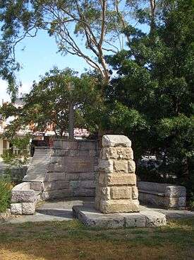
Gallery
 Burraneer Bay Marina
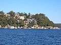 Willarong Point, Caringbah
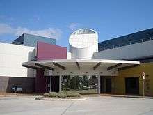 Sutherland Hospital
 Caringbah Railway Station
References
- 1 2 Australian Bureau of Statistics (31 October 2012). "Caringbah (State Suburb)". 2011 Census QuickStats. Retrieved 29 April 2013.
- ↑ Caringbah Lions Club Caringbah Lions Club
- ↑ The Book of Sydney Suburbs, Compiled by Frances Pollen, Angus & Robertson Publishers, 1990, Published in Australia ISBN 0-207-14495-8, p51
| Wikimedia Commons has media related to Caringbah, New South Wales. |
Coordinates: 34°02′43″S 151°07′18″E / 34.0452°S 151.1218°E