Caribou County, Idaho
| Caribou County, Idaho | ||
|---|---|---|
 Caribou County Courthouse, Soda Springs | ||
| ||
 Location in the U.S. state of Idaho | ||
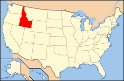 Idaho's location in the U.S. | ||
| Founded | February 11, 1919 | |
| Named for | Caribou Mountains | |
| Seat | Soda Springs | |
| Largest city | Soda Springs | |
| Area | ||
| • Total | 1,799 sq mi (4,659 km2) | |
| • Land | 1,764 sq mi (4,569 km2) | |
| • Water | 34 sq mi (88 km2), 1.9% | |
| Population | ||
| • (2010) | 6,963 | |
| • Density | 3.9/sq mi (2/km²) | |
| Congressional district | 2nd | |
| Time zone | Mountain: UTC-7/-6 | |

Caribou County is a county located in the U.S. state of Idaho. As of the 2010 Census the county had a population of 6,963.[1] The county seat and largest city is Soda Springs.[2]
History
Caribou County was formed on February 11, 1919, by the Idaho Legislature by a partition of Bannock County. It was the last county formed in the state, three days after Jerome County, and was named for the Caribou Mountains.[3]
Geography
According to the U.S. Census Bureau, the county has a total area of 1,799 square miles (4,660 km2), of which 1,764 square miles (4,570 km2) is land and 34 square miles (88 km2) (1.9%) is water.[4]
Adjacent counties
- Bonneville County - north
- Lincoln County, Wyoming - east
- Bear Lake County - south
- Franklin County - south
- Bannock County - west
- Bingham County - northwest
National protected areas
- Cache National Forest (part)
- Caribou National Forest (part)
- Grays Lake National Wildlife Refuge (part)
Major highways
 US 30
US 30 SH-34
SH-34
Demographics
| Historical population | |||
|---|---|---|---|
| Census | Pop. | %± | |
| 1920 | 2,191 | — | |
| 1930 | 2,121 | −3.2% | |
| 1940 | 2,284 | 7.7% | |
| 1950 | 5,576 | 144.1% | |
| 1960 | 5,976 | 7.2% | |
| 1970 | 6,534 | 9.3% | |
| 1980 | 8,695 | 33.1% | |
| 1990 | 6,963 | −19.9% | |
| 2000 | 7,304 | 4.9% | |
| 2010 | 6,963 | −4.7% | |
| Est. 2015 | 6,770 | [5] | −2.8% |
| U.S. Decennial Census[6] 1790-1960[7] 1900-1990[8] 1990-2000[9] 2010-2013[1] | |||
2000 census
As of the census[10] of 2000, there were 7,304 people, 2,560 households, and 1,978 families residing in the county. The population density was 4 people per square mile (2/km²). There were 3,188 housing units at an average density of 2 per square mile (1/km²). The racial makeup of the county was 96.14% White, 0.05% Black or African American, 0.21% Native American, 0.08% Asian, 0.12% Pacific Islander, 2.20% from other races, and 1.19% from two or more races. 3.96% of the population were Hispanic or Latino of any race. 29.7% were of English, 12.2% German, 11.0% American, 8.2% Danish and 5.5% Irish ancestry according to Census 2000.
There were 2,560 households out of which 39.60% had children under the age of 18 living with them, 69.30% were married couples living together, 5.20% had a female householder with no husband present, and 22.70% were non-families. 20.40% of all households were made up of individuals and 10.30% had someone living alone who was 65 years of age or older. The average household size was 2.83 and the average family size was 3.29.
In the county the population was spread out with 31.70% under the age of 18, 8.20% from 18 to 24, 24.50% from 25 to 44, 22.00% from 45 to 64, and 13.60% who were 65 years of age or older. The median age was 35 years. For every 100 females there were 99.20 males. For every 100 females age 18 and over, there were 98.60 males.
The median income for a household in the county was $37,609, and the median income for a family was $42,630. Males had a median income of $38,575 versus $20,085 for females. The per capita income for the county was $15,179. About 7.00% of families and 9.60% of the population were below the poverty line, including 10.60% of those under age 18 and 9.90% of those age 65 or over.
2010 census
As of the 2010 United States Census, there were 6,963 people, 2,606 households, and 1,936 families residing in the county.[11] The population density was 3.9 inhabitants per square mile (1.5/km2). There were 3,226 housing units at an average density of 1.8 per square mile (0.69/km2).[12] The racial makeup of the county was 95.3% white, 0.3% American Indian, 0.2% Pacific islander, 0.2% Asian, 0.1% black or African American, 2.3% from other races, and 1.5% from two or more races. Those of Hispanic or Latino origin made up 4.8% of the population.[11] In terms of ancestry, 27.5% were English, 17.0% were German, 7.2% were Swedish, 7.0% were Danish, 5.0% were Irish, and 4.3% were American.[13]
Of the 2,606 households, 35.0% had children under the age of 18 living with them, 64.3% were married couples living together, 6.1% had a female householder with no husband present, 25.7% were non-families, and 22.9% of all households were made up of individuals. The average household size was 2.64 and the average family size was 3.12. The median age was 37.7 years.[11]
The median income for a household in the county was $44,958 and the median income for a family was $53,615. Males had a median income of $45,904 versus $23,837 for females. The per capita income for the county was $20,637. About 4.2% of families and 8.4% of the population were below the poverty line, including 10.4% of those under age 18 and 5.0% of those age 65 or over.[14]
Communities
Cities
Unincorporated communities
See also
References
- 1 2 "State & County QuickFacts". United States Census Bureau. Retrieved June 28, 2014.
- ↑ "Find a County". National Association of Counties. Archived from the original on 2011-05-31. Retrieved 2011-06-07.
- ↑ Idaho.gov - Caribou County Archived August 15, 2009, at the Wayback Machine. accessed 2009-05-29
- ↑ "US Gazetteer files: 2010, 2000, and 1990". United States Census Bureau. 2011-02-12. Retrieved 2011-04-23.
- ↑ "County Totals Dataset: Population, Population Change and Estimated Components of Population Change: April 1, 2010 to July 1, 2015". Retrieved July 2, 2016.
- ↑ "U.S. Decennial Census". United States Census Bureau. Archived from the original on May 11, 2015. Retrieved June 28, 2014.
- ↑ "Historical Census Browser". University of Virginia Library. Retrieved June 28, 2014.
- ↑ "Population of Counties by Decennial Census: 1900 to 1990". United States Census Bureau. Retrieved June 28, 2014.
- ↑ "Census 2000 PHC-T-4. Ranking Tables for Counties: 1990 and 2000" (PDF). United States Census Bureau. Retrieved June 28, 2014.
- ↑ "American FactFinder". United States Census Bureau. Archived from the original on 2013-09-11. Retrieved 2008-01-31.
- 1 2 3 "DP-1 Profile of General Population and Housing Characteristics: 2010 Demographic Profile Data". United States Census Bureau. Retrieved 2016-01-09.
- ↑ "Population, Housing Units, Area, and Density: 2010 - County". United States Census Bureau. Retrieved 2016-01-09.
- ↑ "DP02 SELECTED SOCIAL CHARACTERISTICS IN THE UNITED STATES – 2006-2010 American Community Survey 5-Year Estimates". United States Census Bureau. Retrieved 2016-01-09.
- ↑ "DP03 SELECTED ECONOMIC CHARACTERISTICS – 2006-2010 American Community Survey 5-Year Estimates". United States Census Bureau. Retrieved 2016-01-09.
 |
Bingham County | Bonneville County | | |
| Bannock County | |
Lincoln County, Wyoming | ||
| ||||
| | ||||
| Bear Lake County and Franklin County |
Municipalities and communities of Caribou County, Idaho, United States | ||
|---|---|---|
| Cities | ||
| Unincorporated communities | ||
| Indian reservation | ||
| Ghost town | ||
| Footnotes | ‡ This populated place also extends into Wyoming, ‡‡ This populated place also has portions in an adjacent county or counties | |
Coordinates: 42°46′N 111°33′W / 42.76°N 111.55°W