Capillas
| Capillas | |
|---|---|
| Municipality | |
|
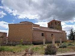
Church of St. Augustinus | |
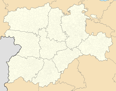 Capillas Location in Castile and León | |
| Coordinates: 42°0′48″N 4°53′27″W / 42.01333°N 4.89083°WCoordinates: 42°0′48″N 4°53′27″W / 42.01333°N 4.89083°W | |
| Country | Spain |
| Community |
|
| Province |
|
| Comarca | Tierra de Campos |
| Government | |
| • Mayor |
Ascensión Curieses Alonso (PSOE, since 2007) |
| Area | |
| • Total | 18.27 km2 (7.05 sq mi) |
| Elevation | 753 m (2,470 ft) |
| Population (2013) | |
| • Total | 86 |
| • Density | 4.7/km2 (12/sq mi) |
| Demonym(s) | Capilludo, capilluda, capilludos, capilludas |
| Time zone | CET (UTC+1) |
| • Summer (DST) | CEST (UTC+2) |
| Website | Official website |
Capillas is a Spanish municipality located in the province of Palencia, Castile and León. As of 2013 its population was of 86.
History
The town was first mentioned in 916 as Fonte de Capela, one of the first settlements of the region.[1] Its name, in Spanish, means "chapels".
Geography
Capillas, part of the comarca of Tierra de Campos, is 30 km far from Palencia and 52 from Valladolid.[2] The municipality borders with Boada de Campos, Castil de Vela, Castromocho, Gatón de Campos (in the province of Valladolid), Meneses de Campos and Villarramiel.[3]
Demographics
| 1900[4] | 1910[4] | 1920[4] | 1930[4] | 1940[4] | 1950[4] | 1960[4] | 1970[4] | 1981[4] | 1991[4] | 2004 | 2013 |
| 513 | 465 | 386 | 365 | 389 | 375 | 354 | 181 | 162 | 143 | 102 | 86 |
Personalities
- Francisco Blanco Salcedo (1512–1581), archibishop of Iria and Compostela
References
- ↑ Luis Frechilla García: GR 26 y GR 89. Los senderos de Tierra de Campos. Fundación Patrimonio Natural de Castilla León, 2008. ISBN 9788461214334
- ↑ Google. "Capillas" (Map). Google Maps. Google.
- ↑ 340275 Capillas on OpenStreetMap
- 1 2 3 4 5 6 7 8 9 10 (Spanish) Source Archived 18 October 2014 at the Wayback Machine.: INE
External links
![]() Media related to Capillas at Wikimedia Commons
Media related to Capillas at Wikimedia Commons
- (Spanish) Capillas official website
This article is issued from Wikipedia - version of the 11/18/2016. The text is available under the Creative Commons Attribution/Share Alike but additional terms may apply for the media files.